Garrachan

Settlement in Inverness-shire

Scotland

Garrachan

View from Kilmuir campsite down Loch Dunveagan
View from Kilmuir campsite down Loch Dunveagan Credit: thejackrustles

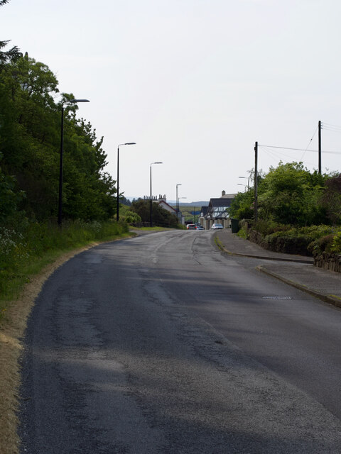
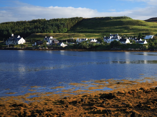
Garrachan is a small rural village located in the heart of Inverness-shire, Scotland. Nestled amidst the breathtaking Scottish Highlands, this picturesque village is known for its stunning natural beauty and tranquil surroundings. Situated just a few miles away from the bustling town of Inverness, Garrachan offers a peaceful escape from the urban hustle and bustle.

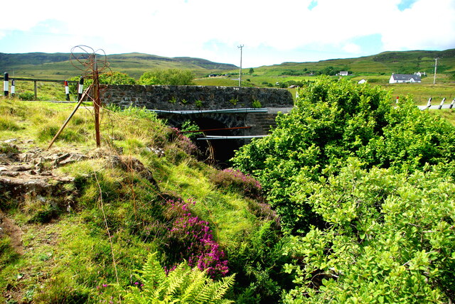
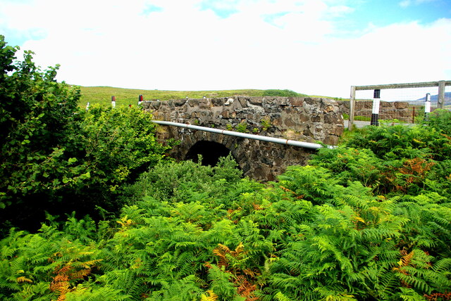
The village is characterized by its charming traditional stone houses, which exude a rustic and timeless charm. Surrounded by verdant hills and lush green forests, Garrachan is a paradise for nature lovers and outdoor enthusiasts. The area is home to an abundance of wildlife, including deer, rabbits, and various species of birds, making it a haven for wildlife enthusiasts and birdwatchers.

For those who enjoy outdoor activities, Garrachan offers numerous opportunities for hiking, mountain biking, and fishing. The nearby Loch Ness, famous for its mysterious monster, is a popular destination for tourists and locals alike. Visitors can also explore the nearby Caledonian Canal, which offers scenic boat trips and a chance to witness the impressive engineering marvel of the staircase locks.

Despite its rural setting, Garrachan is well-connected to the rest of Inverness-shire. The village is served by a reliable bus service, ensuring convenient access to the nearby towns and attractions. Additionally, the vibrant city of Inverness, with its shops, restaurants, and cultural attractions, is just a short drive away.

Overall, Garrachan offers a peaceful and idyllic retreat in the heart of the Scottish Highlands, where visitors can immerse themselves in nature and enjoy the tranquility of rural life.

If you have any feedback on the listing, please let us know in the comments section below.

Garrachan Images

Images are sourced within 2km of 57.429205/-6.6000061 or Grid Reference NG2447. Thanks to Geograph Open Source API. All images are credited.
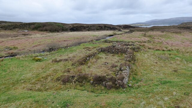
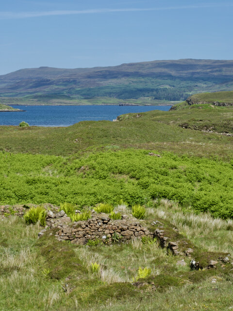
View from Kilmuir campsite down Loch Dunveagan
Loch Dunvegan
Loch Dunvegan
War Memorial and Duirinish Stone at Dunvegan
St Mary's Church; Dunvegan Late 17th century with some later additions. Abandoned in the mid 19th century <span class="nowrap"><a title="https://canmore.org.uk/site/10798/skye-dunvegan-st-marys-church-dunvegan-st-marys-old-church-kilmuir" rel="nofollow ugc noopener" href="https://canmore.org.uk/site/10798/skye-dunvegan-st-marys-church-dunvegan-st-marys-old-church-kilmuir">Link</a><img style="margin-left:2px;" alt="External link" title="External link - shift click to open in new window" src="https://s1.geograph.org.uk/img/external.png" width="10" height="10"/></span>
St Mary's Church; Dunvegan
Late 17th century with some later additions. Abandoned in the mid 19th century LinkExternal link
Ruined Blackhouse Settlement
Disused quarry close to the B884
Dùn Osdale Broch <span class="nowrap"><a title="https://canmore.org.uk/site/10832/skye-dun-osdale" rel="nofollow ugc noopener" href="https://canmore.org.uk/site/10832/skye-dun-osdale">Link</a><img style="margin-left:2px;" alt="External link" title="External link - shift click to open in new window" src="https://s1.geograph.org.uk/img/external.png" width="10" height="10"/></span>
Dùn Osdale Broch
Interior of Dùn Osdale Broch <span class="nowrap"><a title="https://canmore.org.uk/site/10832/skye-dun-osdale" rel="nofollow ugc noopener" href="https://canmore.org.uk/site/10832/skye-dun-osdale">Link</a><img style="margin-left:2px;" alt="External link" title="External link - shift click to open in new window" src="https://s1.geograph.org.uk/img/external.png" width="10" height="10"/></span>
Interior of Dùn Osdale Broch
Dusk's embrace—Captivating Loch Dunvegan in the twilight glow
A sunny day view of a ruined shieling amidst a sea of bracken
Tràigh Bheag, the 'little beach' that hides its sands
A choice of features: a bog, a stream, a fence, or the basalt ridge of Cnoc a' Chrochadair
Dun Totaig — a mass of tumbled stone and an invasion of bracken For historical information, see ‘Skye, Dun Totaig | Canmore’. 2023. Canmore.org.uk <<span class="nowrap"><a title="https://canmore.org.uk/site/10834/skye-dun-totaig" rel="nofollow ugc noopener" href="https://canmore.org.uk/site/10834/skye-dun-totaig">Link</a><img style="margin-left:2px;" alt="External link" title="External link - shift click to open in new window" src="https://s1.geograph.org.uk/img/external.png" width="10" height="10"/></span> > [accessed 14 July 2023]

‌
Dun Totaig — a mass of tumbled stone and an invasion of bracken
For historical information, see ‘Skye, Dun Totaig | Canmore’. 2023. Canmore.org.uk <LinkExternal link > [accessed 14 July 2023] ‌
Looking down on Dunvegan from Druim na Creige
A850 at Dunvegan
A850 at Dunvegan
Drochaid Peigi Siosalaiche (1) Peggy Chisholm&amp;#039;s Bridge carries the B884 Glendale road over the Brunigill Burn near its outflow into Loch Erghallan, just south of the township of Skinidin (Sgianaidin).  In the early 20th century Peggy lived in a house near the bridge, of which no traces remain. The parapets have frequently had to be rebuilt following impacts by vehicles on the narrow road.

The Ordnance Survey Name Books of 1876-8 record Brunigill as the name &amp;quot;applied to a house one Storey high thatched and in ordinary repair Situated about ½ mile to the South-east of Skinidin Property of McLeod of Mcleod&amp;quot;; this may have been Peggy&amp;#039;s home. Alexander Forbes in his 1923 work on the place names of Skye  derives the name from the Norse &amp;quot;Brunnr&amp;quot; indicating a ravine.

This image shows the downstream side of the bridge. For the view from upstream see &lt;a href=&quot;https://www.geograph.org.uk/photo/7560297&quot;&gt;NG2247 : Drochaid Peigi Siosalaiche (2)&lt;/a&gt;.
Drochaid Peigi Siosalaiche (1)
Peggy Chisholm's Bridge carries the B884 Glendale road over the Brunigill Burn near its outflow into Loch Erghallan, just south of the township of Skinidin (Sgianaidin). In the early 20th century Peggy lived in a house near the bridge, of which no traces remain. The parapets have frequently had to be rebuilt following impacts by vehicles on the narrow road. The Ordnance Survey Name Books of 1876-8 record Brunigill as the name "applied to a house one Storey high thatched and in ordinary repair Situated about ½ mile to the South-east of Skinidin Property of McLeod of Mcleod"; this may have been Peggy's home. Alexander Forbes in his 1923 work on the place names of Skye derives the name from the Norse "Brunnr" indicating a ravine. This image shows the downstream side of the bridge. For the view from upstream see NG2247 : Drochaid Peigi Siosalaiche (2).
Drochaid Peigi Siosalaiche (2) Peggy Chisholm&amp;#039;s Bridge carries the B884 Glendale road over the Brunigill Burn near its outflow into Loch Erghallan, just south of the township of Skinidin (Sgianaidin). In the early 20th century Peggy lived in a house near the bridge, of which no traces remain. The parapets have frequently had to be rebuilt following impacts by vehicles on the narrow road.

The Ordnance Survey Name Books of 1876-8 record Brunigill as the name &amp;quot;applied to a house one Storey high thatched and in ordinary repair Situated about ½ mile to the South-east of Skinidin Property of McLeod of Mcleod&amp;quot;; this may have been Peggy&amp;#039;s home. Alexander Forbes in his 1923 work on the place names of Skye derives the name from the Norse &amp;quot;Brunnr&amp;quot; indicating a ravine.

This image shows the view from upstream. For downstream side of the bridge see &lt;a href=&quot;https://www.geograph.org.uk/photo/7560294&quot;&gt;NG2247 : Drochaid Peigi Siosalaiche (1)&lt;/a&gt;.
Drochaid Peigi Siosalaiche (2)
Peggy Chisholm's Bridge carries the B884 Glendale road over the Brunigill Burn near its outflow into Loch Erghallan, just south of the township of Skinidin (Sgianaidin). In the early 20th century Peggy lived in a house near the bridge, of which no traces remain. The parapets have frequently had to be rebuilt following impacts by vehicles on the narrow road. The Ordnance Survey Name Books of 1876-8 record Brunigill as the name "applied to a house one Storey high thatched and in ordinary repair Situated about ½ mile to the South-east of Skinidin Property of McLeod of Mcleod"; this may have been Peggy's home. Alexander Forbes in his 1923 work on the place names of Skye derives the name from the Norse "Brunnr" indicating a ravine. This image shows the view from upstream. For downstream side of the bridge see NG2247 : Drochaid Peigi Siosalaiche (1).
Old shed in Dunvegan Tucked away at the very corner of Mill Road, and well screened from the main road into the village, this corrugated structure has seen better days.
Old shed in Dunvegan
Tucked away at the very corner of Mill Road, and well screened from the main road into the village, this corrugated structure has seen better days.
Show me another place!

Garrachan is located at Grid Ref: NG2447 (Lat: 57.429205, Lng: -6.6000061)

Unitary Authority: Highland

Police Authority: Highlands and Islands

What 3 Words

///escorting.studio.soft. Near Dunvegan, Highland

Related Wikis

Dunvegan

Dunvegan (Scottish Gaelic: Dùn Bheagain) is a village on the Isle of Skye in Scotland. It is famous for Dunvegan Castle, seat of the chiefs of Clan MacLeod...

Dunvegan Castle

Dunvegan Castle (Caisteal Dhùn Bheagain) is located 1 mile (1.6 km) to the north of Dunvegan on the Isle of Skye, off the west coast of Scotland. It is...

Eilean Mòr, Loch Dunvegan

Eilean Mòr is an uninhabited island in Loch Dunvegan in north west Skye, Scotland. At low water the island is connected to Eilean Dubh. == Footnotes ==

The Three Chimneys

The Three Chimneys is a restaurant in Colbost, Isle of Skye, Scotland. While in operation beforehand, the restaurant came to prominence after being taken...

Nearby Amenities

Located within 500m of 57.429205,-6.6000061
Power: pole
Lat/Long: 57.4248108/-6.6014104
Power: pole
Lat/Long: 57.4250861/-6.6020545
Power: pole
Lat/Long: 57.4255435/-6.6030932
Power: pole
Lat/Long: 57.4259336/-6.6039709
Power: pole
Lat/Long: 57.4262479/-6.6046634
Power: pole
Lat/Long: 57.4266836/-6.6056336
Power: pole
Lat/Long: 57.4270369/-6.6064146
Power: pole
Lat/Long: 57.4272536/-6.6075218
Power: pole
Lat/Long: 57.4326946/-6.5974207
Power: pole
Lat/Long: 57.4317573/-6.5977689
Power: pole
Lat/Long: 57.4308026/-6.5981292
Power: pole
Lat/Long: 57.4299054/-6.5984634
Power: pole
Lat/Long: 57.4289149/-6.5988459
Power: pole
Lat/Long: 57.4279114/-6.5992042
Power: pole
Lat/Long: 57.4269924/-6.5995544
Power: pole
Lat/Long: 57.4259/-6.599957
Power: pole
Lat/Long: 57.4248964/-6.6003475
Power: pole
Lat/Long: 57.4327954/-6.5961626
The data included in this document is from www.openstreetmap.org. The data is made available under ODbL.

Have you been to Garrachan?

Leave your review of Garrachan below (or comments, questions and feedback).