Fers Ness

Coastal Feature, Headland, Point in Orkney

Scotland

Fers Ness

Point of Scaraber Passing the southern tip of Faray on route to Kirkwall.
Point of Scaraber Credit: Andy Farrington

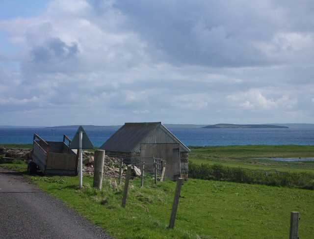
Fers Ness is a prominent coastal feature located in Orkney, Scotland. It is a headland that extends into the North Sea and serves as a significant point on the easternmost part of the Orkney Mainland. The name "Fers Ness" is derived from the Old Norse words "Fjǫrðr" (meaning fjord) and "Nes" (meaning headland), reflecting the Norse influence in the region's history.

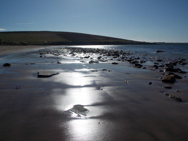
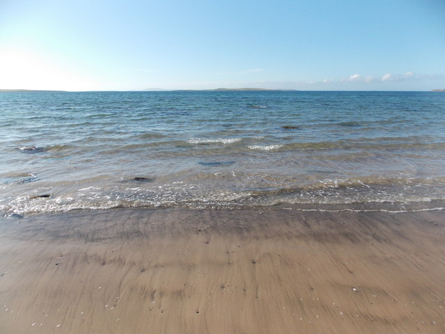
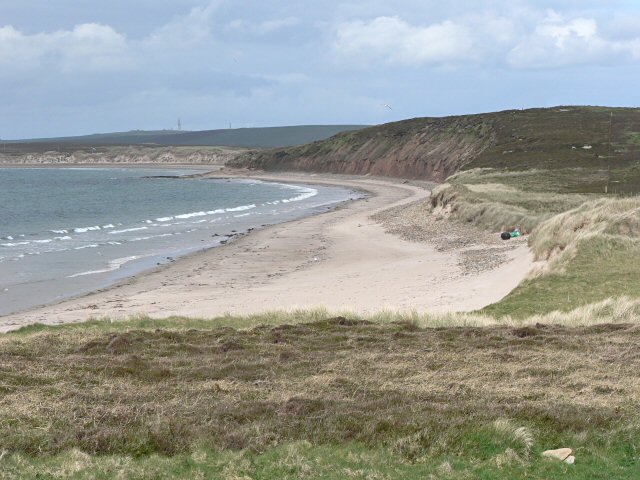
This headland is known for its stunning natural beauty and its rugged, rocky coastline. The cliffs of Fers Ness rise dramatically from the sea, providing breathtaking views of the surrounding landscape. The area is rich in diverse flora and fauna, with seabirds such as puffins, razorbills, and fulmars nesting in the cliffs.

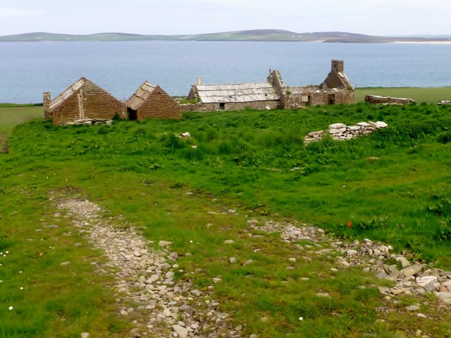
Fers Ness is also of historical significance, with several archaeological sites found in the vicinity. The ruins of a broch, an ancient fortified structure, can be seen on the headland, indicating that the area was inhabited during the Iron Age. Additionally, there are remnants of a World War II radar station, highlighting Fers Ness's strategic importance during the conflict.

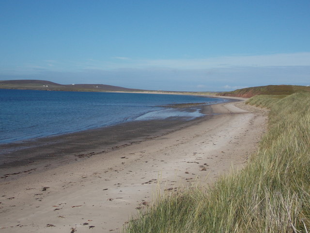
The headland is easily accessible and attracts visitors who come to appreciate its natural and historical wonders. Hikers and nature enthusiasts can explore the coastal paths and enjoy the panoramic views of the surrounding sea and neighboring islands. Fers Ness is a popular spot for birdwatching, photography, and simply immersing oneself in the awe-inspiring beauty of the Orkney coastline.

If you have any feedback on the listing, please let us know in the comments section below.

Fers Ness Images

Images are sourced within 2km of 59.191833/-2.8239318 or Grid Reference HY5334. Thanks to Geograph Open Source API. All images are credited.

Point of Scaraber Passing the southern tip of Faray on route to Kirkwall.
Point of Scaraber
Passing the southern tip of Faray on route to Kirkwall.
Eday Passing by Fers Ness the northern tip of the island on route to Kirkwall.
Eday
Passing by Fers Ness the northern tip of the island on route to Kirkwall.
Rammy Geo, Eday View to the shore with Fersness Farm on the horizon.
Rammy Geo, Eday
View to the shore with Fersness Farm on the horizon.
Eday Passing West Side on the way to Kirkwall.
Eday
Passing West Side on the way to Kirkwall.
Fersness Hill Parked near gate then walked up moorland to various likely high points on the moorland near man made ditch with Jim Bloomer, Richard Tibbetts and Tricky Speirs.
Name: Fersness Hill
Hill number:12219
Height: 89m / 292ft
Parent (Ma/M):none
Area:23: Orkney Islands
Class:0
Grid ref: HY537327 (est)
Drop: 36m
Col: 53m  HY542321
Fersness Hill
Parked near gate then walked up moorland to various likely high points on the moorland near man made ditch with Jim Bloomer, Richard Tibbetts and Tricky Speirs. Name: Fersness Hill Hill number:12219 Height: 89m / 292ft Parent (Ma/M):none Area:23: Orkney Islands Class:0 Grid ref: HY537327 (est) Drop: 36m Col: 53m HY542321
Ruined Farmstead On Eday
Eday: Sands of Mussetter against the evening sun Looking along this fine sandy beach at 5:45 on a glorious summer's evening, the sun's reflection picking out the gentle undulations of the sand and the random sprinkling of small rocks.
Eday: Sands of Mussetter against the evening sun
Looking along this fine sandy beach at 5:45 on a glorious summer's evening, the sun's reflection picking out the gentle undulations of the sand and the random sprinkling of small rocks.
Eday: looking out across Fersness Bay A simple but attractive scene, looking squarely out to sea from the Sands of Mussetter.
Eday: looking out across Fersness Bay
A simple but attractive scene, looking squarely out to sea from the Sands of Mussetter.
Eday: Sands of Mussetter This fine sandy beach lines the shore of Fersness Bay, and runs as far as the slight promontory on the right; separated by a rocky area the sands continue as the Sands of Doomy.
Eday: Sands of Mussetter
This fine sandy beach lines the shore of Fersness Bay, and runs as far as the slight promontory on the right; separated by a rocky area the sands continue as the Sands of Doomy.
Fers Ness A headland in the west of Eday. You can see the Sands of Doomy behind.
Fers Ness
A headland in the west of Eday. You can see the Sands of Doomy behind.
The west coast of Eday A low but significant cliff. Fersness Farm is on top of the rise behind. A new barn has been built since this image: <a href="https://www.geograph.org.uk/photo/3492747">HY5233 : Rammy Geo, Eday</a>.
The west coast of Eday
A low but significant cliff. Fersness Farm is on top of the rise behind. A new barn has been built since this image: HY5233 : Rammy Geo, Eday.
Tractor at work above the coast of Eday They are a bit dark, but the cliffs of this west side of Eday have clear wavy strata. Fersness Hill rises behind.
Tractor at work above the coast of Eday
They are a bit dark, but the cliffs of this west side of Eday have clear wavy strata. Fersness Hill rises behind.
The west coast of Eday The coastline is very low here. Fersness Hill rises behind.
The west coast of Eday
The coastline is very low here. Fersness Hill rises behind.
Farmland at Westside, Eday A minor road runs around the western peninsula of Eday and stops just past the point of Sandybank.
Farmland at Westside, Eday
A minor road runs around the western peninsula of Eday and stops just past the point of Sandybank.
Sands of Mussetter
Sands of Mussetter
Fersness The land on across Fursness Bay is still Eday, but the wind turbines beyond are on the southern tip of Sanday.
Fersness
The land on across Fursness Bay is still Eday, but the wind turbines beyond are on the southern tip of Sanday.
Ruined houses Beyond is Furs Ness, and in the distance the southern tip of Westray. On the skyline to the left of the picture is Fitty Hill on the west side of Westray.
Ruined houses
Beyond is Furs Ness, and in the distance the southern tip of Westray. On the skyline to the left of the picture is Fitty Hill on the west side of Westray.
Eday from Faray Sound of Faray and Fersness Bay in background
Eday from Faray
Sound of Faray and Fersness Bay in background
Show me another place!

Fers Ness is located at Grid Ref: HY5334 (Lat: 59.191833, Lng: -2.8239318)

Unitary Authority: Orkney Islands

Police Authority: Highlands and Islands

What 3 Words

///broached.sloping.sleep. Near Backaland, Orkney Islands

Nearby Locations

Fers Ness Axna Geo

Related Wikis

Rusk Holm

Rusk Holm is a small island in the Orkney Islands, near Faray to the west. == History == There is a prehistoric cairn on it . Rusk Holm is also home to...

Faray

Faray (Old Norse: Færey) is a small island in Orkney, Scotland, lying between Eday and Westray. Previously inhabited, the low-lying island is now a successful...

Eday

Eday (, Scots: Aidee) is one of the islands of Orkney, which are located to the north of the Scottish mainland. One of the North Isles, Eday is about 24...

Eday Airport

Eday London Airport (IATA: EOI, ICAO: EGED) is located on Eday in Orkney, Scotland. As it is close to the Bay of London it is known locally as just London...

Nearby Amenities

Located within 500m of 59.191833,-2.8239318
Fers Ness
Place: locality
Source: OS7
Lat/Long: 59.1933925/-2.823486
Generator Method: wind_turbine
Generator Source: wind
Generator Type: horizontal_axis
Power: generator
Lat/Long: 59.1892731/-2.8247757
Location Transition: yes
Power: pole
Lat/Long: 59.1879962/-2.822788
Axna Geo
Natural: bay
Lat/Long: 59.1934161/-2.8217778
The data included in this document is from www.openstreetmap.org. The data is made available under ODbL.

Have you been to Fers Ness?

Leave your review of Fers Ness below (or comments, questions and feedback).