Rose Ness

Coastal Feature, Headland, Point in Orkney

Scotland

Rose Ness

The Bay of Semolie, Southern Part Wave-cut platform with mini seastack.
The Bay of Semolie, Southern Part Credit: Ian Balcombe

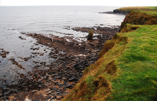
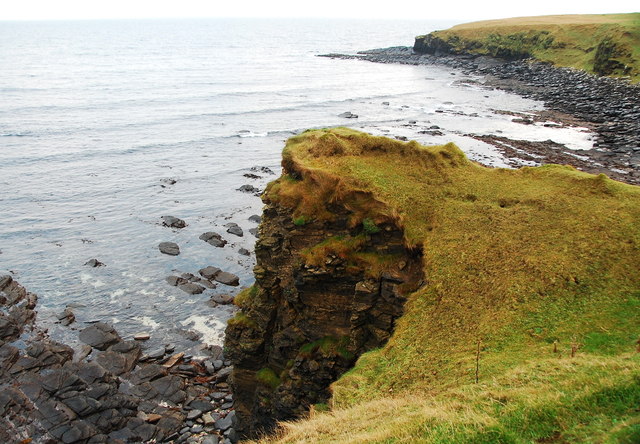
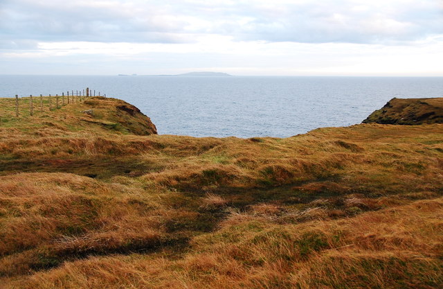
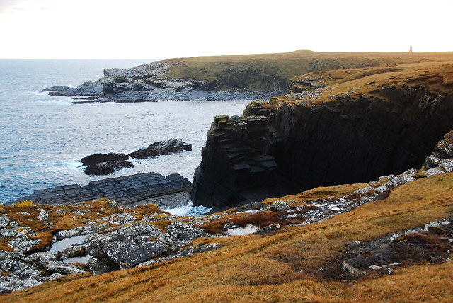
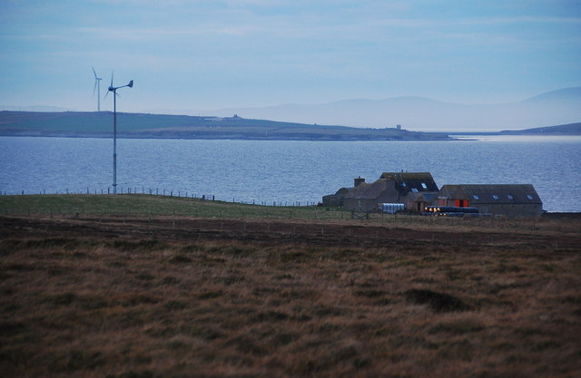
Rose Ness is a prominent coastal feature located on the northeastern coast of Orkney, a group of islands off the northeastern coast of Scotland. It is a headland that juts out into the North Sea, forming a distinct point along the coastline. With its picturesque cliffs and stunning views, Rose Ness is a popular destination for nature enthusiasts, hikers, and photographers.

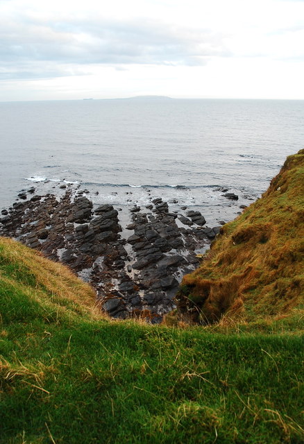
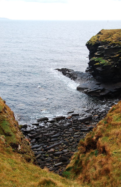
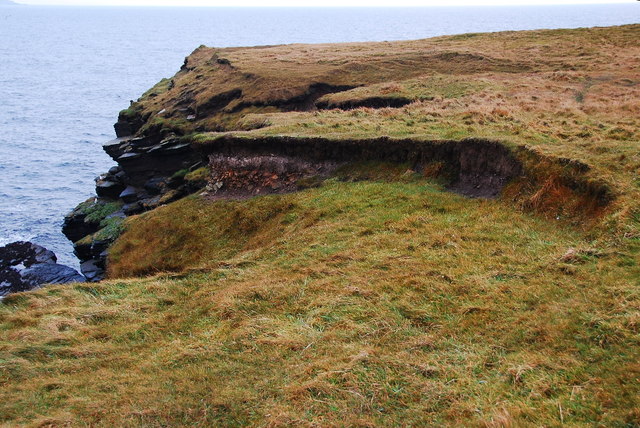
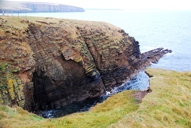
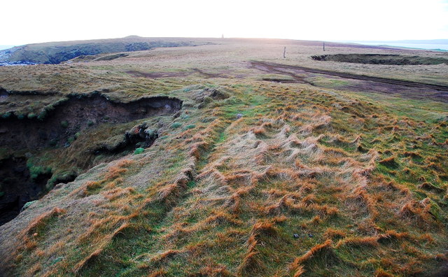
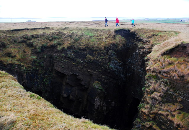
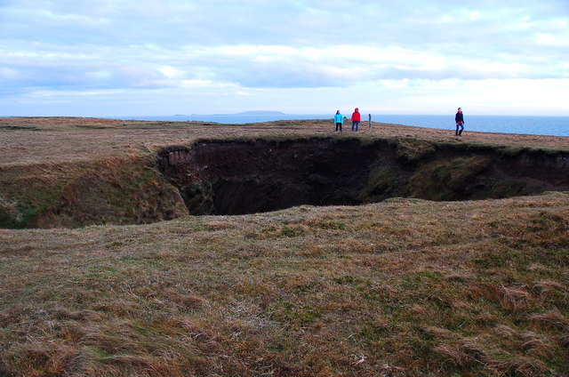
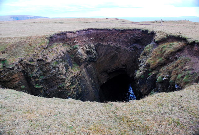
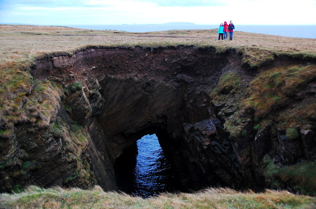
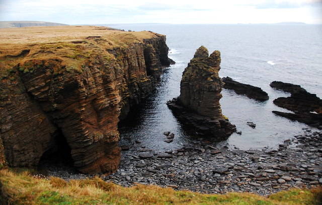
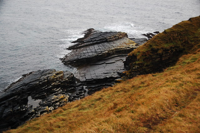
The headland is characterized by its rugged and rocky terrain, with steep cliffs that rise sharply from the sea. These cliffs are composed of sedimentary rocks, including sandstone and limestone, which have been shaped by the relentless forces of erosion over millions of years. The result is a dramatic landscape with towering cliffs and deep crevices, creating a stunning backdrop against the backdrop of the deep blue sea.

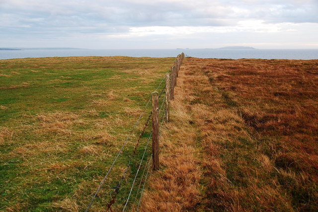
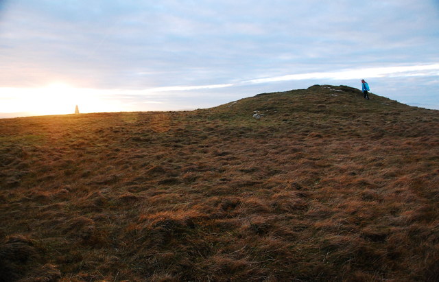
Rose Ness is home to a diverse range of wildlife, including seabirds such as puffins, guillemots, and kittiwakes, which nest on the cliffs. The surrounding waters are also teeming with marine life, making it a popular spot for fishing and birdwatching. Visitors to Rose Ness can enjoy walks along the coastal paths, taking in the breathtaking views and immersing themselves in the tranquility of this remote corner of Orkney.

The headland is easily accessible by car or on foot, with parking facilities available nearby. It is also a short distance from the village of Dounby, where visitors can find amenities such as accommodation, cafes, and shops. Whether it's exploring the rugged coastline or simply enjoying the natural beauty, Rose Ness offers a captivating and unforgettable experience for all who visit.

If you have any feedback on the listing, please let us know in the comments section below.

Rose Ness Images

Images are sourced within 2km of 58.876511/-2.8292718 or Grid Reference ND5299. Thanks to Geograph Open Source API. All images are credited.

The Bay of Semolie, Southern Part Wave-cut platform with mini seastack.
The Bay of Semolie, Southern Part
Wave-cut platform with mini seastack.
Wave-cut Platform Looking towards Copinsay, on the horizon.
Wave-cut Platform
Looking towards Copinsay, on the horizon.
The Bay of Semolie Southern end of the bay.
The Bay of Semolie
Southern end of the bay.
What a difference a fence makes Boundary between pasture and rough grazing.
What a difference a fence makes
Boundary between pasture and rough grazing.
Approaching Bruce's Hole That must cause some disappointing first visits to Geograph.
Approaching Bruce's Hole
That must cause some disappointing first visits to Geograph.
Bruce's Hole Or is it Tur Geo?
Bruce's Hole
Or is it Tur Geo?
The start of cliff collapse By Bruce's Hole, the clifftop is showing signs of subsidence, due to undercutting below.
The start of cliff collapse
By Bruce's Hole, the clifftop is showing signs of subsidence, due to undercutting below.
Bruce's Hole Looking from the southern side of the geo.
Bruce's Hole
Looking from the southern side of the geo.
Looking towards North Cairn A whole range of coastal features evident here.
Looking towards North Cairn
A whole range of coastal features evident here.
Approaching Hole of the Ness Truly amazing blowhole. I love Orkney..... no fence, no warning signs, nothing. My kind of Health and Safety: if you fall down a great big hole it's your fault.
Approaching Hole of the Ness
Truly amazing blowhole. I love Orkney..... no fence, no warning signs, nothing. My kind of Health and Safety: if you fall down a great big hole it's your fault.
Hole of the Ness Must come back here to watch the sea explode up out of the ground when it's blowing an easterly gale. Here on Orkney, that could be anything up to four or five hours away, of course.
Hole of the Ness
Must come back here to watch the sea explode up out of the ground when it's blowing an easterly gale. Here on Orkney, that could be anything up to four or five hours away, of course.
Hole of the Ness Impressive blowhole, so to speak.
Hole of the Ness
Impressive blowhole, so to speak.
Hole of the Ness Blowhole with tunnel.
Hole of the Ness
Blowhole with tunnel.
Hole of the Ness Blowhole with tunnel.
Hole of the Ness
Blowhole with tunnel.
Roy, buildings and turbine With the much larger Burray turbine in the distance.
Roy, buildings and turbine
With the much larger Burray turbine in the distance.
Stack, arch, stump As "Natural Arch" is written large on the map, I was expecting something more spectacular than this small tunnel. Perhaps another arch lies hidden nearby, or the arch has since collapsed, leaving the stump.
Stack, arch, stump
As "Natural Arch" is written large on the map, I was expecting something more spectacular than this small tunnel. Perhaps another arch lies hidden nearby, or the arch has since collapsed, leaving the stump.
Wave-cut platform Part of some extensive stretches of wave-cut platform along this area of coast.
Wave-cut platform
Part of some extensive stretches of wave-cut platform along this area of coast.
North Cairn Nearly sunset. Old beacon on Rose Ness beyond.
North Cairn
Nearly sunset. Old beacon on Rose Ness beyond.
Show me another place!

Rose Ness is located at Grid Ref: ND5299 (Lat: 58.876511, Lng: -2.8292718)

Unitary Authority: Orkney Islands

Police Authority: Highlands and Islands

What 3 Words

///pipe.defrost.hides. Near Holm, Orkney Islands

Related Wikis

Lamb Holm

Lamb Holm is a small uninhabited island in Orkney, Scotland. The Italian Chapel, constructed during the Second World War, is the island's main attraction...

Italian Chapel

The Italian Chapel is a highly ornate Catholic chapel on Lamb Holm in the Orkney Islands. It was built during World War II by Italian prisoners of war...

A961 road

The A961 is a single-carriageway road on the eastern side of Scapa Flow in the Orkney Islands, connecting the town of Kirkwall on the Orkney Mainland to...

Orkney F.C.

Orkney Football Club is a senior association football club from the Orkney Islands, Scotland. The club was founded in 2012 and competes in the North Caledonian...

Holm, Orkney

Holm (pronounced /hæm/ ), also spelled Ham, is a parish on Mainland, Orkney.An adjacent Sound, running between Mainland, and Burray, is named after Holm...

Glimps Holm

Glimps Holm or Glims Holm (Old Norse: Glums Holm) is a small uninhabited islet in Orkney, Scotland. == Geography == Glimps Holm lies in Holm Sound, one...

St Mary's, Orkney

St Mary's (also known as St. Mary's Holm) is a small village in the parish of Holm on Mainland, Orkney, Scotland. It was originally a fishing port.Orkney...

St Peter's Pool, Orkney

St Peter's Pool is a bay in the East Mainland of Orkney, Scotland. This bay was the site of significant coastal defences during World War II, when a German...

Nearby Amenities

Located within 500m of 58.876511,-2.8292718
Seamark Light Character: Fl
Seamark Light Colour: white
Seamark Light Height: 24
Seamark Light Period: 6
Seamark Light Range: 8
Seamark Light Reference: A 3626
Seamark Light Sequence: 0.5+(5.5)
Seamark Name: Rose Ness
Seamark Type: light_minor
Source: US NGA Pub. 114. 2011-05-26.
Lat/Long: 58.8726333/-2.8317667
Description: Farm
Lat/Long: 58.8788809/-2.8324126
Generator Method: wind_turbine
Generator Source: wind
Generator Type: horizontal_axis
Power: generator
Lat/Long: 58.8789672/-2.8299639
Generator Method: wind_turbine
Generator Source: wind
Generator Type: horizontal_axis
Power: generator
Lat/Long: 58.8784695/-2.8304896
Power: pole
Lat/Long: 58.8787163/-2.8317623
Power: pole
Lat/Long: 58.8794843/-2.831364
Power: pole
Lat/Long: 58.8799388/-2.8309059
Beacon, Rose Ness built 1867
Man Made: lighthouse
Lat/Long: 58.8740568/-2.8292319
Rose Ness Beacon built 1905
Man Made: lighthouse
Lat/Long: 58.8727358/-2.8319798
Long Cairn (Neolithic)
Historic: archaeological_site
Lat/Long: 58.8738925/-2.8294903
Sand of Cornquoy
Natural: beach
Lat/Long: 58.8803179/-2.832701
Rose Ness
Place: locality
Lat/Long: 58.8749818/-2.83198
Paintie Geo
Natural: creek
Lat/Long: 58.8754174/-2.8248567
Dishan
Lat/Long: 58.8743824/-2.826853
North Cairn (Chambered, Neolithic - possible)
Historic: archaeological_site
Lat/Long: 58.8771474/-2.8236474
Sae Geo
Natural: bay
Lat/Long: 58.8784512/-2.8226691
The data included in this document is from www.openstreetmap.org. The data is made available under ODbL.

Have you been to Rose Ness?

Leave your review of Rose Ness below (or comments, questions and feedback).