An Dùn

Coastal Feature, Headland, Point in Caithness

Scotland

An Dùn

Castlehill filling station Though it has been many a year that you could get fuel here. Now there are no petrol stations between Brora and Thrumster, the best part of 50 miles.
Castlehill filling station Credit: Peter Moore

An Dùn is a prominent headland located in the county of Caithness, on the northeastern coast of Scotland. Situated near the town of Thurso, this coastal feature is known for its stunning natural beauty and historical significance.

Rising majestically from the rugged coastline, An Dùn is characterized by its steep cliffs and rocky terrain. The headland offers breathtaking panoramic views of the North Sea and the surrounding countryside, making it a popular destination for nature enthusiasts and photographers. The rugged cliffs also provide a habitat for various seabirds, including gulls, puffins, and guillemots, adding to the area's wildlife diversity.

In addition to its natural beauty, An Dùn has a rich historical heritage. The headland is home to the ruins of an ancient fort, believed to have been constructed during the Iron Age. The fort, built on a strategic location overlooking the sea, provides insights into the region's past and offers visitors a chance to step back in time. The site is of great archaeological importance, attracting history enthusiasts and researchers alike.

Access to An Dùn is relatively easy, with well-marked walking trails leading visitors to the headland. The area is also equipped with viewing platforms and information boards, providing visitors with a deeper understanding of the site's geological and historical significance. Whether it's exploring the cliffs, observing the wildlife, or delving into the past, An Dùn offers a captivating and educational experience for all who visit.

If you have any feedback on the listing, please let us know in the comments section below.

An Dùn Images

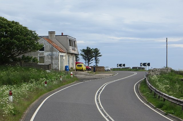
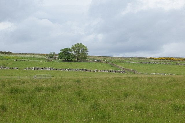
Images are sourced within 2km of 58.211397/-3.4637061 or Grid Reference ND1425. Thanks to Geograph Open Source API. All images are credited.

Castlehill filling station Though it has been many a year that you could get fuel here. Now there are no petrol stations between Brora and Thrumster, the best part of 50 miles.
Castlehill filling station
Though it has been many a year that you could get fuel here. Now there are no petrol stations between Brora and Thrumster, the best part of 50 miles.
Coastal view from the A9
A9, Newport At the northern edge of the notorious Berriedale Braes.
A9, Newport
At the northern edge of the notorious Berriedale Braes.
Newport, Caithness A view from the A9 which sweeps beneath the line of houses.
Newport, Caithness
A view from the A9 which sweeps beneath the line of houses.
Gates off the A9, Newport Field access: there are many narrow fields between Newport and the sea.
Gates off the A9, Newport
Field access: there are many narrow fields between Newport and the sea.
Coastal view, Newport The Caithness coast is crying out for a path. It is well worth taking a boat trip along (and through) it.
Coastal view, Newport
The Caithness coast is crying out for a path. It is well worth taking a boat trip along (and through) it.
Ruin, Borgue Lichen encrusted stones beside the A9. The field was being grazed by Simmental cattle, a popular breed in Caithness.
Ruin, Borgue
Lichen encrusted stones beside the A9. The field was being grazed by Simmental cattle, a popular breed in Caithness.
A9, Borgue A bend in the long gentle northbound descent from the top of the Berriedale Braes at Newport. Sea views are very fine from this road.
A9, Borgue
A bend in the long gentle northbound descent from the top of the Berriedale Braes at Newport. Sea views are very fine from this road.
A9, Ramscraigs Northbound view. The road was very quiet this morning.
A9, Ramscraigs
Northbound view. The road was very quiet this morning.
Road to Rockhead Land between the A9 and sea, by Borgue and Ramscraigs, Caithness.
Road to Rockhead
Land between the A9 and sea, by Borgue and Ramscraigs, Caithness.
Leathad na Goibhre Above the "goat coast", fields with bale covering snagged on barbed wire.
Leathad na Goibhre
Above the "goat coast", fields with bale covering snagged on barbed wire.
A9, Ramscraigs A fine view northwards along the Caithness coast.
A9, Ramscraigs
A fine view northwards along the Caithness coast.
Castlehill filling station A derelict petrol station on the A9. Now there is no fuel before Brora going south or Thurso on one of the two northbound routes (probably Wick on the other).
Castlehill filling station
A derelict petrol station on the A9. Now there is no fuel before Brora going south or Thurso on one of the two northbound routes (probably Wick on the other).
Fields, Castlehill Inland of the A9.
Fields, Castlehill
Inland of the A9.
Cattle, Castlehill One of the many small fields above the sea cliffs.
Cattle, Castlehill
One of the many small fields above the sea cliffs.
Coastline from the A9
Bus Stop on the Southbound A9 at Newport The A9 is a strategic link between the Highlands of Scotland and the Central Belt. Running for 273 miles, it is the longest road in Scotland and the fifth-longest A-road in the United Kingdom. Historically it was the main road between Edinburgh and John o' Groats but its importance has been eclipsed somewhat in the south by the A90 across the Forth Road Bridge and the M90 motorway, which now links Edinburgh more directly with Perth, and the M9, which is now the main road between Edinburgh and Bridge of Allan.
Bus Stop on the Southbound A9 at Newport
The A9 is a strategic link between the Highlands of Scotland and the Central Belt. Running for 273 miles, it is the longest road in Scotland and the fifth-longest A-road in the United Kingdom. Historically it was the main road between Edinburgh and John o' Groats but its importance has been eclipsed somewhat in the south by the A90 across the Forth Road Bridge and the M90 motorway, which now links Edinburgh more directly with Perth, and the M9, which is now the main road between Edinburgh and Bridge of Allan.
Northbound A9 near Newton The A9 is a strategic link between the Highlands of Scotland and the Central Belt. Running for 273 miles, it is the longest road in Scotland and the fifth-longest A-road in the United Kingdom. Historically it was the main road between Edinburgh and John o' Groats but its importance has been eclipsed somewhat in the south by the A90 across the Forth Road Bridge and the M90 motorway, which now links Edinburgh more directly with Perth, and the M9, which is now the main road between Edinburgh and Bridge of Allan.
Northbound A9 near Newton
The A9 is a strategic link between the Highlands of Scotland and the Central Belt. Running for 273 miles, it is the longest road in Scotland and the fifth-longest A-road in the United Kingdom. Historically it was the main road between Edinburgh and John o' Groats but its importance has been eclipsed somewhat in the south by the A90 across the Forth Road Bridge and the M90 motorway, which now links Edinburgh more directly with Perth, and the M9, which is now the main road between Edinburgh and Bridge of Allan.
Show me another place!

An Dùn is located at Grid Ref: ND1425 (Lat: 58.211397, Lng: -3.4637061)

Unitary Authority: Highland

Police Authority: Highlands and Islands

What 3 Words

///honey.penned.darts. Near Dunbeath, Highland

Related Wikis

Ramscraig

Ramscraig is a small scattered crofting hamlet, located 2 miles southwest from Dunbeath, in eastern Caithness, Scottish Highlands and is in the Scottish...

Newport, Caithness

Newport is a small remote village on the eastern shore of Caithness, Scottish Highlands and is in the Scottish council area of Highland.Ramscraig lies...

Borgue, Highland

Borgue is a village in the historical county of Caithness, 3 miles (5 km) south of Dunbeath in the local authority are of Highland, Scotland.Rev Samuel...

Berriedale, Highland

Berriedale (Scottish Gaelic: Bearghdal) is a small estate village on the northern east coast of Caithness, Scotland, on the A9 road between Helmsdale and...

Nearby Amenities

Located within 500m of 58.211397,-3.4637061
Bench
Lat/Long: 58.2096897/-3.4668528
Natural: arch
Lat/Long: 58.2116478/-3.4641664
The data included in this document is from www.openstreetmap.org. The data is made available under ODbL.

Have you been to An Dùn?

Leave your review of An Dùn below (or comments, questions and feedback).