Ashprington Point

Coastal Feature, Headland, Point in Devon South Hams

England

Ashprington Point

Ruin, Fleet Mill The disintegration of the building must be fairly recent, as the current satellite map I am using shows its roof intact.
Ruin, Fleet Mill Credit: Derek Harper

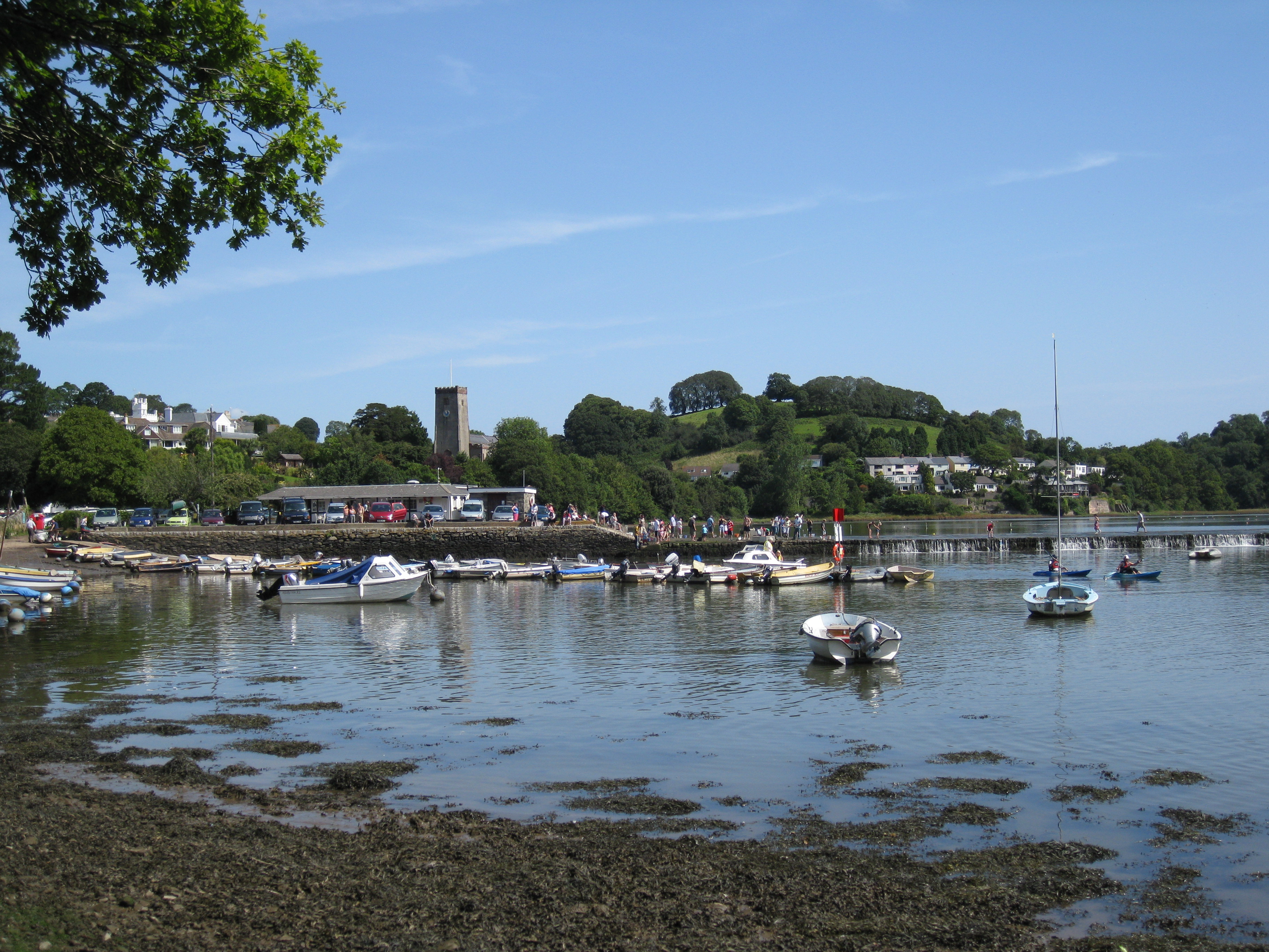
Ashprington Point is a prominent coastal feature located in the county of Devon, England. Situated on the southern coast, it is a headland that juts out into the English Channel, offering stunning views and a picturesque landscape. The point is positioned near the village of Ashprington, from which it takes its name.

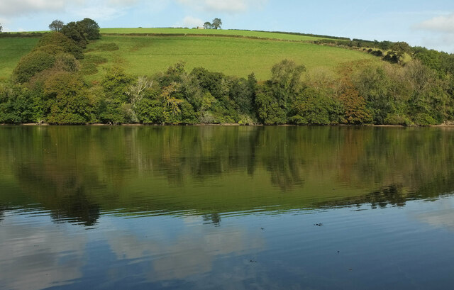
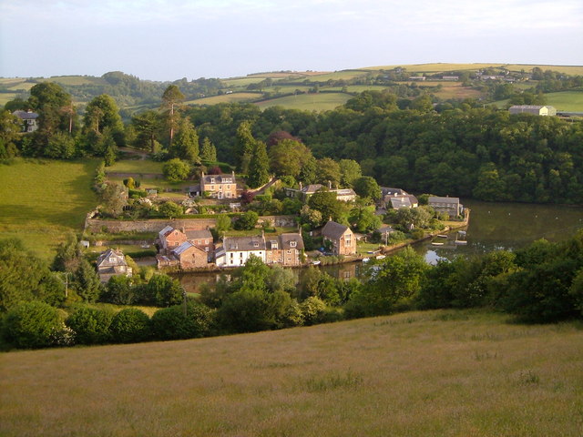
This headland is characterized by its rocky cliffs and diverse wildlife, making it a popular destination for nature enthusiasts and hikers. The rugged terrain is dotted with lush greenery, creating a contrasting backdrop against the deep blue waters of the Channel. Visitors can explore the numerous walking trails that traverse the area, providing access to breathtaking vistas and hidden coves.

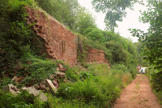
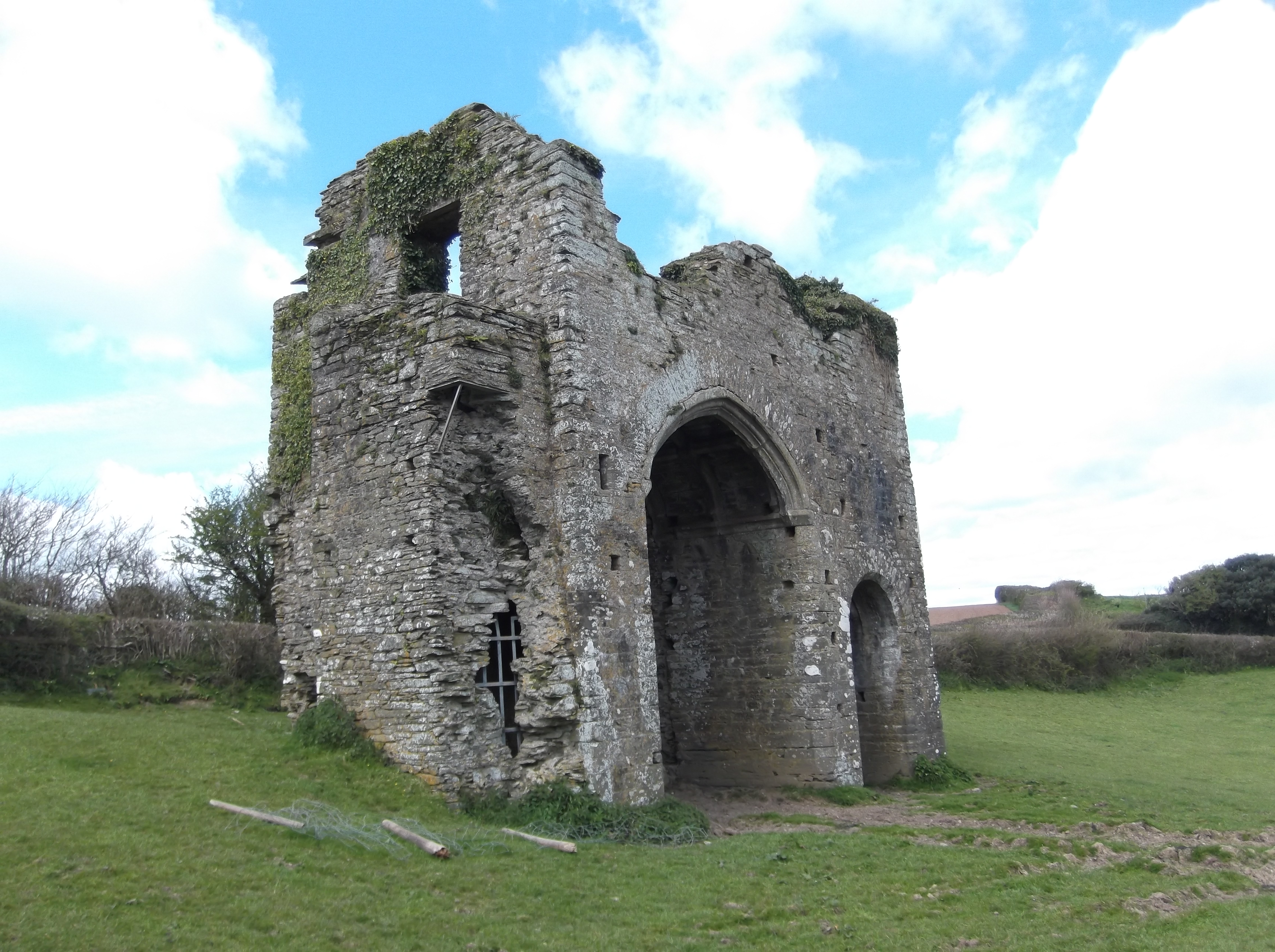
Ashprington Point is also notable for its historical significance. The remains of a Napoleonic-era fortification, known as Ashprington Battery, can be found here. Built in the 19th century to protect against potential French invasions, the battery played a crucial role in the defense of the coast. Today, the remnants of the fort can still be seen, adding an intriguing element to the landscape and serving as a reminder of the area's past.

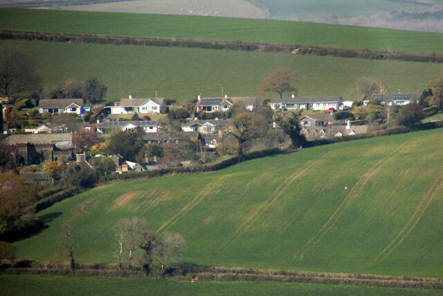
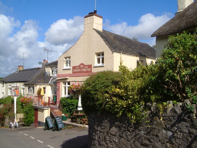
The headland benefits from its close proximity to the charming village of Ashprington, which offers amenities such as accommodation, pubs, and restaurants. This makes it a convenient base for visitors wishing to explore the area further.

Overall, Ashprington Point is a captivating coastal feature that combines natural beauty, historical interest, and recreational opportunities, making it a must-visit destination for both locals and tourists alike.

If you have any feedback on the listing, please let us know in the comments section below.

Ashprington Point Images

Images are sourced within 2km of 50.404575/-3.6357083 or Grid Reference SX8357. Thanks to Geograph Open Source API. All images are credited.

Ruin, Fleet Mill The disintegration of the building must be fairly recent, as the current satellite map I am using shows its roof intact.
Ruin, Fleet Mill
The disintegration of the building must be fairly recent, as the current satellite map I am using shows its roof intact.
Houses at Ashprington from near Tideford Looking more to the right than <a href="https://www.geograph.org.uk/photo/6816464">SX8157 : Ashprington from near Tideford</a>; the church is on the left. The houses are on Church Close.
Houses at Ashprington from near Tideford
Looking more to the right than SX8157 : Ashprington from near Tideford; the church is on the left. The houses are on Church Close.
Across Bow Creek From Cornworthy footpath 1a, which runs along the southern foreshore.
Across Bow Creek
From Cornworthy footpath 1a, which runs along the southern foreshore.
Cattle by Bow Creek These fine beasts are grazing along the line of Cornworthy footpath 1 and I am trying to distract them as a rather nervous member of our party passes. Probably among the most placid cattle I have ever encountered.
Cattle by Bow Creek
These fine beasts are grazing along the line of Cornworthy footpath 1 and I am trying to distract them as a rather nervous member of our party passes. Probably among the most placid cattle I have ever encountered.
Boats, Bow Creek Colourful rowing craft pass each other, seen from Cornworthy footpath 1.
Boats, Bow Creek
Colourful rowing craft pass each other, seen from Cornworthy footpath 1.
Pebble, Hoyle Copse One of several attractive little features in the woodland.
Pebble, Hoyle Copse
One of several attractive little features in the woodland.
Woodland ornament, Hoyle Copse One of several charming miniature items in the wood. Doors are a frequent theme in such ventures.
Woodland ornament, Hoyle Copse
One of several charming miniature items in the wood. Doors are a frequent theme in such ventures.
Woodland ornament, Hoyle Copse Not far from <a href="https://www.geograph.org.uk/photo/6832242">SX8457 : Miniature house, Hoyle Copse</a>.
Woodland ornament, Hoyle Copse
Your amazing, Hoyle Copse Well, a pleasing message, although a shame about the grammar - or is there a word missing? "Your amazing freckles", perhaps?
Your amazing, Hoyle Copse
Well, a pleasing message, although a shame about the grammar - or is there a word missing? "Your amazing freckles", perhaps?
Miniature door, Hoyle Copse As I said at <a href="https://www.geograph.org.uk/photo/7001868">SX8457 : Woodland ornament, Hoyle Copse</a>, doors are a frequent theme in woodland ornamentation.
Miniature door, Hoyle Copse
As I said at SX8457 : Woodland ornament, Hoyle Copse, doors are a frequent theme in woodland ornamentation.
Royal fairy mailbox, Hoyle Copse "Collection everyday".
Royal fairy mailbox, Hoyle Copse
"Collection everyday".
Nursery work, New Wood Trees To be honest, I can't recall nearly six months afterwards whether they were planting or lifting a tree, but I think perhaps the latter. The footpath is Stoke Gabriel 7. Hoyle Copse is in the background.
Nursery work, New Wood Trees
To be honest, I can't recall nearly six months afterwards whether they were planting or lifting a tree, but I think perhaps the latter. The footpath is Stoke Gabriel 7. Hoyle Copse is in the background.
Stoke Gabriel House The grade II listed house <span class="nowrap"><a title="https://historicengland.org.uk/listing/the-list/list-entry/1147601" rel="nofollow ugc noopener" href="https://historicengland.org.uk/listing/the-list/list-entry/1147601">Link</a><img style="margin-left:2px;" alt="External link" title="External link - shift click to open in new window" src="https://s1.geograph.org.uk/img/external.png" width="10" height="10"/></span> is not easily photographed. although the link provides a good image. This glimpse is from Duncannon Lane. "Large detached house in garden. Built in 1798 for Rear Admiral Thomas Hicks ... Centre breaks forward with pediment ...".
Stoke Gabriel House
The grade II listed house LinkExternal link is not easily photographed. although the link provides a good image. This glimpse is from Duncannon Lane. "Large detached house in garden. Built in 1798 for Rear Admiral Thomas Hicks ... Centre breaks forward with pediment ...".
Sharpham House from Stoke Gabriel The grade I listed house, seen here across the Dart from two kilometres away, is more clearly shown at <a title="https://www.geograph.org.uk/search.php?i=144315938" href="https://www.geograph.org.uk/search.php?i=144315938">Link</a> .
Sharpham House from Stoke Gabriel
The grade I listed house, seen here across the Dart from two kilometres away, is more clearly shown at Link .
Walkers near Stoke Gabriel Looking left from <a href="https://www.geograph.org.uk/photo/7002347">SX8257 : Sharpham House from Stoke Gabriel</a> along Stoke Gabriel Footpath 3.
Walkers near Stoke Gabriel
Looking left from SX8257 : Sharpham House from Stoke Gabriel along Stoke Gabriel Footpath 3.
Field near Stoke Gabriel House Looking in the opposite direction from <a href="https://www.geograph.org.uk/photo/6832263">SX8457 : Path near Stoke Gabriel</a>, to a tree in the same field surrounded by bushes. On the right, a wall borders the grounds of Stoke Gabriel House.
Field near Stoke Gabriel House
Looking in the opposite direction from SX8457 : Path near Stoke Gabriel, to a tree in the same field surrounded by bushes. On the right, a wall borders the grounds of Stoke Gabriel House.
Path to Stoke Gabriel Stoke Gabriel footpath 3 approaches the unused stile shown from the other side in <a href="https://www.geograph.org.uk/photo/6832263">SX8457 : Path near Stoke Gabriel</a>.
Path to Stoke Gabriel
Stoke Gabriel footpath 3 approaches the unused stile shown from the other side in SX8457 : Path near Stoke Gabriel.
Walkers near Stoke Gabriel Looking in the opposite direction from <a href="https://www.geograph.org.uk/photo/7002413">SX8457 : Path to Stoke Gabriel</a>, as the party of walkers follows Stoke Gabriel footpath 3 towards the River Dart.
Walkers near Stoke Gabriel
Looking in the opposite direction from SX8457 : Path to Stoke Gabriel, as the party of walkers follows Stoke Gabriel footpath 3 towards the River Dart.
Show me another place!

Ashprington Point is located at Grid Ref: SX8357 (Lat: 50.404575, Lng: -3.6357083)

Administrative County: Devon

District: South Hams

Police Authority: Devon and Cornwall

What 3 Words

///payer.anyway.putts. Near Stoke Gabriel, Devon

Related Wikis

Stoke Gabriel

Stoke Gabriel is a village and parish in Devon, England, situated on a creek of the River Dart. The village is a popular tourist destination in the South...

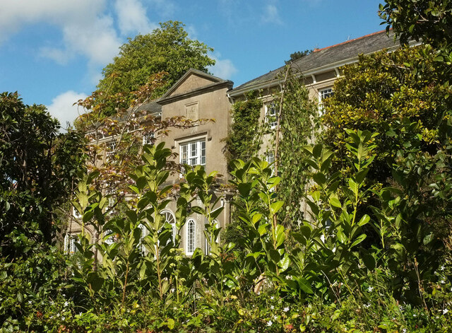
Sharpham, Ashprington

Sharpham is an historic estate in the parish of Ashprington, Devon. The Georgian mansion house, known as Sharpham House, overlooks the River Dart and is...

Aish, Stoke Gabriel

Aish is a hamlet in the English county of Devon, near the village of Stoke Gabriel. Aish House is a Grade II listed 19th century house on the south side...

Stoke Gabriel & Torbay Police F.C.

Stoke Gabriel & Torbay Police Football Club is a football club based in Stoke Gabriel, Devon, established in the early 1900s as Stoke Gabriel AFC. In June...

Cornworthy

Cornworthy is a village and civil parish in the South Hams, Devon, England. The hamlet of East Cornworthy lies due east of the village at grid reference...
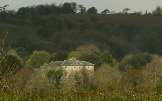
Sandridge Park

Sandridge Park, near Stoke Gabriel, Devon, is an English country house in the Italianate style, designed by John Nash around 1805 for the Dowager Lady...

Tuckenhay

Tuckenhay is a hamlet in the South Hams in Devon, England, 2.5 miles (4.0 km) south of Totnes. It lies on the south bank of Bow Creek, the estuary of...

Cornworthy Priory

Cornworthy Priory was a priory in Devon, England. It was founded in the early thirteenth century, for Augustinian nuns, and existed until 1536. At the...

Nearby Amenities

Located within 500m of 50.404575,-3.6357083
Source: PGS
Lat/Long: 50.4005875/-3.6379229
Source: PGS
Lat/Long: 50.4010498/-3.6374861
Source: PGS
Lat/Long: 50.4012652/-3.6372974
Source: PGS
Lat/Long: 50.4016975/-3.6369074
Source: PGS
Lat/Long: 50.4018827/-3.6366942
Source: PGS
Lat/Long: 50.4023355/-3.6361649
Source: PGS
Lat/Long: 50.4027836/-3.6357653
Source: PGS
Lat/Long: 50.4030234/-3.6356127
Source: PGS
Lat/Long: 50.4035659/-3.6352539
Source: PGS
Lat/Long: 50.4039644/-3.6346621
Source: PGS
Lat/Long: 50.4044653/-3.6342533
Source: PGS
Lat/Long: 50.4050085/-3.6339408
Source: PGS
Lat/Long: 50.4054167/-3.6352612
Source: PGS
Lat/Long: 50.4053928/-3.6359458
Source: PGS
Lat/Long: 50.4052592/-3.6369612
Source: PGS
Lat/Long: 50.4052544/-3.6371596
Source: PGS
Lat/Long: 50.4044104/-3.6388363
Source: PGS
Lat/Long: 50.4058604/-3.6418775
Source: PGS
Lat/Long: 50.4060736/-3.6414051
Source: PGS
Lat/Long: 50.4062212/-3.6408899
Source: PGS
Lat/Long: 50.4065663/-3.6398981
Source: PGS
Lat/Long: 50.4068117/-3.6392005
Created By: almien_coastlines
Source: PGS
Lat/Long: 50.4069825/-3.6387067
Source: PGS
Lat/Long: 50.4072247/-3.6380582
Source: PGS
Lat/Long: 50.4087272/-3.6359814
Source: PGS
Lat/Long: 50.4083027/-3.635087
Source: PGS
Lat/Long: 50.4076994/-3.6356921
Source: PGS
Lat/Long: 50.4064324/-3.6328967
Source: PGS
Lat/Long: 50.4058458/-3.6320024
Source: PGS
Lat/Long: 50.4055587/-3.6315476
Source: PGS
Lat/Long: 50.405011/-3.631249
Source: PGS
Lat/Long: 50.4044685/-3.6308499
Source: PGS
Lat/Long: 50.4038513/-3.6303097
Source: PGS
Lat/Long: 50.4034557/-3.6300387
Source: PGS
Lat/Long: 50.402469/-3.6311116
Source: PGS
Lat/Long: 50.4020953/-3.6321095
Source: PGS
Lat/Long: 50.4019021/-3.633227
Source: PGS
Lat/Long: 50.4013869/-3.6331911
Source: PGS
Lat/Long: 50.4011054/-3.6331193
Source: PGS
Lat/Long: 50.4040249/-3.6395539
Source: PGS
Lat/Long: 50.4037362/-3.640957
Source: PGS
Lat/Long: 50.4059788/-3.6322611
Ashprington Point
Natural: headland
Lat/Long: 50.4049534/-3.6342761
Source: PGS
Lat/Long: 50.4069898/-3.6342154
Source: PGS
Lat/Long: 50.4066258/-3.6333373
Langham Wood Point
Natural: headland
Source: OS_OpenData_StreetView
Lat/Long: 50.4005044/-3.6385907
The data included in this document is from www.openstreetmap.org. The data is made available under ODbL.

Have you been to Ashprington Point?

Leave your review of Ashprington Point below (or comments, questions and feedback).