Baggy Point

Coastal Feature, Headland, Point in Devon North Devon

England

Baggy Point

Croydehoe Farm Farmhouse near Baggy Point
Croydehoe Farm Credit: Richard Gadsby

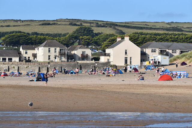
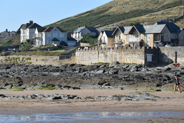
Baggy Point is a prominent headland located on the North Devon coast in England. It is situated within the boundaries of the UNESCO-designated Biosphere Reserve of Braunton Burrows, near the village of Croyde. This coastal feature is a popular destination for locals and tourists alike due to its stunning natural beauty and recreational opportunities.

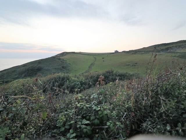
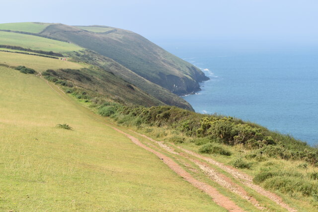
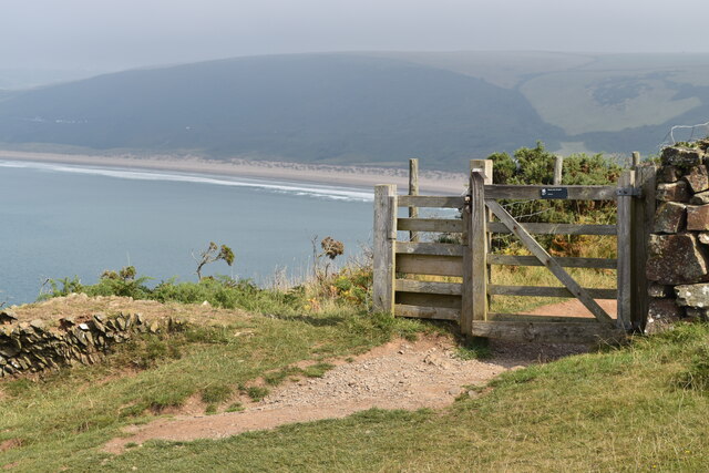
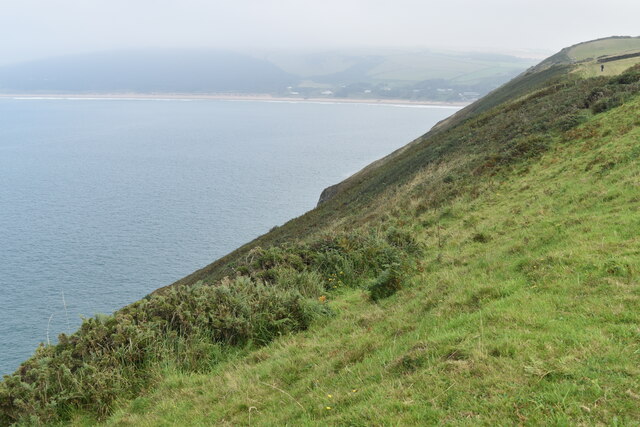
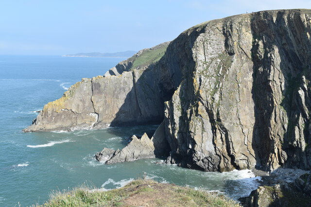
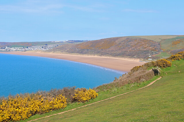
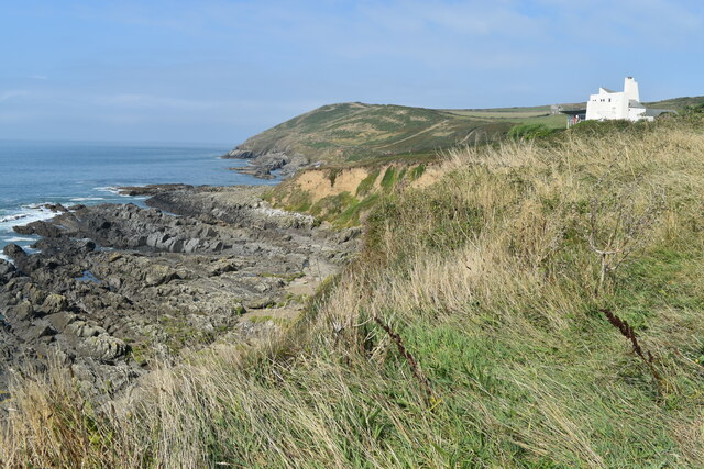
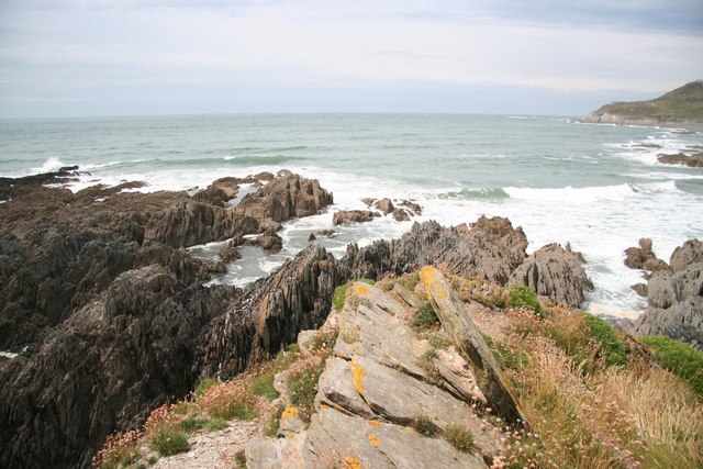
Baggy Point is characterized by its rugged cliffs, which rise to a height of approximately 110 meters above sea level. The cliffs are composed of sandstone and shale, providing a diverse geological landscape. The point offers breathtaking views of the Atlantic Ocean, with clear visibility of the nearby Lundy Island on clear days.

The area surrounding Baggy Point is abundant in wildlife and plant species. The headland provides a habitat for various seabirds, including razorbills, guillemots, and fulmars, making it a popular spot for birdwatching. Additionally, the coastal heathlands and grasslands support a rich diversity of flora, including vibrant wildflowers such as thrift and sea campion.

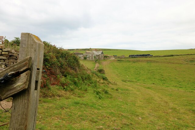
Baggy Point is also well-known for its recreational activities. The cliff paths and coastal trails attract hikers, walkers, and runners, who can enjoy the panoramic views while exploring the area. The rugged coastline is a haven for rock climbers, with numerous challenging routes available for all skill levels.

Overall, Baggy Point in Devon offers visitors a unique blend of natural beauty, geological interest, and outdoor activities. It is a must-visit location for nature enthusiasts, geologists, and those seeking an adventure on the stunning North Devon coast.

If you have any feedback on the listing, please let us know in the comments section below.

Baggy Point Images

Images are sourced within 2km of 51.143043/-4.2606915 or Grid Reference SS4140. Thanks to Geograph Open Source API. All images are credited.

Croydehoe Farm Farmhouse near Baggy Point
Croydehoe Farm
Farmhouse near Baggy Point
The Path to Baggy Point Popular cliff edge path to Baggy Point.
The Path to Baggy Point
Popular cliff edge path to Baggy Point.
Croydehoe Farm Farmhouse near Baggy Point
Croydehoe Farm
Farmhouse near Baggy Point
South West Coast Path towards Baggy Point
Gate with a view Gate on South West Coast Path with the southern end of Morte Bay in the distance.
Gate with a view
Gate on South West Coast Path with the southern end of Morte Bay in the distance.
Cliff top south of Morte Bay
On Baggy Point, looking inland
Baggy Point
Baggy Point
Cliffs at Baggy Point
Shore below Pencil Rock
Rocky shore below the path to Baggy Point
Pond with viewing platform By the coastal path to Baggy Point.
Pond with viewing platform
By the coastal path to Baggy Point.
Field Barn Fields overlooking Croyde.
Field Barn
Fields overlooking Croyde.
Woolacombe Bay From near the South West Coast Path.
Woolacombe Bay
From near the South West Coast Path.
Woolacombe Bay South West Coast Path overlooking Woolacombe Bay.
Woolacombe Bay
South West Coast Path overlooking Woolacombe Bay.
On the beach at Croyde
Seafront accommodation, Croyde
Shore below Baggy House
Show me another place!

Baggy Point is located at Grid Ref: SS4140 (Lat: 51.143043, Lng: -4.2606915)

Administrative County: Devon

District: North Devon

Police Authority: Devon and Cornwall

What 3 Words

///short.dancer.written. Near Braunton, Devon

Nearby Locations

Baggy Point

Related Wikis

Baggy Point

Baggy Point is a headland in north Devon, England. It separates Croyde Bay and Morte Bay which includes the beaches of Woolacombe and Putsborough. There...

Putsborough

Putsborough is a hamlet in Georgeham Civil Parish on the west-facing coast of North Devon, England. It is about 3⁄4 mile (1.2 km) north of the village...

Croyde

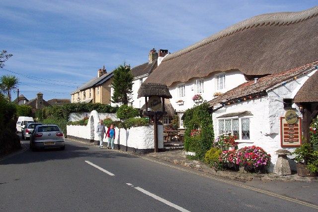
Croyde is a village on the west-facing coastline of North Devon, England. The village lies on the South West Coast Path near to Baggy Point, which is owned...

Morte Bay

Morte Bay is a bay on the northwest coast of Devon in southwest England. It stretches from Whiting Hole about 500m north of Baggy Point in the south to...

Nearby Amenities

Located within 500m of 51.143043,-4.2606915
Source: PGS
Lat/Long: 51.1466326/-4.2574244
Source: PGS
Lat/Long: 51.1463803/-4.2574528
Source: PGS
Lat/Long: 51.1460118/-4.2575991
Source: PGS
Lat/Long: 51.1456138/-4.257505
Source: PGS
Lat/Long: 51.1452717/-4.2579125
Source: PGS
Lat/Long: 51.1450139/-4.2580458
Source: PGS
Lat/Long: 51.1447612/-4.2596541
Source: PGS
Lat/Long: 51.1446987/-4.2593621
Source: PGS
Lat/Long: 51.144645/-4.2590002
Source: PGS
Lat/Long: 51.1444294/-4.25922
Source: PGS
Lat/Long: 51.144047/-4.2597142
Source: PGS
Lat/Long: 51.1437409/-4.2603167
Source: PGS
Lat/Long: 51.1435377/-4.2617724
Source: PGS
Lat/Long: 51.1428449/-4.2618993
Source: PGS
Lat/Long: 51.1424553/-4.2610652
Source: PGS
Lat/Long: 51.1423033/-4.2609563
Source: PGS
Lat/Long: 51.1421564/-4.2607556
Source: PGS
Lat/Long: 51.1412892/-4.2601507
Source: PGS
Lat/Long: 51.1411899/-4.2600156
Source: PGS
Lat/Long: 51.141083/-4.2596884
Source: PGS
Lat/Long: 51.1405823/-4.2583221
Source: PGS
Lat/Long: 51.1404354/-4.2583631
Source: PGS
Lat/Long: 51.1403459/-4.2583127
Baggy Point
Place: locality
Source: NPE
Wikidata: Q4841602
Wikipedia: en:Baggy Point
Lat/Long: 51.1430386/-4.2608747
Whiting Hole
Lat/Long: 51.1466712/-4.2574482
Baggy Hole
Lat/Long: 51.144403/-4.2590468
Pencil Rock
Lat/Long: 51.1406467/-4.256032
Small Daymark
Man Made: cairn
Lat/Long: 51.1437485/-4.2574834
WW 2 Bunker/OP (Ruin)
Historic: ruins
Lat/Long: 51.1428099/-4.2572675
WW 2 Bunker/OP (Ruin)
Historic: ruins
Lat/Long: 51.1439441/-4.2547569
Hiking: yes
Image: https://archive.org/details/baggy-point-2021-09-10/PXL_20210910_130133449.jpg
Information: guidepost
Tourism: information
Lat/Long: 51.1420749/-4.2578191
Tourism: viewpoint
Lat/Long: 51.1429306/-4.2611852
Baggy Point Coastguard Pole
Information: board
Tourism: information
Lat/Long: 51.1437387/-4.2573393
Baggy Point Coastguard Pole
Historic: monument
Lat/Long: 51.1437459/-4.2573738
Bench
Source: survey;gps
Lat/Long: 51.1426453/-4.2589898
Bench
Source: survey;gps
Lat/Long: 51.1422608/-4.2581999
The data included in this document is from www.openstreetmap.org. The data is made available under ODbL.

Have you been to Baggy Point?

Leave your review of Baggy Point below (or comments, questions and feedback).