A' Ghoil

Coastal Feature, Headland, Point in Sutherland

Scotland

A' Ghoil

The summit of Beinn an Duibhe Looking east across the Faraid peninsula to the distant Whiten Head.
The summit of Beinn an Duibhe Credit: Michael Earnshaw

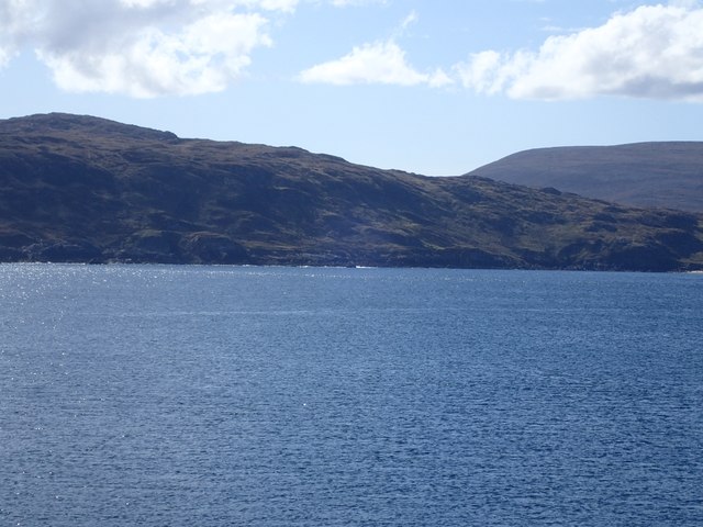
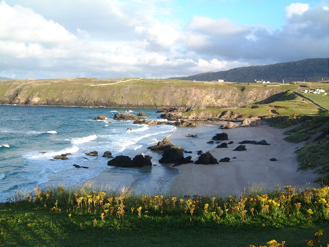
A' Ghoil is a prominent coastal feature located in Sutherland, Scotland. It is a headland that forms a distinct point jutting out into the North Sea. This geographical formation is known for its picturesque beauty and rugged cliffs that offer breathtaking views of the surrounding landscape.

A' Ghoil is situated on the northern coast of Sutherland, near the village of Tongue. The headland is characterized by steep cliffs that rise dramatically from the sea, reaching heights of up to 100 meters in some areas. These cliffs are composed of ancient rock formations, displaying layers of sedimentary rocks that have been shaped by erosion over millions of years.

The headland is a popular destination for nature enthusiasts, hikers, and photographers due to its stunning natural scenery. The panoramic views from A' Ghoil provide visitors with an opportunity to witness the raw power of the North Sea as it crashes against the cliffs below. The area is also home to a diverse range of wildlife, including seabirds such as puffins, guillemots, and kittiwakes.

Access to A' Ghoil is relatively easy, with well-maintained footpaths leading to the headland. Visitors can explore the rugged coastline, walk along the cliff tops, or simply relax and soak in the awe-inspiring surroundings. It is important to note that care should be taken while navigating the cliffs, as they can be treacherous and slippery, especially during wet or windy conditions.

Overall, A' Ghoil is a captivating coastal feature that offers visitors a unique and unforgettable experience. Its stunning cliffs, panoramic views, and abundant wildlife make it a must-visit destination for anyone exploring the scenic beauty of Sutherland's northern coast.

If you have any feedback on the listing, please let us know in the comments section below.
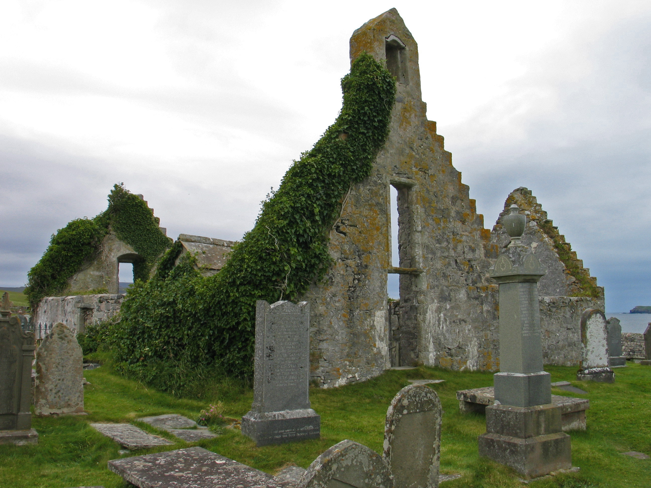
A' Ghoil Images

Images are sourced within 2km of 58.601192/-4.8413477 or Grid Reference NC3571. Thanks to Geograph Open Source API. All images are credited.

The summit of Beinn an Duibhe Looking east across the Faraid peninsula to the distant Whiten Head.
The summit of Beinn an Duibhe
Looking east across the Faraid peninsula to the distant Whiten Head.
North east slopes of Beinn an Duibhe Taken from the west side of Faraid Head
North east slopes of Beinn an Duibhe
Taken from the west side of Faraid Head
Sea and coast line to south east of Port Obhar Taken from the west side of Faraid Head
Sea and coast line to south east of Port Obhar
Taken from the west side of Faraid Head
UXB,  Unexploded NATO shell Unexploded NATO (blue) shell in an impact crater on the MOD NATO Naval firing range. The shell was fired from 12 miles offshore. Some of the soil inside & around the impact crater has been carbonised by the heat of the first exploding shell.
UXB, Unexploded NATO shell
Unexploded NATO (blue) shell in an impact crater on the MOD NATO Naval firing range. The shell was fired from 12 miles offshore. Some of the soil inside & around the impact crater has been carbonised by the heat of the first exploding shell.
Disused cargo container Disused cargo container strafed with built and shrapnel holes. Latitude 58°35'56.01"N longitude 4°51'47.26"W
Disused cargo container
Disused cargo container strafed with built and shrapnel holes. Latitude 58°35'56.01"N longitude 4°51'47.26"W
Target practice Disused armoured personnel carrier. Latitude 58°36'3.50"N longitude 4°51'46.09"W
Target practice
Disused armoured personnel carrier. Latitude 58°36'3.50"N longitude 4°51'46.09"W
The Austin Allegro is a small family car Disused armored personnel carrier. Latitude 58°36'3.50"N longitude 4°51'46.09"W
The Austin Allegro is a small family car
Disused armored personnel carrier. Latitude 58°36'3.50"N longitude 4°51'46.09"W
Used car For sale one careful owner, unfortunately one careless naval bombardment direct hit, so it needs a T-cut a wax & some tlc
Used car
For sale one careful owner, unfortunately one careless naval bombardment direct hit, so it needs a T-cut a wax & some tlc
Viewing the cliffs to the northeast of Sgribhis- bheinn On the previous three nights these bird watchers had been netting and ringing storm petrels on the cliff tops here.
Viewing the cliffs to the northeast of Sgribhis- bheinn
On the previous three nights these bird watchers had been netting and ringing storm petrels on the cliff tops here.
Storm Petrel is released from a "mist net" on the slopes of Sgribhis-bheinn
"Ringing" a Storm Petrel by Cape Wrath These tiny, swallow-like birds fly with a non stop wing action and fly in the most atrocious conditions close to the surface of the sea.  They nest in burrows and lay a single egg.
"Ringing" a Storm Petrel by Cape Wrath
These tiny, swallow-like birds fly with a non stop wing action and fly in the most atrocious conditions close to the surface of the sea. They nest in burrows and lay a single egg.
A rare view of a Storm Petrel (Hydrobates pelagicus)
Balnakeil Bay and Faraid Head From the west side of the Kyle of Durness.
Balnakeil Bay and Faraid Head
From the west side of the Kyle of Durness.
Port Odhar, Cape Wrath Bombing Range
Land Rover, Cape Wrath Range
Sunset from the bomb site. Cape Wrath Range.
Sunset from the bomb site.
Cape Wrath Range.
Show me another place!

A' Ghoil is located at Grid Ref: NC3571 (Lat: 58.601192, Lng: -4.8413477)

Unitary Authority: Highland

Police Authority: Highlands and Islands

What 3 Words

///hires.moved.pixel. Near Oldshoremore, Highland

Related Wikis

Faraid Head

Faraid Head (Scottish Gaelic: An Fharaird) is a small peninsula on the northern coast of Sutherland, Highland, Scotland, located around 2 miles (3 kilometres...

Achiemore, Durness

Achiemore was a crofting community located on the Cape Wrath peninsula near the village of Durness in the Scottish county of Sutherland. The hamlet is...

Balnakeil

Balnakeil is a hamlet in the parish of Durness, Sutherland, Scottish Highlands, and is in the Scottish council area of Highland. It is on the north coast...

Durness

Durness (Scottish Gaelic: Diùranais) is a village and civil parish in the north-west Highlands of Scotland. It lies on the north coast of the country in...

Nearby Amenities

Located within 500m of 58.601192,-4.8413477
Source: PGS
Lat/Long: 58.5987629/-4.8470953
Created By: almien_coastlines
Source: PGS
Lat/Long: 58.599212/-4.847328
Source: PGS
Lat/Long: 58.5996501/-4.8480764
Source: PGS
Lat/Long: 58.599615/-4.8488864
Source: PGS
Lat/Long: 58.5998059/-4.8487987
Created By: almien_coastlines
Source: PGS
Lat/Long: 58.600722/-4.849124
Source: PGS
Lat/Long: 58.601053/-4.8498911
Created By: almien_coastlines
Source: PGS
Lat/Long: 58.599539/-4.833365
Source: PGS
Lat/Long: 58.5996907/-4.8364704
Created By: almien_coastlines
Source: PGS
Lat/Long: 58.599878/-4.836572
Source: PGS
Lat/Long: 58.6000615/-4.8367085
Source: PGS
Lat/Long: 58.6002433/-4.8361615
Source: PGS
Lat/Long: 58.6003947/-4.8353109
Source: PGS
Lat/Long: 58.6011896/-4.8353938
Source: PGS
Lat/Long: 58.6012673/-4.8362682
Source: PGS
Lat/Long: 58.601317/-4.8369762
Created By: almien_coastlines
Source: PGS
Lat/Long: 58.601146/-4.837374
Source: PGS
Lat/Long: 58.6012773/-4.8399824
Created By: almien_coastlines
Source: PGS
Lat/Long: 58.601616/-4.840341
Source: PGS
Lat/Long: 58.601718/-4.8410503
Source: PGS
Lat/Long: 58.6019379/-4.8415797
Source: PGS
Lat/Long: 58.6018508/-4.8423327
Source: PGS
Lat/Long: 58.601612/-4.8434194
Source: PGS
Lat/Long: 58.6013292/-4.8434728
Source: PGS
Lat/Long: 58.6010866/-4.8426682
Source: PGS
Lat/Long: 58.6004947/-4.8421193
Source: PGS
Lat/Long: 58.6000908/-4.841148
Created By: almien_coastlines
Source: PGS
Lat/Long: 58.599918/-4.842705
Created By: almien_coastlines
Source: PGS
Lat/Long: 58.599648/-4.843671
Created By: almien_coastlines
Source: PGS
Lat/Long: 58.599385/-4.844148
Created By: almien_coastlines
Source: PGS
Lat/Long: 58.59925/-4.844632
Source: PGS
Lat/Long: 58.5990257/-4.8452158
Source: PGS
Lat/Long: 58.598799/-4.84596
Source: PGS
Lat/Long: 58.5986155/-4.8461213
Source: PGS
Lat/Long: 58.598451/-4.846797
A'Ghoil
Place: locality
Source: OS7
Lat/Long: 58.6027605/-4.8398393
The data included in this document is from www.openstreetmap.org. The data is made available under ODbL.

Have you been to A' Ghoil?

Leave your review of A' Ghoil below (or comments, questions and feedback).