Carreg y Defaid

Coastal Feature, Headland, Point in Caernarfonshire

Wales

Carreg y Defaid

A499 east of Llanbedrog
A499 east of Llanbedrog Credit: Alpin Stewart

Carreg y Defaid is a prominent coastal feature located in Caernarfonshire, Wales. It is a headland that juts out into the Irish Sea, forming a distinctive point along the coastline. The name "Carreg y Defaid" translates to "Sheep Rock" in English, which is derived from the unique rock formation found on the headland.

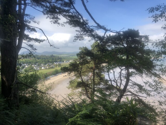
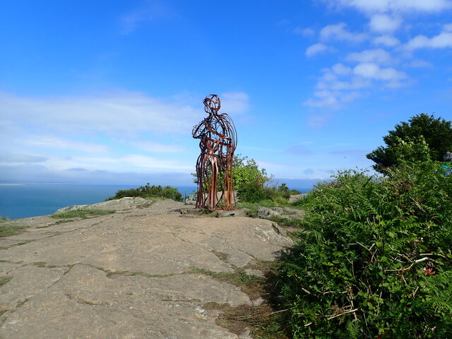
The headland is situated in an area of outstanding natural beauty, offering breathtaking views of the surrounding landscape. It is characterized by rugged cliffs that drop down into the sea, creating a dramatic and picturesque scene. The rock formation itself resembles the shape of a sheep, which adds to the charm and allure of the location.

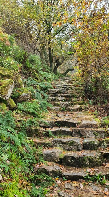
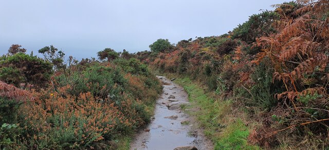
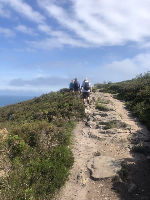
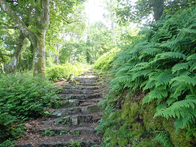
Carreg y Defaid is a popular destination for outdoor enthusiasts and nature lovers. The headland provides excellent opportunities for hiking and exploring the coastal trails, allowing visitors to immerse themselves in the stunning scenery and observe the diverse marine life that inhabits the surrounding waters. Birdwatchers also frequent the area, as it is home to a variety of seabirds, including puffins, guillemots, and razorbills.

Due to its location, Carreg y Defaid is subject to the powerful forces of the sea. The crashing waves and strong currents have carved out sea caves and arches along the cliffs, further enhancing the natural beauty of the area. It is important for visitors to exercise caution and stay within designated paths, as the rugged terrain can be treacherous.

Overall, Carreg y Defaid is a captivating coastal feature that offers a combination of stunning vistas, diverse wildlife, and unique rock formations. It is a must-visit destination for those seeking an authentic and awe-inspiring experience along the Caernarfonshire coastline.

If you have any feedback on the listing, please let us know in the comments section below.

Carreg y Defaid Images

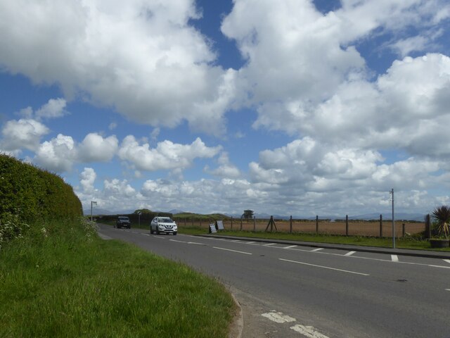
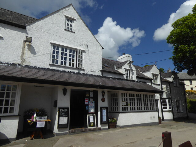
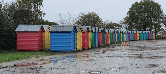
Images are sourced within 2km of 52.864225/-4.4658852 or Grid Reference SH3432. Thanks to Geograph Open Source API. All images are credited.

A499 east of Llanbedrog
Glyn Y Weddw Arms, Llanbedrog
North Wales WWII defences: RAF Penrhos - Air Raid Shelter  (1) -
Air Raid Shelter: EDoB ID: e61394

On a dispersed site, located next to a probable maintenance/workshop hangar.

<a href="https://www.geograph.org.uk/photo/6944913">SH3334 : North Wales WWII defences: RAF Penrhos - Air Raid Shelter  (2)</a>
North Wales WWII defences: RAF Penrhos - Air Raid Shelter (1)
- Air Raid Shelter: EDoB ID: e61394 On a dispersed site, located next to a probable maintenance/workshop hangar. SH3334 : North Wales WWII defences: RAF Penrhos - Air Raid Shelter (2)
North Wales WWII defences: RAF Penrhos - Air Raid Shelter  (2) -
Air Raid Shelter: EDoB ID: e61394

<a href="https://www.geograph.org.uk/photo/6944916">SH3334 : North Wales WWII defences: RAF Penrhos - disused hangar  (1)</a>
North Wales WWII defences: RAF Penrhos - Air Raid Shelter (2)
North Wales WWII defences: RAF Penrhos - disused hangar  (1) A now derelict hangar remote from the airfield, that was probably a maintenance workshop of some kind.

<a href="https://www.geograph.org.uk/photo/6944917">SH3334 : North Wales WWII defences: RAF Penrhos - disused hangar  (2)</a>
North Wales WWII defences: RAF Penrhos - disused hangar (1)
A now derelict hangar remote from the airfield, that was probably a maintenance workshop of some kind. SH3334 : North Wales WWII defences: RAF Penrhos - disused hangar (2)
North Wales WWII defences: RAF Penrhos - disused hangar  (2) -
START: <a href="https://www.geograph.org.uk/photo/5409513">SH3333 : North Wales WWII defences: RAF Penrhos - pillbox (1)</a>
North Wales WWII defences: RAF Penrhos - disused hangar (2)
Llanbedrog, Gwynedd Beach huts moth-balled for the winter at Llanbedrog.
Llanbedrog, Gwynedd
Beach huts moth-balled for the winter at Llanbedrog.
Llanbedrog, Gwynedd Steep, slippery steps up through woodland from Llanbedrog to the high ground of Mynydd Tir-y-cwmwd.
Llanbedrog, Gwynedd
Steep, slippery steps up through woodland from Llanbedrog to the high ground of Mynydd Tir-y-cwmwd.
Mynydd Tir-y-cwmwd, Gwynedd A muddy track cutting though gorse and heather on Mynydd Tir-y-cwmwd.
Mynydd Tir-y-cwmwd, Gwynedd
A muddy track cutting though gorse and heather on Mynydd Tir-y-cwmwd.
Llanbedrog, Gwynedd A fine collection of mushrooms - possibly Honey Mushrooms.
Llanbedrog, Gwynedd
A fine collection of mushrooms - possibly Honey Mushrooms.
Llanbedrog, Gwynedd Plas Glyn y Weddw is now a gallery and arts centre. It was built in 1857 for Elizabeth Jones Parry, widow of Sir Love Jones Parry of Madryn. Following the death of Lady Parry and her son Thomas Love Duncombe Jones Parry, the mansion was sold to Cardiff businessman Solomon Andrews. An art gallery was first established in the house in 1896. The gallery was closed at the outbreak of the Second World War and the Land Army girls stayed in part of the house. The Andrews family sold the mansion and the grounds in 1945. During this period the building was turned into residential flats and by the late 1970’s it was in a bad state. In 1979 the artist Gwyneth ap Tomos and her husband Dafydd bought Plas Glyn y Weddw and through their hard work the Plas was saved from becoming a ruin. A charitable trust was formed during the mid 1990’s to take over the running of the gallery.
Llanbedrog, Gwynedd
Plas Glyn y Weddw is now a gallery and arts centre. It was built in 1857 for Elizabeth Jones Parry, widow of Sir Love Jones Parry of Madryn. Following the death of Lady Parry and her son Thomas Love Duncombe Jones Parry, the mansion was sold to Cardiff businessman Solomon Andrews. An art gallery was first established in the house in 1896. The gallery was closed at the outbreak of the Second World War and the Land Army girls stayed in part of the house. The Andrews family sold the mansion and the grounds in 1945. During this period the building was turned into residential flats and by the late 1970’s it was in a bad state. In 1979 the artist Gwyneth ap Tomos and her husband Dafydd bought Plas Glyn y Weddw and through their hard work the Plas was saved from becoming a ruin. A charitable trust was formed during the mid 1990’s to take over the running of the gallery.
Llanbedrog and its beach A row of gaily coloured huts line the back of the beach. This is a view from the Welsh Coast Path on Mynydd Tir-y-Cwmwd
Llanbedrog and its beach
A row of gaily coloured huts line the back of the beach. This is a view from the Welsh Coast Path on Mynydd Tir-y-Cwmwd
Walkers on the Wales Coast Path On Mynydd Tir-y-Cwmwd
Walkers on the Wales Coast Path
On Mynydd Tir-y-Cwmwd
Welsh Coast Path climbing south from Plas Glyn y Weddw
Beach huts, Llanbedrog beach For £450, you can book a beach hut for the whole season from the National Trust.
Beach huts, Llanbedrog beach
For £450, you can book a beach hut for the whole season from the National Trust.
The Tin Man, Mynydd Tir-y-Cwmwd This is the third figurehead to have been placed here on the headland. The original was a wooden ship's figurehead but it was burnt by vandals in the late 1970's. This was replaced by a metal statue by sculptor Simon van de Put in 1981. Over the years this rusted and the local council commissioned the present statue which was placed here in 2002.
The Tin Man, Mynydd Tir-y-Cwmwd
This is the third figurehead to have been placed here on the headland. The original was a wooden ship's figurehead but it was burnt by vandals in the late 1970's. This was replaced by a metal statue by sculptor Simon van de Put in 1981. Over the years this rusted and the local council commissioned the present statue which was placed here in 2002.
The Tin Man overlooking Llanbedrog Beach This is the third figurehead to have been placed here on the headland of Mynydd Tir-y-Cwmwd. The original was a wooden ship's figurehead but it was burnt by vandals in the late 1970's. This was replaced by a metal statue by sculptor Simon van de Put in 1981. Over the years this rusted and the local council commissioned the present statue which was placed here in 2002.
The Tin Man overlooking Llanbedrog Beach
This is the third figurehead to have been placed here on the headland of Mynydd Tir-y-Cwmwd. The original was a wooden ship's figurehead but it was burnt by vandals in the late 1970's. This was replaced by a metal statue by sculptor Simon van de Put in 1981. Over the years this rusted and the local council commissioned the present statue which was placed here in 2002.
Wales Coast Path Heading towards the headland of Mynydd Tir-y-Cwmwd
Wales Coast Path
Heading towards the headland of Mynydd Tir-y-Cwmwd
Show me another place!

Carreg y Defaid is located at Grid Ref: SH3432 (Lat: 52.864225, Lng: -4.4658852)

Unitary Authority: Gwynedd

Police Authority: North Wales

What 3 Words

///cured.prices.decking. Near Pwllheli, Gwynedd

Related Wikis

RAF Penrhos

Royal Air Force Penrhos, or more simply RAF Penrhos, is a former Royal Air Force airfield located near Penrhos, Gwynedd and 14.7 miles (23.7 km) west of...

Llanbedrog

Llanbedrog is a village and community on the Llŷn peninsula of Gwynedd in Wales. It is situated on the south side of the peninsula on the A499 between...

Penrhos, Gwynedd

Penrhos is a village and former civil parish in the Welsh county of Gwynedd, located on the Llŷn Peninsula. The parish was abolished in 1934, and incorporated...

Penyberth

Penyberth was a farmhouse at Penrhos, on the Llŷn Peninsula near Pwllheli, Gwynedd, which had been the home to generations of patrons of poets, and also...

Nearby Amenities

Located within 500m of 52.864225,-4.4658852
Source: PGS
Lat/Long: 52.8613457/-4.4701684
Source: PGS
Lat/Long: 52.8616789/-4.4693962
Source: PGS
Lat/Long: 52.8622396/-4.4685748
Source: PGS
Lat/Long: 52.8625902/-4.4676851
Source: PGS
Lat/Long: 52.862803/-4.4669846
Source: PGS
Lat/Long: 52.8632145/-4.4657823
Source: PGS
Lat/Long: 52.8633727/-4.4654792
Source: PGS
Lat/Long: 52.8635899/-4.4645411
Source: PGS
Lat/Long: 52.863808/-4.4641225
Source: PGS
Lat/Long: 52.8638787/-4.4639204
Source: PGS
Lat/Long: 52.8641347/-4.4640062
Source: PGS
Lat/Long: 52.8645867/-4.4646499
Source: PGS
Lat/Long: 52.8647377/-4.4646473
Source: PGS
Lat/Long: 52.8652464/-4.4648051
Source: PGS
Lat/Long: 52.8653838/-4.464899
Source: PGS
Lat/Long: 52.8661839/-4.4655555
Source: PGS
Lat/Long: 52.866749/-4.4659712
Created By: dmgroom_coastlines
Source: PGS
Lat/Long: 52.866931/-4.465912
Source: PGS
Lat/Long: 52.8671262/-4.4657865
Source: PGS
Lat/Long: 52.8674362/-4.465428
Source: PGS
Lat/Long: 52.86777/-4.4650777
Source: PGS
Lat/Long: 52.868168/-4.4644083
Source: PGS
Lat/Long: 52.8612197/-4.4708348
Source: PGS
Lat/Long: 52.8616962/-4.4698815
Source: PGS
Lat/Long: 52.8620168/-4.4686183
Source: PGS
Lat/Long: 52.8622719/-4.4679261
Source: PGS
Lat/Long: 52.8625077/-4.46727
Source: PGS
Lat/Long: 52.8635454/-4.4645298
The data included in this document is from www.openstreetmap.org. The data is made available under ODbL.

Have you been to Carreg y Defaid?

Leave your review of Carreg y Defaid below (or comments, questions and feedback).