Gargunnock

Settlement in Stirlingshire

Scotland

Gargunnock

Unnamed reservoir A small reservoir formed by damming the two Blackspouts.
Unnamed reservoir Credit: Stephen Coyne

Gargunnock is a charming village located in the county of Stirlingshire, Scotland. Situated approximately six miles west of Stirling, it is nestled in the picturesque countryside and surrounded by rolling hills. With a population of around 700 residents, Gargunnock retains its small and close-knit community feel.

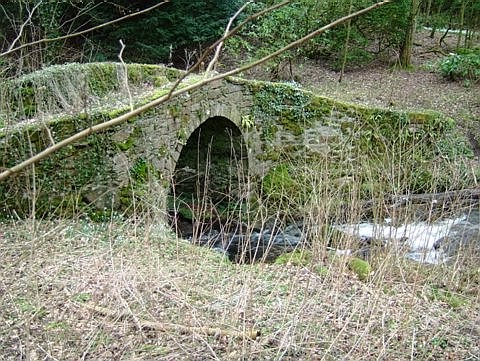
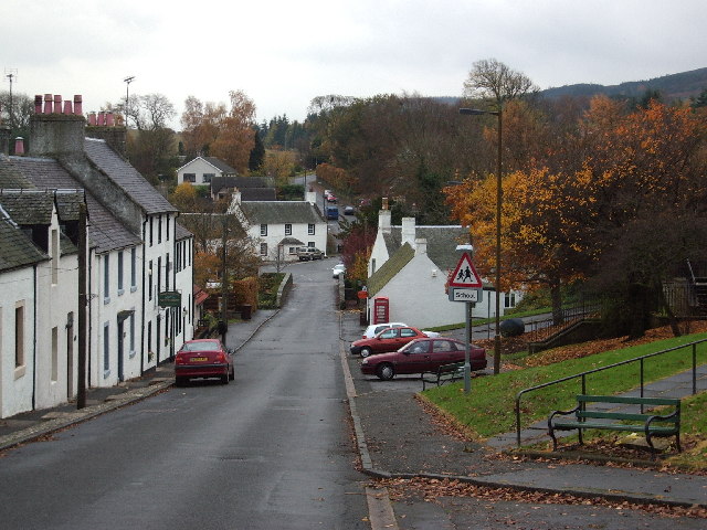
The village boasts a rich history, dating back to at least the 12th century. It is known for its well-preserved traditional Scottish architecture, with many old stone buildings lining the streets. One of the notable landmarks is Gargunnock House, an elegant Georgian mansion that has been home to the Grahams of Gargunnock for over 400 years.

Despite its small size, Gargunnock offers a range of amenities and services to its residents. These include a primary school, a village hall, a post office, and a local shop. The village also has a lively social scene, with various community groups and events taking place throughout the year.

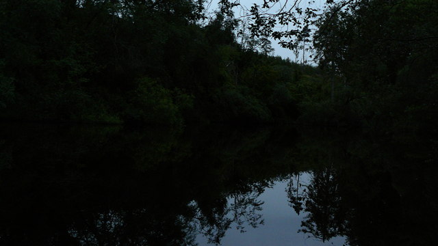
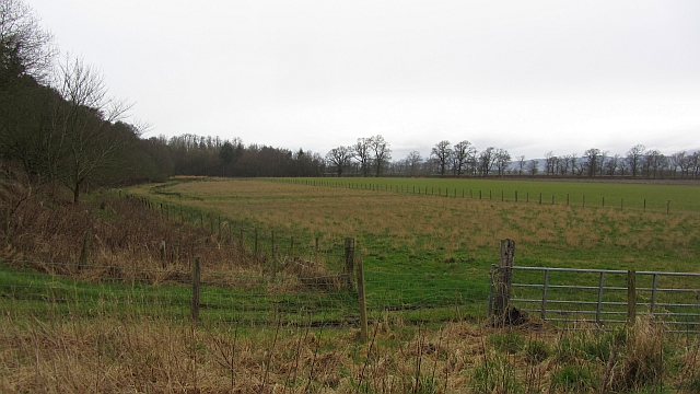
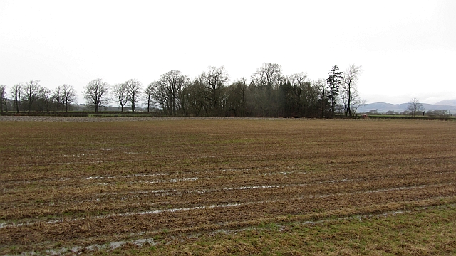
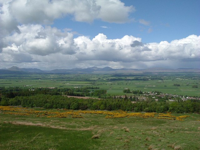
Surrounded by stunning natural beauty, Gargunnock is an ideal location for outdoor enthusiasts. The area offers numerous walking and cycling trails, allowing visitors to explore the captivating Scottish countryside. Additionally, the nearby Gargunnock Hills provide breathtaking views of the surrounding landscapes.

With its rich history, beautiful landscapes, and strong sense of community, Gargunnock offers a tranquil and idyllic setting for both residents and visitors alike.

If you have any feedback on the listing, please let us know in the comments section below.

Gargunnock Images

Images are sourced within 2km of 56.125525/-4.086953 or Grid Reference NS7094. Thanks to Geograph Open Source API. All images are credited.

Unnamed reservoir A small reservoir formed by damming the two Blackspouts.
Unnamed reservoir
A small reservoir formed by damming the two Blackspouts.
Foot of the steps Where the carse meets the first steep section of the Gargunnock Hills. The scarp is stepped with successive lava flows.
Foot of the steps
Where the carse meets the first steep section of the Gargunnock Hills. The scarp is stepped with successive lava flows.
Stubble, Gargunnock The field is a bit wet after a day of rain. This is the flat carse land beside the Forth.
Stubble, Gargunnock
The field is a bit wet after a day of rain. This is the flat carse land beside the Forth.
Turning for Gargunnock From A811 east
Turning for Gargunnock
From A811 east
Gargunnock junction with A811 Junction with A811. The road to Gargunnock (behind photographer), and farm road to Nether Carse.
Gargunnock junction with A811
Junction with A811. The road to Gargunnock (behind photographer), and farm road to Nether Carse.
Turning for Nether Carse and Patrickston
Footbridge in the Leckie Estate A bridge carrying a woodland path over a branch of the Leckie Burn.
Footbridge in the Leckie Estate
A bridge carrying a woodland path over a branch of the Leckie Burn.
Auld Leckie Brig - Leckie Estate - Gargunnock The Leckie Estate in the Parish of Gargunnock lies just south of the A811 about 6 miles West of Stirling. The old bridge crosses the Leckie Burn that runs down from the Gargunnock Hills to the River Forth.
Auld Leckie Brig - Leckie Estate - Gargunnock
The Leckie Estate in the Parish of Gargunnock lies just south of the A811 about 6 miles West of Stirling. The old bridge crosses the Leckie Burn that runs down from the Gargunnock Hills to the River Forth.
Pasture and mown meadow near Gargunnock From the A811 at the crossroads west of Gargunnock.
Pasture and mown meadow near Gargunnock
From the A811 at the crossroads west of Gargunnock.
Below the Gargunnock Hills
Bield Farm Bield Farm at bend in road towards Gargunock from the road that runs from the A811
Bield Farm
Bield Farm at bend in road towards Gargunock from the road that runs from the A811
Cottages South of Birkenwood Farm Cottages South of Birkenwood Farm taken from the A811 looking south.
Cottages South of Birkenwood Farm
Cottages South of Birkenwood Farm taken from the A811 looking south.
Knock O' Ronald This is Knock O' Ronald Farm, showing mostly the steadings, but with the white farm house peeking out from behind the hill.
Knock O' Ronald
This is Knock O' Ronald Farm, showing mostly the steadings, but with the white farm house peeking out from behind the hill.
East Lodge East Lodge, Leckie, was originally the gate lodge for Watson House. It has no been extended and is a private family home.
East Lodge
East Lodge, Leckie, was originally the gate lodge for Watson House. It has no been extended and is a private family home.
Inside Leckie Broch
Inside Leckie Broch
Open hillside below Gargunnock Crags Looking over Flanders Moss toward the twin peaks of Ben Vorlich and Stuc a'Chroin in centre and Ben Ledi to the left. The village of Gargunnock is to the right of the photo. Flanders Moss is a vast area of around 50 square miles forming the flood plain for the River Forth. Once entirely bog it was drained and is now rich arable farmland.
Open hillside below Gargunnock Crags
Looking over Flanders Moss toward the twin peaks of Ben Vorlich and Stuc a'Chroin in centre and Ben Ledi to the left. The village of Gargunnock is to the right of the photo. Flanders Moss is a vast area of around 50 square miles forming the flood plain for the River Forth. Once entirely bog it was drained and is now rich arable farmland.
Knock O' Ronald, Winter 2009/2010 Knock O' Ronald farm can be seen in the lower left corner and the western Ochils can be seen across a mist filled carse of Stirling.
Knock O' Ronald, Winter 2009/2010
Knock O' Ronald farm can be seen in the lower left corner and the western Ochils can be seen across a mist filled carse of Stirling.
Crags above Gargunnock Looking across the tussocks and broom to the crags above Gargunnock.
Crags above Gargunnock
Looking across the tussocks and broom to the crags above Gargunnock.
Show me another place!

Gargunnock is located at Grid Ref: NS7094 (Lat: 56.125525, Lng: -4.086953)

Unitary Authority: Stirling

Police Authority: Forth Valley

What 3 Words

///gross.escorting.chilling. Near Kippen, Stirling

Nearby Locations

Keir Hill Gargunnock

Related Wikis

Gargunnock

Gargunnock is a small village in the Stirling council area with an active community trust, seven miles (eleven kilometres) west of Stirling, in Scotland...

Stirling (UK Parliament constituency)

Stirling is a county constituency of the House of Commons of the Parliament of the United Kingdom. It elects one Member of Parliament (MP) by the first...

Gargunnock railway station

Gargunnock railway station served the village of Gargunnock, Stirling, Scotland, from 1856 to 1959 on the Forth and Clyde Junction Railway. == History... ==

Leckie Broch

Leckie Broch is an iron-age broch located in Stirlingshire, Scotland. == Location == Just above the confluence of two streams with deep gulleys on the...

Nearby Amenities

Located within 500m of 56.125525,-4.086953
Traffic Calming: rumble_strip
Lat/Long: 56.1230054/-4.0887587
Crossing
Crossing: unmarked
Crossing Island: no
Tactile Paving: no
Lat/Long: 56.1244198/-4.0894539
Noexit: yes
Lat/Long: 56.1262752/-4.0869309
Gargunnock
Is In: Stirling
Old Name: Gargouthie
Place: village
Population: 720
Source: local knowledge
Wikidata: Q1013539
Wikipedia: en:Gargunnock
Lat/Long: 56.1244452/-4.0828296
Turning Circle
Lat/Long: 56.1226267/-4.0912296
Traffic Calming: bump
Lat/Long: 56.1227733/-4.0903857
Traffic Calming: bump
Lat/Long: 56.1228484/-4.0896164
Keir Hill
Natural: wood
Lat/Long: 56.1233413/-4.0826417
Bench
Lat/Long: 56.1239751/-4.0820629
Bench
Lat/Long: 56.1239261/-4.0821252
Defibrillator
Booth: K6
Covered: booth
Defibrillator Location: inside red phone box, Main Street, Gargunnock - next to village store
Disused Amenity: telephone
Emergency: defibrillator
Man Made: telephone_box
Lat/Long: 56.1246826/-4.0838464
Post Box
Collection Times: Mo-Fr 12:00; Sa 11:45
Drive Through: no
Operator: Royal Mail
Post Box Type: pillar
Ref: FK8 158
Royal Cypher: scottish_crown
Lat/Long: 56.1244603/-4.0825955
Traffic Calming: bump
Lat/Long: 56.123032/-4.0881562
Traffic Calming: bump
Lat/Long: 56.123091/-4.0871767
Traffic Calming: bump
Lat/Long: 56.1233537/-4.0863214
Traffic Calming: bump
Lat/Long: 56.1236154/-4.0855006
Traffic Calming: bump
Lat/Long: 56.1242931/-4.0817782
Traffic Calming: bump
Lat/Long: 56.1265298/-4.0825578
Bench
Lat/Long: 56.1240534/-4.0819788
Bench
Lat/Long: 56.1242155/-4.0820419
Bench
Lat/Long: 56.1246618/-4.0829817
Traffic Calming: bump
Lat/Long: 56.126292/-4.0825908
Bus Stop
George Place
Bench: yes
Bin: no
Bus: yes
Departures Board: timetable
Naptan AtcoCode: 66005130005
Naptan NaptanCode: 78423987
Operator: First
Public Transport: platform
Ref: 78423987
Shelter: yes
Lat/Long: 56.1249966/-4.083223
Bus Stop
George Place
Bus: yes
Departures Board: no
Operator: First
Public Transport: platform
Ref: 78424895
Shelter: no
Lat/Long: 56.124909/-4.0832347
Bus Stop
Church Hall
Bench: no
Bus: yes
Departures Board: timetable
Operator: First
Public Transport: platform
Ref: 78424236
Shelter: no
Lat/Long: 56.1261974/-4.0826484
Bus Stop
Church Hall
Bench: no
Bus: yes
Departures Board: no
Operator: First
Public Transport: platform
Ref: 78424894
Shelter: no
Lat/Long: 56.1259672/-4.0825852
Gargunnock War Memorial
Historic: memorial
Start Date: 1919
Lat/Long: 56.1246251/-4.0829129
Door: yes
Entrance: yes
Lat/Long: 56.1248351/-4.084156
Door: yes
Entrance: staircase
Lat/Long: 56.1251025/-4.0840392
Playground: roundabout
Lat/Long: 56.123785/-4.0864585
Playground: swing
Lat/Long: 56.1237593/-4.0862537
Leisure: picnic_table
Lat/Long: 56.1238134/-4.0862737
Playground: climbingframe
Lat/Long: 56.1241122/-4.0869401
Traffic Calming: choker
Lat/Long: 56.1239049/-4.08498
Man Made: flagpole
Lat/Long: 56.1246033/-4.0828864
Playground: climbingframe
Lat/Long: 56.1264413/-4.0839388
Playground: climbingframe
Lat/Long: 56.1263386/-4.0838124
Playground: climbingframe
Lat/Long: 56.1264226/-4.0838345
Playground: climbingframe
Lat/Long: 56.1264219/-4.0837587
Playground: slide
Lat/Long: 56.1241083/-4.0857831
Bench
Lat/Long: 56.125913/-4.0798748
Bench
Lat/Long: 56.125984/-4.0800022
Playground: zipwire
Lat/Long: 56.1240528/-4.0869592
Playground: climbingframe
Lat/Long: 56.1240277/-4.0858355
Advertising: board
Lat/Long: 56.1247203/-4.083448
Power: pole
Lat/Long: 56.1280503/-4.0848917
Power: pole
Lat/Long: 56.1287626/-4.0850026
Power: pole
Lat/Long: 56.1295716/-4.0851344
Power: pole
Lat/Long: 56.1286821/-4.0821181
Power: pole
Lat/Long: 56.1284933/-4.0831347
Power: pole
Lat/Long: 56.1283277/-4.0838019
Power: pole
Lat/Long: 56.1274732/-4.0854711
Power: pole
Lat/Long: 56.1268914/-4.086107
Power: pole
Lat/Long: 56.1262327/-4.0865233
Power: pole
Lat/Long: 56.1270605/-4.0866718
Power: pole
Lat/Long: 56.1272109/-4.0871738
Power: pole
Lat/Long: 56.1272995/-4.0883431
Power: pole
Lat/Long: 56.1272272/-4.0891965
Power: pole
Lat/Long: 56.1271596/-4.0900813
Power: pole
Lat/Long: 56.1271969/-4.0909536
Power: pole
Lat/Long: 56.1272552/-4.0918551
Power: pole
Lat/Long: 56.127324/-4.0927546
Power: pole
Lat/Long: 56.1273753/-4.0935724
Material: wood
Power: pole
Lat/Long: 56.1241676/-4.0943647
Material: wood
Power: pole
Lat/Long: 56.1242271/-4.0932414
Material: wood
Power: pole
Lat/Long: 56.1242947/-4.0921558
The data included in this document is from www.openstreetmap.org. The data is made available under ODbL.

Have you been to Gargunnock?

Leave your review of Gargunnock below (or comments, questions and feedback).