Caldey Point

Coastal Feature, Headland, Point in Pembrokeshire

Wales

Caldey Point

Redberry Bay, Caldey Island "Below is Redberry Bay, which is formed of mudstone rock. The ruined building to the right is Palmerstone Fort, built in the 1860s to protect our coastline from the French Navy. Choughs and Peregrine Falcons nest on the cliff face. There is pink thrift in abundance and Grey Seals are frequently to be seen on the rocks below."
Redberry Bay, Caldey Island Credit: Nigel Thompson

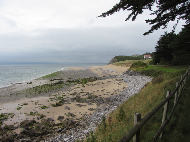
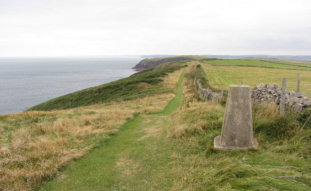
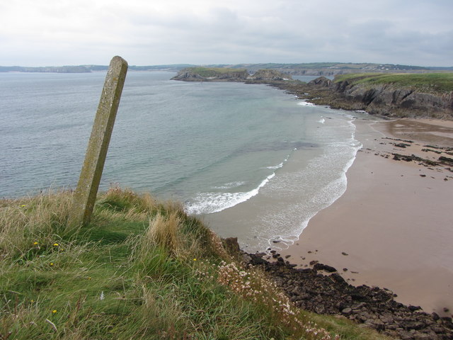
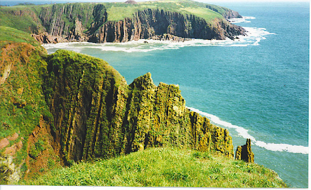
Caldey Point is a prominent headland located on the southwestern coast of Pembrokeshire, Wales. Jutting out into the Celtic Sea, it offers stunning views of the surrounding coastline and is a popular destination for nature enthusiasts and hikers.

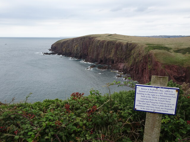
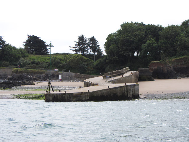
The headland is characterized by its rugged cliffs, which rise steeply from the sea, providing a dramatic backdrop to the crashing waves below. The cliffs are predominantly composed of sedimentary rock, showcasing layers of different geological formations. This makes Caldey Point an interesting site for geologists and those interested in the Earth's history.

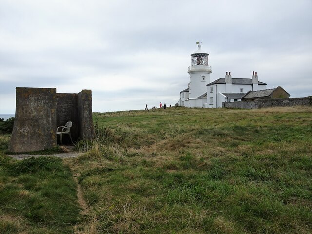
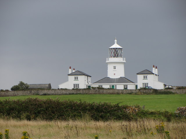
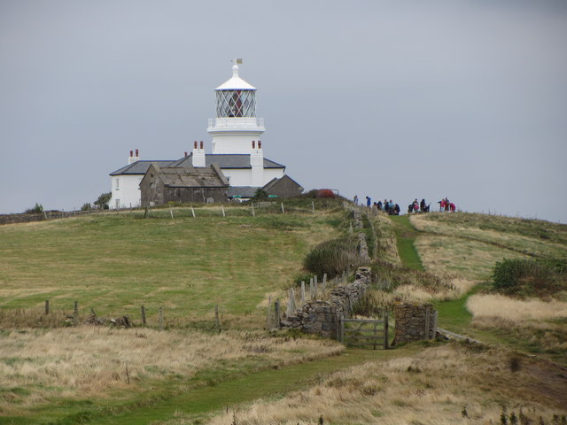
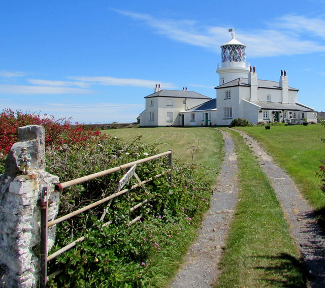
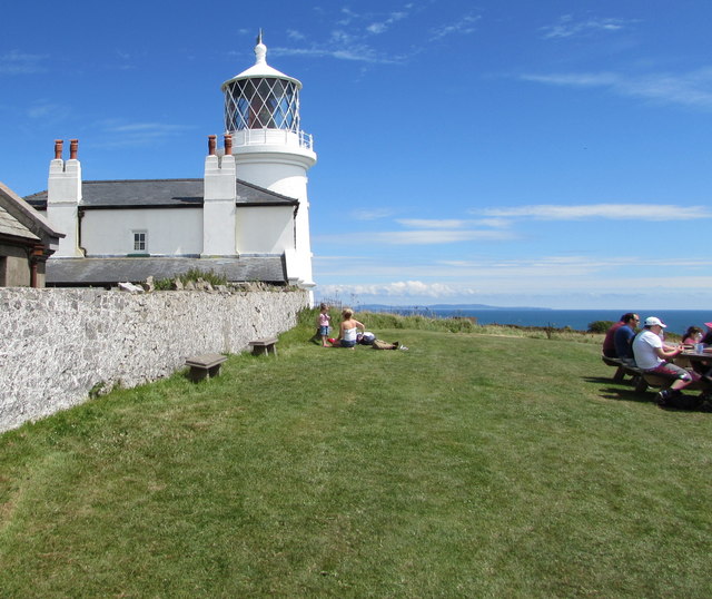
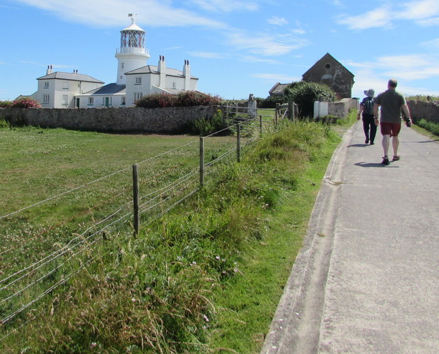
At the tip of the headland, there is a small lighthouse that has been guiding ships since its construction in the early 20th century. The lighthouse serves as an important navigational aid for vessels navigating the treacherous waters around the headland.

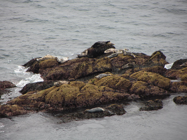
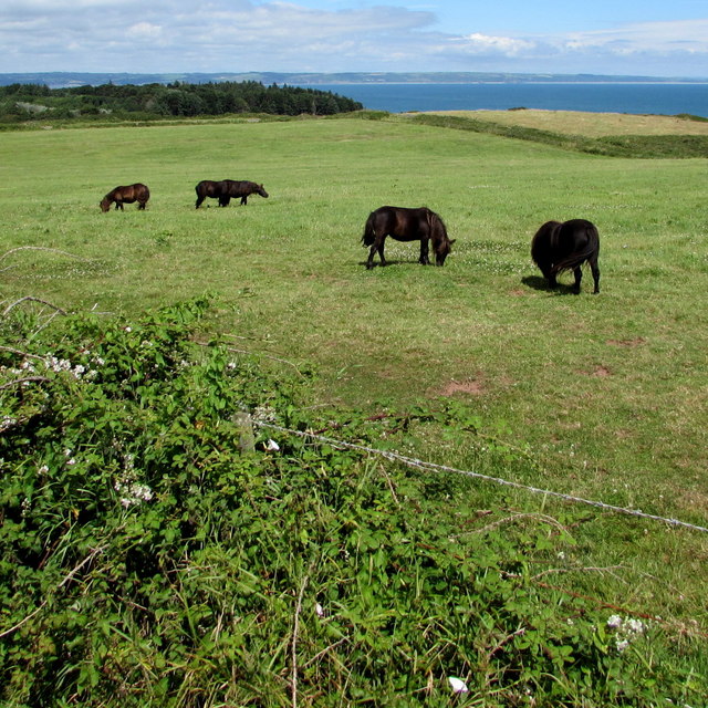
The area surrounding Caldey Point is rich in biodiversity, with a variety of plant and animal species calling it home. Seabirds, such as gulls and razorbills, can often be spotted nesting on the cliffs, while seals can be seen lounging on the rocks below. The coastal waters are also teeming with marine life, including dolphins and porpoises, adding to the area's natural beauty and appeal.

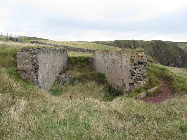
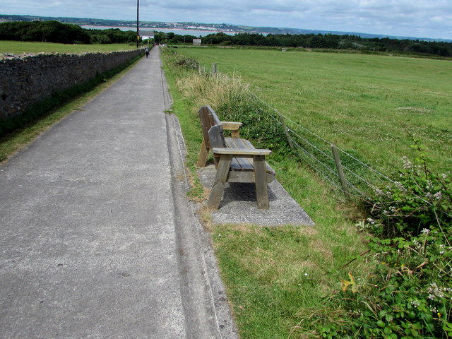
Visitors to Caldey Point can explore the headland via a network of footpaths and hiking trails, which offer stunning views of the coastline and provide opportunities for wildlife spotting. The area is also a popular spot for rock climbing and birdwatching, attracting outdoor enthusiasts from near and far.

If you have any feedback on the listing, please let us know in the comments section below.
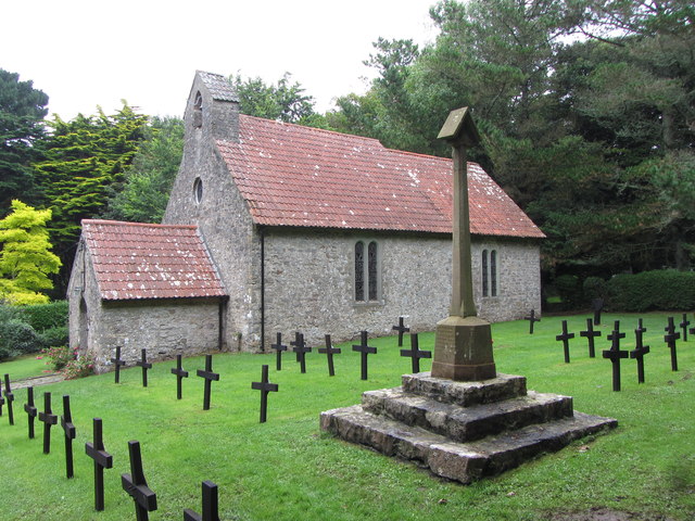
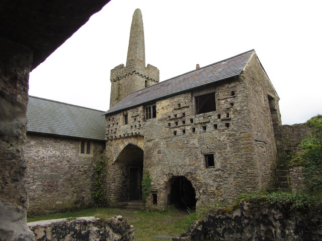
Caldey Point Images

Images are sourced within 2km of 51.6387/-4.6759067 or Grid Reference SS1496. Thanks to Geograph Open Source API. All images are credited.

Redberry Bay, Caldey Island "Below is Redberry Bay, which is formed of mudstone rock. The ruined building to the right is Palmerstone Fort, built in the 1860s to protect our coastline from the French Navy. Choughs and Peregrine Falcons nest on the cliff face. There is pink thrift in abundance and Grey Seals are frequently to be seen on the rocks below."
Redberry Bay, Caldey Island
"Below is Redberry Bay, which is formed of mudstone rock. The ruined building to the right is Palmerstone Fort, built in the 1860s to protect our coastline from the French Navy. Choughs and Peregrine Falcons nest on the cliff face. There is pink thrift in abundance and Grey Seals are frequently to be seen on the rocks below."
Caldey Island lighthouse and unknown structure
St. David's church, Caldey Island Parts date from around 1100 but on Celtic foundations that go back to around 550.
St. David's church, Caldey Island
Parts date from around 1100 but on Celtic foundations that go back to around 550.
Beach at Priory Bay on Caldey Island
St. David's church, Caldey Island
The Old Priory on Caldey Island
View to the lighthouse on Caldey Island
Caldey Island Trig Point
Seals near Chapel Point on Caldey Island
Footpath and lighthouse on Caldey Island
Remains of a structure on Caldey Island
Looking down on Sandtop Bay, Caldey Island
The jetty on Caldey Island
Grade II listed Caldey Island lighthouse Located in the SE corner of the island. The Caldey Island website states that the lighthouse was built in 1828. It was originally powered by oil lamps and had resident keepers to maintain the service. In 1927 the lighthouse was fully automated on conversion to gas power. Converted to electricity in 1997. 
The lighthouse was Grade II listed in 1970.
Grade II listed Caldey Island lighthouse
Located in the SE corner of the island. The Caldey Island website states that the lighthouse was built in 1828. It was originally powered by oil lamps and had resident keepers to maintain the service. In 1927 the lighthouse was fully automated on conversion to gas power. Converted to electricity in 1997. The lighthouse was Grade II listed in 1970.
Caldey Island lighthouse Located in the SE corner of the island. The Caldey Island website states that the lighthouse was built in 1828. It was originally powered by oil lamps and had resident keepers to maintain the service. In 1927 the lighthouse was fully automated on conversion to gas power. Converted to electricity in 1997. 
The lighthouse was Grade II listed in 1970. <a title="https://www.geograph.org.uk/photo/5047950" href="https://www.geograph.org.uk/photo/5047950">Link</a> to another view.
Caldey Island lighthouse
Located in the SE corner of the island. The Caldey Island website states that the lighthouse was built in 1828. It was originally powered by oil lamps and had resident keepers to maintain the service. In 1927 the lighthouse was fully automated on conversion to gas power. Converted to electricity in 1997. The lighthouse was Grade II listed in 1970. Link to another view.
Walking towards Caldey Island lighthouse Walkers approach the Grade II listed lighthouse <a title="https://www.geograph.org.uk/photo/5047979" href="https://www.geograph.org.uk/photo/5047979">Link</a> on a clifftop in the SE corner of the island.
Walking towards Caldey Island lighthouse
Walkers approach the Grade II listed lighthouse Link on a clifftop in the SE corner of the island.
Shetland ponies on Caldey Island Grazing in a field near the lighthouse. <a title="https://www.geograph.org.uk/photo/5047979" href="https://www.geograph.org.uk/photo/5047979">Link</a>
Shetland ponies on Caldey Island
Grazing in a field near the lighthouse. Link
Roadside wooden bench in the southeast of Caldey Island Alongside the road to the lighthouse. <a title="https://www.geograph.org.uk/photo/5047950" href="https://www.geograph.org.uk/photo/5047950">Link</a>
Roadside wooden bench in the southeast of Caldey Island
Alongside the road to the lighthouse. Link
Show me another place!

Caldey Point is located at Grid Ref: SS1496 (Lat: 51.6387, Lng: -4.6759067)

Unitary Authority: Pembrokeshire

Police Authority: Dyfed Powys

What 3 Words

///buns.same.unzipped. Near Penally, Pembrokeshire

Related Wikis

Caldey Abbey

Caldey Abbey is an abbey of the Trappists situated on Caldey Island off the coast of Pembrokeshire, Wales, south of Tenby. Caldey Island has been known...

Caldey Priory

Caldey Priory is a Grade I-listed priory on Caldey Island off the coast of Pembrokeshire, Wales, some 300 metres (330 yd) south of the modern Caldey Abbey...

Caldey Lighthouse

Caldey Lighthouse is located on the south end of Caldey Island, three miles (5 km) off the south Pembrokeshire, Wales coastline, a small island inhabited...

Caldey Island

Caldey Island (Welsh:Ynys Bŷr) is a small island near Tenby, Pembrokeshire, Wales, less than 1 mile (1.6 km) off the coast. With a recorded history going...

Nearby Amenities

Located within 500m of 51.6387,-4.6759067
Caldey Point
Natural: cape
Lat/Long: 51.6387971/-4.6756734
Small Ord Point
Natural: cape
Lat/Long: 51.6378387/-4.6757711
Little Drinkim
Natural: cape
Lat/Long: 51.6356539/-4.6782623
Bullum's Bay
Natural: bay
Lat/Long: 51.6372063/-4.6766724
Jones' Bay
Natural: bay
Lat/Long: 51.6392733/-4.678591
Den Point
Natural: cape
Lat/Long: 51.6411181/-4.6809429
Daylight Rock
Natural: cape
Lat/Long: 51.6382201/-4.6753355
Tourism: viewpoint
Lat/Long: 51.6410679/-4.6814227
The data included in this document is from www.openstreetmap.org. The data is made available under ODbL.

Have you been to Caldey Point?

Leave your review of Caldey Point below (or comments, questions and feedback).