Braich y Pwll

Coastal Feature, Headland, Point in Caernarfonshire

Wales

Braich y Pwll

Milestone
Milestone Credit: Adrian Dust

Braich y Pwll is a prominent headland located in Caernarfonshire, Wales. Situated along the stunning North Wales coastline, it serves as a distinctive landmark and is a popular destination for tourists and locals alike.

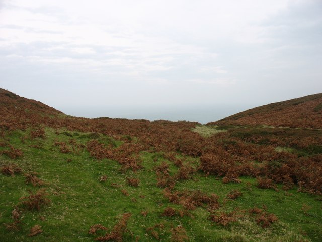
The headland is characterized by its rugged and dramatic cliffs that rise steeply from the sea, offering breathtaking views of the surrounding area. The cliffs are composed of a variety of rock types, including slate and limestone, which add to the area's geological significance.

Braich y Pwll is known for its diverse wildlife, with numerous species of birds, seals, and dolphins frequently spotted in the waters surrounding the headland. The area is also home to a variety of plant life, including rare coastal species that thrive in the harsh conditions.

Visitors to Braich y Pwll can enjoy a range of outdoor activities. The headland offers excellent opportunities for hiking and walking, with several well-marked trails that allow visitors to explore the area's natural beauty. The coastal cliffs are also popular among rock climbers, attracting enthusiasts from all over the country.

In addition to its natural beauty, Braich y Pwll is steeped in history. The headland is home to the ruins of an ancient hillfort, which dates back to the Iron Age. The fortifications provide a glimpse into the region's rich past and offer a fascinating insight into the lives of the people who once inhabited the area.

Overall, Braich y Pwll is a captivating coastal feature that combines stunning natural scenery, abundant wildlife, and a rich historical heritage. It is a must-visit destination for anyone seeking to explore the beauty of Caernarfonshire's coastline.

If you have any feedback on the listing, please let us know in the comments section below.

Braich y Pwll Images

Images are sourced within 2km of 52.797598/-4.7662505 or Grid Reference SH1325. Thanks to Geograph Open Source API. All images are credited.

Milestone
Milestone
The southern slopes of Mynydd Mawr Bardsey Island in the hazy background.
The southern slopes of Mynydd Mawr
Bardsey Island in the hazy background.
North-eastern slopes of Mynydd Mawr
Steps to the summit of Mynydd Mawr I presume that the steps, and the concrete platform at their foot, are the remains of constructions during World War II.
Steps to the summit of Mynydd Mawr
I presume that the steps, and the concrete platform at their foot, are the remains of constructions during World War II.
The summit of Mynydd y Gwyddel This small hill is 99m high. Bardsey Island is in a rather misty distance.
The summit of Mynydd y Gwyddel
This small hill is 99m high. Bardsey Island is in a rather misty distance.
Trwy'r gat / Through a gate Cerddwyr yn mynd trwy gat yn Uwchfynydd.

Walkers going through gate at Uwchfynydd (trans. above mountain).
Trwy'r gat / Through a gate
Cerddwyr yn mynd trwy gat yn Uwchfynydd. Walkers going through gate at Uwchfynydd (trans. above mountain).
Llwybr yn Uwchfynydd / Path at Uwchfynydd Llwybr yn mynd drwy gaeau yn Uwchfynydd. Nid yw'r llwybr ar y ddaear yn dilyn yr un a ddynodir ar y Map OS. 

A path going through fields in Uwchfynydd (trans. above mountain). The path on the ground does not correspond with that as shown by the OS Map.
Llwybr yn Uwchfynydd / Path at Uwchfynydd
Llwybr yn mynd drwy gaeau yn Uwchfynydd. Nid yw'r llwybr ar y ddaear yn dilyn yr un a ddynodir ar y Map OS. A path going through fields in Uwchfynydd (trans. above mountain). The path on the ground does not correspond with that as shown by the OS Map.
Tuag at Fynydd Mawr / Towards Mynydd Mawr Cerddwyr yn cyrraedd hen ddisgwylfa wylwyr y glannau ar Fynydd Mawr.

Walkers approaching the former coastguard lookout on Mynydd Mawr (trans. big mountain).
Tuag at Fynydd Mawr / Towards Mynydd Mawr
Cerddwyr yn cyrraedd hen ddisgwylfa wylwyr y glannau ar Fynydd Mawr. Walkers approaching the former coastguard lookout on Mynydd Mawr (trans. big mountain).
Ger Bryn Goronwy / Near Bryn Goronwy Gat fochyn ger anhedd-dy o'r enw Bryn Goronwy.

A kissing gate near a property known as Bryn Goronwy (trans. Goronwy's hill).
Ger Bryn Goronwy / Near Bryn Goronwy
Gat fochyn ger anhedd-dy o'r enw Bryn Goronwy. A kissing gate near a property known as Bryn Goronwy (trans. Goronwy's hill).
Hen gat fochyn / Old kissing gate Hen gar fochyn ger Bryn Goronwy.

An old kissing gate near Bryn Goronwy. (trans. Goronwy's hill).
Hen gat fochyn / Old kissing gate
Hen gar fochyn ger Bryn Goronwy. An old kissing gate near Bryn Goronwy. (trans. Goronwy's hill).
Sheep pasture, Uwchmynydd Following a footpath across sheep pasture towards the white farmhouse. The hill in the distance is Mynydd Anelog.
Sheep pasture, Uwchmynydd
Following a footpath across sheep pasture towards the white farmhouse. The hill in the distance is Mynydd Anelog.
Coastal sheep, Pennant Sheep on clifftop pasture close to Pennant cottage. The first traces of a sea mist can be seen creeping around the headland.
Coastal sheep, Pennant
Sheep on clifftop pasture close to Pennant cottage. The first traces of a sea mist can be seen creeping around the headland.
The start of a testing little hill The coast path near Pennant makes a shortish but very steep ascent of the northern spur of Mynydd Mawr. Meanwhile a sea mist creeps in from behind, soon enveloping the headland and obliterating the view along the path.
The start of a testing little hill
The coast path near Pennant makes a shortish but very steep ascent of the northern spur of Mynydd Mawr. Meanwhile a sea mist creeps in from behind, soon enveloping the headland and obliterating the view along the path.
Misty coastline from Mynydd y Gwyddel Looking down from the southern slopes of Mynydd y Gwyddel towards the waymarked coast path. A sea mist has reached this far from the NW side of the peninsula.
Misty coastline from Mynydd y Gwyddel
Looking down from the southern slopes of Mynydd y Gwyddel towards the waymarked coast path. A sea mist has reached this far from the NW side of the peninsula.
Waymarker on the coast path Waymarker on the Wales coast path below Mynydd y Gwyddel with a fine specimen of a parasol mushroom [Macropiota procera] close by.
Waymarker on the coast path
Waymarker on the Wales coast path below Mynydd y Gwyddel with a fine specimen of a parasol mushroom [Macropiota procera] close by.
View across Porth Felen Part of the most southerly section of the Llyn coastline. Still a little sea mist reaching this far from the NW coast.
View across Porth Felen
Part of the most southerly section of the Llyn coastline. Still a little sea mist reaching this far from the NW coast.
Trwyn y Gwyddel Trwyn y Gwyddel is this small headland on the west side of Porth Felen.
Trwyn y Gwyddel
Trwyn y Gwyddel is this small headland on the west side of Porth Felen.
North west along the coast Looking NW towards Trwyn y Gwyddel headland.
North west along the coast
Looking NW towards Trwyn y Gwyddel headland.
Show me another place!

Braich y Pwll is located at Grid Ref: SH1325 (Lat: 52.797598, Lng: -4.7662505)

Unitary Authority: Gwynedd

Police Authority: North Wales

What 3 Words

///compelled.swan.bumps. Near Nefyn, Gwynedd

Related Wikis

St Hywyn's Church, Aberdaron

The Church of St Hywyn, Aberdaron, Gwynedd, Wales, is a parish church dating from the 12th century. Its origins are earlier, as a clas church from the...

Aberdaron

Aberdaron (Welsh pronunciation: [abɛrˈdarɔn]) is a community, electoral ward and former fishing village at the western tip of the Llŷn Peninsula in the...

Bardsey Island

Bardsey Island (Welsh: Ynys Enlli), known as the legendary "Island of 20,000 Saints", is located 1.9 miles (3.1 km) off the Llŷn Peninsula in the Welsh...

Bardsey Bird and Field Observatory

Bardsey Bird and Field Observatory is a bird observatory on Bardsey Island, off the Welsh coast. It was founded in 1953 by a group of ornithologists from...

Nearby Amenities

Located within 500m of 52.797598,-4.7662505
WWII Chain Home Low radar station
Historic: ruins
Lat/Long: 52.7969003/-4.7629593
Mynydd Mawr
Ele: 150
Natural: peak
Lat/Long: 52.7981127/-4.7609337
Barrier: block
Bicycle: yes
Foot: yes
Lat/Long: 52.798338/-4.7607701
Barrier: block
Bicycle: yes
Foot: yes
Lat/Long: 52.7983494/-4.760742
Barrier: block
Bicycle: yes
Foot: yes
Lat/Long: 52.7983583/-4.7607125
Barrier: block
Bicycle: yes
Foot: yes
Lat/Long: 52.7983721/-4.760691
Barrier: block
Bicycle: yes
Foot: yes
Lat/Long: 52.7983842/-4.7606548
Barrier: block
Bicycle: yes
Foot: yes
Lat/Long: 52.7983956/-4.7606267
Braich y Pwll
Natural: cape
Lat/Long: 52.7979158/-4.7665381
Tourism: viewpoint
Lat/Long: 52.798147/-4.761242
Bicycle Parking
Bicycle Parking: stands
Capacity: 4
Lat/Long: 52.798232/-4.7606684
The data included in this document is from www.openstreetmap.org. The data is made available under ODbL.

Have you been to Braich y Pwll?

Leave your review of Braich y Pwll below (or comments, questions and feedback).