Rubha Learain

Coastal Feature, Headland, Point in Cromartyshire

Scotland

Rubha Learain

Camascoille A run out this morning onto the wide expanse of the wild Ruhba Mòr. The highest elevation, a mere 90m. The plan was to get to the headland, Rubha na Còigich but the wind and tough going caused second thoughts. It would have been an epic. I was intrigued by a small collection of walls and buildings on the eastern side of the peninsula mapped as Camascoille. I expected ruined crofts but instead found three very well maintained cottages accessed by the faintest of paths across the moor. Whoever lived here permanently would have led a hard life. A few clearance cairns show attempts at cultivation and the way down to the rocky cove where a boat could be beached is steep.

From my photo-diary for 30 June 2019 see <span class="nowrap"><a title="http://www.fhithich.uk/?p=21327" rel="nofollow ugc noopener" href="http://www.fhithich.uk/?p=21327">Link</a><img style="margin-left:2px;" alt="External link" title="External link - shift click to open in new window" src="https://s1.geograph.org.uk/img/external.png" width="10" height="10"/></span>
Camascoille Credit: Mick Garratt

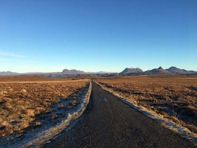
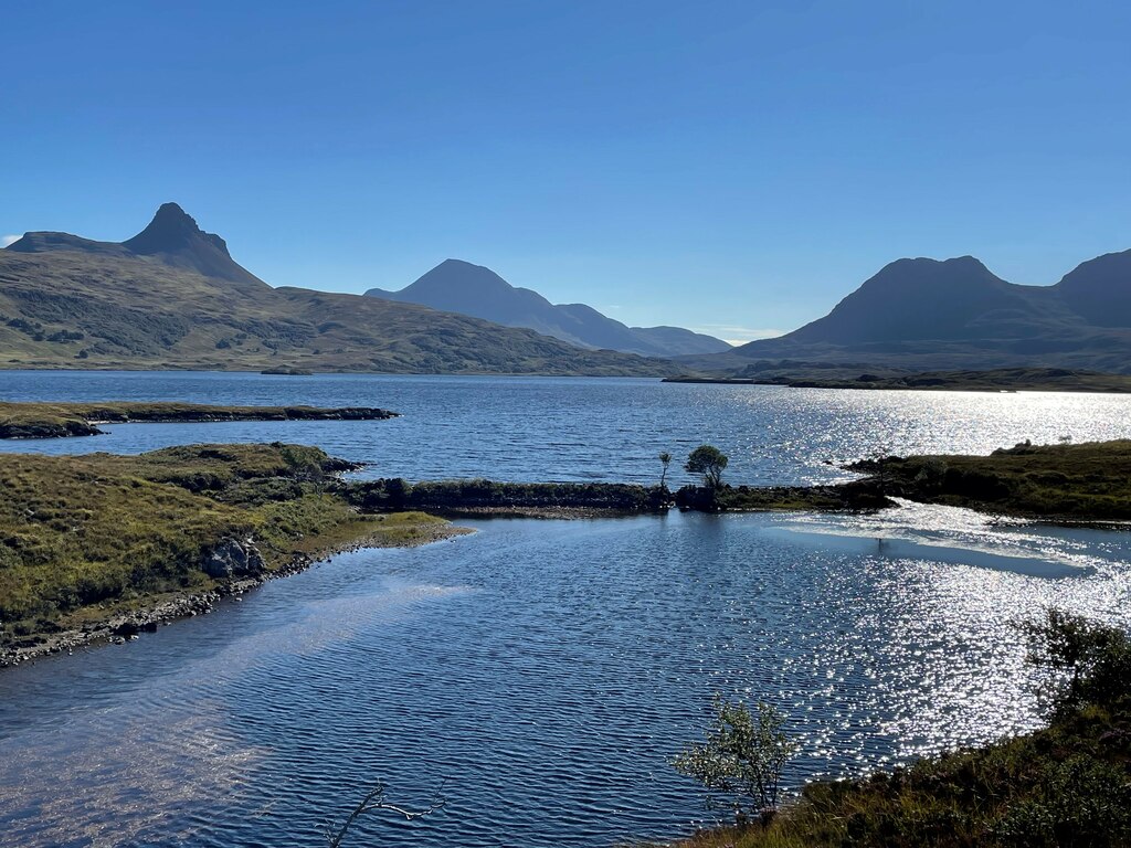
Rubha Learain is a prominent headland located in Cromartyshire, a coastal region in Scotland. Situated on the eastern coast, this rugged point extends into the North Sea, offering breathtaking panoramic views of the surrounding landscape. Its geographical coordinates are approximately 57.695°N latitude and 4.157°W longitude.

Characterized by its towering cliffs and rocky terrain, Rubha Learain is a notable coastal feature that attracts both locals and tourists alike. The headland is known for its dramatic coastline and diverse wildlife, making it a popular destination for nature enthusiasts and birdwatchers. Visitors can expect to encounter various seabirds such as guillemots, puffins, and gannets, as well as seals and dolphins swimming in the nearby waters.

The headland also boasts historical significance, with remnants of ancient settlements and structures scattered throughout the area. Ruins of old fishing huts and stone walls can be found, serving as a reminder of the region's rich maritime heritage. Additionally, several walking trails and paths have been established, allowing visitors to explore the headland while taking in the stunning vistas.

Rubha Learain is accessible by both land and sea. There are well-maintained roads leading to the headland, and parking facilities are available for those arriving by car. Boat tours and cruises are also offered, providing a unique perspective of Rubha Learain from the water.

Overall, Rubha Learain in Cromartyshire is a captivating coastal feature that showcases the raw beauty of Scotland's eastern coast. Its rugged cliffs, diverse wildlife, and historical significance make it a must-visit destination for nature lovers and history enthusiasts alike.

If you have any feedback on the listing, please let us know in the comments section below.

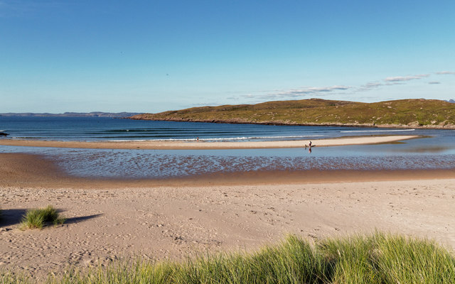
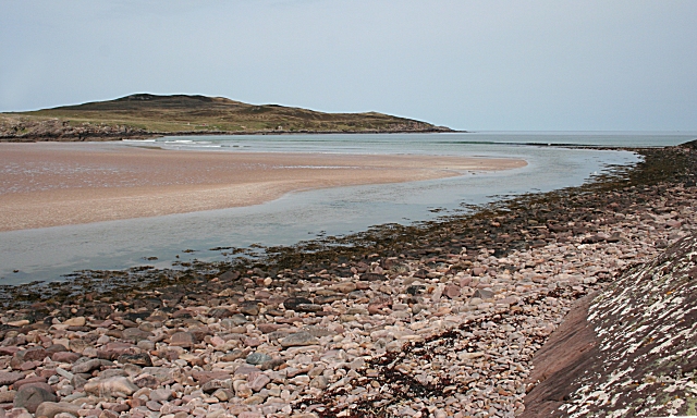
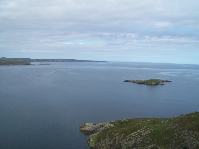
Rubha Learain Images

Images are sourced within 2km of 58.076573/-5.3693105 or Grid Reference NC0114. Thanks to Geograph Open Source API. All images are credited.

Camascoille A run out this morning onto the wide expanse of the wild Ruhba Mòr. The highest elevation, a mere 90m. The plan was to get to the headland, Rubha na Còigich but the wind and tough going caused second thoughts. It would have been an epic. I was intrigued by a small collection of walls and buildings on the eastern side of the peninsula mapped as Camascoille. I expected ruined crofts but instead found three very well maintained cottages accessed by the faintest of paths across the moor. Whoever lived here permanently would have led a hard life. A few clearance cairns show attempts at cultivation and the way down to the rocky cove where a boat could be beached is steep.

From my photo-diary for 30 June 2019 see <span class="nowrap"><a title="http://www.fhithich.uk/?p=21327" rel="nofollow ugc noopener" href="http://www.fhithich.uk/?p=21327">Link</a><img style="margin-left:2px;" alt="External link" title="External link - shift click to open in new window" src="https://s1.geograph.org.uk/img/external.png" width="10" height="10"/></span>
Camascoille
A run out this morning onto the wide expanse of the wild Ruhba Mòr. The highest elevation, a mere 90m. The plan was to get to the headland, Rubha na Còigich but the wind and tough going caused second thoughts. It would have been an epic. I was intrigued by a small collection of walls and buildings on the eastern side of the peninsula mapped as Camascoille. I expected ruined crofts but instead found three very well maintained cottages accessed by the faintest of paths across the moor. Whoever lived here permanently would have led a hard life. A few clearance cairns show attempts at cultivation and the way down to the rocky cove where a boat could be beached is steep. From my photo-diary for 30 June 2019 see LinkExternal link
Minor road towards Brae of Achnahaird
Achnahaird Bay
Achnahaird Bay
Achnahaird Bay
Achnahaird Bay
Low tide Achnahaird Bay On a warm September evening just after the wind died down, the midges came out in force and cleared the beach of holidaymakers
Low tide Achnahaird Bay
On a warm September evening just after the wind died down, the midges came out in force and cleared the beach of holidaymakers
Sand dunes at Moravach
Achnahaird Bay and Clouds over Coigach, Scotland Dark clouds over the mountains of the Coigach range in the Assynt region, in the northern Scottish Highlands.
Achnahaird Bay and Clouds over Coigach, Scotland
Dark clouds over the mountains of the Coigach range in the Assynt region, in the northern Scottish Highlands.
Coast below Camascoille
Clearance Cairn, Camascoille
Sea stack near Rubha Dubh
Allt Loch Raa
Allt Loch Raa
Coastline, Achnahaird Bay
Coast by Achnahaird Bay On a walk from the parking area to the glorious sands of the bay.
Coast by Achnahaird Bay
On a walk from the parking area to the glorious sands of the bay.
The Altandhu to Achnahaird road With a magnificent view to left to right, Suilven, Cul Mor and Stac Pollaidh.
The Altandhu to Achnahaird road
With a magnificent view to left to right, Suilven, Cul Mor and Stac Pollaidh.
Cnoc Camascoille I parked at Achnahaird Beach car park then walked along the trackness coastal moorland to bag the TUMP Cnoc Camascoille plus to get to Cnoc an Lochain-dèabhaidh and its remote trig point.
Name: Cnoc Camascoille
Hill number: 9999
Height: 90m / 295ft
Parent (Ma/M): 1217  Meall an Fheadain
Section: 16F: Lochinver to Ullapool
County/UA: Highland (UA)
Class: Tump (0-99m)
Grid ref: NB999159 (est)
Drop: 49m
Col: 41m  NB997147
Cnoc Camascoille
I parked at Achnahaird Beach car park then walked along the trackness coastal moorland to bag the TUMP Cnoc Camascoille plus to get to Cnoc an Lochain-dèabhaidh and its remote trig point. Name: Cnoc Camascoille Hill number: 9999 Height: 90m / 295ft Parent (Ma/M): 1217 Meall an Fheadain Section: 16F: Lochinver to Ullapool County/UA: Highland (UA) Class: Tump (0-99m) Grid ref: NB999159 (est) Drop: 49m Col: 41m NB997147
Coast by Achnahaird Bay One gem of the west coast of Scotland and backed by some inspiring mountains.
Coast by Achnahaird Bay
One gem of the west coast of Scotland and backed by some inspiring mountains.
Road to the Achnahaird Bay car park The single-track road goes straight to the coast. Suilven is the mountain ahead.
Road to the Achnahaird Bay car park
The single-track road goes straight to the coast. Suilven is the mountain ahead.
Brae of Achnahaird
Brae of Achnahaird
Show me another place!

Rubha Learain is located at Grid Ref: NC0114 (Lat: 58.076573, Lng: -5.3693105)

Unitary Authority: Highland

Police Authority: Highlands and Islands

What 3 Words

///slate.incurs.paramedic. Near Clachtoll, Highland

Related Wikis

Achnahaird Bay

Achnahaird Bay is an inlet of Enard Bay and is located on the Coigach peninsula, Wester Ross, Scotland. It can be reached by following the road to the...

Brae of Achnahaird

Brae of Achnahaird (Achadh na h-Àirde) is a small settlement at the head of Achnahaird Bay in Achiltibuie, Ullapool in Ross-shire, Scottish Highlands and...

Achnahaird

Ahnahaird (Scottish Gaelic: Achadh na h-Àirde) is a small settlement on Achnahaird Bay in Ross and Cromarty, in the Scottish council area of Highland....

Enard Bay

Enard Bay is a large remote tidal coastal embayment, located 10.5 miles northwest of Ullapool, in northwestern Ross and Cromarty, Scottish Highlands in...
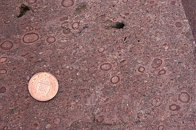
Stac Fada Member

The Stac Fada Member is a distinctive layer towards the top of the Mesoproterozoic Bay of Stoer Formation, part of the Stoer Group (lowermost Torridonian...

Altandhu

Altandhu is a small hamlet, overlooking the sea loch, Loch an Alltain Duibh to the west, on the western shore of the Rubha Mor Peninsula, in the Achiltibuie...

Loch Osgaig

Loch Osgaig (Loch Owskeich) is a small remote and deep freshwater loch, orientated on north-west to south-east axis, that is located 1 miles south of Enard...

Blairbuie

Blairbuie is a hamlet in Coigach, Scotland. It has just 6 houses and a sheep shed. When driving past the junction which connects Blairbuie to the rest...

Have you been to Rubha Learain?

Leave your review of Rubha Learain below (or comments, questions and feedback).