Black Point

Coastal Feature, Headland, Point in Pembrokeshire

Wales

Black Point

North end of Broad Haven beach Looking south-east to Emmet Rock and beyond to the houses  and hotel at Broad Haven.
North end of Broad Haven beach Credit: Trevor Rickard

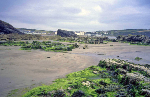
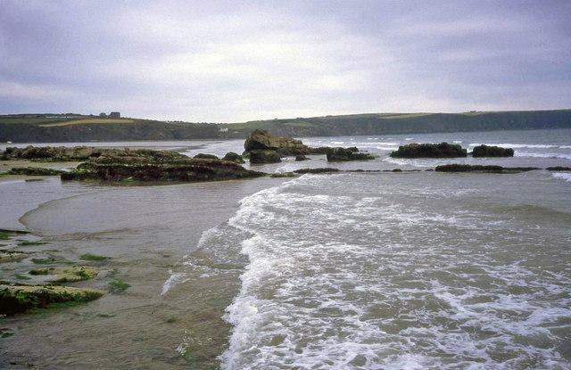
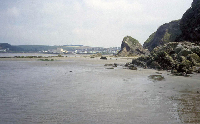
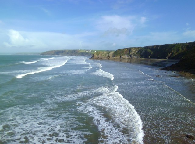
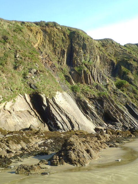
Black Point is a prominent headland located on the western coast of Pembrokeshire in southwest Wales. Jutting out into the Irish Sea, this coastal feature offers stunning panoramic views of the surrounding rugged coastline and the open ocean. The point is characterized by its sheer cliffs, rocky outcrops, and dramatic sea caves carved out by centuries of erosion from the powerful waves.

The headland is a popular destination for hikers, nature enthusiasts, and photographers seeking to explore its unique geological formations and observe the diverse marine life that inhabits the surrounding waters. Visitors can enjoy walking along the coastal path that winds its way around the point, taking in the sights and sounds of the crashing waves and seabirds soaring overhead.

Black Point is also a significant landmark for sailors and fishermen navigating the treacherous waters off the coast of Pembrokeshire. Its distinctive silhouette serves as a navigational aid, helping ships safely navigate the rocky shoreline and avoid potential hazards.

Overall, Black Point is a striking coastal feature that showcases the natural beauty and rugged charm of the Pembrokeshire coastline.

If you have any feedback on the listing, please let us know in the comments section below.
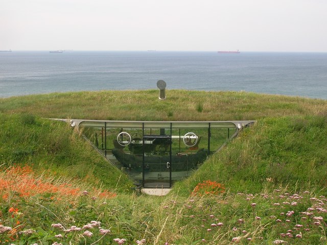
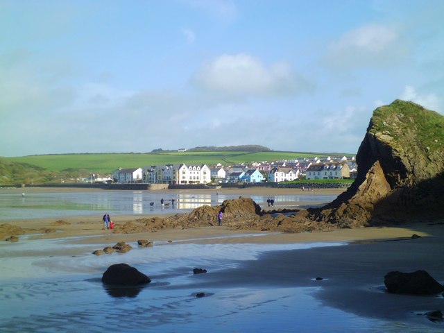
Black Point Images

Images are sourced within 2km of 51.795207/-5.106273 or Grid Reference SM8515. Thanks to Geograph Open Source API. All images are credited.

North end of Broad Haven beach Looking south-east to Emmet Rock and beyond to the houses  and hotel at Broad Haven.
North end of Broad Haven beach
Looking south-east to Emmet Rock and beyond to the houses and hotel at Broad Haven.
Shag Rock and Broad Haven Beach Looking south at low tide towards the cliffs at Little haven.
Shag Rock and Broad Haven Beach
Looking south at low tide towards the cliffs at Little haven.
Broad Haven beach At low tide looking north-east towards the village. Settlands rocks on the right.
Broad Haven beach
At low tide looking north-east towards the village. Settlands rocks on the right.
Entrance gateway, Haroldston Hall
Malator House Another view of this earth covered, eco-house, from Druidston Haven beach
Malator House
Another view of this earth covered, eco-house, from Druidston Haven beach
Druidston Cross Looking west, the no through road on the far side of the crossroads leads to Druidston.
Druidston Cross
Looking west, the no through road on the far side of the crossroads leads to Druidston.
Coast road above Druidston Haven The coast road here forms part of National Cycle Network Route 4.  The St David's peninsula can be seen in the background across St Bride's Bay.
Coast road above Druidston Haven
The coast road here forms part of National Cycle Network Route 4. The St David's peninsula can be seen in the background across St Bride's Bay.
Underground house at Druidston Haven Looking west from the coast road, with tankers moored in St Bride's Bay visible on the horizon.
Underground house at Druidston Haven
Looking west from the coast road, with tankers moored in St Bride's Bay visible on the horizon.
Coast road near Haroldston West Looking north-west towards Druidston Haven.  The road forms part of National Cycle Network Route 4.
Coast road near Haroldston West
Looking north-west towards Druidston Haven. The road forms part of National Cycle Network Route 4.
Looking north across The Settlands The view north along the coast from The Point at Little Haven. The first bay in view is The Settlands which is followed by the minor headland of The Rain, beyond which is the beach at Broad Haven.
Looking north across The Settlands
The view north along the coast from The Point at Little Haven. The first bay in view is The Settlands which is followed by the minor headland of The Rain, beyond which is the beach at Broad Haven.
Folded rock strata at The Settlands Folded sedimentary rocks of carboniferous age coal measure sandstones, shales etc. The coal measure series run in a narrow band from St Bride's Bay eastwards through the Haverfordwest area to emerge on the SE coast near Saundersfoot. Coal was once mined in this area, but the contorted strata gives some idea as to how difficult extraction must have been.
Folded rock strata at The Settlands
Folded sedimentary rocks of carboniferous age coal measure sandstones, shales etc. The coal measure series run in a narrow band from St Bride's Bay eastwards through the Haverfordwest area to emerge on the SE coast near Saundersfoot. Coal was once mined in this area, but the contorted strata gives some idea as to how difficult extraction must have been.
Heading for Broad Haven At low tide one can walk along the beach from Little Haven to Broad Haven. This is the view of Broad Haven beach and village as the second headland is passed.
Heading for Broad Haven
At low tide one can walk along the beach from Little Haven to Broad Haven. This is the view of Broad Haven beach and village as the second headland is passed.
Broad Haven beach Looking across the sandy beach towards buildings on the sea front.
Broad Haven beach
Looking across the sandy beach towards buildings on the sea front.
Rocky foreshore at Broad Haven At the north end of Broad Haven beach, sand gives way to rocks and cliffs composed of coal measures sandstones.
Rocky foreshore at Broad Haven
At the north end of Broad Haven beach, sand gives way to rocks and cliffs composed of coal measures sandstones.
Broad Haven beach The north end of the beach where rocky outcrops and cliffs take over from smooth sands.
Broad Haven beach
The north end of the beach where rocky outcrops and cliffs take over from smooth sands.
Evening light, Broad Haven beach October sunset from Broad Haven beach. Looking towards the Marloes peninsula and Stack Rocks.
Evening light, Broad Haven beach
October sunset from Broad Haven beach. Looking towards the Marloes peninsula and Stack Rocks.
Sunset at Broad Haven October sunset from the north end of Broad Haven beach.
Sunset at Broad Haven
October sunset from the north end of Broad Haven beach.
Little Haven beach - tide out Much more fun for Daft Dog, loads of space for a run, and the sea to cool off in. When the tide's in, all this sand vanishes <a href="https://www.geograph.org.uk/photo/4165288">SM8512 : Little Haven beach - tide in</a>
Little Haven beach - tide out
Much more fun for Daft Dog, loads of space for a run, and the sea to cool off in. When the tide's in, all this sand vanishes SM8512 : Little Haven beach - tide in
Show me another place!

Black Point is located at Grid Ref: SM8515 (Lat: 51.795207, Lng: -5.106273)

Unitary Authority: Pembrokeshire

Police Authority: Dyfed Powys

What 3 Words

///ushering.accordion.infects. Near Broad Haven, Pembrokeshire

Related Wikis

Haroldston West

Haroldston West is a rural coastal parish in west Pembrokeshire, Wales, 5.5 miles (8.9 km) west of Haverfordwest. It is in the community of Merlin's Bridge...

Druidston

Druidston is a hamlet within the community of Nolton and Roch on the St Brides Bay coast of Pembrokeshire, Wales. Druidston Cross is an eastern outlier...

Little Haven

Little Haven (Welsh: Hafan Fach) is a village at the south-east corner of St Bride's Bay, Pembrokeshire, Wales. It is in the Pembrokeshire Coast National...

Broad Haven

Broad Haven (Welsh: Aberllydan) is a village and seaside resort in the south east corner of St Bride's Bay at the western terminus of the B4341 road in...

Related Videos

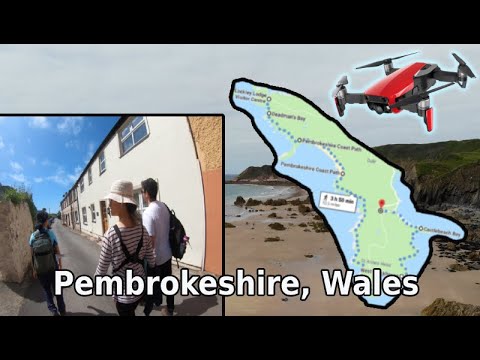
Hiking trip to Pembrokeshire, Wales || DJI Mavic Air 4k

Went to Pembrokeshire, Wales for bird watching and hiking with a group of friends. This has to be one of the best hiking spots that ...

Freedom. Never stop chasing it. #hiking #drone #adventure #inspiration #coast

Playing around with the Drone at the weekend. Taking it out along the Pembrokeshire coast feeling grateful, feeling free.

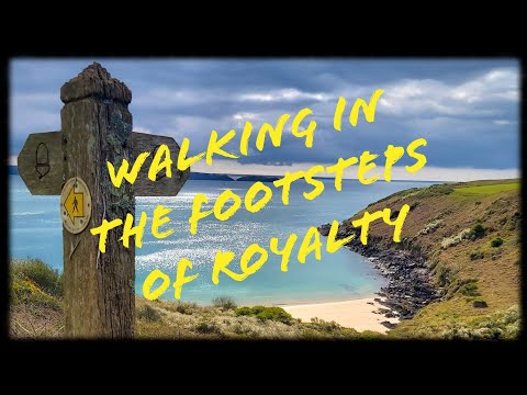
Walking in the footsteps of a King | Dale Peninsula | Pembrokeshire Coast Path | Pembrokeshire

A walk around the Dale Peninsula, Starting at the Dale seafront Car park and following the route in a clockwise direction.

How to Walk the Pembrokeshire Coast Path

I spent 2 weeks walking the Pembrokeshire Coast Path in Wales, UK. The trail is 186 miles long and runs from Amroth to St ...

Nearby Amenities

Located within 500m of 51.795207,-5.106273
The data included in this document is from www.openstreetmap.org. The data is made available under ODbL.

Have you been to Black Point?

Leave your review of Black Point below (or comments, questions and feedback).