Trwyn Elen

Coastal Feature, Headland, Point in Pembrokeshire

Wales

Trwyn Elen

Cerrig Gwylan These two rocky islets are popular with seabirds (Kittiwake, Cormorant and Black-backed Gulls).
Cerrig Gwylan Credit: Anthony Parkes

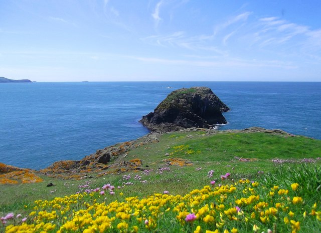
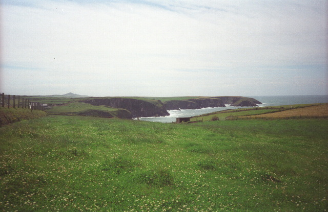
Trwyn Elen, also known as Elen's Point, is a prominent coastal feature located in the county of Pembrokeshire, Wales. Situated on the westernmost part of the Welsh coastline, it is a headland that juts out into the Celtic Sea. The point is named after Elen, a legendary figure from Welsh folklore.

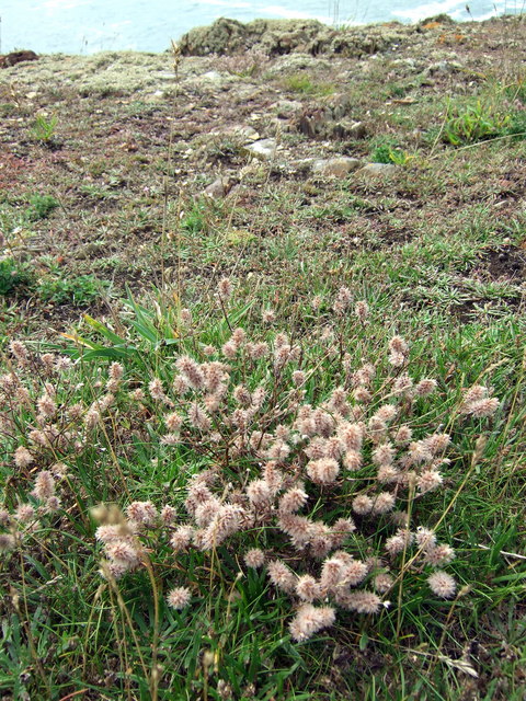
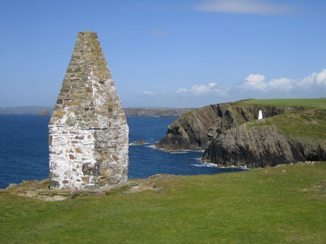
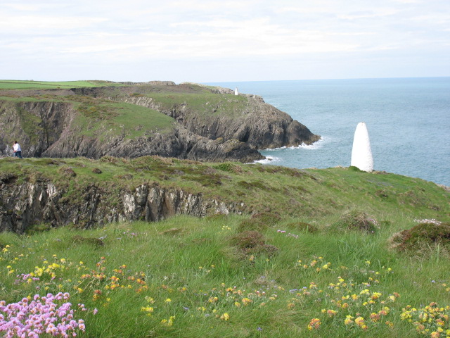
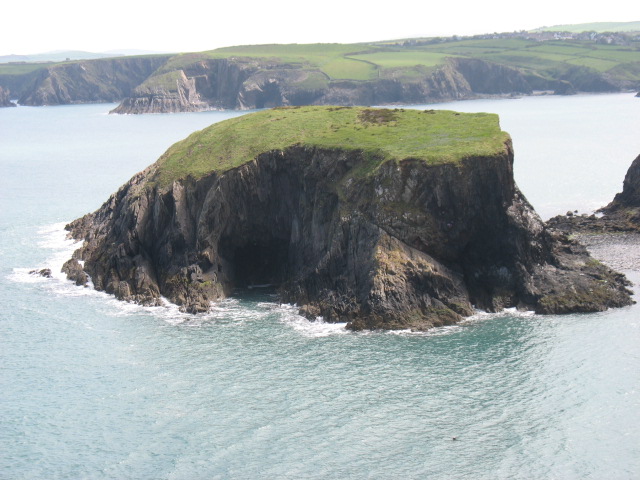
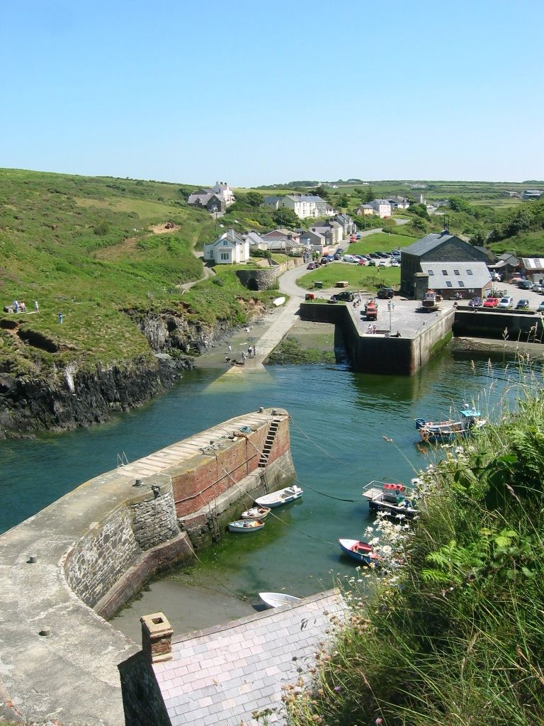
Trwyn Elen is characterized by its rugged and dramatic landscape, with steep cliffs that offer breathtaking views of the surrounding sea and coastline. It is a popular destination for nature enthusiasts, hikers, and photographers, who are drawn to its natural beauty and tranquility. The headland is home to a diverse range of flora and fauna, including various seabirds, wildflowers, and marine life.

The area around Trwyn Elen is also of historical significance, with several ancient sites nearby. One notable feature is Carreg Sampson, a Neolithic burial chamber that dates back thousands of years. This prehistoric monument adds an element of intrigue and mystery to the already captivating landscape.

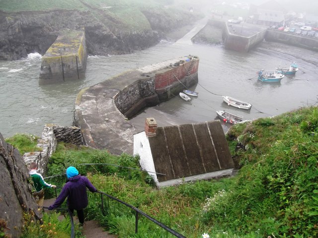
Access to Trwyn Elen is relatively easy, with a footpath that leads visitors to the headland. There is ample parking available nearby, making it convenient for those traveling by car. The site is well-maintained, with designated viewpoints and picnic areas for visitors to enjoy.

Overall, Trwyn Elen is a remarkable coastal feature that showcases the raw beauty of Pembrokeshire's coastline. With its stunning cliffs, rich wildlife, and historical significance, it is a must-visit destination for anyone exploring this picturesque region of Wales.

If you have any feedback on the listing, please let us know in the comments section below.
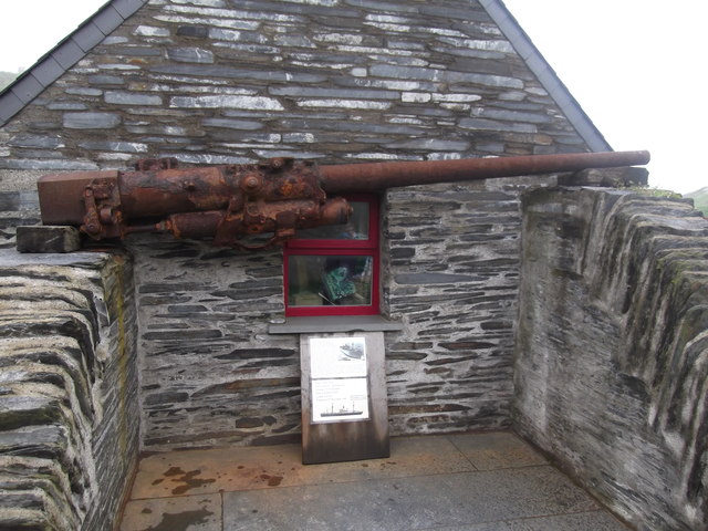
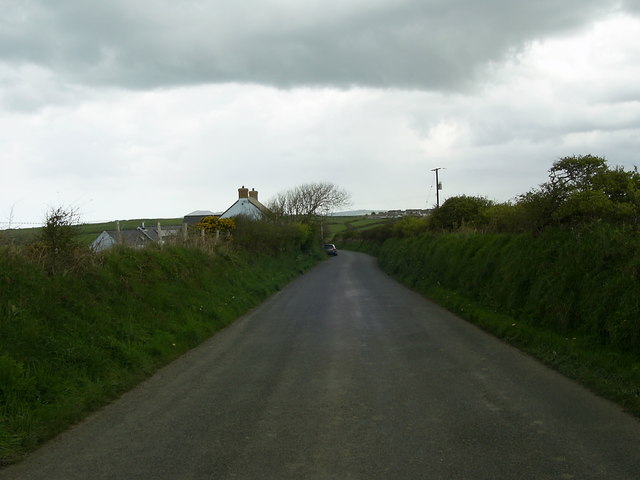
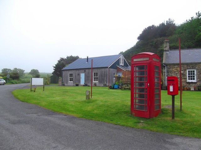
Trwyn Elen Images

Images are sourced within 2km of 51.950641/-5.1756993 or Grid Reference SM8132. Thanks to Geograph Open Source API. All images are credited.

Cerrig Gwylan These two rocky islets are popular with seabirds (Kittiwake, Cormorant and Black-backed Gulls).
Cerrig Gwylan
These two rocky islets are popular with seabirds (Kittiwake, Cormorant and Black-backed Gulls).
Hare's foot clover (Trifolium arvense) A low-growing plant that likes sandy soil, seen here on the sea cliffs above Traeth Llyfn. Its soft downy flower heads turn from pinkish-purple to silvery-beige as they mature.
Hare's foot clover (Trifolium arvense)
A low-growing plant that likes sandy soil, seen here on the sea cliffs above Traeth Llyfn. Its soft downy flower heads turn from pinkish-purple to silvery-beige as they mature.
Rock samphire (Crithmum maritimum) This plant, with the fleshy leaf spikes and knobbly greeny-yellow flowers growing in the crevice behind the sea campion in the foreground, was the one whose perilous collection from the sea cliffs Shakespeare described as a 'dreadful trade'. It has long been used as a pickling vegetable and was once supplied in large quantities to London markets. Nowadays it has been rediscovered by wild food enthusiasts, for example see <span class="nowrap"><a title="http://www.bbc.co.uk/food/recipes/database/saltmarshlambsamphir_89242.shtml" rel="nofollow ugc noopener" href="http://www.bbc.co.uk/food/recipes/database/saltmarshlambsamphir_89242.shtml">Link</a><img style="margin-left:2px;" alt="External link" title="External link - shift click to open in new window" src="https://s1.geograph.org.uk/img/external.png" width="10" height="10"/></span>
It is sometimes confused with the marsh samphire or glasswort (Salicornia sp.) that may be seen on fishmongers' slabs.
The name samphire comes from the French 'herbe de St Pierre' because of its rocky habitat, and by further association it was deemed beneficial for kidney stone ailments! It is in fact a succulent member of the carrot family, adapted for arid conditions.
Rock samphire (Crithmum maritimum)
This plant, with the fleshy leaf spikes and knobbly greeny-yellow flowers growing in the crevice behind the sea campion in the foreground, was the one whose perilous collection from the sea cliffs Shakespeare described as a 'dreadful trade'. It has long been used as a pickling vegetable and was once supplied in large quantities to London markets. Nowadays it has been rediscovered by wild food enthusiasts, for example see LinkExternal link It is sometimes confused with the marsh samphire or glasswort (Salicornia sp.) that may be seen on fishmongers' slabs. The name samphire comes from the French 'herbe de St Pierre' because of its rocky habitat, and by further association it was deemed beneficial for kidney stone ailments! It is in fact a succulent member of the carrot family, adapted for arid conditions.
Fields near Trefin Looking westward across Aber Draw from the footpath joining Trefin with the coast path.
Fields near Trefin
Looking westward across Aber Draw from the footpath joining Trefin with the coast path.
Sawn slate wall, Porthgain
Navigation aids, Porthgain
Quarry buildings, above Porthgain
Traeth Llyfn
Traeth Llyfn
Navigation aids, Porthgain These two stone markers stand high above the narrow entrance to Porthgain harbour, which might otherwise be difficult to spot from the sea.
The nearer (east) marker is circular in cross-section whereas the further one is square. I confess that I do not really see much point in this: from a distance out at sea it would be difficult to distinguish the cross-section, and once you have identified both markers you know that you want to navigate between them!
Navigation aids, Porthgain
These two stone markers stand high above the narrow entrance to Porthgain harbour, which might otherwise be difficult to spot from the sea. The nearer (east) marker is circular in cross-section whereas the further one is square. I confess that I do not really see much point in this: from a distance out at sea it would be difficult to distinguish the cross-section, and once you have identified both markers you know that you want to navigate between them!
Ynys-fach from the west A small tidal island well seen from the Pembrokeshire Coast Path.
Ynys-fach from the west
A small tidal island well seen from the Pembrokeshire Coast Path.
Sea Pink Covered Cliff-tops above Traeth Llyfn
Porth-gain from the Coastal Path
Gun from the Liberty Ship 'Dan Beard' The gun, which once belonged to the American Liberty Ship, Dan Beard, was found by divers off the northern coast of Pembrokeshire.
The ship was returning from the Normandy landings when it fell prey to a German U-Boat in December 1944. A total of 29 men lost their lives.
Now the gun has been placed on display in the tiny harbour village of Porthgain
Gun from the Liberty Ship 'Dan Beard'
The gun, which once belonged to the American Liberty Ship, Dan Beard, was found by divers off the northern coast of Pembrokeshire. The ship was returning from the Normandy landings when it fell prey to a German U-Boat in December 1944. A total of 29 men lost their lives. Now the gun has been placed on display in the tiny harbour village of Porthgain
Traeth Llyfn
Traeth Llyfn
Traeth Llyfn
Traeth Llyfn
Access Stairs - Traeth Llyfn
Minor road to Trefin This short stretch of road near Awel-For heading for Trefin, is just within the relevant grid square.
Minor road to Trefin
This short stretch of road near Awel-For heading for Trefin, is just within the relevant grid square.
Postal & Telephone Service - Porthgain
Show me another place!

Trwyn Elen is located at Grid Ref: SM8132 (Lat: 51.950641, Lng: -5.1756993)

Unitary Authority: Pembrokeshire

Police Authority: Dyfed Powys

What 3 Words

///torch.startles.fanfare. Near Llanrhian, Pembrokeshire

Related Wikis

Porthgain Railway

The Porthgain Railway was a 3 ft (914 mm) narrow gauge industrial railway connecting the Pen Clegyr and St. Bride's quarries with Porthgain harbour. It...
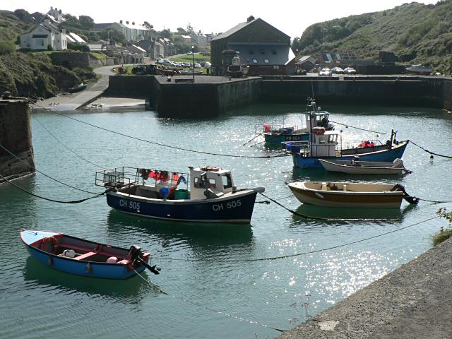
Porthgain

Porthgain (Welsh for fair/beautiful port or more likely 'chisel port' from the Welsh 'porth' meaning port and 'gaing' meaning chisel as used by the many...

Llanrhian

Llanrhian is a small village, community and parish in Pembrokeshire in west Wales, near the coast, south of Porthgain village. The community of Llanrhian...
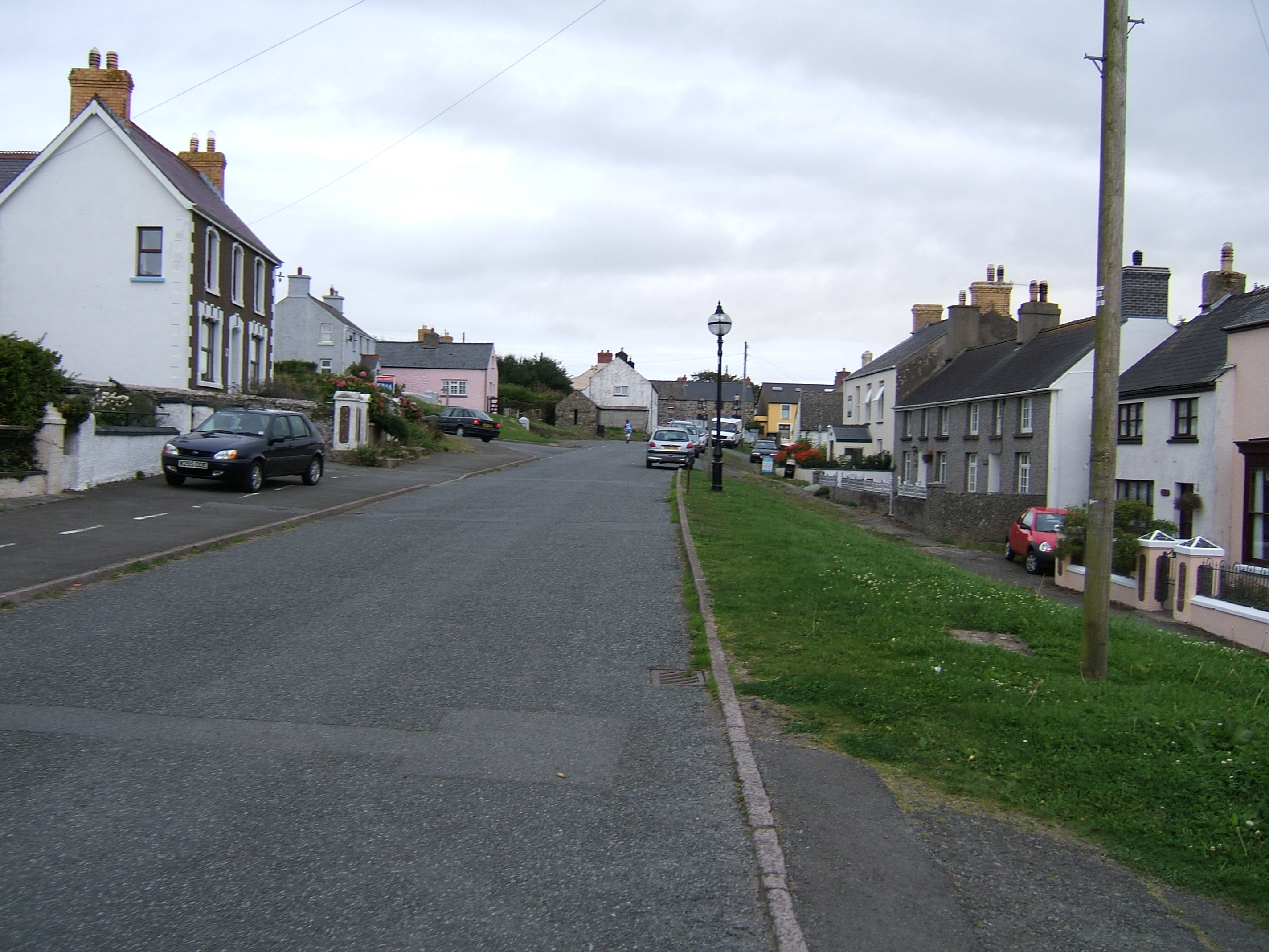
Trefin

Trefin (Welsh standardised:Tre-fin), formerly anglicised as Trevine, is a village in North Pembrokeshire, south-west Wales. The village lies within the...

Nearby Amenities

Located within 500m of 51.950641,-5.1756993
Telephone
Booth: K6
Covered: booth
Listed Status: Grade II
Operator: BT
Phone: +44 1348 831298
Lat/Long: 51.9473572/-5.1800052
Post Box
Post Box Type: lamp
Royal Cypher: EIIR
Royal Cypher Wikidata: Q33102113
Lat/Long: 51.9473715/-5.1800276
Restaurant
The Shed Bistro
Addr Postcode: SA62 5BN
Description: Fish & Seafood Restaurant
Fhrs Id: 857072
Opening Hours: Mo-Su 10:00-17:00, 17:30-24:00
Phone: +44 1348 831518
Source Addr Postcode: FHRS Open Data
Website: https://www.theshedporthgain.co.uk/
Lat/Long: 51.9481401/-5.1815428
Pub
Sloop Inn
Addr Postcode: SA62 5BN
Fhrs Id: 856138
Opening Hours: Mo-Fr,Su 09:30-23:00; Sa 09:30-00:00; Dec 25 off
Phone: +441348 831449
Source Addr Postcode: FHRS Open Data
Website: http://www.sloop.co.uk/
Wikidata: Q80856281
Lat/Long: 51.9481551/-5.1804962
Bus Stop
Porthgain
Lat/Long: 51.9481004/-5.1806605
Power: pole
Lat/Long: 51.9469404/-5.1791326
Note: White painted
Seamark Landmark Category: column
Seamark Type: landmark
Lat/Long: 51.9503076/-5.1821584
Porthgain
Is In: Pembrokeshire,Wales,UK
Place: hamlet
Wikidata: Q3404798
Lat/Long: 51.9482833/-5.1814375
Parcheggio
Lat/Long: 51.9479529/-5.1808168
Leisure: picnic_table
Lat/Long: 51.9478153/-5.181079
Leisure: picnic_table
Lat/Long: 51.9481634/-5.1812812
Leisure: picnic_table
Lat/Long: 51.9481062/-5.1808671
The data included in this document is from www.openstreetmap.org. The data is made available under ODbL.

Have you been to Trwyn Elen?

Leave your review of Trwyn Elen below (or comments, questions and feedback).