Applecross
Coastal Feature, Headland, Point in Ross-shire
Scotland
Applecross

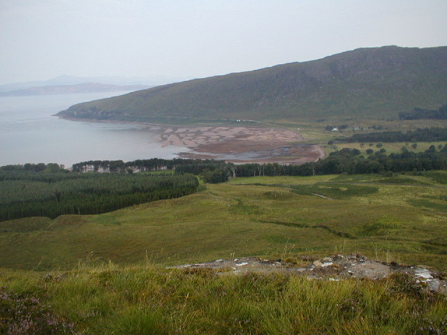
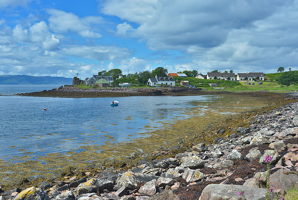
Applecross is a picturesque coastal feature located in the county of Ross-shire, Scotland. Situated on the Applecross Peninsula, it is known for its breathtaking natural beauty and stunning vistas of the Inner Sound, a body of water that separates the peninsula from the Isle of Skye.
As a headland, Applecross juts out into the sea, forming a distinctive point that offers panoramic views of the surrounding landscape. The rugged cliffs that line the coastline are a testament to the area's geological history, showcasing layers of sedimentary rock that have been shaped by centuries of erosion.
The area is rich in biodiversity, with a diverse array of plant and animal species calling Applecross home. The grassy slopes that lead down to the sea are adorned with wildflowers and heather, creating a colorful tapestry that contrasts with the deep blue of the ocean. Seabirds, such as puffins and gannets, can often be seen nesting on the cliffs, while seals and dolphins can occasionally be spotted in the waters below.
Applecross is also renowned for its historic significance. The peninsula has been inhabited since prehistoric times, with evidence of ancient settlements and burial sites scattered throughout the area. The nearby Applecross Abbey, founded in the 7th century, is a popular attraction for visitors interested in the region's religious heritage.
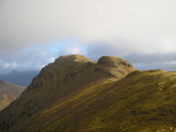
In addition to its natural and historical attractions, Applecross offers a range of activities for outdoor enthusiasts. The area is a paradise for hikers and climbers, with numerous trails and peaks to explore. Fishing and boating are also popular pastimes, with the calm waters of the Inner Sound providing ample opportunities to cast a line or sail along the coast.
Overall, Applecross is a captivating coastal feature that combines stunning natural beauty, rich history, and a wealth of recreational opportunities. It is a must-visit destination for anyone seeking tranquility, adventure, and a deep connection with Scotland's coastal landscape.
If you have any feedback on the listing, please let us know in the comments section below.
Applecross Images
Images are sourced within 2km of 57.454922/-5.7415676 or Grid Reference NG7546. Thanks to Geograph Open Source API. All images are credited.


Applecross is located at Grid Ref: NG7546 (Lat: 57.454922, Lng: -5.7415676)
Unitary Authority: Highland
Police Authority: Highlands and Islands
What 3 Words
///chucks.hooked.poets. Near Lochcarron, Highland
Nearby Locations
Related Wikis

Bealach na Bà
Bealach na Bà (pronounced [bjaLəx na baː]) is a winding single track road through the mountains of the Applecross peninsula, in Wester Ross in the Scottish...

Applecross
Applecross (Scottish Gaelic: A' Chomraich) is a peninsula north-west of Kyle of Lochalsh in the council area of Highland, Scotland. The name Applecross...

Beinn Bhàn (Applecross)
Beinn Bhàn is a mountain in the highlands of Scotland, lying on the Applecross peninsula, on the north side of Loch Kishorn.Located on the eastern side...
Applecross Bay
Applecross Bay is large remote tidal coastal embayment, located next to the small fishing village of Applecross and is on the west coast of the Applecross...

Camusteel
Camusteel (Scottish Gaelic: Camas Teile) is a remote crofting and former fishing village in the Applecross peninsula, located less than 1 mile directly...
Camusterrach
Camusterrach (Scottish Gaelic: Camas Tearach) is a remote hamlet, situated on the west coast of Scotland, on the Applecross peninsula, in Strathcarron...
Sgùrr a' Chaorachain (Corbett)
Sgurr a' Chaorachain (792 m) is a mountain in the Northwest Highlands, Scotland, on the remote Applecross peninsula in the North of Scotland. A fine sandstone...

Sand, Applecross
Sand on the Applecross Peninsula in Wester Ross, Scotland, is an archaeological site. Sand is the site of a major archaeological excavation on the Inner...
Have you been to Applecross?
Leave your review of Applecross below (or comments, questions and feedback).