Galmpton

Settlement in Devon

England

Galmpton

Rocks near Churston Point Devonian limestone just northwest of Elberry Cove. Paignton and Torquay are across the bay.
Rocks near Churston Point Credit: Derek Harper

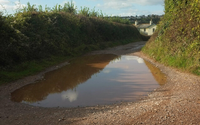
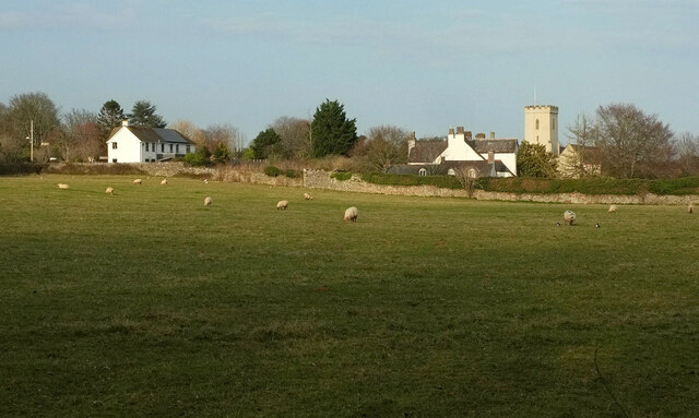
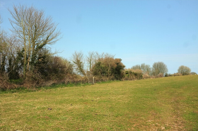
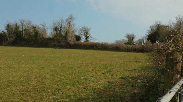
Galmpton is a charming village located in the South Hams district of Devon, England. Situated on the banks of the River Dart, it offers stunning views of the surrounding countryside and the river itself. With a population of around 1,300, Galmpton maintains a close-knit community atmosphere.

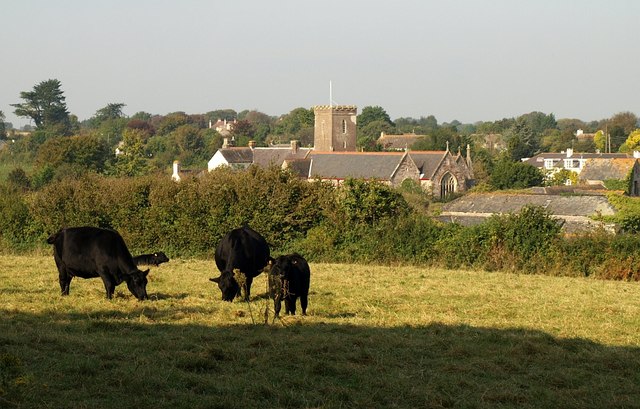
The village is known for its picturesque thatched cottages and traditional Devonian architecture, which adds to its quaint and idyllic charm. It boasts a rich history, with the parish church of St. Mary and St. George dating back to the 13th century, showcasing beautiful stained glass windows and a striking bell tower.

Galmpton is a popular destination for tourists and locals alike, due to its proximity to nearby attractions. The village is just a short distance from the renowned Dartmouth, a historic port town with a wealth of shops, restaurants, and cultural sites. Additionally, the stunning beaches of the English Riviera are within easy reach, making Galmpton an ideal base for exploring the beautiful South Devon coastline.

The village offers a range of amenities to cater to residents and visitors, including a primary school, a village hall, a church, and a pub. It also has excellent transport links, with a regular bus service connecting it to nearby towns and cities.

Overall, Galmpton is a picturesque and peaceful village that provides the perfect blend of history, natural beauty, and community spirit, making it an appealing destination for those seeking a tranquil escape in the heart of Devon.

If you have any feedback on the listing, please let us know in the comments section below.

Galmpton Images

Images are sourced within 2km of 50.396283/-3.56873 or Grid Reference SX8856. Thanks to Geograph Open Source API. All images are credited.

Rocks near Churston Point Devonian limestone just northwest of Elberry Cove. Paignton and Torquay are across the bay.
Rocks near Churston Point
Devonian limestone just northwest of Elberry Cove. Paignton and Torquay are across the bay.
Coast path near Elberry Cove Following footpath BX 29#1 through woodland west of the cove.
Coast path near Elberry Cove
Following footpath BX 29#1 through woodland west of the cove.
Puddle near Elberry Farm Taken at a footpath junction; footpath BX 55a#3 goes ahead past the puddle and the farm to Broad Sands.
Puddle near Elberry Farm
Taken at a footpath junction; footpath BX 55a#3 goes ahead past the puddle and the farm to Broad Sands.
Pasture behind Elberry Cove From a gate just behind the camera in <a href="https://www.geograph.org.uk/photo/7000776">SX9057 : Puddle near Elberry Farm</a>. To the left of the further area, where grazing is taking place, the lane drops quickly to the cove's beach. In the background is Marridge Wood.
Pasture behind Elberry Cove
From a gate just behind the camera in SX9057 : Puddle near Elberry Farm. To the left of the further area, where grazing is taking place, the lane drops quickly to the cove's beach. In the background is Marridge Wood.
Pasture by Elberry Lane Elberry Lane is on the right; Marridge Wood is in the background. This field - or collection of fenced compartments - is seen from the far end in <a href="https://www.geograph.org.uk/photo/2774153">SX9056 : Elbury Lane</a> and <a href="https://www.geograph.org.uk/photo/6702972">SX9056 : Field by Elberry Lane</a>.
Pasture by Elberry Lane
Elberry Lane is on the right; Marridge Wood is in the background. This field - or collection of fenced compartments - is seen from the far end in SX9056 : Elbury Lane and SX9056 : Field by Elberry Lane.
Toy in field by Elberry Lane A representation of the creature occupying this field; do they belong to one another, or was this left by a visiting child?
Toy in field by Elberry Lane
A representation of the creature occupying this field; do they belong to one another, or was this left by a visiting child?
Field boundary, Elberry A view across the field shown in <a href="https://www.geograph.org.uk/photo/7000817">SX9056 : Pasture by Elberry Lane</a> from a few metres further up Elberry Lane.
Field boundary, Elberry
A view across the field shown in SX9056 : Pasture by Elberry Lane from a few metres further up Elberry Lane.
Elberry Lane Looking right from <a href="https://www.geograph.org.uk/photo/7001004">SX9056 : Field boundary, Elberry</a>. The straight stretch of old lane is followed by footpath BX 55a#1. On the left ahead is Marridge Wood, on the right are houses on Brunel Road.
Elberry Lane
Looking right from SX9056 : Field boundary, Elberry. The straight stretch of old lane is followed by footpath BX 55a#1. On the left ahead is Marridge Wood, on the right are houses on Brunel Road.
Dog waste bin, Elberry Lane At the junction of footpath BX 55a#1 with a short path between houses onto the cul-de-sac at the southeast end of Brunel Road. Tor Bay and Torquay are in the background.
Dog waste bin, Elberry Lane
At the junction of footpath BX 55a#1 with a short path between houses onto the cul-de-sac at the southeast end of Brunel Road. Tor Bay and Torquay are in the background.
Path, Brunel Road, Broadsands See <a href="https://www.geograph.org.uk/photo/7001036">SX9056 : Dog waste bin, Elberry Lane</a>; this looks along the path mentioned from the cul-de-sa. The dog bin is visible on Elberry Lane.
Path, Brunel Road, Broadsands
See SX9056 : Dog waste bin, Elberry Lane; this looks along the path mentioned from the cul-de-sa. The dog bin is visible on Elberry Lane.
Monkey puzzle tree, Brunel Road, Broadsands An Araucaria bearing fruit, by the cul-de-sac where <a href="https://www.geograph.org.uk/photo/7001042">SX9056 : Path, Brunel Road, Broadsands</a> was taken.
Monkey puzzle tree, Brunel Road, Broadsands
An Araucaria bearing fruit, by the cul-de-sac where SX9056 : Path, Brunel Road, Broadsands was taken.
Brunel Road, Broadsands Looking left from <a href="https://www.geograph.org.uk/photo/7001042">SX9056 : Path, Brunel Road, Broadsands</a>. The monkey puzzle tree shown in <a href="https://www.geograph.org.uk/photo/7001053">SX9056 : Monkey puzzle tree, Brunel Road, Broadsands</a> is on the right. On the left is the eastern junction with Lower Fowden.
Brunel Road, Broadsands
Looking left from SX9056 : Path, Brunel Road, Broadsands. The monkey puzzle tree shown in SX9056 : Monkey puzzle tree, Brunel Road, Broadsands is on the right. On the left is the eastern junction with Lower Fowden.
Lower Fowden, Broadsands The eastern junction with Brunel Road, also glimpsed in <a href="https://www.geograph.org.uk/photo/7001079">SX9056 : Brunel Road, Broadsands</a>. The road loops around the hillside to rejoin Brunel Road as shown in <a href="https://www.geograph.org.uk/photo/7000317">SX8956 : Junction on Brunel Road, Broadsands</a>.
Lower Fowden, Broadsands
The eastern junction with Brunel Road, also glimpsed in SX9056 : Brunel Road, Broadsands. The road loops around the hillside to rejoin Brunel Road as shown in SX8956 : Junction on Brunel Road, Broadsands.
Junction on Brunel Road, Broadsands Showing the northern end of the triangle at the junction of Brunel Road and Lower Fowden; the southern end is seen in <a href="https://www.geograph.org.uk/photo/7001079">SX9056 : Brunel Road, Broadsands</a>.
Junction on Brunel Road, Broadsands
Showing the northern end of the triangle at the junction of Brunel Road and Lower Fowden; the southern end is seen in SX9056 : Brunel Road, Broadsands.
Fallen tree, Marridge Wood Impressively weathered, this is on the Greenway Walk.
Fallen tree, Marridge Wood
Impressively weathered, this is on the Greenway Walk.
Sheep, Churston From Bascombe Road, with Churston Court <span class="nowrap"><a title="https://historicengland.org.uk/listing/the-list/list-entry/1208761?section=official-list-entry" rel="nofollow ugc noopener" href="https://historicengland.org.uk/listing/the-list/list-entry/1208761?section=official-list-entry">Link</a><img style="margin-left:2px;" alt="External link" title="External link - shift click to open in new window" src="https://s1.geograph.org.uk/img/external.png" width="10" height="10"/></span> on this side of St Mary's church <span class="nowrap"><a title="https://historicengland.org.uk/listing/the-list/list-entry/1293060?section=official-list-entry" rel="nofollow ugc noopener" href="https://historicengland.org.uk/listing/the-list/list-entry/1293060?section=official-list-entry">Link</a><img style="margin-left:2px;" alt="External link" title="External link - shift click to open in new window" src="https://s1.geograph.org.uk/img/external.png" width="10" height="10"/></span> , both of which are grade II* listed.
Sheep, Churston
From Bascombe Road, with Churston Court LinkExternal link on this side of St Mary's church LinkExternal link , both of which are grade II* listed.
Field, Churston From a gateway at the junction of Church Road with Bascombe Road, and on the route of the:John Musgrave Heritage Trail. <a href="https://www.geograph.org.uk/photo/7130354">SX9056 : Field, Churston</a> and <a href="https://www.geograph.org.uk/photo/7130347">SX9056 : Field, Churston</a> look right from here.
Field, Churston
From a gateway at the junction of Church Road with Bascombe Road, and on the route of the:John Musgrave Heritage Trail. SX9056 : Field, Churston and SX9056 : Field, Churston look right from here.
Field, Churston Looking right from <a href="https://www.geograph.org.uk/photo/7130354">SX9056 : Field, Churston</a>. The hedge ahead borders the John Musgrave Heritage Trail as it follows a track to The Grove.
Field, Churston
Looking right from SX9056 : Field, Churston. The hedge ahead borders the John Musgrave Heritage Trail as it follows a track to The Grove.
Show me another place!

Galmpton is located at Grid Ref: SX8856 (Lat: 50.396283, Lng: -3.56873)

Unitary Authority: Torbay

Police Authority: Devon and Cornwall

What 3 Words

///posts.kingdom.agency. Near Brixham, Devon

Nearby Locations

Port Hill Galmpton

Related Wikis

Galmpton, Torbay

Galmpton is a semi-rural village in Torbay, in the ceremonial county of Devon, England. It is located in the ward of Churston-with-Galmpton and the historic...

Churston Ferrers Grammar School

Churston Ferrers Grammar School (also known as CFGS) is a selective coeducational Grammar School with Academy status, situated in the village of Galmpton...

Churston railway station

Churston railway station is on the Dartmouth Steam Railway, a heritage railway in Torbay, Devon, England. It is situated beside the main road to Brixham...

Churston Ferrers

Churston Ferrers is an area and former civil parish, in the borough of Torbay, Devon, England, situated between the south coast towns of Paignton and Brixham...

Greenway Halt railway station (Devon)

Greenway Halt railway station is a small railway station on the Dartmouth Steam Railway, a heritage railway in Devon, England. It is situated near the...

Broadsands Chambered Tomb

The Broadsands Chambered Tomb is a Neolithic burial chamber located on a slope overlooking Broadsands Beach. It is listed as a Scheduled Monument by English...

Broadsands

Broadsands is a beach on the coast of Torbay in South Devon, England. It is also the name of an area of housing inland from the beach, in the Churston...

Elberry Cove

Elberry Cove, also known as Elbury Cove, is a shingle beach surrounded by woodland and fields, that lies between Brixham and Paignton in Devon, England...

Nearby Amenities

Located within 500m of 50.396283,-3.56873
Mini Roundabout
Direction: clockwise
Lat/Long: 50.3999166/-3.5668675
Galmpton
Is In: Devon, England, UK
Place: village
Wikidata: Q5519263
Lat/Long: 50.3952271/-3.5655815
Description: Lime Kiln
Historic: industrial
Lat/Long: 50.3949959/-3.5723539
Post Box
Brand: Royal Mail
Brand Wikidata: Q638098
Brand Wikipedia: en:Royal Mail
Collection Times: Mo-Fr 09:00; Sa 07:00; Su off
Operator: Royal Mail
Operator Wikidata: Q638098
Post Box Design: type_a
Post Box Type: pillar
Postal Code: TQ5
Ref: TQ5 396D
Royal Cypher: EIIR
Royal Cypher Wikidata: Q33102113
Source: survey;streetlevel imagery;aerial imagery
Lat/Long: 50.3944767/-3.5651269
Bus Stop
Greenway Park
Bench: no
Bin: no
Bus: yes
Lit: yes
Naptan AtcoCode: 1190TOA11004
Naptan Bearing: SW
Naptan CommonName: Greenway Park
Naptan Crossing: Old Road
Naptan NaptanCode: tbyapwj
Naptan Street: Greenway Road
Naptan Verified: no
Public Transport: platform
Shelter: no
Source: naptan_import
Tactile Paving: no
Lat/Long: 50.3930786/-3.5660353
Bus Stop
Galmpton Primary School
Bench: no
Bin: yes
Bus: yes
Naptan AtcoCode: 1190TOA11005
Naptan Bearing: S
Naptan CommonName: Galmpton Primary School
Naptan Crossing: Greenway Road
Naptan NaptanCode: tbyatad
Naptan PlusbusZoneRef: NABT
Naptan Street: Old Road
Naptan Verified: no
Public Transport: platform
Shelter: no
Source: naptan_import
Tactile Paving: no
Lat/Long: 50.3941004/-3.5656328
Bus Stop
Galmpton Triangle
Bus: yes
Naptan AtcoCode: 1190TOZ00869
Naptan Bearing: NE
Naptan CommonName: Galmpton Triangle
Naptan Crossing: The Roundings
Naptan NaptanCode: tbygmwm
Naptan PlusbusZoneRef: NABT
Naptan Street: Greenway Road
Naptan Verified: no
Public Transport: platform
Source: naptan_import
Lat/Long: 50.3955727/-3.5644994
Barrier: stile
Lat/Long: 50.3971825/-3.5755862
Post Office
Galmpton Post Office
Addr City: Brixham
Addr Housenumber: 51
Addr Postcode: TQ5 0NH
Addr Street: Stoke Gabriel Road
Addr Village: Galmpton
Brand: Post Office
Brand Wikidata: Q1783168
Opening Hours: Mo-Fr 07:30-17:30; Sa 07:30-14:00; Su 08:00-12:00
Ref Pol Id: 4118
Source: pol_branch_list_2020‑11‑13
Source Postcode: ONS_Postcode_Directory
Website: https://www.postoffice.co.uk/branch-finder/1655523/galmpton
Lat/Long: 50.3955296/-3.5675352
Post Box
Brand: Royal Mail
Brand Wikidata: Q638098
Brand Wikipedia: en:Royal Mail
Collection Times: Mo-Fr 16:30; Sa 10:00; Su off
Operator: Royal Mail
Operator Wikidata: Q638098
Post Box Design: type_b
Post Box Type: pillar
Postal Code: TQ5
Ref: TQ5 149
Royal Cypher: EIIR
Royal Cypher Wikidata: Q33102113
Source: survey;streetlevel imagery;aerial imagery
Lat/Long: 50.3956378/-3.5675345
Barrier: cycle_barrier
Bicycle: yes
Foot: yes
Motorcar: no
Lat/Long: 50.396606/-3.5659265
Galleon Stores
Addr City: Brixham
Addr Postcode: TQ5 0NQ
Shop: convenience
Source Postcode: ONS_Postcode_Directory
Lat/Long: 50.3955467/-3.5674656
Savills
Addr City: Brixham
Addr Postcode: TQ5 0NH
Shop: butcher
Source Postcode: ONS_Postcode_Directory
Lat/Long: 50.3955848/-3.5673002
Highwell Land Rovers
Shop: car_repair
Lat/Long: 50.3945416/-3.5722002
Generator Method: photovoltaic
Generator Output Electricity: yes
Generator Source: solar
Generator Type: solar_photovoltaic_panel
Location: roof
Power: generator
Lat/Long: 50.3963355/-3.5654928
Generator Method: photovoltaic
Generator Output Electricity: yes
Generator Source: solar
Generator Type: solar_photovoltaic_panel
Location: roof
Power: generator
Lat/Long: 50.3931885/-3.5644114
Generator Method: photovoltaic
Generator Output Electricity: yes
Generator Source: solar
Generator Type: solar_photovoltaic_panel
Location: roof
Power: generator
Lat/Long: 50.3930641/-3.5649532
Generator Method: photovoltaic
Generator Output Electricity: yes
Generator Source: solar
Generator Type: solar_photovoltaic_panel
Location: roof
Power: generator
Lat/Long: 50.3952876/-3.5661569
Generator Method: photovoltaic
Generator Output Electricity: yes
Generator Source: solar
Generator Type: solar_photovoltaic_panel
Location: roof
Power: generator
Lat/Long: 50.3953026/-3.5665036
Generator Method: photovoltaic
Generator Output Electricity: yes
Generator Source: solar
Generator Type: solar_photovoltaic_panel
Location: roof
Power: generator
Lat/Long: 50.3933151/-3.5636185
Generator Method: photovoltaic
Generator Output Electricity: yes
Generator Source: solar
Generator Type: solar_photovoltaic_panel
Location: roof
Power: generator
Lat/Long: 50.395289/-3.566394
Generator Method: photovoltaic
Generator Output Electricity: yes
Generator Source: solar
Generator Type: solar_photovoltaic_panel
Location: roof
Power: generator
Lat/Long: 50.39678/-3.5661011
Generator Method: photovoltaic
Generator Output Electricity: yes
Generator Source: solar
Generator Type: solar_photovoltaic_panel
Location: roof
Power: generator
Lat/Long: 50.3973251/-3.566555
Generator Method: photovoltaic
Generator Output Electricity: yes
Generator Source: solar
Generator Type: solar_photovoltaic_panel
Location: roof
Power: generator
Lat/Long: 50.3935066/-3.5643942
Generator Method: photovoltaic
Generator Output Electricity: yes
Generator Source: solar
Generator Type: solar_photovoltaic_panel
Location: roof
Power: generator
Lat/Long: 50.3931078/-3.5642096
Generator Method: photovoltaic
Generator Output Electricity: yes
Generator Source: solar
Generator Type: solar_photovoltaic_panel
Location: roof
Power: generator
Lat/Long: 50.3952658/-3.5661215
Generator Method: photovoltaic
Generator Output Electricity: yes
Generator Source: solar
Generator Type: solar_photovoltaic_panel
Location: roof
Power: generator
Lat/Long: 50.3999614/-3.5672303
Generator Method: photovoltaic
Generator Output Electricity: yes
Generator Source: solar
Generator Type: solar_photovoltaic_panel
Location: roof
Power: generator
Lat/Long: 50.3989004/-3.5686646
Generator Method: photovoltaic
Generator Output Electricity: yes
Generator Source: solar
Generator Type: solar_photovoltaic_panel
Location: roof
Power: generator
Lat/Long: 50.3996664/-3.5671614
Generator Method: photovoltaic
Generator Output Electricity: yes
Generator Source: solar
Generator Type: solar_photovoltaic_panel
Location: roof
Power: generator
Lat/Long: 50.3948231/-3.5635168
Generator Method: photovoltaic
Generator Output Electricity: yes
Generator Source: solar
Generator Type: solar_photovoltaic_panel
Location: roof
Power: generator
Lat/Long: 50.4005209/-3.5686181
Generator Method: photovoltaic
Generator Output Electricity: yes
Generator Source: solar
Generator Type: solar_photovoltaic_panel
Location: roof
Power: generator
Lat/Long: 50.3986569/-3.5680332
Generator Method: photovoltaic
Generator Output Electricity: yes
Generator Source: solar
Generator Type: solar_photovoltaic_panel
Location: roof
Power: generator
Lat/Long: 50.399963/-3.567334
Generator Method: photovoltaic
Generator Output Electricity: yes
Generator Source: solar
Generator Type: solar_photovoltaic_panel
Location: roof
Power: generator
Lat/Long: 50.3982626/-3.5685204
Power: pole
Lat/Long: 50.3922019/-3.5687971
Power: pole
Lat/Long: 50.393322/-3.5695669
Power: pole
Lat/Long: 50.3942855/-3.5702495
Power: pole
Lat/Long: 50.3950105/-3.5704909
Power: pole
Lat/Long: 50.3958723/-3.5708007
Power: pole
Lat/Long: 50.3969153/-3.5711467
Power: pole
Lat/Long: 50.3979352/-3.5714901
Power: pole
Lat/Long: 50.3988858/-3.5718012
Power: pole
Lat/Long: 50.4001066/-3.5722196
Post Box
Brand: Royal Mail
Brand Wikidata: Q638098
Brand Wikipedia: en:Royal Mail
Collection Times: Mo-Fr 09:00; Sa 07:00; Su off
Operator: Royal Mail
Operator Wikidata: Q638098
Post Box Mounting: brick_pillar
Post Box Type: wall
Ref: TQ5 275D
Royal Cypher: GVIR
Royal Cypher Wikidata: Q33102169
Source: survey;streetlevel imagery;aerial imagery
Lat/Long: 50.3980013/-3.5667649
Grit Bin
Survey Date: 2022-04-15
Lat/Long: 50.3941573/-3.565692
Waste Basket
Survey Date: 2022-04-15
Lat/Long: 50.3940783/-3.5656425
Fire Hydrant
Emergency: fire_hydrant
Survey Date: 2022-04-15
Lat/Long: 50.3947062/-3.5686749
Fire Hydrant
Emergency: fire_hydrant
Fire Hydrant Type: underground
Survey Date: 2022-04-15
Lat/Long: 50.3953166/-3.5685774
Fire Hydrant
Emergency: fire_hydrant
Fire Hydrant Type: underground
Survey Date: 2022-04-15
Lat/Long: 50.3956326/-3.5707727
Grit Bin
Survey Date: 2022-04-15
Lat/Long: 50.3955992/-3.5709176
Fire Hydrant
Emergency: fire_hydrant
Fire Hydrant Type: underground
Survey Date: 2022-04-15
Lat/Long: 50.393324/-3.5659364
The data included in this document is from www.openstreetmap.org. The data is made available under ODbL.

Have you been to Galmpton?

Leave your review of Galmpton below (or comments, questions and feedback).