Am Port

Coastal Feature, Headland, Point in Inverness-shire

Scotland

Am Port

Glaschoille shore and Sgeirean Dearga
Glaschoille shore and Sgeirean Dearga Credit: Alan Reid

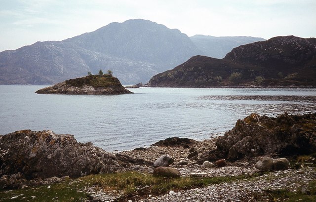
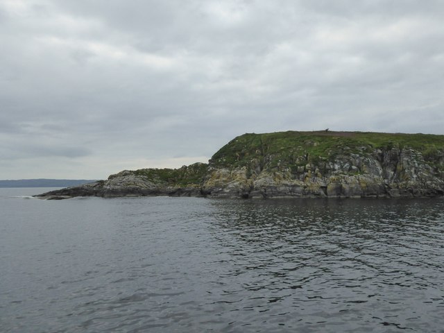
Am Port is a coastal feature located in Inverness-shire, Scotland. It is classified as a headland, also known as a point, and is situated along the rugged coastline of the Scottish Highlands. The name "Am Port" is Gaelic for "the port," referring to its historical significance as a small harbor.

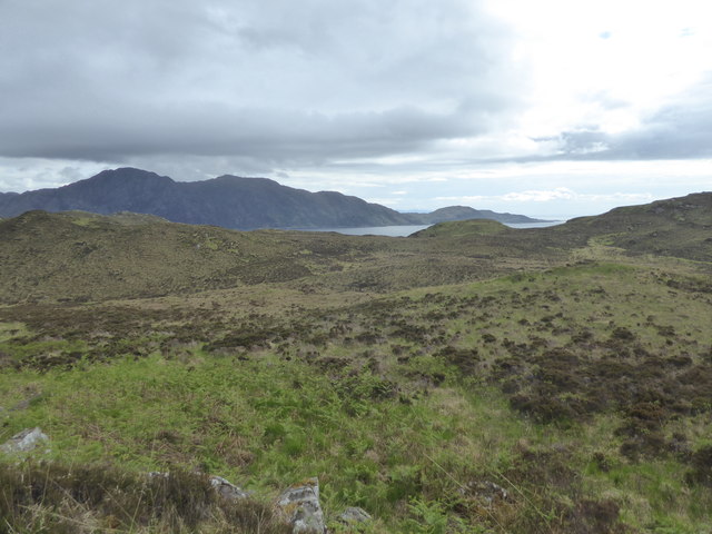
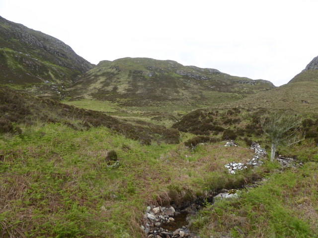
This prominent headland extends into the North Atlantic Ocean, offering breathtaking views of the surrounding seascape. It is characterized by its steep cliffs, which tower over the crashing waves below. The cliffs are composed of ancient rock formations, showcasing the geological history of the area.

Am Port is known for its diverse wildlife and rich biodiversity. The headland serves as a habitat for a variety of seabirds, including guillemots, razorbills, and fulmars. Visitors may also spot seals and dolphins swimming in the waters surrounding the point.

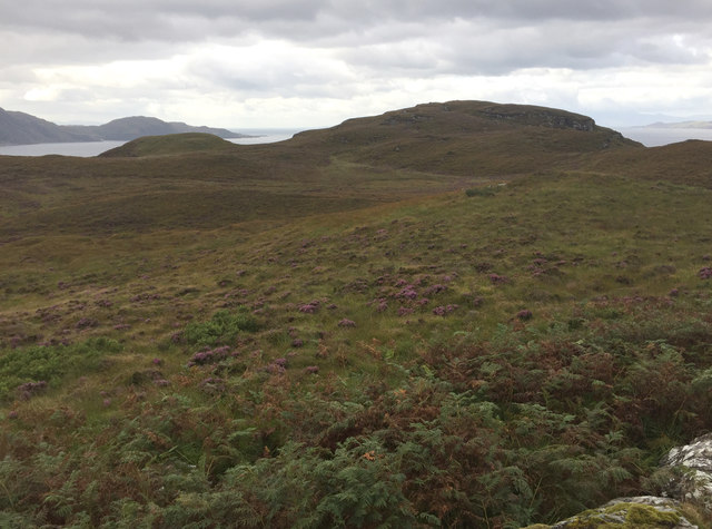
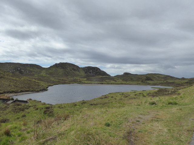
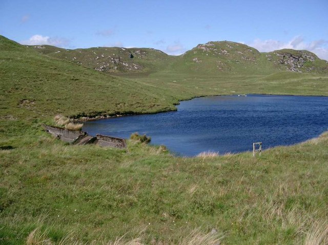
The rugged beauty of Am Port makes it a popular destination for outdoor enthusiasts and nature lovers. Hiking trails and paths wind along the headland, providing opportunities for scenic walks and exploration. The dramatic cliffs and panoramic views make it a photographer's paradise.

Although Am Port is primarily known for its natural beauty, it also holds historical significance. The area was once a bustling port and fishing village, with remnants of old fishing huts and boat shelters still visible along the coastline.

Am Port is a must-visit destination for those seeking to immerse themselves in the stunning landscapes and rich history of the Scottish Highlands.

If you have any feedback on the listing, please let us know in the comments section below.

Am Port Images

Images are sourced within 2km of 57.039263/-5.7558364 or Grid Reference NG7200. Thanks to Geograph Open Source API. All images are credited.

Glaschoille shore and Sgeirean Dearga
The dam on Glaschoille Loch A small dam of in-situ cast concrete rasing the level of the loch a little. Water was leaking fast around the left side of the wall.
The dam on Glaschoille Loch
A small dam of in-situ cast concrete rasing the level of the loch a little. Water was leaking fast around the left side of the wall.
Allt an Lagain Looking downstream from Lagan Bridge.
Allt an Lagain
Looking downstream from Lagan Bridge.
Knoydart moorland A view from the Inverie - Airor road towards the mouth of Loch Nevis and Mallaig.
Knoydart moorland
A view from the Inverie - Airor road towards the mouth of Loch Nevis and Mallaig.
Sandaig Looking along the beach to Sandaig Cottage.
Sandaig
Looking along the beach to Sandaig Cottage.
Remaking the track to Sandaig The quarry on the left has been the source of much of the material used to improve the road.
Remaking the track to Sandaig
The quarry on the left has been the source of much of the material used to improve the road.
Glaschoille Loch, Knoydart
Road to Airor, Knoydart
Moorland and plantation above Sandaig, Knoydart
Moorland east of Sandaig, Knoydart
Old walls by Allt an Lagain, Knoydart
Road to Airor, Knoydart
South end of Glas Eilein
Knoydart - Inverie to Sandaig and  Airor To the right, Roinn na Beinne, 441m, and low down on the left, a footbridge over the Allt an Lagain (where a damp packed lunch beckons!).
Knoydart - Inverie to Sandaig and Airor
To the right, Roinn na Beinne, 441m, and low down on the left, a footbridge over the Allt an Lagain (where a damp packed lunch beckons!).
Inverie Bay, Knoydart Looking eastwards from high up on the Inverie to Airor track, and across the bay. Inverie just visible towards the left. ( And for some 2mins., the rain stopped!)
Inverie Bay, Knoydart
Looking eastwards from high up on the Inverie to Airor track, and across the bay. Inverie just visible towards the left. ( And for some 2mins., the rain stopped!)
The Allt an Lagain The Sgurr of Eigg showing nicely in the distance.
The Allt an Lagain
The Sgurr of Eigg showing nicely in the distance.
The dam at Glaschoille Loch
The low pass between Rubha Raonuill and Creagan Dearga looking WNW to Glas Eilean and, in the far distance, Skye.
The low pass between Rubha Raonuill and Creagan Dearga
looking WNW to Glas Eilean and, in the far distance, Skye.
Show me another place!

Am Port is located at Grid Ref: NG7200 (Lat: 57.039263, Lng: -5.7558364)

Unitary Authority: Highland

Police Authority: Highlands and Islands

What 3 Words

///producers.retaliate.extend. Near Armadale, Highland

Nearby Locations

Am Port Carn an t-Seididh

Related Wikis

Sandaig Bay

Sandaig Bay is a coastal embayment, on a chord of 2.04 kilometres (1 mile 471 yards), on a 194° orientation, located on the northwestern end of the sea...

Inverie Bay

Inverie Bay is a coastal embayment, on a chord of 2.12 miles, on a 207° orientation, on the northwestern coast of the sea loch in Loch Nevis, and is next...

Inverie

Inverie (; Scottish Gaelic: Inbhir Aoidh) is the main village on the Knoydart peninsula in the Scottish Highlands. It is located on the north side of Loch...

Airor

Airor is a hamlet in the peninsula of Knoydart, Lochaber, Highland, on the west coast of Scotland. It is situated on the north-west coast of Knoydart,...

Nearby Amenities

Located within 500m of 57.039263,-5.7558364
Created By: almien_coastlines
Source: PGS
Lat/Long: 57.042767/-5.760275
Created By: almien_coastlines
Source: PGS
Lat/Long: 57.042/-5.760218
Created By: almien_coastlines
Source: PGS
Lat/Long: 57.041877/-5.759973
Created By: almien_coastlines
Source: PGS
Lat/Long: 57.041897/-5.759034
Created By: almien_coastlines
Source: PGS
Lat/Long: 57.042031/-5.75881
Created By: almien_coastlines
Source: PGS
Lat/Long: 57.042164/-5.758584
Source: PGS
Lat/Long: 57.0423724/-5.7583725
Source: PGS
Lat/Long: 57.0426371/-5.7568018
Source: PGS
Lat/Long: 57.0421727/-5.7563261
Source: PGS
Lat/Long: 57.041698/-5.7563728
Source: PGS
Lat/Long: 57.0415452/-5.7569814
Created By: almien_coastlines
Source: PGS
Lat/Long: 57.040783/-5.757308
Source: PGS
Lat/Long: 57.0401573/-5.7569143
Created By: almien_coastlines
Source: PGS
Lat/Long: 57.040128/-5.757963
Source: PGS
Lat/Long: 57.0398951/-5.7580663
Created By: almien_coastlines
Source: PGS
Lat/Long: 57.039228/-5.758132
Created By: almien_coastlines
Source: PGS
Lat/Long: 57.039105/-5.757888
Source: PGS
Lat/Long: 57.0387776/-5.7570687
Source: PGS
Lat/Long: 57.0387584/-5.7565372
Created By: almien_coastlines
Source: PGS
Lat/Long: 57.038379/-5.755954
Source: PGS
Lat/Long: 57.0384774/-5.7552148
Source: PGS
Lat/Long: 57.0376509/-5.7546434
Source: PGS
Lat/Long: 57.0372929/-5.7544234
Source: PGS
Lat/Long: 57.0371464/-5.7542622
Source: PGS
Lat/Long: 57.0369094/-5.7538009
Source: PGS
Lat/Long: 57.0351419/-5.7559507
Source: PGS
Lat/Long: 57.0348499/-5.7561019
Am Port
Place: locality
Lat/Long: 57.039617/-5.7550754
Torr Mor
Place: locality
Lat/Long: 57.0425931/-5.7593374
The data included in this document is from www.openstreetmap.org. The data is made available under ODbL.

Have you been to Am Port?

Leave your review of Am Port below (or comments, questions and feedback).