Bass Point

Coastal Feature, Headland, Point in Cornwall

England

Bass Point

Polpeor Cove
Polpeor Cove Credit: Matthew Chadwick

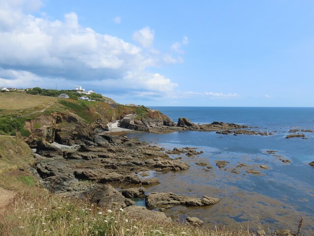
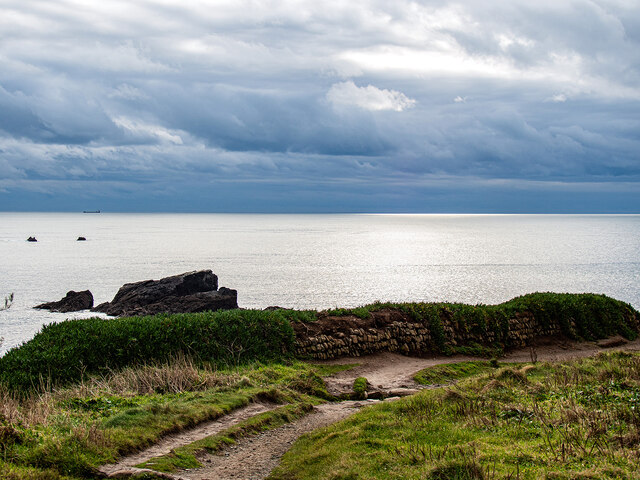
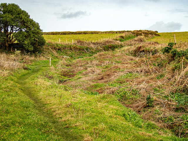
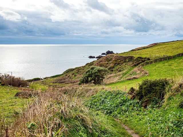
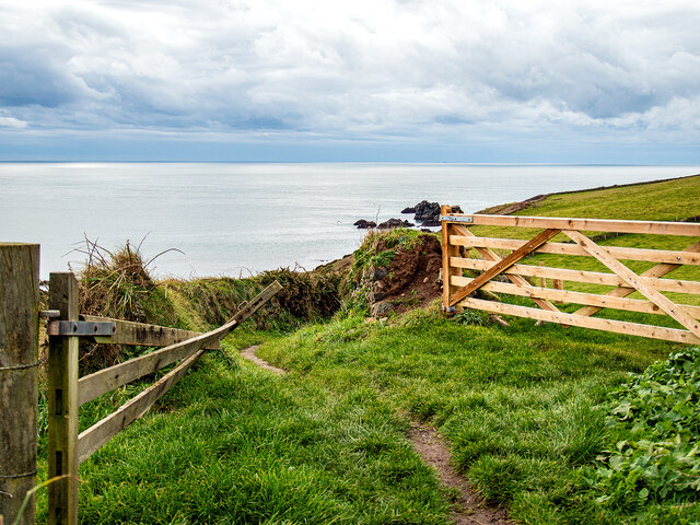
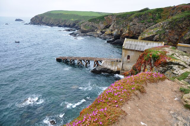
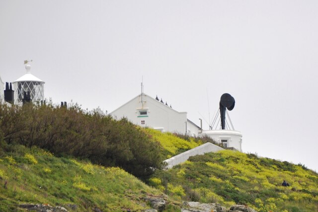
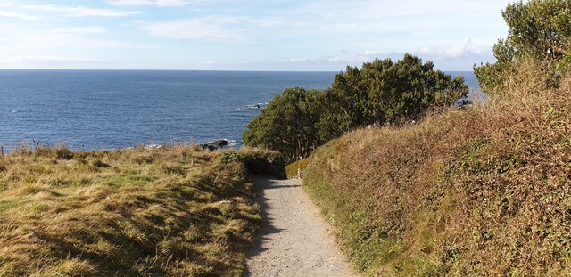
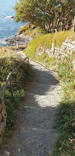
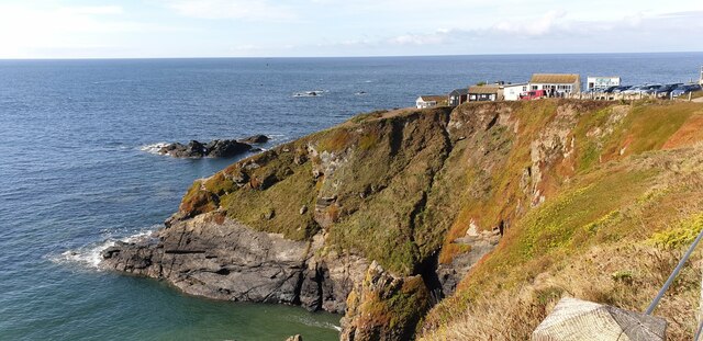
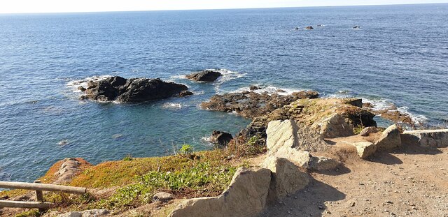
Bass Point is a prominent headland located on the southern coast of Cornwall, England. This coastal feature juts out into the Atlantic Ocean, offering stunning panoramic views of the surrounding coastline. The point is characterized by rugged cliffs, rocky outcrops, and a diverse array of marine and bird life.

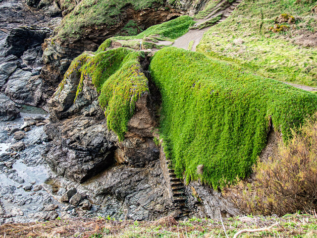
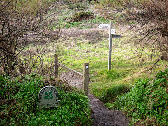
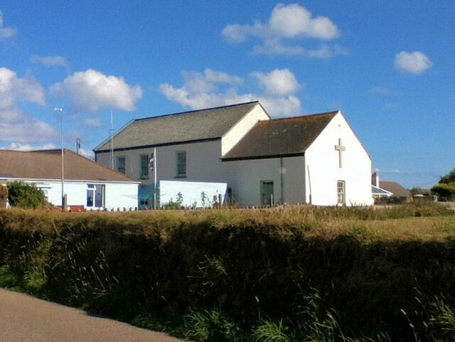
The area surrounding Bass Point is popular among hikers and nature enthusiasts, as it is home to a variety of coastal flora and fauna. Visitors can explore the winding coastal paths that hug the cliffs, providing access to secluded coves and hidden beaches. The headland is also known for its historic significance, with remnants of old mining operations and military structures scattered throughout the landscape.

Bass Point is a popular spot for birdwatching, with a variety of seabirds and migratory species making their home in the area. The headland is also a prime location for fishing, as the waters surrounding Bass Point are teeming with a variety of fish species.

Overall, Bass Point is a must-visit destination for those seeking to experience the natural beauty and rich history of Cornwall's rugged coastline.

If you have any feedback on the listing, please let us know in the comments section below.

Bass Point Images

Images are sourced within 2km of 49.963744/-5.1862599 or Grid Reference SW7111. Thanks to Geograph Open Source API. All images are credited.

Polpeor Cove
Polpeor Cove
Steps down to Polpeor Cove After you!
Steps down to Polpeor Cove
After you!
Entering Pistil Meadow Legend has it that this was the burial site of 200 souls lost in the wreck of the Royal Anne Galley in 1721. This has now probably been disproved by a study conducted in 2014-16 <span class="nowrap"><a title="https://thisismast.org//research/pistil-meadow-and-the-royal-anne.html" rel="nofollow ugc noopener" href="https://thisismast.org//research/pistil-meadow-and-the-royal-anne.html">Link</a><img style="margin-left:2px;" alt="External link" title="External link - shift click to open in new window" src="https://s1.geograph.org.uk/img/external.png" width="10" height="10"/></span>
Entering Pistil Meadow
Legend has it that this was the burial site of 200 souls lost in the wreck of the Royal Anne Galley in 1721. This has now probably been disproved by a study conducted in 2014-16 LinkExternal link
Looking out from Pistil Meadow Shag Rock on the left.
Looking out from Pistil Meadow
Shag Rock on the left.
Bridleway leading from Pistil Meadow to Lizard Village
Looking down on Pistil Meadow From the bridleway down from Lizard Village.
Looking down on Pistil Meadow
From the bridleway down from Lizard Village.
Farm gates by the bridleway Down from Lizard Village.
Farm gates by the bridleway
Down from Lizard Village.
The Lizard Lifeboat Station The Lizard Lifeboat Station at Lizard Point, below the Lighthouse.
The Lizard Lifeboat Station
The Lizard Lifeboat Station at Lizard Point, below the Lighthouse.
The Lizard Lighthouse Foghorn The Lizard Foghorn comprises two diaphone horns operated by compressed air, nowadays electrically operated giving one three second blast every thirty seconds when air moisture exceeds a certain figure.  Originally it was operated by a steam compressor, changed to diesel operation after 1907.
The Lizard Lighthouse Foghorn
The Lizard Foghorn comprises two diaphone horns operated by compressed air, nowadays electrically operated giving one three second blast every thirty seconds when air moisture exceeds a certain figure. Originally it was operated by a steam compressor, changed to diesel operation after 1907.
Lizard Methodist Church
Footpath down to Lizard Point A footpath leading down to Lizard Point.
Footpath down to Lizard Point
A footpath leading down to Lizard Point.
Steps down to Lizard Point A footpath with steps down to Lizard Point.
Steps down to Lizard Point
A footpath with steps down to Lizard Point.
Lizard Point Lizard Point is the most southerly place in Britain.
Lizard Point
Lizard Point is the most southerly place in Britain.
Rocks near Lizard Point Rocks to the east of Lizard Point.
Rocks near Lizard Point
Rocks to the east of Lizard Point.
Britain's most southerly building A "National Trust Wildlife Watchpoint" used as an educational centre sits at the end of Lizard Point peninsula, claiming the title of the most southerly building in Britain.
Britain's most southerly building
A "National Trust Wildlife Watchpoint" used as an educational centre sits at the end of Lizard Point peninsula, claiming the title of the most southerly building in Britain.
Ramp down to lifeboat station The ramp down to the old lifeboat station to the west of Lizard Point.
Ramp down to lifeboat station
The ramp down to the old lifeboat station to the west of Lizard Point.
Old lifeboat station The old lifeboat station is at the base of a very steep hill. It has been disused for some years.
Old lifeboat station
The old lifeboat station is at the base of a very steep hill. It has been disused for some years.
Old lifeboat station in disrepair The old lifeboat station is missing its roof on part of the building.
Old lifeboat station in disrepair
The old lifeboat station is missing its roof on part of the building.
Show me another place!

Bass Point is located at Grid Ref: SW7111 (Lat: 49.963744, Lng: -5.1862599)

Unitary Authority: Cornwall

Police Authority: Devon and Cornwall

What 3 Words

///handed.wonderfully.waltzed. Near Landewednack, Cornwall

Related Wikis

Bass Point (England)

Bass Point is a headland on the coast of Cornwall, England. It is at the southern tip of the Lizard peninsula, in the civil parish of Landewednack. The...

Adolf Vinnen (barquentine)

Adolf Vinnen was a five-masted barquentine that was built by Friedrich Krupp Germaniawerft, Kiel, Germany. She was wrecked on her maiden voyage in 1923...

The Lizard Lifeboat Station

The Lizard Lifeboat Station can refer to several Royal National Lifeboat Institution lifeboat stations located on the Lizard in Cornwall, United Kingdom...

Church Cove

For Church Cove, Gunwalloe, see GunwalloeChurch Cove is a hamlet in the civil parish of Landewednack in Cornwall, England. Its nearest town is Helston...

Nearby Amenities

Located within 500m of 49.963744,-5.1862599
Bass Point
Tourism: viewpoint
Lat/Long: 49.9636184/-5.1869267
Lizard Wireless Station
Museum: technology
Source: GPS
Tourism: museum
Website: https://www.nationaltrust.org.uk/lizard-point/features/marconi-on-the-lizard
Lat/Long: 49.9635018/-5.1918508
Pen Olver
Is In: Cornwall, England, UK
Place: locality
Lat/Long: 49.9612594/-5.189044
Hot Point
Is In: Cornwall, England, UK
Name Kw: Penn Hatt
Place: locality
Lat/Long: 49.967073/-5.1833426
Bench
Backrest: yes
Check Date: 2021-06-30
Lat/Long: 49.9635272/-5.1864592
Bench
Backrest: no
Check Date: 2021-06-30
Lat/Long: 49.9637028/-5.1911545
Bench
Backrest: yes
Check Date: 2021-06-30
Lat/Long: 49.9634937/-5.1928327
Tourism: viewpoint
Lat/Long: 49.962242/-5.1904555
Bass Point Station
Board Type: history
Check Date: 2021-06-30
Information: board
Tourism: information
Wikidata: Q4867952
Wikipedia: en:Bass Point (England)
Lat/Long: 49.9633711/-5.1867156
Bugaled Breizh 15.01.2004
Historic: memorial
Lat/Long: 49.9641594/-5.1866546
Barrier: stile
Material: wood
Source: survey;gps
Stile: stepover
Lat/Long: 49.9646039/-5.1871523
Barrier: kissing_gate
Source: survey;gps
Lat/Long: 49.9647887/-5.1872564
Natural: rock
Lat/Long: 49.9672641/-5.1850185
Barrier: kissing_gate
Lat/Long: 49.9642487/-5.1900557
WW2 Pen Olver Chain Home Low Radar Station
Communication Military: yes
Man Made: antenna
Operator: RAF
Lat/Long: 49.9647591/-5.1892239
Location Transition: yes
Material: wood
Power: pole
Lat/Long: 49.9659339/-5.1903534
Material: wood
Power: pole
Lat/Long: 49.9666326/-5.1909193
Seamark Daymark Colour: red;white
Seamark Daymark Colour Pattern: vertical
Seamark Daymark Shape: board
Seamark Type: daymark
Lat/Long: 49.9634714/-5.1865193
Bench
Backrest: no
Lat/Long: 49.966946/-5.1853935
Bench
Survey Date: 2023-10-22
Lat/Long: 49.9634689/-5.1866305
The data included in this document is from www.openstreetmap.org. The data is made available under ODbL.

Have you been to Bass Point?

Leave your review of Bass Point below (or comments, questions and feedback).