An Fhaochag

Coastal Feature, Headland, Point in Inverness-shire

Scotland

An Fhaochag

The road from Airor to Inverie, Knoydart This is the only surfaced road on Knoydart and measures seven miles long and has very little traffic.
The road from Airor to Inverie, Knoydart Credit: Colin Park

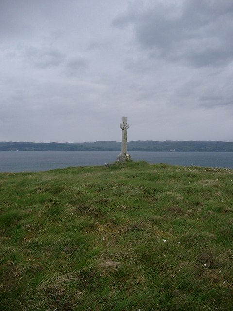
An Fhaochag, located in Inverness-shire, is a prominent coastal feature that is classified as a headland or point. It is situated on the northeastern coast of Scotland, along the North Sea. The name "An Fhaochag" translates to "the little sea vent" in Gaelic, which aptly describes its unique geography.

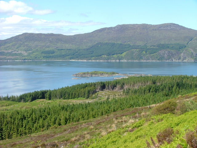
An Fhaochag is characterized by its rugged and rocky terrain, with steep cliffs that descend into the crashing waves of the sea below. It offers breathtaking panoramic views of the surrounding coastline, making it a popular destination for tourists and nature lovers alike.

The headland is known for its diverse wildlife, including various seabirds that nest in the cliffs, such as puffins, guillemots, and razorbills. The surrounding waters are also home to seals, dolphins, and occasional sightings of whales.

The coastal feature is an important landmark for navigational purposes, serving as a reference point for sailors and fishermen. Its strategic location also makes it an ideal spot for lighthouses, with the Tarbat Ness Lighthouse located nearby.

In addition to its natural beauty, An Fhaochag is steeped in history and folklore. It is said to be the site of countless shipwrecks throughout the centuries, adding to its mystique. The headland's rich cultural heritage is reflected in its connection to local legends and tales that have been passed down through generations.

Overall, An Fhaochag is a captivating coastal feature that boasts stunning scenery, abundant wildlife, and a rich history. It is a must-visit destination for anyone seeking to immerse themselves in Scotland's natural beauty and maritime heritage.

If you have any feedback on the listing, please let us know in the comments section below.

An Fhaochag Images

Images are sourced within 2km of 57.065372/-5.7943082 or Grid Reference NG7003. Thanks to Geograph Open Source API. All images are credited.

The road from Airor to Inverie, Knoydart This is the only surfaced road on Knoydart and measures seven miles long and has very little traffic.
The road from Airor to Inverie, Knoydart
This is the only surfaced road on Knoydart and measures seven miles long and has very little traffic.
Path to Doune, Knoydart
Moorland and plantation above Sandaig, Knoydart
Road to Airor, Knoydart
Doune Seasonal accommodation and boating holidays on the Knoydart peninsula.  About as isolated as you can get and owned by a very hospitable English family.
Doune
Seasonal accommodation and boating holidays on the Knoydart peninsula. About as isolated as you can get and owned by a very hospitable English family.
Un-named burn above Sandaig Looking over Sandaig and Loch Nevis to North Morar
Un-named burn above Sandaig
Looking over Sandaig and Loch Nevis to North Morar
Jetty at Doune Gripper 2 tied up alongside.  This boat, the main transport link to Mallaig, was built in recent years in the boatyard at Doune.
Jetty at Doune
Gripper 2 tied up alongside. This boat, the main transport link to Mallaig, was built in recent years in the boatyard at Doune.
Luggage transport at Doune Not quite limousine transport, but the bags are delivered from boat to accommodation.
Luggage transport at Doune
Not quite limousine transport, but the bags are delivered from boat to accommodation.
Airor - Inverie road Mallaig in the distance.  The sign indicates the rough track down to Doune (or doun to Down?)
Airor - Inverie road
Mallaig in the distance. The sign indicates the rough track down to Doune (or doun to Down?)
The Airor to Inverie road This road is maintained by the estate.  There are no public roads on Knoydart, hence no need for vehicles to have road tax.  The peak in the background is Roinn na Beinne.
The Airor to Inverie road
This road is maintained by the estate. There are no public roads on Knoydart, hence no need for vehicles to have road tax. The peak in the background is Roinn na Beinne.
War memorial on Knoydart Dedicated by his wife to Captain Geoffrey Vaux Salvin Bowlby, killed at Ypres.  The Bowlby family are previous owners of the entire Knoydart estate.
War memorial on Knoydart
Dedicated by his wife to Captain Geoffrey Vaux Salvin Bowlby, killed at Ypres. The Bowlby family are previous owners of the entire Knoydart estate.
Moorland north of Eilean Dearg
Moored at Doune As the holiday centre here is run by relatives of a personal friend I'm tempted to advertise. Suffice it to say that i'm looking forward to going again.
Moored at Doune
As the holiday centre here is run by relatives of a personal friend I'm tempted to advertise. Suffice it to say that i'm looking forward to going again.
Is this the low road? That's the Isle of Skye in the background.
Is this the low road?
That's the Isle of Skye in the background.
On the road to Airor View taken looking North towards the Isle of Skye
On the road to Airor
View taken looking North towards the Isle of Skye
Lunch stop after crossing from Sleat Low cloud and intermittent drizzle heralded a more serious deterioration of the weather on this easter sea kayak trip out to Skye from Mallaig. This was the third day, and we had just returned from two nights on the Point of Sleat, by paddling up to Armadale and making the six kilometre crossing back to the mainland. This tiny beach was our landfall and much-needed late lunch stop.
Lunch stop after crossing from Sleat
Low cloud and intermittent drizzle heralded a more serious deterioration of the weather on this easter sea kayak trip out to Skye from Mallaig. This was the third day, and we had just returned from two nights on the Point of Sleat, by paddling up to Armadale and making the six kilometre crossing back to the mainland. This tiny beach was our landfall and much-needed late lunch stop.
Rocky Coast Just south of Dun Ban there is a band of low lying sea rocks.
Rocky Coast
Just south of Dun Ban there is a band of low lying sea rocks.
Sea Rocks Tidal mark on the low lying rocks which lie at the foot of Uamph (surely a mis-spelling on the Explorer Map?) Dhorch.
Sea Rocks
Tidal mark on the low lying rocks which lie at the foot of Uamph (surely a mis-spelling on the Explorer Map?) Dhorch.
Show me another place!

An Fhaochag is located at Grid Ref: NG7003 (Lat: 57.065372, Lng: -5.7943082)

Unitary Authority: Highland

Police Authority: Highlands and Islands

What 3 Words

///pickup.verges.stews. Near Armadale, Highland

Related Wikis

Airor

Airor is a hamlet in the peninsula of Knoydart, Lochaber, Highland, on the west coast of Scotland. It is situated on the north-west coast of Knoydart,...

Sandaig Bay

Sandaig Bay is a coastal embayment, on a chord of 2.04 kilometres (1 mile 471 yards), on a 194° orientation, located on the northwestern end of the sea...

Sound of Sleat

The Sound of Sleat is a narrow sea channel off the western coast of Scotland. It divides the Sleat peninsula on the south-east side of the Isle of Skye...

Sabhal Mòr Ostaig

Sabhal Mòr Ostaig ([ˌs̪ɔɫ̪ ˌmoɾ ˈɔs̪t̪ɪkʲ]) (Great Barn of Ostaig) is a public higher education college situated in the Sleat peninsula in the south of...

Nearby Amenities

Located within 500m of 57.065372,-5.7943082
Source: PGS
Lat/Long: 57.0676112/-5.7878261
Created By: almien_coastlines
Source: PGS
Lat/Long: 57.068135/-5.788726
Source: PGS
Lat/Long: 57.0680573/-5.7892955
Source: PGS
Lat/Long: 57.0677398/-5.7890342
Source: PGS
Lat/Long: 57.0675247/-5.7887607
Source: PGS
Lat/Long: 57.0673493/-5.7885801
Source: PGS
Lat/Long: 57.0672622/-5.7883747
Source: PGS
Lat/Long: 57.067042/-5.7879473
Source: PGS
Lat/Long: 57.0668208/-5.7878159
Source: PGS
Lat/Long: 57.0664424/-5.7877755
Source: PGS
Lat/Long: 57.066073/-5.7880831
Source: PGS
Lat/Long: 57.0653841/-5.7887208
Source: PGS
Lat/Long: 57.0651797/-5.7898076
Created By: almien_coastlines
Source: PGS
Lat/Long: 57.065654/-5.790891
Source: PGS
Lat/Long: 57.0661396/-5.7914922
Source: PGS
Lat/Long: 57.0662943/-5.7922066
Source: PGS
Lat/Long: 57.0663479/-5.7926178
Source: PGS
Lat/Long: 57.0665622/-5.793042
Source: PGS
Lat/Long: 57.0668327/-5.7934506
Source: PGS
Lat/Long: 57.0669196/-5.7938478
Source: PGS
Lat/Long: 57.0663168/-5.7942715
Source: PGS
Lat/Long: 57.0657233/-5.7950015
Source: PGS
Lat/Long: 57.0660183/-5.7954777
Source: PGS
Lat/Long: 57.0659729/-5.7963563
Source: PGS
Lat/Long: 57.0653795/-5.797509
Source: PGS
Lat/Long: 57.0651135/-5.7977157
Source: PGS
Lat/Long: 57.0649372/-5.7976175
Source: PGS
Lat/Long: 57.0648838/-5.7972303
Source: PGS
Lat/Long: 57.0649858/-5.7966313
Source: PGS
Lat/Long: 57.0649951/-5.7955541
Source: PGS
Lat/Long: 57.064421/-5.7945587
Source: PGS
Lat/Long: 57.0634842/-5.7951436
Source: PGS
Lat/Long: 57.0638242/-5.7962687
Source: PGS
Lat/Long: 57.0634843/-5.7968179
Source: PGS
Lat/Long: 57.0631089/-5.7968951
Source: PGS
Lat/Long: 57.0625723/-5.7975111
Created By: almien_coastlines
Source: PGS
Lat/Long: 57.061666/-5.79741
An Fhaochag
Place: locality
Lat/Long: 57.0652812/-5.7937761
Cnoc a' Chomhlachaidh
Place: locality
Lat/Long: 57.0618363/-5.7944947
Doune
Name Gd: An Dùn
Place: hamlet
Lat/Long: 57.0649362/-5.7878871
Dun Ban
Place: locality
Lat/Long: 57.0665979/-5.7935828
The data included in this document is from www.openstreetmap.org. The data is made available under ODbL.

Have you been to An Fhaochag?

Leave your review of An Fhaochag below (or comments, questions and feedback).