Barabhaig
Coastal Feature, Headland, Point in Inverness-shire
Scotland
Barabhaig
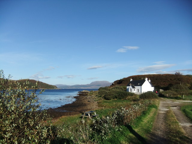
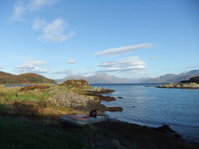
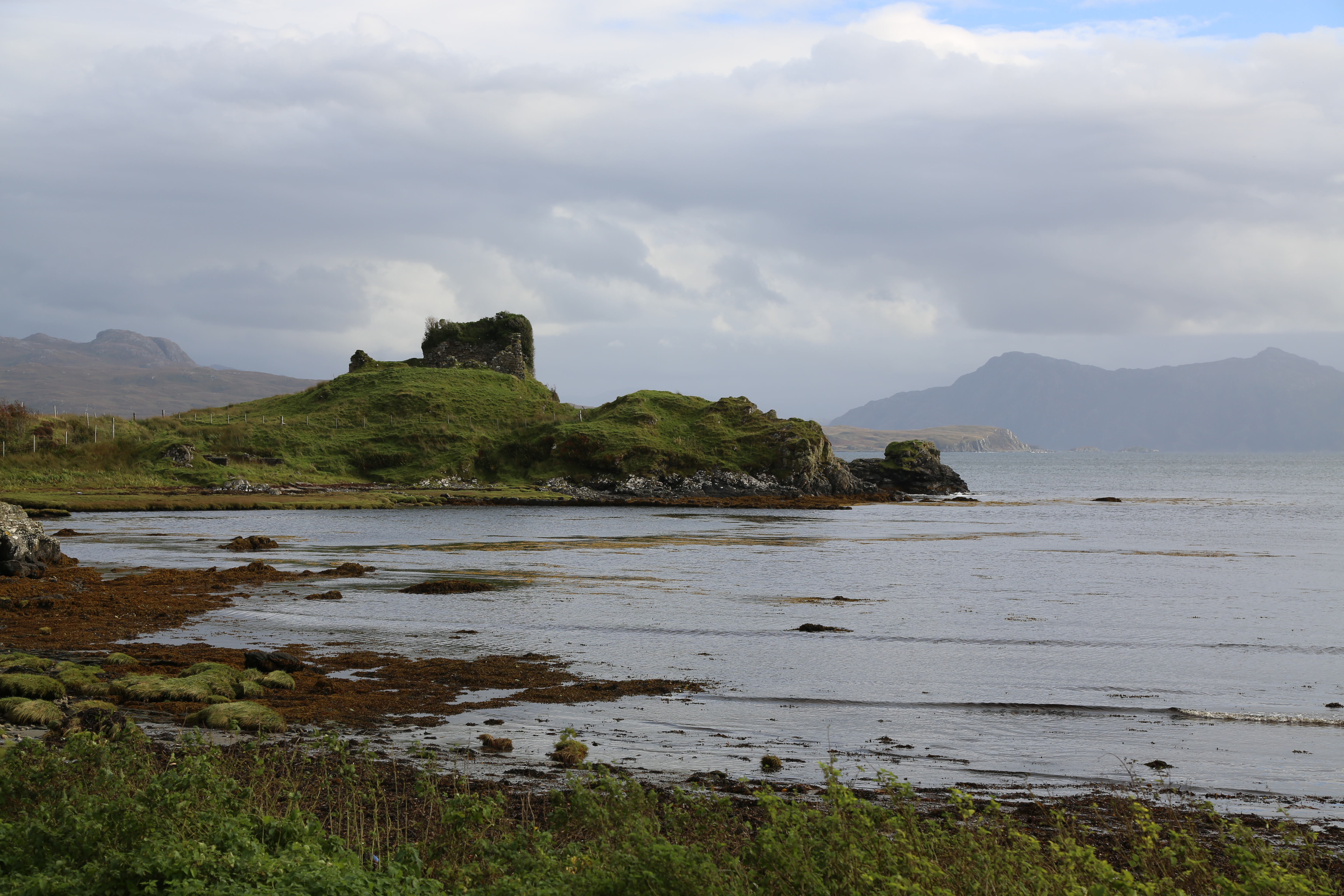
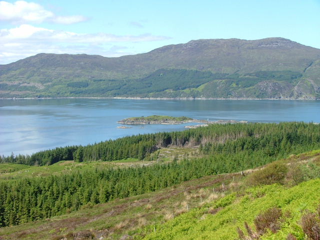
Barabhaig is a stunning coastal feature located in Inverness-shire, Scotland. Situated on the western coast of the Isle of Skye, Barabhaig is known for its picturesque headland and point, attracting visitors from all over the world.
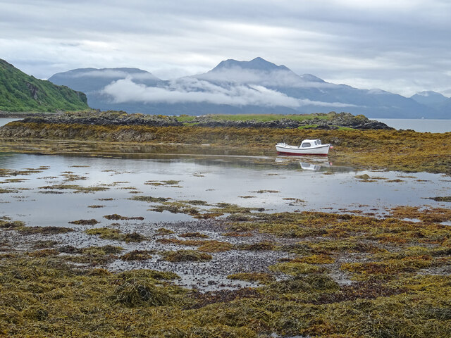
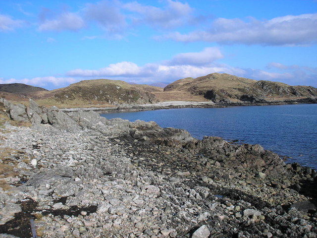
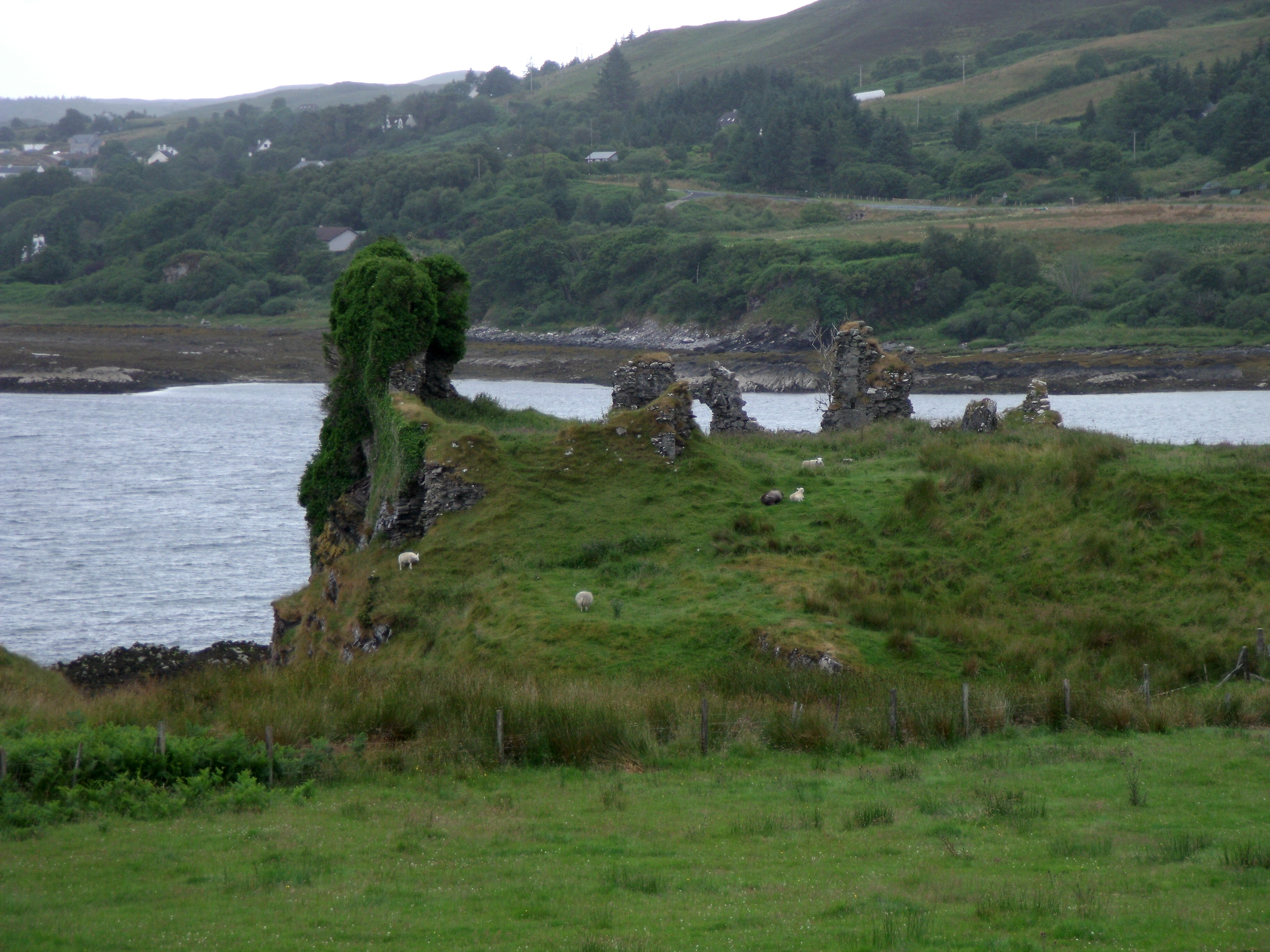
The headland at Barabhaig offers breathtaking views of the surrounding Atlantic Ocean, with its rugged cliffs and dramatic rock formations. The area is abundant in wildlife, making it a popular spot for birdwatching enthusiasts. Visitors can often spot various seabirds such as puffins, guillemots, and gannets, as well as seals and otters swimming in the crystal-clear waters.
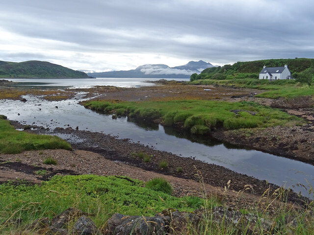
At the point of Barabhaig, there is a small, sandy beach nestled between the cliffs. This secluded beach is a hidden gem and provides a peaceful spot for relaxation or a picnic. The beach is also a great place for rock pooling, allowing visitors to discover a diverse array of marine life.
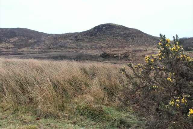
The landscape surrounding Barabhaig is characterized by rolling hills and lush greenery, offering visitors the opportunity to explore the area through scenic walks and hikes. There are numerous walking trails that lead to and from Barabhaig, providing stunning views of the coastline and the nearby Cuillin Mountains.
Overall, Barabhaig in Inverness-shire is a captivating coastal feature that combines natural beauty, wildlife, and tranquility. Whether you are seeking adventure, relaxation, or simply a break from the hustle and bustle of everyday life, Barabhaig is a must-visit destination that showcases the breathtaking beauty of the Scottish coast.
If you have any feedback on the listing, please let us know in the comments section below.
Barabhaig Images
Images are sourced within 2km of 57.117634/-5.815723 or Grid Reference NG6909. Thanks to Geograph Open Source API. All images are credited.


Barabhaig is located at Grid Ref: NG6909 (Lat: 57.117634, Lng: -5.815723)
Unitary Authority: Highland
Police Authority: Highlands and Islands
What 3 Words
///begins.flickers.allow. Near Armadale, Highland
Nearby Locations
Related Wikis
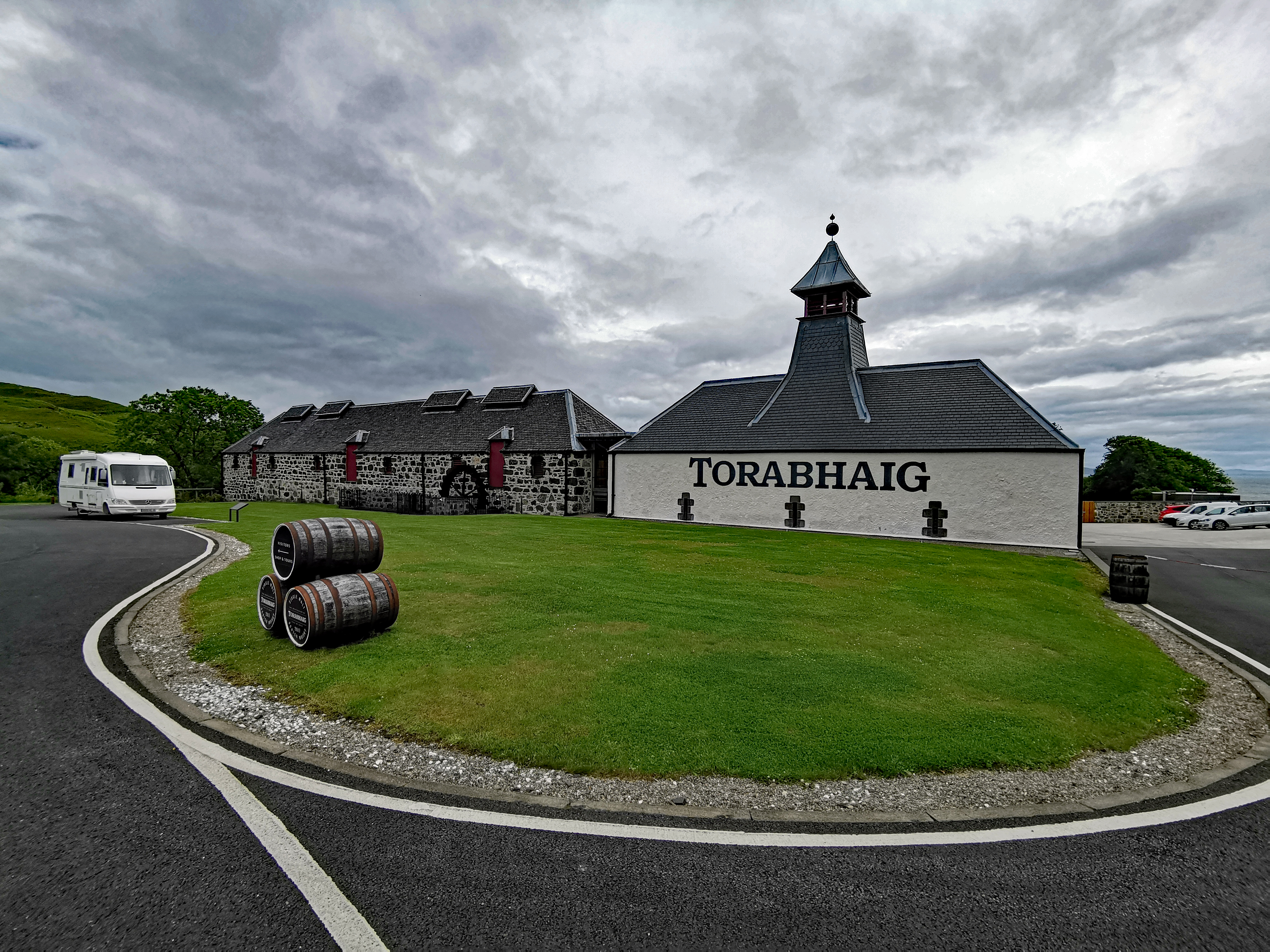
Torabhaig distillery
Torabhaig distillery is a Scotch whisky distillery in Teangue on the Isle of Skye. The distillery is the second ever licensed distillery on Skye and the...
Knock Castle (Isle of Skye)
Knock Castle, also known as Caisteal Chamuis (Castle Camus) is a former stronghold of the MacDonalds. It lies on the east coast of Sleat, approximately...

Camuscross
Camuscross (Scottish Gaelic: Camus Croise) is a small crofting township on the Isle of Skye in Scotland. Camuscross is situated on Camus Croise bay, on...
Sound of Sleat
The Sound of Sleat is a narrow sea channel off the western coast of Scotland. It divides the Sleat peninsula on the south-east side of the Isle of Skye...
Teangue
Teangue (Scottish Gaelic: An Teanga) is a fishing village on the Sleat peninsula, Isle of Skye, Highlands of Scotland. It is situated in Knock Bay on the...

Isleornsay
Isleornsay (Scottish Gaelic: Eilean Iarmain) is a village lying off the main Armadale to Sleat road (the A851) on the Isle of Skye in Scotland. It overlooks...

Té Bheag
Té Bheag (Scottish Gaelic pronunciation: [ˈtʲʰeː ˈvek]) is a blended Scotch whisky made by Pràban na Linne Ltd in Scotland. It is one of Sir Iain Noble...

Ornsay
Ornsay is a small tidal island to the east of the Sleat peninsula on the Isle of Skye in the Inner Hebrides of Scotland. == Description == The island provides...
Nearby Amenities
Located within 500m of 57.117634,-5.815723Have you been to Barabhaig?
Leave your review of Barabhaig below (or comments, questions and feedback).