Acarsaid Mòr

Coastal Feature, Headland, Point in Argyllshire

Scotland

Acarsaid Mòr

Cliffs, river and beach This terrain is difficult to cross but deer have made paths. There were signs of human use down on the beach, probably nets and ropes from a fishing vessel.
Cliffs, river and beach Credit: Graham Cole

Acarsaid Mòr is a prominent coastal feature located in Argyllshire, Scotland. It is specifically classified as a headland or point due to its distinctive shape and geographical characteristics. The headland is situated on the western coast of Scotland, on the Ardnamurchan Peninsula.

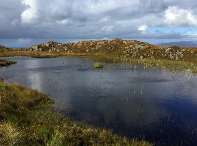
Acarsaid Mòr is known for its stunning natural beauty and rugged landscape. It is characterized by steep cliffs that rise dramatically from the ocean, providing breathtaking views of the surrounding area. The headland is made up of a mix of rocky outcrops and lush green vegetation, creating a striking contrast against the deep blue waters of the Atlantic Ocean.

The area surrounding Acarsaid Mòr is rich in biodiversity, with various species of seabirds, including puffins and gannets, nesting along the cliffs. Visitors to the headland can often witness these magnificent creatures in their natural habitat, making it a popular spot for birdwatching enthusiasts.

In addition to its natural wonders, Acarsaid Mòr also holds historical significance. The headland is home to the ruins of an ancient castle, dating back to the medieval period. This castle, known as Ardnamurchan Castle, served as a strategic stronghold and played a significant role in the region's history.

Acarsaid Mòr is a must-visit destination for nature lovers, history enthusiasts, and those seeking a peaceful retreat along the Scottish coast. Its stunning views, diverse wildlife, and historical charm make it a truly captivating place to explore.

If you have any feedback on the listing, please let us know in the comments section below.

Acarsaid Mòr Images

Images are sourced within 2km of 56.777638/-5.9474555 or Grid Reference NM5872. Thanks to Geograph Open Source API. All images are credited.

Cliffs, river and beach This terrain is difficult to cross but deer have made paths. There were signs of human use down on the beach, probably nets and ropes from a fishing vessel.
Cliffs, river and beach
This terrain is difficult to cross but deer have made paths. There were signs of human use down on the beach, probably nets and ropes from a fishing vessel.
Natural ramp down to the sea Perhaps this feature is the result of a geological fault?
Natural ramp down to the sea
Perhaps this feature is the result of a geological fault?
Headland wilderness In sheltered places small trees can grow but are likely to be kept low by browsing deer. Heather and miniature willows are common among the usual moorland grasses and rushes with various small flowers.
Headland wilderness
In sheltered places small trees can grow but are likely to be kept low by browsing deer. Heather and miniature willows are common among the usual moorland grasses and rushes with various small flowers.
A coastal ravine Our walk towards the tip of the headland had plenty of awkward features to cross or avoid.
A coastal ravine
Our walk towards the tip of the headland had plenty of awkward features to cross or avoid.
River development The meandering stream has apparently cut downwards into a former river plain. In the foreground notice some ruins of human habitations, possibly shealings. Paths in this valley were made by deer.
River development
The meandering stream has apparently cut downwards into a former river plain. In the foreground notice some ruins of human habitations, possibly shealings. Paths in this valley were made by deer.
Rugged terrain There are no footpaths around here but there are deer paths. Here is a fairly easy slope for us bipeds to negotiate.
Rugged terrain
There are no footpaths around here but there are deer paths. Here is a fairly easy slope for us bipeds to negotiate.
Sgeir Charrach A low lying skerry off the coast near Rubha Aird Druimnich
Sgeir Charrach
A low lying skerry off the coast near Rubha Aird Druimnich
Coastline at Rubha na h-Acairseid Rubha na h-Acairseid - the point of the anchorage - lies below the several ruined houses of the abandoned village of Arcasaid Mor, west of Kentra.
Coastline at Rubha na h-Acairseid
Rubha na h-Acairseid - the point of the anchorage - lies below the several ruined houses of the abandoned village of Arcasaid Mor, west of Kentra.
Lochan by the path to Arcasaid Mor
Line of a burn on Liath Dhoire The burn can be heard, but not seen, as it flows below the vegetation.
Line of a burn on Liath Dhoire
The burn can be heard, but not seen, as it flows below the vegetation.
Approaching Arcasaid Mor The track here falls towards the dozen or so ruined houses of the former settlement at Arcasaid.
Approaching Arcasaid Mor
The track here falls towards the dozen or so ruined houses of the former settlement at Arcasaid.
Lochan and tussock A tiny island in a lochan on the way over to Acarsaid Mòr.
Lochan and tussock
A tiny island in a lochan on the way over to Acarsaid Mòr.
Road to Acarsaid Mòr Passing a small lochan before the steep descent to the shoreline.
Road to Acarsaid Mòr
Passing a small lochan before the steep descent to the shoreline.
Liath Doire descent The steep drop towards Acarsaid Mòr.
Liath Doire descent
The steep drop towards Acarsaid Mòr.
Eilagadale A secluded house between Ockle and Gortenfern in north Ardnamurchan
Eilagadale
A secluded house between Ockle and Gortenfern in north Ardnamurchan
Beach and cliffs at Eilagadale A shingle beach with a fishing hut
Beach and cliffs at Eilagadale
A shingle beach with a fishing hut
Allt an Rubha Ruaidh on the Ockle path A beautiful path in a very remote part of the Ardnamurchan peninsula.
Allt an Rubha Ruaidh on the Ockle path
A beautiful path in a very remote part of the Ardnamurchan peninsula.
Allt Eilagadale on the Ockle path A beautiful valley and burn which runs down to Eilagadale where there is still at least one property in beautiful condition, hidden by the trees.
Allt Eilagadale on the Ockle path
A beautiful valley and burn which runs down to Eilagadale where there is still at least one property in beautiful condition, hidden by the trees.
Show me another place!

Acarsaid Mòr is located at Grid Ref: NM5872 (Lat: 56.777638, Lng: -5.9474555)

Unitary Authority: Highland

Police Authority: Highlands and Islands

What 3 Words

///fell.dragonfly.wishing. Near Kilchoan, Highland

Related Wikis

Ockle

Ockle (Scottish Gaelic: Ocal) is a remote hamlet, situated on the northcoast of the Ardnamurchan peninsula, Scottish Highlands and is in the Scottish council...

Ardtoe

Ardtoe (Scottish Gaelic: Àird Tobha) is a place on the coast of Ardnamurchan, Lochaber, in the Highland council area of Scotland. It has sandy beaches...

Eden (2016 TV series)

Eden is a British reality TV series; the first series was broadcast on Channel 4 from 18 July to 8 August 2016. It featured 23 participants living for...

Port an Eilean Mhòir boat burial

The Port an Eilean Mhòir boat burial is a Viking boat burial site in Ardnamurchan, Scotland, the most westerly point on the island of Great Britain. Dated...

Nearby Amenities

Located within 500m of 56.777638,-5.9474555
Created By: dmgroom_coastlines
Source: PGS
Lat/Long: 56.780703/-5.951212
Created By: dmgroom_coastlines
Source: PGS
Lat/Long: 56.78082/-5.951688
Source: PGS
Lat/Long: 56.781167/-5.9523393
Created By: dmgroom_coastlines
Source: PGS
Lat/Long: 56.78147/-5.951272
Created By: dmgroom_coastlines
Source: PGS
Lat/Long: 56.781459/-5.951738
Source: PGS
Lat/Long: 56.7811677/-5.9511172
Source: PGS
Lat/Long: 56.7807918/-5.9507477
Harcarsaid Mor
Place: locality
Lat/Long: 56.7773279/-5.9507949
The data included in this document is from www.openstreetmap.org. The data is made available under ODbL.

Have you been to Acarsaid Mòr?

Leave your review of Acarsaid Mòr below (or comments, questions and feedback).