Rubha Allt a' Chromain

Coastal Feature, Headland, Point in Argyllshire

Scotland

Rubha Allt a' Chromain

Loch na Pearaich Looking southwest over Loch na Pearaich and Loch Tarbert on a glorious summer's day.  The peaks of two of the Paps of Jura are visible in the distance.
Loch na Pearaich Credit: David Hoult

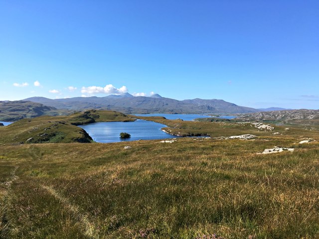
Rubha Allt a' Chromain is a picturesque coastal feature located in Argyllshire, Scotland. It is a headland that juts out into the sea, forming a prominent point in the landscape. The name Rubha Allt a' Chromain translates to "point of the burn of the bending."

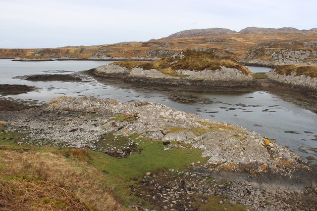
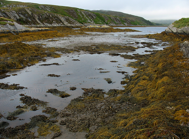
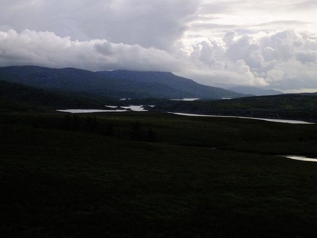
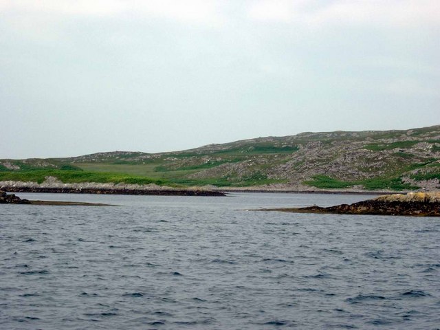
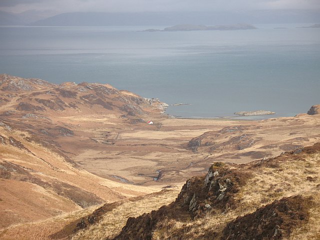
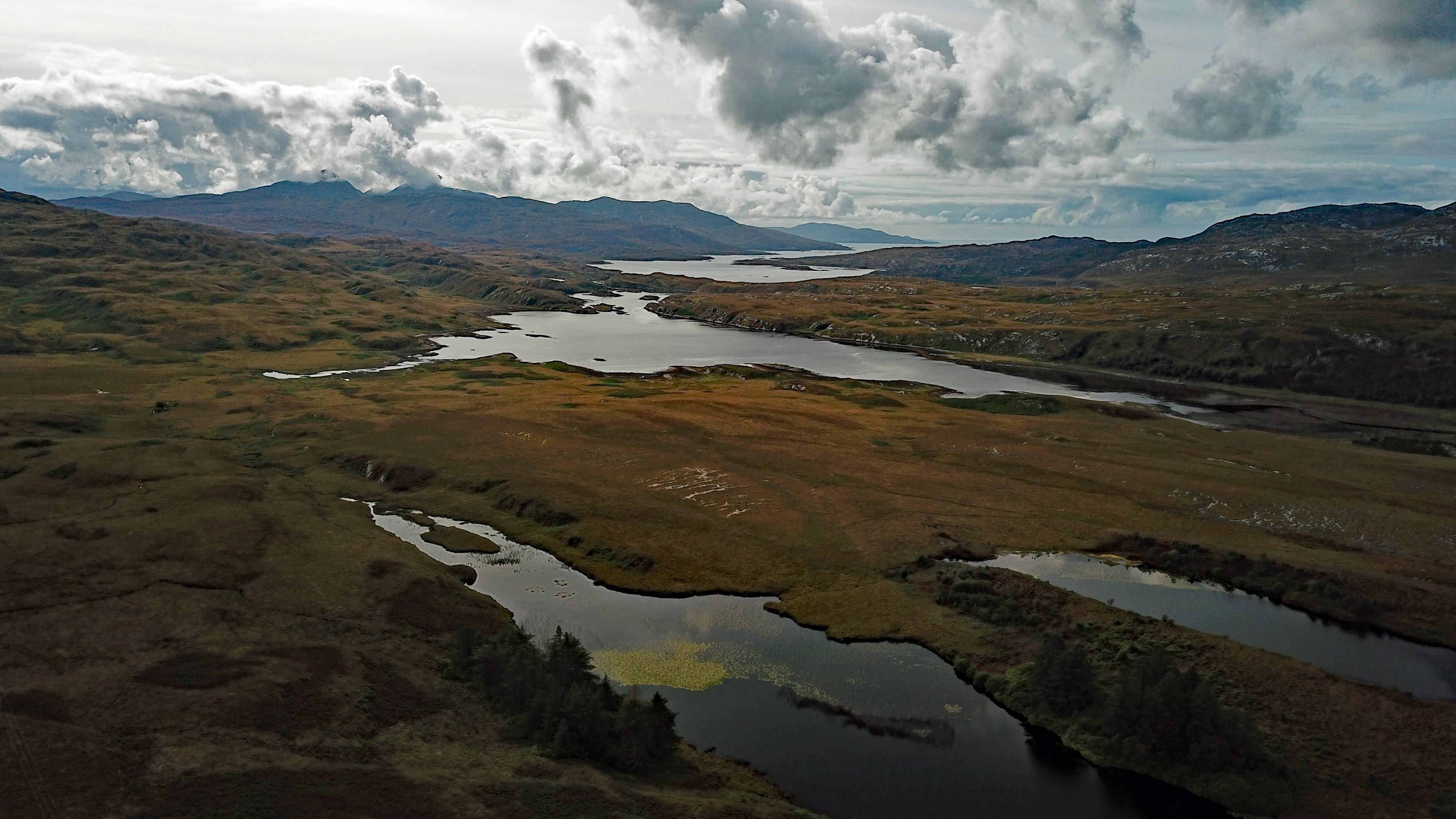
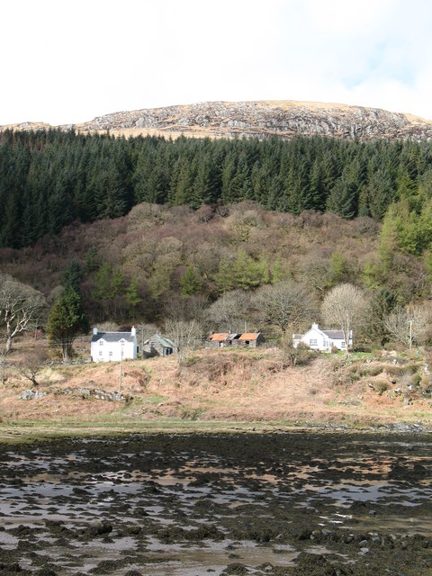
This headland is characterized by its rugged and rocky terrain, with steep cliffs that plunge into the crystal-clear waters of the Atlantic Ocean. The coastline surrounding Rubha Allt a' Chromain is dotted with small sandy coves, providing a contrast to the imposing cliffs. The area is rich in diverse marine life, making it a popular spot for snorkeling and diving enthusiasts.

The headland is also home to a variety of bird species, including guillemots, puffins, and gannets. Birdwatching is a popular activity for visitors to Rubha Allt a' Chromain, as the headland provides an ideal vantage point to observe these winged creatures in their natural habitat.

The location offers breathtaking panoramic views, with the nearby Isle of Mull visible on clear days. The headland is surrounded by lush greenery, consisting mainly of heather and grasses, providing a vibrant backdrop to the rugged cliffs.

Rubha Allt a' Chromain is easily accessible by foot, with a well-maintained footpath leading to the point. The headland is a favorite spot for hikers and nature enthusiasts, who can explore the surrounding coastal trails and enjoy the tranquility of this remote and beautiful location.

If you have any feedback on the listing, please let us know in the comments section below.

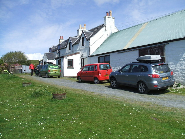
Rubha Allt a' Chromain Images

Images are sourced within 2km of 55.975832/-5.896059 or Grid Reference NR5782. Thanks to Geograph Open Source API. All images are credited.

Loch na Pearaich Looking southwest over Loch na Pearaich and Loch Tarbert on a glorious summer's day.  The peaks of two of the Paps of Jura are visible in the distance.
Loch na Pearaich
Looking southwest over Loch na Pearaich and Loch Tarbert on a glorious summer's day. The peaks of two of the Paps of Jura are visible in the distance.
Islets in Loch Tarbert
Valley of Allt Fearna Mor
The navigable channel of Loch Tarbert
On the shore of Loch Tarbert
Tents on the beach near Cruib Lodge The temporary campsite was set up for the Schools Hebridean Society <span class="nowrap"><a title="http://www.schools-hebridean-society.co.uk" rel="nofollow ugc noopener" href="http://www.schools-hebridean-society.co.uk">Link</a><img style="margin-left:2px;" alt="External link" title="External link - shift click to open in new window" src="https://s1.geograph.org.uk/img/external.png" width="10" height="10"/></span> expedition in 1973. The exact location of photographer is an estimate as it was a long time ago!
Tents on the beach near Cruib Lodge
The temporary campsite was set up for the Schools Hebridean Society LinkExternal link expedition in 1973. The exact location of photographer is an estimate as it was a long time ago!
Loch Tarbert An inlet on the southern shore of Loch Tarbert on the Isle of Jura.
Loch Tarbert
An inlet on the southern shore of Loch Tarbert on the Isle of Jura.
Loch Tarbert, Jura This is the view from the main road between Lussa and Tarbert of Loch Tarbert. The loch cuts deep into the landscape and the island which is 7 miles or so wide for most of its length is less than a mile wide between the loch and the hamlet of Tarbert.
Loch Tarbert, Jura
This is the view from the main road between Lussa and Tarbert of Loch Tarbert. The loch cuts deep into the landscape and the island which is 7 miles or so wide for most of its length is less than a mile wide between the loch and the hamlet of Tarbert.
Cruib Bothy Cruib Bothy, formerly known as Cruib Lodge, and marked as such on OS maps, belongs to the Ruantallain Estate, but is maintained as an unlocked bothy, free for anyone to use, by the Mountain Bothies Association (MBA).  The MBA assumed responsibility for it in 2012, and it was extensively refurbished at that time, as can be seen by comparing this photograph with the one taken by Gordon Brown in 2006.
Cruib Bothy
Cruib Bothy, formerly known as Cruib Lodge, and marked as such on OS maps, belongs to the Ruantallain Estate, but is maintained as an unlocked bothy, free for anyone to use, by the Mountain Bothies Association (MBA). The MBA assumed responsibility for it in 2012, and it was extensively refurbished at that time, as can be seen by comparing this photograph with the one taken by Gordon Brown in 2006.
Loch Tarbert, Isle of Jura This narrow 'gut' called the Chumhainn Bhig (Little Strait) connects the middle loch to the passage leading to the inner loch.  You can just see two of the leading marks, beyond the cliff on the left of the picture.
Loch Tarbert, Isle of Jura
This narrow 'gut' called the Chumhainn Bhig (Little Strait) connects the middle loch to the passage leading to the inner loch. You can just see two of the leading marks, beyond the cliff on the left of the picture.
Inner Loch Tarbert, Isle of Jura This picture is taken above the passage connecting the middle and inner lochs, looking into the inner loch.  We had gone ashore to clear bracken from one of the leading marks. We only managed one clearing, then the midges got us!
Inner Loch Tarbert, Isle of Jura
This picture is taken above the passage connecting the middle and inner lochs, looking into the inner loch. We had gone ashore to clear bracken from one of the leading marks. We only managed one clearing, then the midges got us!
Loch Tarbert, Jura This photo shows a pair of the leading marks, plus one other mark, for piloting a boat between middle Loch Tarbert and the inner loch.  This passage is not for the faint-hearted!
Loch Tarbert, Jura
This photo shows a pair of the leading marks, plus one other mark, for piloting a boat between middle Loch Tarbert and the inner loch. This passage is not for the faint-hearted!
Cruib Lodge, Loch Tarbert, Jura
Skerries in Middle Loch Tarbert Eilean Ard on the right, Eilean Dubh a Chumhain Mhoir on the left.
Skerries in Middle Loch Tarbert
Eilean Ard on the right, Eilean Dubh a Chumhain Mhoir on the left.
Looking towards the hills The valley of the Allt Fearna Mor, looking south west into wild country above Loch Tarbert.
Looking towards the hills
The valley of the Allt Fearna Mor, looking south west into wild country above Loch Tarbert.
Loch na Pearaich Like many of the hill lochs near here, used for fishing. A hut can be seen at the far end of the loch.
Loch na Pearaich
Like many of the hill lochs near here, used for fishing. A hut can be seen at the far end of the loch.
Abhainn a' Ghleann Duirch reaches the sea The Glen Duirch stream goes over a waterfall, then a last couple of bends before reaching the estuary, which is an almost enclosed sea loch that empties at low tide. It is part of Loch Tarbert.
Abhainn a' Ghleann Duirch reaches the sea
The Glen Duirch stream goes over a waterfall, then a last couple of bends before reaching the estuary, which is an almost enclosed sea loch that empties at low tide. It is part of Loch Tarbert.
Above Loch Tarbert Bracken covered slopes above Loch Tarbert. What looks like a river mouth across Loch Tarbert is actually the entrance to the almost completely enclosed Upper Loch Tarbert, a very safe anchorage.
Above Loch Tarbert
Bracken covered slopes above Loch Tarbert. What looks like a river mouth across Loch Tarbert is actually the entrance to the almost completely enclosed Upper Loch Tarbert, a very safe anchorage.
Show me another place!

Rubha Allt a' Chromain is located at Grid Ref: NR5782 (Lat: 55.975832, Lng: -5.896059)

Unitary Authority: Argyll and Bute

Police Authority: Argyll and West Dunbartonshire

What 3 Words

///remover.veered.according. Near Craighouse, Argyll & Bute

Related Wikis

Battle of the Western Isles

The Battle of the Western Isles was a series of conflicts in 1585 and 1586 on the islands of Jura, Islay, Mull and Tiree, Scotland as well as the peninsula...

Loch Tarbert, Jura

Loch Tarbert is a sea loch on the west coast of Jura, an island in Scotland. As the name Tarbert suggests, it comes close to cutting the island in half...

Tarbert, Jura

Tarbert is a hamlet on Tarbert Bay, on the east coast of the island of Jura, in the council area of Argyll and Bute, Scotland. The Tarbert estate is owned...

Lagg, Jura

Lagg is a hamlet on Lagg Bay, on the east coast of the island of Jura, in the council area of Argyll and Bute, Scotland. It is on the A846 8 miles (13...

Nearby Amenities

Located within 500m of 55.975832,-5.896059
Rubha' Allt a' Chromain
Natural: cape
Source: OS_OpenData_StreetView
Lat/Long: 55.9742269/-5.8952059
Learadail
Natural: bay
Source: OS_OpenData_StreetView
Lat/Long: 55.9795999/-5.8943578
Sailean Allt a' Chromain
Natural: bay
Source: OS_OpenData_StreetView
Lat/Long: 55.9743836/-5.9000096
Sailean nam Maireach
Natural: bay
Source: OS_OpenData_StreetView
Lat/Long: 55.9773076/-5.8888466
The data included in this document is from www.openstreetmap.org. The data is made available under ODbL.

Have you been to Rubha Allt a' Chromain?

Leave your review of Rubha Allt a' Chromain below (or comments, questions and feedback).