Àird Sgeginis

Coastal Feature, Headland, Point in Ross-shire

Scotland

Àird Sgeginis

Skaraval at Port Nis View along the coast from Skaraval at Port Nis.
Skaraval at Port Nis Credit: Ajay Tegala

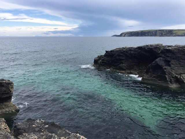
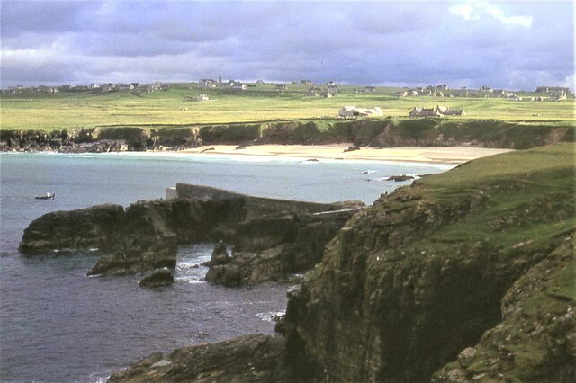
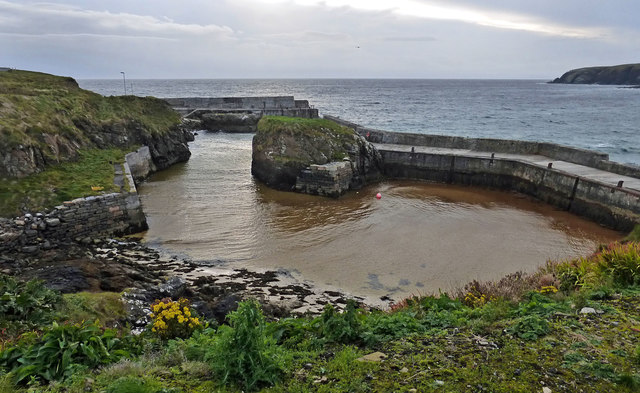
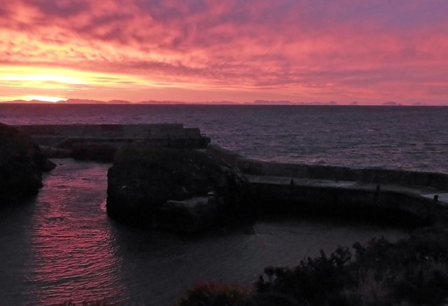
Àird Sgeginis is a prominent coastal feature located in Ross-shire, Scotland. Situated on the northwest coast of the country, it is a headland that juts out into the North Atlantic Ocean. This stunning point offers breathtaking views of the surrounding landscape and is a popular destination for nature enthusiasts and tourists alike.

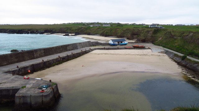
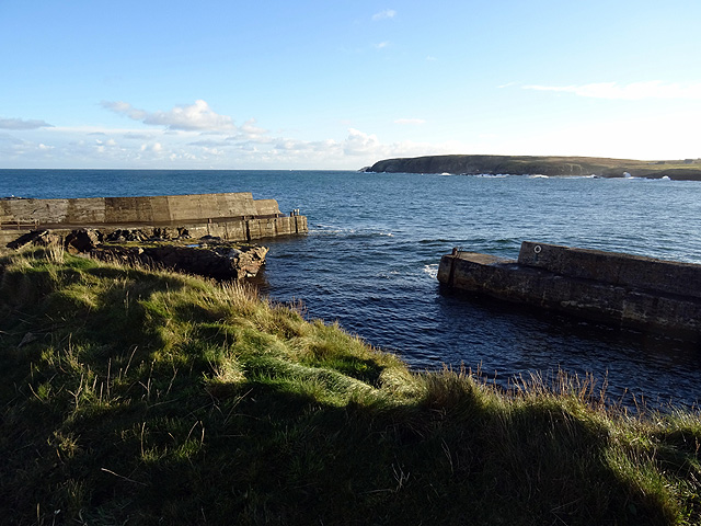
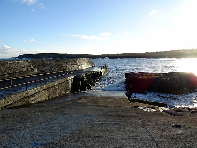
The headland is characterized by its rugged cliffs, which rise dramatically from the sea, creating a striking contrast against the deep blue waters below. The cliffs are composed of ancient rock formations, showcasing layers of sedimentary rock that have been shaped by centuries of erosion from the crashing waves.

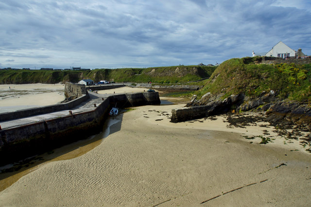
The area surrounding Àird Sgeginis is rich in biodiversity, with a variety of plant and animal species inhabiting the region. Seabirds such as gannets, fulmars, and kittiwakes can often be seen nesting on the cliffs, while seals and dolphins are occasionally spotted swimming in the nearby waters.

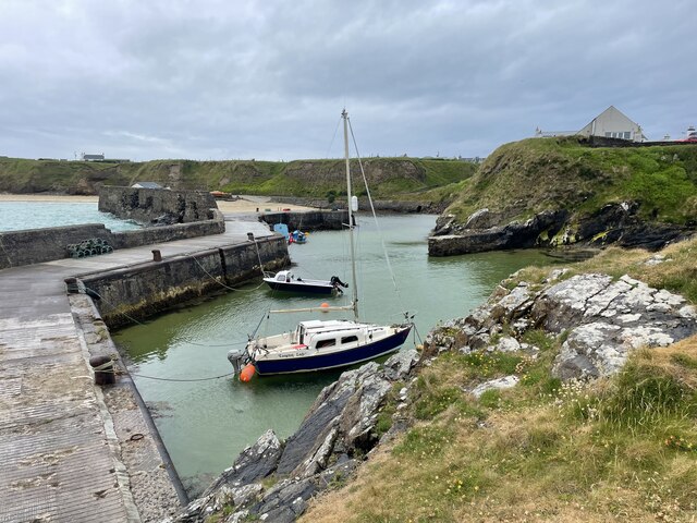
Access to Àird Sgeginis is relatively easy, with a well-maintained footpath leading visitors to the headland. The path winds its way through picturesque coastal heathland, offering opportunities for birdwatching and admiring the wildflowers that bloom during the summer months.

The location of Àird Sgeginis also makes it an excellent spot for outdoor activities such as hiking and photography. Visitors can explore the rugged coastline, capturing the dramatic scenery and enjoying the tranquility of the area.

Overall, Àird Sgeginis is a captivating coastal feature in Ross-shire, providing visitors with a glimpse of Scotland's stunning natural beauty and offering a memorable experience for those who venture to this picturesque headland.

If you have any feedback on the listing, please let us know in the comments section below.

Àird Sgeginis Images

Images are sourced within 2km of 58.482258/-6.210726 or Grid Reference NB5462. Thanks to Geograph Open Source API. All images are credited.

Skaraval at Port Nis View along the coast from Skaraval at Port Nis.
Skaraval at Port Nis
View along the coast from Skaraval at Port Nis.
Port of Ness
Port of Ness
Skigersta harbour
Skigersta harbour
Port of Ness Post Office
Rocky headland at Port of Ness Houses at Callicvol sit above the beach.
Rocky headland at Port of Ness
Houses at Callicvol sit above the beach.
Port Nis In around 1999, the Ordnance Survey replaced English-language placenames in the Western Isles with Gaelic-language names. Some of the more prominent features (e.g. Isle of Barra; Stornoway; Sound of Harris) do have bilingual labels but, on the whole, villages, lochs, peaks etc. generally have the Gaelic names on the modern-day mapping.

Because the English versions have a tendency not to appear on the maps any more, I have decided to use them in my image titles and, as such, a translation will be readily available from the Gaelic labelling on the map. 

(NB I have not translated some of the more minor loch and river names, where I have not easily found the English version.)
Port Nis
In around 1999, the Ordnance Survey replaced English-language placenames in the Western Isles with Gaelic-language names. Some of the more prominent features (e.g. Isle of Barra; Stornoway; Sound of Harris) do have bilingual labels but, on the whole, villages, lochs, peaks etc. generally have the Gaelic names on the modern-day mapping. Because the English versions have a tendency not to appear on the maps any more, I have decided to use them in my image titles and, as such, a translation will be readily available from the Gaelic labelling on the map. (NB I have not translated some of the more minor loch and river names, where I have not easily found the English version.)
A857 entering Port of Ness
Harbour at Port of Ness
Old Rover 2000 (1) The remains of a once-beautiful car crumble away outside a derelict garage.  This series of Rovers was produced at Solihull from 1963 to 1977. <span class="nowrap"><a title="https://en.wikipedia.org/wiki/Rover_P6" rel="nofollow ugc noopener" href="https://en.wikipedia.org/wiki/Rover_P6">Link</a><img style="margin-left:2px;" alt="External link" title="External link - shift click to open in new window" src="https://s1.geograph.org.uk/img/external.png" width="10" height="10"/></span> .  For the front view see <a href="https://www.geograph.org.uk/photo/4705342">NB5363 : Old Rover 2000 (2)</a>.
Old Rover 2000 (1)
The remains of a once-beautiful car crumble away outside a derelict garage. This series of Rovers was produced at Solihull from 1963 to 1977. LinkExternal link . For the front view see NB5363 : Old Rover 2000 (2).
Old Rover 2000 (2) Once a fine car, rusting away outside a derelict garage in Port.  For the rear view see <a href="https://www.geograph.org.uk/photo/4705333">NB5363 : Old Rover 2000 (1)</a>.
Old Rover 2000 (2)
Once a fine car, rusting away outside a derelict garage in Port. For the rear view see NB5363 : Old Rover 2000 (1).
The harbour at Port Nis/Cealagbhal
Port Nis/Cealagbhal slipway
Port Nis
Port Nis
Houses In Port Nis Attractive properties on the Isle of Lewis.
Houses In Port Nis
Attractive properties on the Isle of Lewis.
Port Nis Harbour Also known as Port of Ness.
Port Nis Harbour
Also known as Port of Ness.
Sunrise At Port Nis The mountains of west Sutherland can be seen on the horizon.
Sunrise At Port Nis
The mountains of west Sutherland can be seen on the horizon.
Abandoned building and phone box
Port Nis harbour and breakwater
Show me another place!

Àird Sgeginis is located at Grid Ref: NB5462 (Lat: 58.482258, Lng: -6.210726)

Unitary Authority: Na h-Eileanan an Iar

Police Authority: Highlands and Islands

What 3 Words

///keener.euphoric.flies. Near North Tolsta, Na h-Eileanan Siar

Related Wikis

Skigersta

Skigersta (Scottish Gaelic: Sgiogarstaigh) is a village to the south east of Ness on the Isle of Lewis, in the Outer Hebrides, Scotland. It is the easternmost...

Eorodale

Eorodale (Scottish Gaelic: Eòradal) is a settlement in the community of Ness, on Lewis, in the Outer Hebrides, Scotland. Eorodale is within the parish...
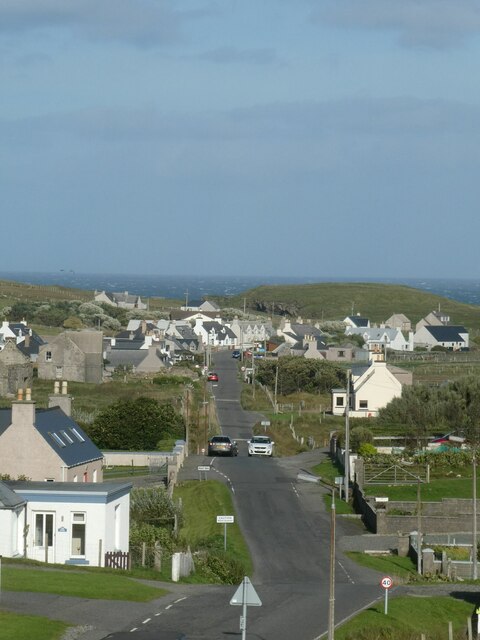
Port of Ness

Port of Ness (Scottish Gaelic: Port Nis) is a village on the Isle of Lewis in the community of Ness, in the Outer Hebrides, Scotland. Port of Ness is within...

Adabroc

Adabrock (Scottish Gaelic: Adabroc), is a village in the area of Ness, Lewis, in the Outer Hebrides, Scotland. Adabrock is within the parish of Barvas...

Nearby Amenities

Located within 500m of 58.482258,-6.210726
Turning Circle
Lat/Long: 58.4789024/-6.2056954
Power: pole
Lat/Long: 58.4791615/-6.2059392
Power: pole
Lat/Long: 58.4783268/-6.2072567
Power: pole
Lat/Long: 58.4780311/-6.2098261
Power: pole
Lat/Long: 58.4783241/-6.2104038
Power: pole
Lat/Long: 58.4786158/-6.2109396
The data included in this document is from www.openstreetmap.org. The data is made available under ODbL.

Have you been to Àird Sgeginis?

Leave your review of Àird Sgeginis below (or comments, questions and feedback).