Airnistean

Coastal Feature, Headland, Point in Ross-shire

Scotland

Airnistean

The Linux Centre On the industrial estate at South Dell (Dail bho Dheas).  A year later it had closed and the premises were to let <a href="https://www.geograph.org.uk/photo/1004368">NB4861 : Former Linux Centre / Ionad Linux a bha</a>.
The Linux Centre Credit: Tiger

A'irnistean is a coastal feature located in the county of Ross-shire, Scotland. It is a prominent headland that extends into the North Atlantic Ocean, forming a distinctive point along the coastline. The name "A'irnistean" is derived from the Gaelic language, translating to "the headland of the storm."

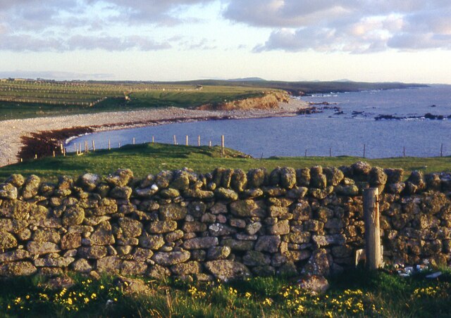
This headland is characterized by its rugged and dramatic cliffs, which rise steeply from the sea, providing breathtaking views of the surrounding landscape. The cliffs are composed mainly of sedimentary rock formations, with layers dating back millions of years. The constant erosion from the powerful waves crashing against the cliffs has shaped the land over time, creating unique geological features such as sea caves and stacks.

A'irnistean is renowned for its rich biodiversity and is home to a variety of plant and animal species. The headland supports a diverse ecosystem, with hardy vegetation clinging to the cliffs and providing habitats for nesting seabirds, including puffins, guillemots, and razorbills. The surrounding waters are also teeming with marine life, making it a popular spot for fishing and wildlife enthusiasts.

The headland is easily accessible to visitors, with a well-maintained footpath leading to the point. The path offers stunning panoramic views of the coastline and the neighboring islands. Additionally, there is a small car park nearby, providing convenient access for those who prefer to drive.

Overall, A'irnistean is a captivating coastal feature that offers a unique blend of natural beauty, geological significance, and diverse wildlife. It is truly a must-visit destination for nature lovers and those seeking an awe-inspiring experience on the Scottish coast.

If you have any feedback on the listing, please let us know in the comments section below.

Airnistean Images

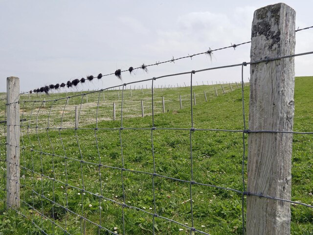
Images are sourced within 2km of 58.478851/-6.3072674 or Grid Reference NB4962. Thanks to Geograph Open Source API. All images are credited.

The Linux Centre On the industrial estate at South Dell (Dail bho Dheas).  A year later it had closed and the premises were to let <a href="https://www.geograph.org.uk/photo/1004368">NB4861 : Former Linux Centre / Ionad Linux a bha</a>.
The Linux Centre
On the industrial estate at South Dell (Dail bho Dheas). A year later it had closed and the premises were to let NB4861 : Former Linux Centre / Ionad Linux a bha.
Lewis moorland at South Dell
OS Surface block, Àird Dhail, Isle of Lewis The block lies near to the cairn marked on the map.
OS Surface block, Àird Dhail, Isle of Lewis
The block lies near to the cairn marked on the map.
South Dell View Viewed from the edge of the adjoining square, looking towards North Dell.
South Dell View
Viewed from the edge of the adjoining square, looking towards North Dell.
Croftland above Tràigh Dhail, Isle of Lewis The land is fenced into narrow strips running from behind the houses of Dail bho Dheas/South Dell to near the coast.
Croftland above Tràigh Dhail, Isle of Lewis
The land is fenced into narrow strips running from behind the houses of Dail bho Dheas/South Dell to near the coast.
Dunasbroc, Isle of Lewis The stack is of archaeological interest and Late Neolithic and Bronze Age pottery and tools have been found on it.  See <span class="nowrap"><a title="https://canmore.org.uk/site/69532" rel="nofollow ugc noopener" href="https://canmore.org.uk/site/69532">Link</a><img style="margin-left:2px;" alt="External link" title="External link - shift click to open in new window" src="https://s1.geograph.org.uk/img/external.png" width="10" height="10"/></span> .
Dunasbroc, Isle of Lewis
The stack is of archaeological interest and Late Neolithic and Bronze Age pottery and tools have been found on it. See LinkExternal link .
Sheep grazing above Cobha Sgeir, Isle of Lewis The fine beaches along the northwest tip of Lewis can be seen in the distance.
Sheep grazing above Cobha Sgeir, Isle of Lewis
The fine beaches along the northwest tip of Lewis can be seen in the distance.
(River) Abhainn Dhail at Dail bho Dheas
Àird Dhail Derelict house at the end of the road.
Àird Dhail
Derelict house at the end of the road.
Remains of old houses at Àird Dhail Looking south from the end of the road at Dell.
Remains of old houses at Àird Dhail
Looking south from the end of the road at Dell.
Modern croft house at Àird Dhail A step up from the blackhouse.
Modern croft house at Àird Dhail
A step up from the blackhouse.
Bus stop at Dhail Bho Dheas At the junction with the road from the township with the A857.
Bus stop at Dhail Bho Dheas
At the junction with the road from the township with the A857.
Fencescape at Buaile na Crois The subdivision of grazings in the crofting community of Dail bho Dheas.
Fencescape at Buaile na Crois
The subdivision of grazings in the crofting community of Dail bho Dheas.
Derelict house at Dail bho Dheas The impressive gate posts behind, to the left, may be something to do with a 'coastguard station' marked on the map?
Derelict house at Dail bho Dheas
The impressive gate posts behind, to the left, may be something to do with a 'coastguard station' marked on the map?
Notice board for Cross Free Church (Continuing) The new FCC church for Cros <a href="https://www.geograph.org.uk/photo/1346098">NB4961 : Free Kirk at Cross</a> is actually in the township of Dail bho Thuath (North Dell) and was opened in December 2003 following the reconstitution of the Free Church of Scotland in 2000.  <span class="nowrap"><a title="http://www.freechurchcontinuing.org/find-us/congregations/item/cross" rel="nofollow ugc noopener" href="http://www.freechurchcontinuing.org/find-us/congregations/item/cross">Link</a><img style="margin-left:2px;" alt="External link" title="External link - shift click to open in new window" src="https://s1.geograph.org.uk/img/external.png" width="10" height="10"/></span>
Notice board for Cross Free Church (Continuing)
The new FCC church for Cros NB4961 : Free Kirk at Cross is actually in the township of Dail bho Thuath (North Dell) and was opened in December 2003 following the reconstitution of the Free Church of Scotland in 2000. LinkExternal link
Aig dol fodha na grèine ... The banner alongside the cattle grid at the approach to Dail bho Dheas (South Dell) announces the North Lewis poppy trail: a red poppy displayed at the former home of each of the 216 servicemen from the Ness parish who fell in the First World War.  The poppies were placed on 4 August 2014, to mark the centenary of the outbreak of the conflict, and will remain in place until Remembrance Sunday, when they will be laid at the war memorials in the district.

The Gaelic motto "At the going down of the sun..." is taken from Laurence Binyon's well-known poem "For the Fallen".
Aig dol fodha na grèine ...
The banner alongside the cattle grid at the approach to Dail bho Dheas (South Dell) announces the North Lewis poppy trail: a red poppy displayed at the former home of each of the 216 servicemen from the Ness parish who fell in the First World War. The poppies were placed on 4 August 2014, to mark the centenary of the outbreak of the conflict, and will remain in place until Remembrance Sunday, when they will be laid at the war memorials in the district. The Gaelic motto "At the going down of the sun..." is taken from Laurence Binyon's well-known poem "For the Fallen".
Cnoc Còrr & Tràigh Chumail The northwest coast of Nis, Isle of Lewis.
Cnoc Còrr & Tràigh Chumail
The northwest coast of Nis, Isle of Lewis.
Moorland Moorland near South Dell, brightened up by the mass of cotton grass.
Moorland
Moorland near South Dell, brightened up by the mass of cotton grass.
Show me another place!

Airnistean is located at Grid Ref: NB4962 (Lat: 58.478851, Lng: -6.3072674)

Unitary Authority: Na h-Eileanan an Iar

Police Authority: Highlands and Islands

What 3 Words

///outraged.blogs.thumbnail. Near North Tolsta, Na h-Eileanan Siar

Related Wikis

North Dell

North Dell (Scottish Gaelic: Dail bho Thuath) is a village on the Isle of Lewis in the community of Ness, in the Outer Hebrides, Scotland. North Dell is...

South Dell

South Dell (Scottish Gaelic: Dail-bho-Dheas) is a village on the Isle of Lewis in the community of Ness, in the Outer Hebrides, Scotland. South Dell is...

Cross, Lewis

Cross (Scottish Gaelic: Cros) is a township on the Isle of Lewis in the community of Ness, in the Outer Hebrides, Scotland. Cross is within the parish...

Swainbost

Swainbost (Scottish Gaelic: Suaineabost) is a village on the Isle of Lewis in the district of Ness, in the Outer Hebrides, Scotland. The name Swainbost...

Nearby Amenities

Located within 500m of 58.478851,-6.3072674
Ford: yes
Lat/Long: 58.476769/-6.3082615
Ford: yes
Lat/Long: 58.4804214/-6.3005296
Airnistean
Natural: cape
Lat/Long: 58.479046/-6.3080602
Dùn Airnistean
Historic: archaeological_site
Lat/Long: 58.4796967/-6.3096373
Cirein Ruadh a' Stangu
Natural: bay
Lat/Long: 58.4809067/-6.3059036
The data included in this document is from www.openstreetmap.org. The data is made available under ODbL.

Have you been to Airnistean?

Leave your review of Airnistean below (or comments, questions and feedback).