Airdean Beaga

Coastal Feature, Headland, Point in Ross-shire

Scotland

Airdean Beaga

Stormy Waves hit Arnish Point Lighthouse Stormy waves batter Arnish Point Lighthouse, Isle of Lewis
Stormy Waves hit Arnish Point Lighthouse Credit: Adam Forsyth

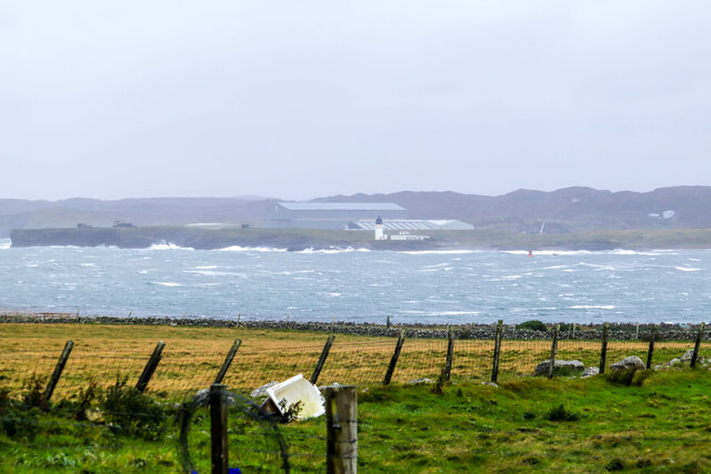
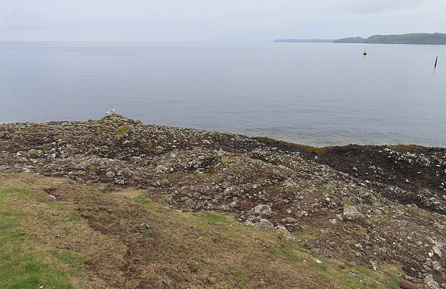
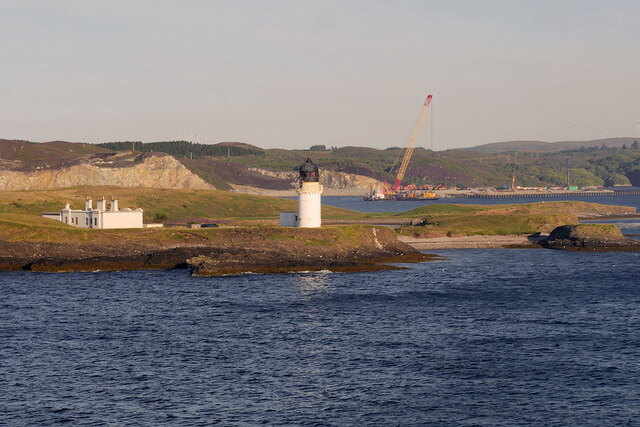
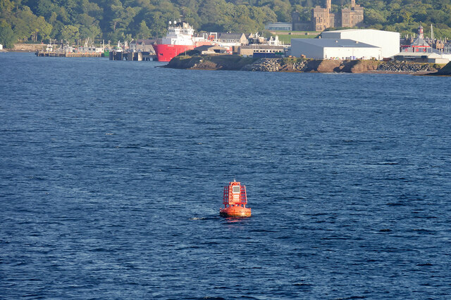
Airdean Beaga is a prominent coastal feature located in Ross-shire, Scotland. It is a headland that extends into the North Sea, forming a distinct point along the coastline. With its breathtaking panoramic views and rugged cliffs, Airdean Beaga is a popular destination for nature enthusiasts and hikers.

The headland is characterized by its dramatic landscape, with steep cliffs that reach heights of up to 100 meters. These cliffs are composed of ancient rock formations, providing insight into the geological history of the area. Visitors can admire the stunning sight of the waves crashing against the rocks, creating a mesmerizing display of natural power.

The headland is also known for its diverse wildlife. Seabirds such as puffins, gannets, and kittiwakes can be spotted nesting on the cliffs, while seals can often be seen basking on the nearby shores. The surrounding waters are teeming with marine life, making it a popular spot for fishing and diving.

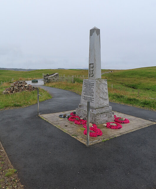
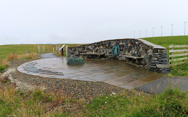
For those interested in history, Airdean Beaga has archaeological significance as well. The remains of ancient settlements and burial sites have been discovered in the vicinity, offering a glimpse into the lives of past civilizations. These historical remnants add depth and intrigue to the already captivating landscape.

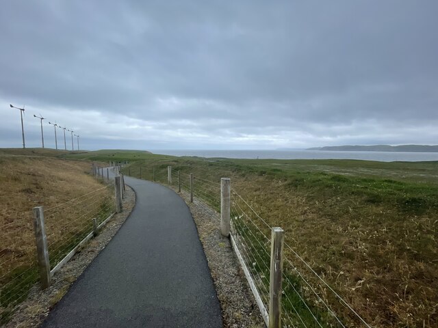
Visitors to Airdean Beaga can access the headland via a well-maintained footpath that winds its way along the coastline. The path offers stunning views of the surrounding area and allows visitors to fully immerse themselves in the natural beauty of this coastal feature.

In conclusion, Airdean Beaga in Ross-shire is a remarkable headland that offers a captivating blend of natural beauty, wildlife, and historical significance. Its rugged cliffs, panoramic views, and diverse wildlife make it an ideal destination for outdoor enthusiasts and those seeking a deeper connection with nature.

If you have any feedback on the listing, please let us know in the comments section below.

Airdean Beaga Images

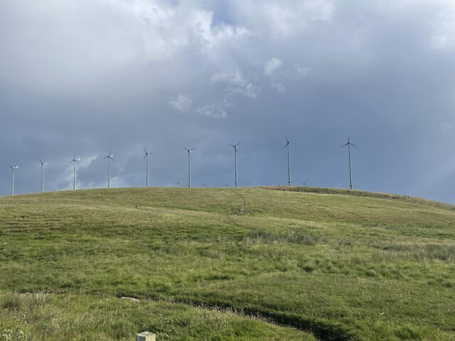
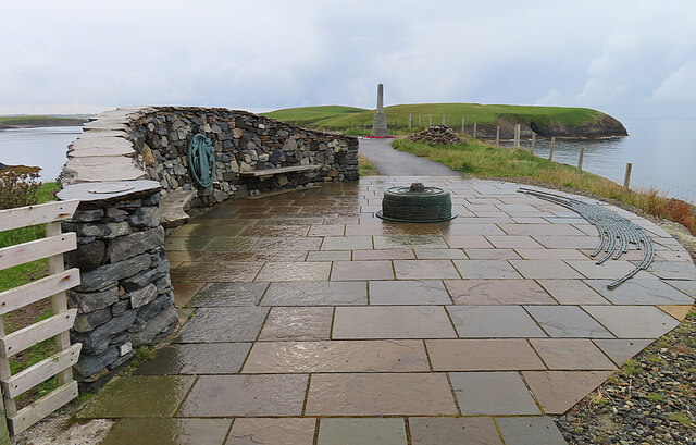
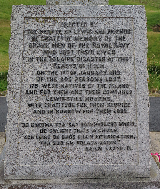
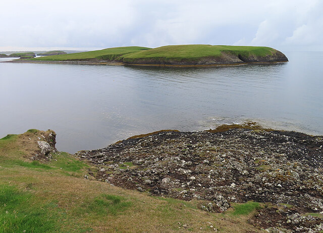
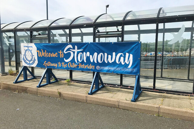
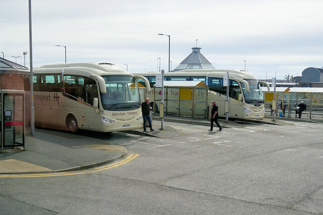
Images are sourced within 2km of 58.198264/-6.3592289 or Grid Reference NB4331. Thanks to Geograph Open Source API. All images are credited.

Stormy Waves hit Arnish Point Lighthouse Stormy waves batter Arnish Point Lighthouse, Isle of Lewis
Stormy Waves hit Arnish Point Lighthouse
Stormy waves batter Arnish Point Lighthouse, Isle of Lewis
Stornoway Town  Stornoway, Isle of Lewis seen from Sandwick with Caledonian MacBrayne's MV Loch Seaforth departing for Ullapool
Stornoway Town
Stornoway, Isle of Lewis seen from Sandwick with Caledonian MacBrayne's MV Loch Seaforth departing for Ullapool
Iolaire memorial In the early hours of New Year's Day 1919 the biggest tragedy ever to affect the Western Isles occurred when H.M.Y. Iolaire carrying soldiers and sailors returning home from the First World War struck rocks within sight of Stornoway harbour. 205 men lost their lives and almost every community in Lewis and Harris was affected with the loss of a father, husband, brother or son. What should have been a joyful celebration at the end of the war turned into years of mourning for these islands and the beginning of the population decline which is still felt in the islands today.
Iolaire memorial
In the early hours of New Year's Day 1919 the biggest tragedy ever to affect the Western Isles occurred when H.M.Y. Iolaire carrying soldiers and sailors returning home from the First World War struck rocks within sight of Stornoway harbour. 205 men lost their lives and almost every community in Lewis and Harris was affected with the loss of a father, husband, brother or son. What should have been a joyful celebration at the end of the war turned into years of mourning for these islands and the beginning of the population decline which is still felt in the islands today.
Path to the shore
Path to the shore
A Lewis Rainbow
A Lewis Rainbow
Sewage Windmills "blowing the smell away" Geocaching is a type of global treasure hunt of people looking for caches, or hidden stashes of objects. Geocaching may also be described as a series of hide-and-seek games, where hiders provide online clues for seekers. Seekers use global positioning system (GPS) devices to find hidden caches
Sewage Windmills "blowing the smell away"
Geocaching is a type of global treasure hunt of people looking for caches, or hidden stashes of objects. Geocaching may also be described as a series of hide-and-seek games, where hiders provide online clues for seekers. Seekers use global positioning system (GPS) devices to find hidden caches
Iolaire Monument The curving strips on the right are the names of the islanders who died in the 'Iolaire' disaster, arranged by the locality where they lived. The longest strips are those communities who lost the largest number of their men. The original monument is in the background.
Iolaire Monument
The curving strips on the right are the names of the islanders who died in the 'Iolaire' disaster, arranged by the locality where they lived. The longest strips are those communities who lost the largest number of their men. The original monument is in the background.
Iolaire Monument This is the plaque on the monument to the men lost in the 'Iolaire' disaster.
Iolaire Monument
This is the plaque on the monument to the men lost in the 'Iolaire' disaster.
Eilean Thuilm Eilean Thuilm lies just offshore, close to the 'Beasts of Holm', the rocks on which HMY 'Iolaire' was wrecked.
Eilean Thuilm
Eilean Thuilm lies just offshore, close to the 'Beasts of Holm', the rocks on which HMY 'Iolaire' was wrecked.
Iolaire Monument This is the original monument commemorating the 'Iolaire' disaster of 1 January 1919.
Iolaire Monument
This is the original monument commemorating the 'Iolaire' disaster of 1 January 1919.
Iolaire Monument The curving strips on the left are the names of the islanders who died in the 'Iolaire' disaster, arranged by the locality where they lived. The longest strips are those communities who lost the largest number of their men. The original monument is in the background.
Iolaire Monument
The curving strips on the left are the names of the islanders who died in the 'Iolaire' disaster, arranged by the locality where they lived. The longest strips are those communities who lost the largest number of their men. The original monument is in the background.
Old Red Sandstone Conglomerate Most of Na h-Eileanan an Iar (The Western Isles) is composed of Lewisian Gneiss, apart from a relatively small area of Old Red Sandstone at Stornoway and the Eye Peninsula. This is some of that sandstone, laid down by intermittent floods in a desert environment over 400 million years ago.
Old Red Sandstone Conglomerate
Most of Na h-Eileanan an Iar (The Western Isles) is composed of Lewisian Gneiss, apart from a relatively small area of Old Red Sandstone at Stornoway and the Eye Peninsula. This is some of that sandstone, laid down by intermittent floods in a desert environment over 400 million years ago.
Traditional Houses On the corner of Keith Street and Francis Street, these are very much in keeping with the sort of late 18th and early 19th century houses found in most parts of Scotland - and they have little in common with the black houses of most of the Hebrides.
Traditional Houses
On the corner of Keith Street and Francis Street, these are very much in keeping with the sort of late 18th and early 19th century houses found in most parts of Scotland - and they have little in common with the black houses of most of the Hebrides.
Arnish Point Lighthouse, Stornoway Harbour Arnish Point Lighthouse marks the entrance to Stornoway Harbour.  As such, it is often referred to as Stornoway Lighthouse.  

Designed by Alan Stevenson of the famous Stevenson family of lighthouse engineers, it is located on a headland on the west side of the entrance to Stornoway Harbour, about 3 miles south of the town. The lighthouse is unusual in that it is made of iron, rather than stone, and was the Northern Lighthouse Board’s first prefabricated lighthouse.

The light was continuously manned from 1852 until it was automated in 1963 and the cottages that housed the keepers were subsequently sold.
Arnish Point Lighthouse, Stornoway Harbour
Arnish Point Lighthouse marks the entrance to Stornoway Harbour. As such, it is often referred to as Stornoway Lighthouse. Designed by Alan Stevenson of the famous Stevenson family of lighthouse engineers, it is located on a headland on the west side of the entrance to Stornoway Harbour, about 3 miles south of the town. The lighthouse is unusual in that it is made of iron, rather than stone, and was the Northern Lighthouse Board’s first prefabricated lighthouse. The light was continuously manned from 1852 until it was automated in 1963 and the cottages that housed the keepers were subsequently sold.
Arnish Point Lateral Marker Buoy Lateral Marks are used generally to mark the sides of well-defined, navigable channels. They are coloured red (port hand marks) and green (starboard hand marks) and indicate the port and starboard hand sides of the route to be followed.
Arnish Point Lateral Marker Buoy
Lateral Marks are used generally to mark the sides of well-defined, navigable channels. They are coloured red (port hand marks) and green (starboard hand marks) and indicate the port and starboard hand sides of the route to be followed.
Landing Stage at Stornoway
Stornoway - Gateway to the Outer Hebrides
Stornoway Bus Station
Show me another place!

Airdean Beaga is located at Grid Ref: NB4331 (Lat: 58.198264, Lng: -6.3592289)

Unitary Authority: Na h-Eileanan an Iar

Police Authority: Highlands and Islands

What 3 Words

///risking.saddens.scoop. Near Stornoway, Na h-Eileanan Siar

Related Wikis

Sandwick, Lewis

Sandwick (Scottish Gaelic: Sanndabhaig, IPA:[ˈs̪aun̴̪t̪əvɪkʲ]) is a village in the Scottish Outer Hebrides, on the Isle of Lewis and a quasi-suburb of...

Stornoway power station

Stornoway power station, also known as Battery Point Power Station, is an electrical generation facility in Stornoway, Scotland. It was commissioned in...

Parkend, Lewis

Parkend (Scottish Gaelic: Ceann nam Buailtean) is a hamlet in the Sandwick region of the Isle of Lewis, although like Melbost, it is not a part of the...
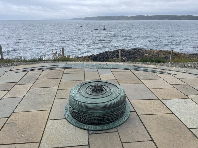
HMY Iolaire

HMY Iolaire was an Admiralty Yacht that sank at the entrance to Stornoway harbour on 1 January 1919, with the loss of at least 201 men out of the 283 on...

Nearby Amenities

Located within 500m of 58.198264,-6.3592289
Turning Circle
Lat/Long: 58.1986165/-6.358435
Bus Stop
Sandwick (Lewis) - Lower Sandwick
Bus: yes
Naptan AtcoCode: 6010731791
Naptan Bearing: N
Naptan CommonName: Sandwick (Lewis)
Naptan Indicator: Lower Sandwick
Naptan Landmark: Lower Sandwick
Naptan NaptanCode: 94723794
Naptan Street: Lower Sandwick
Naptan Verified: no
Public Transport: platform
Source: naptan_import
Lat/Long: 58.1985516/-6.3584648
Seamark Light 1 Character: Fl
Seamark Light 1 Colour: green
Seamark Light 1 Height: 8
Seamark Light 1 Period: 3
Seamark Light 1 Range: 11
Seamark Light 1 Sector End: 73
Seamark Light 1 Sector Start: 10
Seamark Light 2 Character: Fl
Seamark Light 2 Colour: red
Seamark Light 2 Height: 8
Seamark Light 2 Period: 3
Seamark Light 2 Range: 11
Seamark Light 2 Sector End: 102
Seamark Light 2 Sector Start: 73
Seamark Light 3 Character: Fl
Seamark Light 3 Colour: white
Seamark Light 3 Height: 8
Seamark Light 3 Period: 3
Seamark Light 3 Range: 11
Seamark Light 3 Sector End: 109
Seamark Light 3 Sector Start: 102
Seamark Light 4 Character: Fl
Seamark Light 4 Colour: green
Seamark Light 4 Height: 8
Seamark Light 4 Period: 3
Seamark Light 4 Range: 11
Seamark Light 4 Sector End: 190
Seamark Light 4 Sector Start: 109
Seamark Light Reference: A 3978
Seamark Type: light_minor
Source: US NGA Pub. 114. 2011-05-26.
Lat/Long: 58.1948877/-6.3560895
Passing Place
Lat/Long: 58.2008582/-6.3590643
Passing Place
Lat/Long: 58.2014151/-6.3583964
Power: pole
Lat/Long: 58.2021299/-6.3563604
Power: pole
Lat/Long: 58.2015144/-6.3570754
Power: pole
Lat/Long: 58.2009028/-6.3577977
Power: pole
Lat/Long: 58.2002974/-6.3585206
Power: pole
Lat/Long: 58.1993483/-6.3593571
Power: pole
Lat/Long: 58.1990631/-6.3586651
Power: pole
Lat/Long: 58.198685/-6.3585813
Power: pole
Lat/Long: 58.2023338/-6.3569114
Power: pole
Lat/Long: 58.2018914/-6.3569556
Generator Method: photovoltaic
Generator Output Electricity: small_installation
Generator Source: solar
Generator Type: solar_photovoltaic_panel
Power: generator
Lat/Long: 58.2002738/-6.3578689
Power: pole
Lat/Long: 58.2008314/-6.3585193
Power: pole
Lat/Long: 58.2011663/-6.3581961
Power: pole
Lat/Long: 58.2003466/-6.3589619
Power: pole
Lat/Long: 58.2001381/-6.3591483
Power: pole
Lat/Long: 58.2005565/-6.3587876
Power: pole
Lat/Long: 58.1999357/-6.3588547
Power: pole
Lat/Long: 58.1997409/-6.3593468
Power: pole
Lat/Long: 58.201543/-6.3578662
Generator Method: photovoltaic
Generator Output Electricity: small_installation
Generator Source: solar
Generator Type: solar_photovoltaic_panel
Power: generator
Lat/Long: 58.1999229/-6.3595113
Generator Method: photovoltaic
Generator Output Electricity: small_installation
Generator Source: solar
Generator Type: solar_photovoltaic_panel
Power: generator
Lat/Long: 58.1986988/-6.358355
The data included in this document is from www.openstreetmap.org. The data is made available under ODbL.

Have you been to Airdean Beaga?

Leave your review of Airdean Beaga below (or comments, questions and feedback).