Rubha Bhreidein

Coastal Feature, Headland, Point in Inverness-shire

Scotland

Rubha Bhreidein

Roofless Ruin at Lyndale, Isle of Skye At a sheltered location on the north coast of Skye, Scotland.
Roofless Ruin at Lyndale, Isle of Skye Credit: Andrew Tryon

Rubha Bhreidein is a headland located in Inverness-shire, Scotland. Situated along the coast, it extends out into the North Sea, offering magnificent views of the surrounding landscape. With its rugged and rocky terrain, it serves as a prominent coastal feature in the region.

This headland is known for its natural beauty and is a popular destination for outdoor enthusiasts and nature lovers. Its diverse ecosystem provides a habitat for a variety of marine and bird species, making it a haven for wildlife enthusiasts. Seabirds such as guillemots, puffins, and gulls can often be seen nesting along the cliffs, adding to the area's charm.

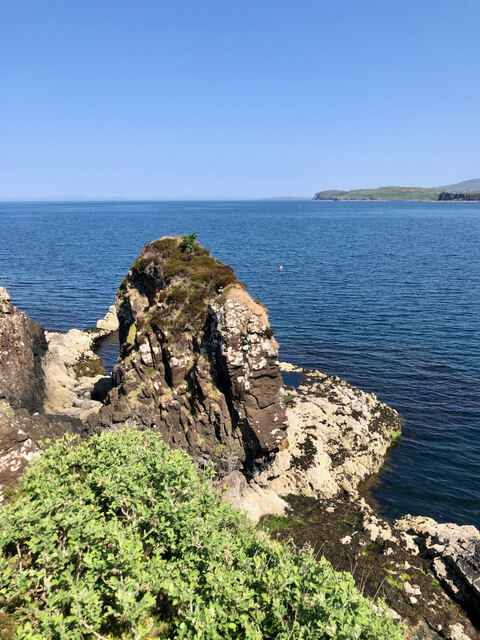
The headland itself is characterized by its towering cliffs, which have been shaped over centuries by the relentless force of the crashing waves. These cliffs offer breathtaking views over the North Sea, and on clear days, one can even catch a glimpse of the distant horizon.

Visitors to Rubha Bhreidein can explore the headland by following a network of footpaths that wind through the rugged landscape. These paths provide access to various viewpoints, allowing visitors to fully appreciate the beauty of the surroundings. Additionally, the headland offers opportunities for outdoor activities such as hiking, birdwatching, and photography.

Overall, Rubha Bhreidein is a stunning coastal feature that showcases the natural beauty of Inverness-shire. Its rugged cliffs, diverse wildlife, and picturesque views make it a must-visit destination for those seeking an immersive experience in Scotland's coastal landscape.

If you have any feedback on the listing, please let us know in the comments section below.

Rubha Bhreidein Images

Images are sourced within 2km of 57.521274/-6.404508 or Grid Reference NG3656. Thanks to Geograph Open Source API. All images are credited.

Roofless Ruin at Lyndale, Isle of Skye At a sheltered location on the north coast of Skye, Scotland.
Roofless Ruin at Lyndale, Isle of Skye
At a sheltered location on the north coast of Skye, Scotland.
Coastal contrasts—Basalt, barnacles and sheep From high above, a black basalt shoreline stretches out, adorned with a splash zone of pale barnacles. In their futile search for sustenance, a sheep and her young one gaze about, oblivious to the presence of luscious green sea weed right before their eyes.
Coastal contrasts—Basalt, barnacles and sheep
From high above, a black basalt shoreline stretches out, adorned with a splash zone of pale barnacles. In their futile search for sustenance, a sheep and her young one gaze about, oblivious to the presence of luscious green sea weed right before their eyes.
A sluggish Breabost Burn, right at that magnificent Spring high tide mark, and ... a Wellington boot!
Camas Mòr—A roofless ruin and an exclusive 'Boathouse' retreat For more info. on the ruins see ‘Skye, Lyndale House | Canmore’. 2023. Canmore.org.uk <<span class="nowrap"><a title="https://canmore.org.uk/site/114718/skye-lyndale-house" rel="nofollow ugc noopener" href="https://canmore.org.uk/site/114718/skye-lyndale-house">Link</a><img style="margin-left:2px;" alt="External link" title="External link - shift click to open in new window" src="https://s1.geograph.org.uk/img/external.png" width="10" height="10"/></span> > [accessed 21 July 2023]
Camas Mòr—A roofless ruin and an exclusive 'Boathouse' retreat
For more info. on the ruins see ‘Skye, Lyndale House | Canmore’. 2023. Canmore.org.uk <LinkExternal link > [accessed 21 July 2023]
Tòrr na Bodhaig According to the Ordnance Surveyor&amp;#039;s notes according to the 1881 Inverness-shire (Isle of Skye), Sheet XVI 6&amp;quot; map, &amp;lt;&amp;lt;this name applies to a prominent hill which signifies &amp;quot;Sea larks hill,&amp;quot; &amp;gt;&amp;gt; — see ‘OS1/16/5/118 | ScotlandsPlaces’. 2019. Scotlandsplaces.gov.uk &amp;lt;&lt;span class=&quot;nowrap&quot;&gt;&lt;a title=&quot;https://scotlandsplaces.gov.uk/digital-volumes/ordnance-survey-name-books/inverness-shire-os-name-books-1876-1878/inverness-shire-skye-volume-05/120&quot; rel=&quot;nofollow ugc noopener&quot; href=&quot;https://scotlandsplaces.gov.uk/digital-volumes/ordnance-survey-name-books/inverness-shire-os-name-books-1876-1878/inverness-shire-skye-volume-05/120&quot;&gt;Link&lt;/a&gt;&lt;img style=&quot;margin-left:2px;&quot; alt=&quot;External link&quot; title=&quot;External link - shift click to open in new window&quot; src=&quot;https://s1.geograph.org.uk/img/external.png&quot; width=&quot;10&quot; height=&quot;10&quot;/&gt;&lt;/span&gt; &amp;gt; [accessed 21 July 2023]

This map shows no contours but does indicate a spot height of 163 feet see &lt;span class=&quot;nowrap&quot;&gt;&lt;a title=&quot;https://maps.nls.uk/view/228778624#zoom=6&amp;amp;lat=8885&amp;amp;lon=11694&amp;amp;layers=BT&quot; rel=&quot;nofollow ugc noopener&quot; href=&quot;https://maps.nls.uk/view/228778624#zoom=6&amp;amp;lat=8885&amp;amp;lon=11694&amp;amp;layers=BT&quot;&gt;Link&lt;/a&gt;&lt;img style=&quot;margin-left:2px;&quot; alt=&quot;External link&quot; title=&quot;External link - shift click to open in new window&quot; src=&quot;https://s1.geograph.org.uk/img/external.png&quot; width=&quot;10&quot; height=&quot;10&quot;/&gt;&lt;/span&gt;
Tòrr na Bodhaig
According to the Ordnance Surveyor's notes according to the 1881 Inverness-shire (Isle of Skye), Sheet XVI 6" map, <<this name applies to a prominent hill which signifies "Sea larks hill," >> — see ‘OS1/16/5/118 | ScotlandsPlaces’. 2019. Scotlandsplaces.gov.uk <LinkExternal link > [accessed 21 July 2023] This map shows no contours but does indicate a spot height of 163 feet see LinkExternal link
Basalt Dyke A basalt dyke stretching out towards Eilean Beag. The intrusion must be younger than the remainder of the rocks that comprise the rest of this coast.

On the Ordnance Survey 6&amp;quot; map Inverness-shire (Isle of Skye), Sheet X published 1881 (see &lt;span class=&quot;nowrap&quot;&gt;&lt;a title=&quot;https://maps.nls.uk/view/228778606#zoom=6&amp;amp;lat=1206&amp;amp;lon=11277&amp;amp;layers=BT&quot; rel=&quot;nofollow ugc noopener&quot; href=&quot;https://maps.nls.uk/view/228778606#zoom=6&amp;amp;lat=1206&amp;amp;lon=11277&amp;amp;layers=BT&quot;&gt;Link&lt;/a&gt;&lt;img style=&quot;margin-left:2px;&quot; alt=&quot;External link&quot; title=&quot;External link - shift click to open in new window&quot; src=&quot;https://s1.geograph.org.uk/img/external.png&quot; width=&quot;10&quot; height=&quot;10&quot;/&gt;&lt;/span&gt; ), the island is named as Eilean an Taomain which means the &amp;quot;Island of the water scoop&amp;quot; — see ‘OS1/16/5/71 | ScotlandsPlaces’. 2019. Scotlandsplaces.gov.uk &amp;lt;&lt;span class=&quot;nowrap&quot;&gt;&lt;a title=&quot;https://scotlandsplaces.gov.uk/digital-volumes/ordnance-survey-name-books/inverness-shire-os-name-books-1876-1878/inverness-shire-skye-volume-05/71&quot; rel=&quot;nofollow ugc noopener&quot; href=&quot;https://scotlandsplaces.gov.uk/digital-volumes/ordnance-survey-name-books/inverness-shire-os-name-books-1876-1878/inverness-shire-skye-volume-05/71&quot;&gt;Link&lt;/a&gt;&lt;img style=&quot;margin-left:2px;&quot; alt=&quot;External link&quot; title=&quot;External link - shift click to open in new window&quot; src=&quot;https://s1.geograph.org.uk/img/external.png&quot; width=&quot;10&quot; height=&quot;10&quot;/&gt;&lt;/span&gt; &amp;gt; [accessed 21 July 2023].
Basalt Dyke
A basalt dyke stretching out towards Eilean Beag. The intrusion must be younger than the remainder of the rocks that comprise the rest of this coast. On the Ordnance Survey 6" map Inverness-shire (Isle of Skye), Sheet X published 1881 (see LinkExternal link ), the island is named as Eilean an Taomain which means the "Island of the water scoop" — see ‘OS1/16/5/71 | ScotlandsPlaces’. 2019. Scotlandsplaces.gov.uk <LinkExternal link > [accessed 21 July 2023].
A deserted township reflected by the peculiar absence of bracken on the buildings' elevated walls For more info see ‘Skye, Lyndale Point | Canmore’. 2023. Canmore.org.uk &amp;lt;&lt;span class=&quot;nowrap&quot;&gt;&lt;a title=&quot;https://canmore.org.uk/site/114717/skye-lyndale-point&quot; rel=&quot;nofollow ugc noopener&quot; href=&quot;https://canmore.org.uk/site/114717/skye-lyndale-point&quot;&gt;Link&lt;/a&gt;&lt;img style=&quot;margin-left:2px;&quot; alt=&quot;External link&quot; title=&quot;External link - shift click to open in new window&quot; src=&quot;https://s1.geograph.org.uk/img/external.png&quot; width=&quot;10&quot; height=&quot;10&quot;/&gt;&lt;/span&gt; &amp;gt; [accessed 21 July 2023]
A deserted township reflected by the peculiar absence of bracken on the buildings' elevated walls
For more info see ‘Skye, Lyndale Point | Canmore’. 2023. Canmore.org.uk <LinkExternal link > [accessed 21 July 2023]
A carpet of cotton-grass unfurls like a magical welcome mat on this sun-kissed Scottish hillside
A buoy with a rebellious spirit, defying cartographic norms by claiming its territory just east of the northing Another photograph taken from the same spot in the same direction on the very edge of this grid square, just a foot or so east of the northing, which the buoy in the distance seems to me to have been conveniently placed on.
A buoy with a rebellious spirit, defying cartographic norms by claiming its territory just east of the northing
Another photograph taken from the same spot in the same direction on the very edge of this grid square, just a foot or so east of the northing, which the buoy in the distance seems to me to have been conveniently placed on.
Leslie Anne in Loch Greshornish The Leslie Anne, a multipurpose workboat, landing craft and support vessel based in Kishorn, is seen working at a Marine Harvest fish farm in Loch Greshornish.
Leslie Anne in Loch Greshornish
The Leslie Anne, a multipurpose workboat, landing craft and support vessel based in Kishorn, is seen working at a Marine Harvest fish farm in Loch Greshornish.
Camas Lagan A small bay a little way south west of Greshornish Point.
Camas Lagan
A small bay a little way south west of Greshornish Point.
Camas Lagan A small bay a little way south west of Greshornish Point.
Camas Lagan
A small bay a little way south west of Greshornish Point.
Beach at Camas Lagan, Greshornish Just south west of Greshornish Point.
Beach at Camas Lagan, Greshornish
Just south west of Greshornish Point.
Beach at Camas Lagan, Greshornish A short distance south west of Greshornish Point.
Beach at Camas Lagan, Greshornish
A short distance south west of Greshornish Point.
Greshornish Point Looking towards Eilean Mor, in Loch Snizort.
Greshornish Point
Looking towards Eilean Mor, in Loch Snizort.
Rainbows over Loch Snizort From Greshornish Point.
Rainbows over Loch Snizort
From Greshornish Point.
Loch Greshornish View from the north end of the Greshornish peninsula. Across the loch are the crofts of Flashader and Kildonan.
Loch Greshornish
View from the north end of the Greshornish peninsula. Across the loch are the crofts of Flashader and Kildonan.
Dun na h'Airde A small fort on a craggy promontory on the east side of Greshornish. This is the view from inside the dun to the well preserved entrance.
Dun na h'Airde
A small fort on a craggy promontory on the east side of Greshornish. This is the view from inside the dun to the well preserved entrance.
Show me another place!

Rubha Bhreidein is located at Grid Ref: NG3656 (Lat: 57.521274, Lng: -6.404508)

Unitary Authority: Highland

Police Authority: Highlands and Islands

What 3 Words

///punks.litigate.basics. Near Uig, Highland

Related Wikis

Snizort

Snizort (Scottish Gaelic: Snìosort) is an area of the Isle of Skye comprising the head of Loch Snizort and the western coast of Trotternish up to Uig,...

Flashader

Flashader (Scottish Gaelic: Flaiseader) is a small crofting township close to the east coast of the sea loch Loch Greshornish on the Isle of Skye. It is...

Kingsburgh, Skye

Kingsburgh (Gaelic: Cinnseaborgh) is a scattered crofting township, overlooking Loch Snizort Beag on the Trotternish peninsula of the Isle of Skye in...

Suladale

Suladale or Suledale (Scottish Gaelic: Sùladal) is a small mixed crofting hamlet of fewer than a dozen houses, located near Edinbane, on the north of...

Nearby Amenities

Located within 500m of 57.521274,-6.404508
Created By: dmgroom_coastlines
Source: PGS
Lat/Long: 57.52523/-6.40318
Created By: dmgroom_coastlines
Source: PGS
Lat/Long: 57.52509/-6.40295
Created By: dmgroom_coastlines
Source: PGS
Lat/Long: 57.52496/-6.40272
Created By: dmgroom_coastlines
Source: PGS
Lat/Long: 57.5247/-6.40274
Created By: dmgroom_coastlines
Source: PGS
Lat/Long: 57.52445/-6.40299
Created By: dmgroom_coastlines
Source: PGS
Lat/Long: 57.52436/-6.4049
Created By: dmgroom_coastlines
Source: PGS
Lat/Long: 57.52425/-6.40586
Created By: dmgroom_coastlines
Source: PGS
Lat/Long: 57.52399/-6.40564
Created By: dmgroom_coastlines
Source: PGS
Lat/Long: 57.52374/-6.40566
Created By: dmgroom_coastlines
Source: PGS
Lat/Long: 57.52349/-6.40616
Created By: dmgroom_coastlines
Source: PGS
Lat/Long: 57.52247/-6.40623
Created By: dmgroom_coastlines
Source: PGS
Lat/Long: 57.52233/-6.406
Created By: dmgroom_coastlines
Source: PGS
Lat/Long: 57.5222/-6.40577
Created By: dmgroom_coastlines
Source: PGS
Lat/Long: 57.52117/-6.40537
Created By: dmgroom_coastlines
Source: PGS
Lat/Long: 57.52091/-6.4054
Created By: dmgroom_coastlines
Source: PGS
Lat/Long: 57.5204/-6.40542
Created By: dmgroom_coastlines
Source: PGS
Lat/Long: 57.52028/-6.40519
Created By: dmgroom_coastlines
Source: PGS
Lat/Long: 57.52014/-6.40497
Created By: dmgroom_coastlines
Source: PGS
Lat/Long: 57.52/-6.40474
Created By: dmgroom_coastlines
Source: PGS
Lat/Long: 57.51987/-6.40451
Created By: dmgroom_coastlines
Source: PGS
Lat/Long: 57.51884/-6.40434
Created By: dmgroom_coastlines
Source: PGS
Lat/Long: 57.5187/-6.4034
Created By: dmgroom_coastlines
Source: PGS
Lat/Long: 57.51842/-6.40247
Created By: dmgroom_coastlines
Source: PGS
Lat/Long: 57.51829/-6.40224
Created By: dmgroom_coastlines
Source: PGS
Lat/Long: 57.51815/-6.40201
Created By: dmgroom_coastlines
Source: PGS
Lat/Long: 57.51788/-6.40108
Created By: dmgroom_coastlines
Source: PGS
Lat/Long: 57.51775/-6.40085
The data included in this document is from www.openstreetmap.org. The data is made available under ODbL.

Have you been to Rubha Bhreidein?

Leave your review of Rubha Bhreidein below (or comments, questions and feedback).