Aird a Bhaile Mhòire

Coastal Feature, Headland, Point in Inverness-shire

Scotland

Aird a Bhaile Mhòire

Loch Caroy Today, there is just the slightest dusting of snow on the distant Cuillin Hills.
Loch Caroy Credit: Richard Dorrell

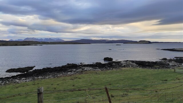
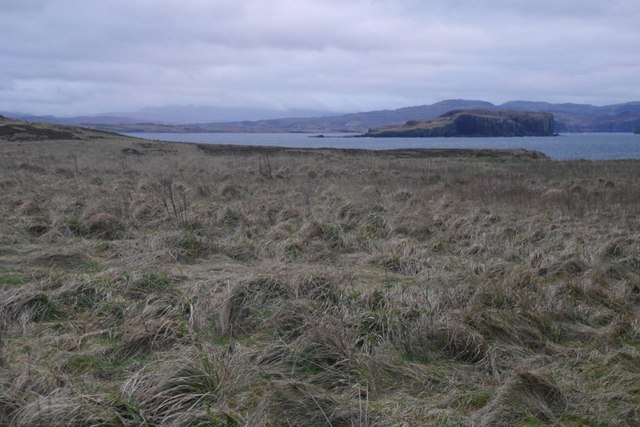
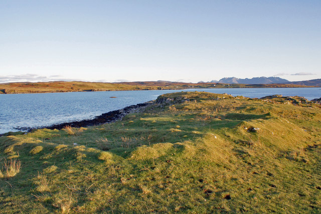
Aird a Bhaile Mhòire is a prominent coastal feature located in Inverness-shire, Scotland. It is commonly referred to as a headland or point due to its geographical structure. Situated on the western coast of Scotland, Aird a Bhaile Mhòire offers breathtaking views of the surrounding landscape and the North Atlantic Ocean.

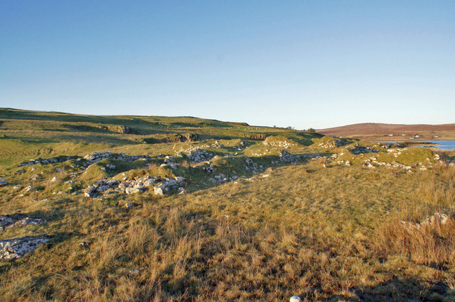
The headland is characterized by its rugged and rocky terrain, making it a distinctive landmark in the area. It is composed of ancient rock formations that have been shaped by millions of years of erosion from the crashing waves of the ocean. These formations create a dramatic and picturesque scenery that attracts both locals and tourists alike.

The area is home to a diverse range of wildlife, including seabirds, seals, and occasionally dolphins, which can be spotted in the waters surrounding the headland. This makes Aird a Bhaile Mhòire a popular destination for birdwatching and nature enthusiasts.

Access to Aird a Bhaile Mhòire is relatively easy, with a well-maintained footpath leading visitors to the headland. The path offers stunning panoramic views of the coastline and the nearby town of Inverness. Additionally, there are several benches strategically placed along the way, providing visitors with the opportunity to rest and fully appreciate the natural beauty of the area.

Overall, Aird a Bhaile Mhòire is a captivating coastal feature in Inverness-shire that showcases the raw power of nature and offers visitors a unique and memorable experience.

If you have any feedback on the listing, please let us know in the comments section below.

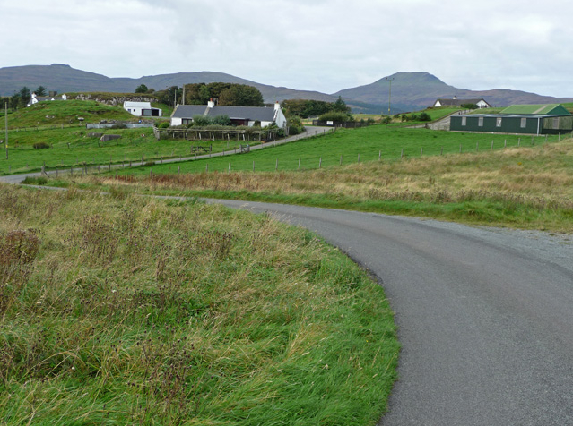
Aird a Bhaile Mhòire Images

Images are sourced within 2km of 57.376246/-6.5156155 or Grid Reference NG2840. Thanks to Geograph Open Source API. All images are credited.

Loch Caroy Today, there is just the slightest dusting of snow on the distant Cuillin Hills.
Loch Caroy
Today, there is just the slightest dusting of snow on the distant Cuillin Hills.
Sheep resting above Crossnish Point A nearby sign warns to 'beware of the bull', but the only livestock here today are these placid-looking sheep. The water is Lach Caroy. The distant Cuillin hills are almost completely obscured by smoke rising from the annual muir burn, when dead grasses and heather are burned off to encourage fresh new growth.
Sheep resting above Crossnish Point
A nearby sign warns to 'beware of the bull', but the only livestock here today are these placid-looking sheep. The water is Lach Caroy. The distant Cuillin hills are almost completely obscured by smoke rising from the annual muir burn, when dead grasses and heather are burned off to encourage fresh new growth.
Long-gone buildings Lumps in the grass are all that now remain of what were once at least two buildings and a wall. Much of the Harlosh peninsula is still valuable grazing land, and still in use as such, though not as many people are working the land today as was the case in the past. There are ruins everywhere, some dating back many hundreds of years.
Long-gone buildings
Lumps in the grass are all that now remain of what were once at least two buildings and a wall. Much of the Harlosh peninsula is still valuable grazing land, and still in use as such, though not as many people are working the land today as was the case in the past. There are ruins everywhere, some dating back many hundreds of years.
Road towards Harlosh This seldom-used road runs through grazing land, and follows the western shore of Loch Caroy.
Road towards Harlosh
This seldom-used road runs through grazing land, and follows the western shore of Loch Caroy.
Feorlig Farm The farmhouse (largely hidden by the trees on the left) was built about eight years ago after the former house, on the same site, was destroyed by fire.
Feorlig Farm
The farmhouse (largely hidden by the trees on the left) was built about eight years ago after the former house, on the same site, was destroyed by fire.
Rear of Harlosh House Originally built as a residential property, the house has been a school and a youth hostel before becoming an hotel. This view shows something of the ugly flat-roofed rear extension. The building has now stood empty for several years, and although the roof still looks to be sound, it must be suffering from damp internally.
View from the road: <a href="https://www.geograph.org.uk/photo/1586651">NG2941 : Former hotel, Balmore</a>.
Rear of Harlosh House
Originally built as a residential property, the house has been a school and a youth hostel before becoming an hotel. This view shows something of the ugly flat-roofed rear extension. The building has now stood empty for several years, and although the roof still looks to be sound, it must be suffering from damp internally. View from the road: NG2941 : Former hotel, Balmore.
Extending a cottage My personal view is that it is far preferable to restore and if necessary, extend an existing property rather than build a new one. Here, the owner is well on the way to completing a large extension on this cottage in Dunanellerich. The entrance in the foreground leads to what I believe is a new building plot.
Extending a cottage
My personal view is that it is far preferable to restore and if necessary, extend an existing property rather than build a new one. Here, the owner is well on the way to completing a large extension on this cottage in Dunanellerich. The entrance in the foreground leads to what I believe is a new building plot.
Modern houses in Dunanellerich These properties have an extensive view to the west over the mouth of Loch Vatten.
The log pile in the foreground will have been delivered from a nearby forest. Much work later, the logs will have been sliced by chain-saw, and then split into smaller chunks suitable for burning on a stove. There's enough timber there to keep a stove going for several winters.
Modern houses in Dunanellerich
These properties have an extensive view to the west over the mouth of Loch Vatten. The log pile in the foreground will have been delivered from a nearby forest. Much work later, the logs will have been sliced by chain-saw, and then split into smaller chunks suitable for burning on a stove. There's enough timber there to keep a stove going for several winters.
Cottage and Loch Vatten Not a lot has changed since I last photographed here in November 2009. 
See: <a href="https://www.geograph.org.uk/photo/1586927">NG2842 : Cottage and Loch Vatten</a>.
Cottage and Loch Vatten
Not a lot has changed since I last photographed here in November 2009. See: NG2842 : Cottage and Loch Vatten.
Young trees, Altavaid By Harlosh, Skye.
Young trees, Altavaid
By Harlosh, Skye.
Harlois / Harlosh Bus stop where the loop road bears left. Mid afternoon and it really was this dull.
Harlois / Harlosh
Bus stop where the loop road bears left. Mid afternoon and it really was this dull.
Camus Bàn, Harlois On Loch Vatten.
Camus Bàn, Harlois
On Loch Vatten.
Grazings, Ardmore The end of the peninsula, with Harlosh Island beyond.
Grazings, Ardmore
The end of the peninsula, with Harlosh Island beyond.
Harlois to Feorlaig road The loop road on the east side of the peninsula. The mapped hotel, Harlosh House is now a private dwelling.
Harlois to Feorlaig road
The loop road on the east side of the peninsula. The mapped hotel, Harlosh House is now a private dwelling.
Building remains, Crossnish Point Unusually, the Highland Historic Environment Record has no entry for the ruins at Crossnish Point, and yet there are remains of at least eight buildings here, probably dating from two different periods.
This image shows what appear to be the older remains, as very few of the stones which once formed the walls are now visible. There were three structures in this group, all approximately the same size, and about the right shape and size to have been dwellings.
Building remains, Crossnish Point
Unusually, the Highland Historic Environment Record has no entry for the ruins at Crossnish Point, and yet there are remains of at least eight buildings here, probably dating from two different periods. This image shows what appear to be the older remains, as very few of the stones which once formed the walls are now visible. There were three structures in this group, all approximately the same size, and about the right shape and size to have been dwellings.
Ruins at Crossnish Point Unusually, the Highland Historic Environment Record has no entry for the ruins at Crossnish Point, and yet there are remains of at least eight buildings here, probably dating from two different periods.
This image attempts to show part of three rectangular building footprints - all about the same size, and the right shape and size to have been dwellings - though they are unusually close to each other. There are two smaller squarer footprints in the group. 
Same ruins, different angle: <a href="https://www.geograph.org.uk/photo/6315906">NG2941 : Ruins at Crossnish Point</a>.
Ruins at Crossnish Point
Unusually, the Highland Historic Environment Record has no entry for the ruins at Crossnish Point, and yet there are remains of at least eight buildings here, probably dating from two different periods. This image attempts to show part of three rectangular building footprints - all about the same size, and the right shape and size to have been dwellings - though they are unusually close to each other. There are two smaller squarer footprints in the group. Same ruins, different angle: NG2941 : Ruins at Crossnish Point.
Ruins at Crossnish Point Unusually, the Highland Historic Environment Record has no entry for the ruins at Crossnish Point, and yet there are remains of at least eight buildings here, probably dating from two different periods.
This image looks west over footprints of part of the group of five structures, three of which are the right shape and size to have been dwellings.
Same ruins, different angle: <a href="https://www.geograph.org.uk/photo/6315905">NG2941 : Ruins at Crossnish Point</a>.
Ruins at Crossnish Point
Unusually, the Highland Historic Environment Record has no entry for the ruins at Crossnish Point, and yet there are remains of at least eight buildings here, probably dating from two different periods. This image looks west over footprints of part of the group of five structures, three of which are the right shape and size to have been dwellings. Same ruins, different angle: NG2941 : Ruins at Crossnish Point.
Looking over Crossnish Point A view from the Harlosh loop road, with Loch Caroy in the foreground and the Cuillin Hills on the horizon. 
A similar view, taken at a different time of year, has been submitted by John Allan: 
<a href="https://www.geograph.org.uk/photo/1733343">NG2941 : Shoreline at Crossnish</a>.
Looking over Crossnish Point
A view from the Harlosh loop road, with Loch Caroy in the foreground and the Cuillin Hills on the horizon. A similar view, taken at a different time of year, has been submitted by John Allan: NG2941 : Shoreline at Crossnish.
Show me another place!

Aird a Bhaile Mhòire is located at Grid Ref: NG2840 (Lat: 57.376246, Lng: -6.5156155)

Unitary Authority: Highland

Police Authority: Highlands and Islands

What 3 Words

///phones.palettes.befitting. Near Dunvegan, Highland

Related Wikis

Harlosh

Harlosh (Scottish Gaelic: Heàrrlois) is a settlement on the island of Skye off the west coast of Scotland. The settlement is on a peninsula of the same...

Harlosh Island

Harlosh Island is one of four islands to be found in Skye's Loch Bracadale. Harlosh Island is one mile (1.5 kilometres) from the coast of the Duirinish...

Tarner Island

Tarner Island is a triangular shaped island in Loch Bracadale just off the coast off the Harlosh peninsula of Skye in Scotland. It is about 28 hectares...

Ose, Skye

Ose (Scottish Gaelic: Òs) is a small coastal settlement of Loch Bracadale, in the Scottish Highland area. It lies on the west coast of the Isle of Skye...

Related Videos

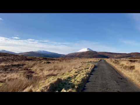
Roag, Isle of Skye January 2021

A January afternoon walk on the north west of Skye in an area called Roag. Snow on the mountain tops but lots of sunshine!

Nearby Amenities

Located within 500m of 57.376246,-6.5156155
Source: PGS
Lat/Long: 57.3801397/-6.5193632
Source: PGS
Lat/Long: 57.3797803/-6.5198034
Source: PGS
Lat/Long: 57.3795041/-6.5198597
Source: PGS
Lat/Long: 57.3790443/-6.5204004
Source: PGS
Lat/Long: 57.3790169/-6.5210959
Source: PGS
Lat/Long: 57.3788535/-6.5212381
Source: PGS
Lat/Long: 57.3785348/-6.5214057
Created By: dmgroom_coastlines
Source: PGS
Lat/Long: 57.3778/-6.52267
Created By: dmgroom_coastlines
Source: PGS
Lat/Long: 57.3773/-6.52317
Created By: dmgroom_coastlines
Source: PGS
Lat/Long: 57.3768/-6.52368
Source: PGS
Lat/Long: 57.3735388/-6.5211372
Created By: dmgroom_coastlines
Source: PGS
Lat/Long: 57.37416/-6.52007
Created By: dmgroom_coastlines
Source: PGS
Lat/Long: 57.37429/-6.51982
Source: PGS
Lat/Long: 57.3746603/-6.5195996
Source: PGS
Lat/Long: 57.3750903/-6.5186176
Source: PGS
Lat/Long: 57.3751196/-6.51786
Created By: dmgroom_coastlines
Source: PGS
Lat/Long: 57.37514/-6.51763
Source: PGS
Lat/Long: 57.3751406/-6.5173764
Source: PGS
Lat/Long: 57.3751364/-6.5170251
Source: PGS
Lat/Long: 57.3752238/-6.5165245
Created By: dmgroom_coastlines
Source: PGS
Lat/Long: 57.37523/-6.51596
Source: PGS
Lat/Long: 57.3753473/-6.515608
Source: PGS
Lat/Long: 57.3754888/-6.5152822
Source: PGS
Lat/Long: 57.3758253/-6.5147447
Created By: dmgroom_coastlines
Source: PGS
Lat/Long: 57.37596/-6.51401
Created By: dmgroom_coastlines
Source: PGS
Lat/Long: 57.3762/-6.51305
Created By: dmgroom_coastlines
Source: PGS
Lat/Long: 57.37632/-6.51281
Created By: dmgroom_coastlines
Source: PGS
Lat/Long: 57.37683/-6.51254
Created By: dmgroom_coastlines
Source: PGS
Lat/Long: 57.37681/-6.51159
Created By: dmgroom_coastlines
Source: PGS
Lat/Long: 57.37732/-6.51132
Created By: dmgroom_coastlines
Source: PGS
Lat/Long: 57.37782/-6.51082
Created By: dmgroom_coastlines
Source: PGS
Lat/Long: 57.37833/-6.51078
Created By: dmgroom_coastlines
Source: PGS
Lat/Long: 57.37884/-6.51074
Chapel
Historic: archaeological_site
Lat/Long: 57.3767154/-6.5209862
Power: pole
Lat/Long: 57.3777059/-6.5182857
Power: pole
Lat/Long: 57.3779696/-6.518179
Power: pole
Lat/Long: 57.378383/-6.5180079
Power: pole
Lat/Long: 57.3783787/-6.5189661
Material: wood
Power: pole
Lat/Long: 57.3783776/-6.516311
Power: pole
Lat/Long: 57.379606/-6.5168746
Power: pole
Lat/Long: 57.3791763/-6.5166874
Power: pole
Lat/Long: 57.3787672/-6.5165062
Material: wood
Power: pole
Lat/Long: 57.379313/-6.5157836
Material: wood
Power: pole
Lat/Long: 57.3802386/-6.5152602
Ardmore
Name Gd: An Àird Mhòr
Place: hamlet
Lat/Long: 57.3785169/-6.5170879
The data included in this document is from www.openstreetmap.org. The data is made available under ODbL.

Have you been to Aird a Bhaile Mhòire?

Leave your review of Aird a Bhaile Mhòire below (or comments, questions and feedback).