Rubha Nic Eamoin

Coastal Feature, Headland, Point in Argyllshire

Scotland

Rubha Nic Eamoin

Tarbert Bay, Isle of Canna Tarbert Bay has good exposures of columnar basalt at the head of the beach as does the coastline beyond. The image was taken while sheltering from hail showers on an extremely windy day. The southern coastline of Canna and Bloodstone Hill and other mountains on Rum are visible in the background.
Tarbert Bay, Isle of Canna Credit: Julian Paren

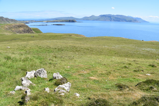
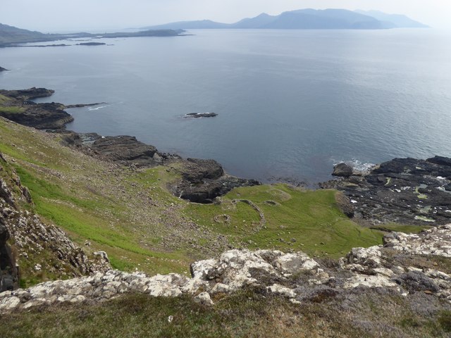
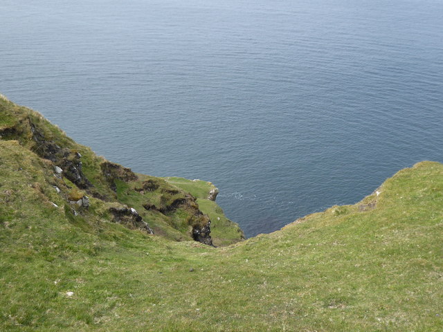
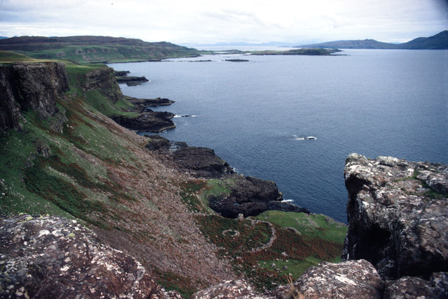
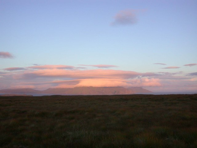
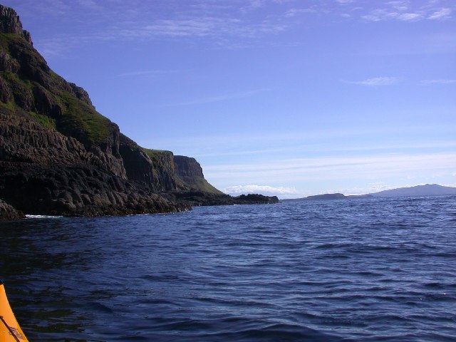
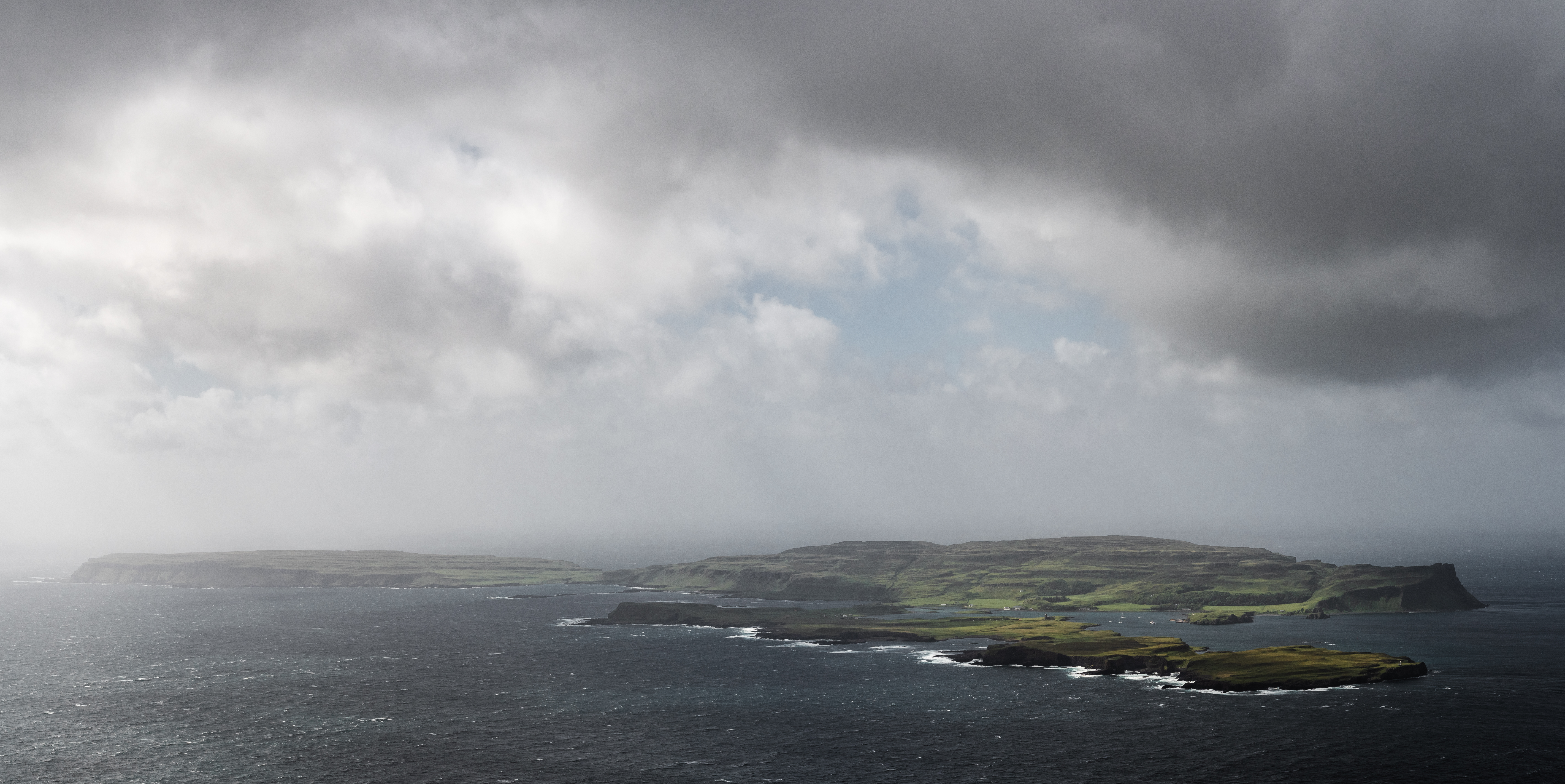
Rubha Nic Eamoin is a prominent headland located in Argyllshire, Scotland. Situated on the west coast of the country, this coastal feature offers stunning views of the surrounding landscape and sea. The headland is characterized by rugged cliffs that drop down to the water below, creating a dramatic and picturesque scene.

Rubha Nic Eamoin is known for its diverse wildlife, with many seabirds nesting on the cliffs and dolphins often spotted swimming in the waters off the coast. The headland is also a popular spot for hikers and nature enthusiasts, with several walking trails that offer access to the stunning views and wildlife of the area.

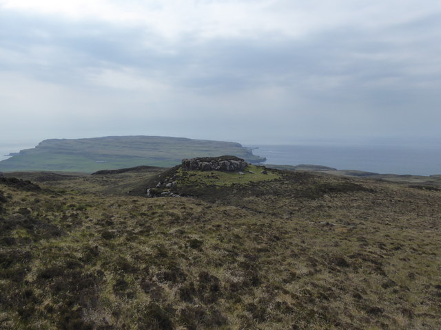
In addition to its natural beauty, Rubha Nic Eamoin has a rich history, with ancient ruins and archaeological sites scattered throughout the headland. Visitors can explore these historic sites while taking in the breathtaking scenery of the area.

Overall, Rubha Nic Eamoin is a must-visit destination for anyone looking to experience the beauty and history of the Scottish coast. Whether you're a nature lover, history buff, or simply looking for a peaceful escape, this headland has something to offer everyone.

If you have any feedback on the listing, please let us know in the comments section below.

Rubha Nic Eamoin Images

Images are sourced within 2km of 57.051908/-6.5556681 or Grid Reference NG2304. Thanks to Geograph Open Source API. All images are credited.

Tarbert Bay, Isle of Canna Tarbert Bay has good exposures of columnar basalt at the head of the beach as does the coastline beyond. The image was taken while sheltering from hail showers on an extremely windy day. The southern coastline of Canna and Bloodstone Hill and other mountains on Rum are visible in the background.
Tarbert Bay, Isle of Canna
Tarbert Bay has good exposures of columnar basalt at the head of the beach as does the coastline beyond. The image was taken while sheltering from hail showers on an extremely windy day. The southern coastline of Canna and Bloodstone Hill and other mountains on Rum are visible in the background.
Possible Cist? Is this an old stone cist or just some stones that happen to be arranged in a rectangle.  Seen with Sanday and Rum in the background.
Possible Cist?
Is this an old stone cist or just some stones that happen to be arranged in a rectangle. Seen with Sanday and Rum in the background.
Inlets on the south coast of Canna
Old wall at Tarbert, Isle of Canna
Sgorr nam Bàn-naomha, Isle of Canna These ruins are thought to be the remains of a nunnery of the Columban or post-Columban era.
Sgorr nam Bàn-naomha, Isle of Canna
These ruins are thought to be the remains of a nunnery of the Columban or post-Columban era.
Ruadh-sgorr, Isle of Canna Not an easy place to get to, but someone made the journey down the cliffs to work these lazy beds on the north of Canna.
Ruadh-sgorr, Isle of Canna
Not an easy place to get to, but someone made the journey down the cliffs to work these lazy beds on the north of Canna.
Steep slopes on the north coast of Canna
Looking westward from Tarbet, Isle of Canna
Old wall, Isle of Canna
Farm building at Tarbert, Isle of Canna
Small inlet on Tarbert Bay, Isle of Canna
Track to Tarbert, Isle of Canna
Rocky outcrop on Beinn Tighe, Isle of Canna
Rocky outcrop on Beinn Tighe A prominent feature on Beinn Tighe seen from another "bump" in the landscape.
Rocky outcrop on Beinn Tighe
A prominent feature on Beinn Tighe seen from another "bump" in the landscape.
The Nunnery, Canna Below the steep cliffs is an ancient site seen from above as two circular rings. Originally it would have been accessed from the sea. The construction comprises an enclosure, the drystone walling of which is 5ft thick. Within the enclosure, four structures are built against the outer wall, while three others are free standing. Of these, only a well-house and mill have so far been determined.
The Nunnery, Canna
Below the steep cliffs is an ancient site seen from above as two circular rings. Originally it would have been accessed from the sea. The construction comprises an enclosure, the drystone walling of which is 5ft thick. Within the enclosure, four structures are built against the outer wall, while three others are free standing. Of these, only a well-house and mill have so far been determined.
Bay on the north coast of Canna The Cuillins of Skye fill the horizon.
Bay on the north coast of Canna
The Cuillins of Skye fill the horizon.
Druim na Tire, Isle of Canna View East to Rum from Druim na Tire on Canna.
Druim na Tire, Isle of Canna
View East to Rum from Druim na Tire on Canna.
South West Corner of Canna. South West Corner of Canna, View toward the East.
South West Corner of Canna.
South West Corner of Canna, View toward the East.
Show me another place!

Rubha Nic Eamoin is located at Grid Ref: NG2304 (Lat: 57.051908, Lng: -6.5556681)

Unitary Authority: Highland

Police Authority: Highlands and Islands

What 3 Words

///koala.friend.blotches. Near Elgol, Highland

Related Wikis

Canna, Scotland

Canna (; Scottish Gaelic: Canaigh, Eilean Chanaigh) is the westernmost of the Small Isles archipelago, in the Scottish Inner Hebrides. It is linked to...

A' Chill

A' Chill was a village on Canna, in the Scottish Small Isles. The name means "the cell", referring to a Culdee church, and is often anglicised as "Kil...

St Edward's Church, Sanday

St Edward's Church, Sanday, is a deconsecrated, and now disused church on the small isle of Sanday, Inner Hebrides, Scotland. The church was a gift to...

St Columba's Church, Canna

St Columba's Church is a Category B listed building on the isle of Canna, in the Small Isles, Highland, Scotland. == History == Prior to the building of...

Nearby Amenities

Located within 500m of 57.051908,-6.5556681
Source: PGS
Lat/Long: 57.0554/-6.55171
Source: PGS
Lat/Long: 57.05464/-6.55176
Source: PGS
Lat/Long: 57.05362/-6.5523
Source: PGS
Lat/Long: 57.0526/-6.55261
Source: PGS
Lat/Long: 57.05249/-6.55354
Source: PGS
Lat/Long: 57.05237/-6.55379
Source: PGS
Lat/Long: 57.05225/-6.55403
Source: PGS
Lat/Long: 57.05201/-6.55499
Source: PGS
Lat/Long: 57.05189/-6.55523
Source: PGS
Lat/Long: 57.05113/-6.55552
Source: PGS
Lat/Long: 57.0517589/-6.556845
Source: PGS
Lat/Long: 57.0509097/-6.5572815
Source: PGS
Lat/Long: 57.0514293/-6.5579648
Source: PGS
Lat/Long: 57.0518404/-6.5584871
Source: PGS
Lat/Long: 57.0517467/-6.5586507
Source: PGS
Lat/Long: 57.0508897/-6.558735
Source: PGS
Lat/Long: 57.0514464/-6.5591566
Source: PGS
Lat/Long: 57.0507178/-6.5596514
Source: PGS
Lat/Long: 57.05045/-6.56026
Source: PGS
Lat/Long: 57.05022/-6.56145
Source: PGS
Lat/Long: 57.0492/-6.56175
Source: PGS
Lat/Long: 57.04933/-6.56222
Sgorr an Duine
Place: locality
Source: OS_OpenData_StreetView
Lat/Long: 57.0514937/-6.5603196
Creag an Sgoiltein
Place: locality
Source: OS_OpenData_StreetView
Lat/Long: 57.052642/-6.5516438
Gualann Sgorr an Duine
Place: locality
Source: OS_OpenData_StreetView
Lat/Long: 57.0540933/-6.5610713
Rubha Nic Eamoin
Place: locality
Source: OS_OpenData_StreetView
Lat/Long: 57.0508824/-6.5555075
Tota Tarra
Place: locality
Source: OS_OpenData_StreetView
Lat/Long: 57.0540541/-6.5526226
The data included in this document is from www.openstreetmap.org. The data is made available under ODbL.

Have you been to Rubha Nic Eamoin?

Leave your review of Rubha Nic Eamoin below (or comments, questions and feedback).