Àird Tharsuinnis

Coastal Feature, Headland, Point in Ross-shire

Scotland

Àird Tharsuinnis

Loch Griomarstadh (Loch Grimersta) Loch Griomarstadh is a long narrow inlet of Loch Ceann Hulabhaig. It is tidal, and this view shows the sea a foot or so below high tide. In the distant, at left is Calanais (Callanish).
Loch Griomarstadh (Loch Grimersta) Credit: Anne Burgess

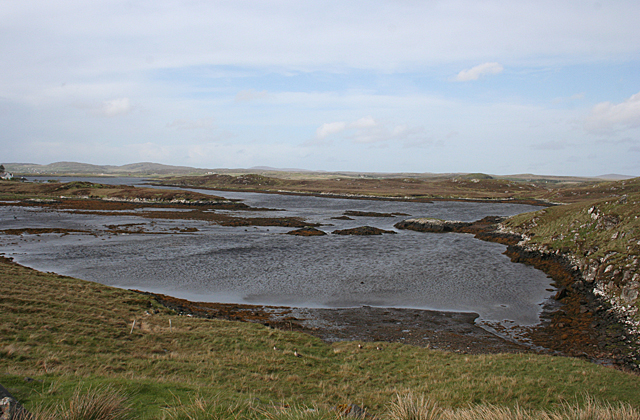
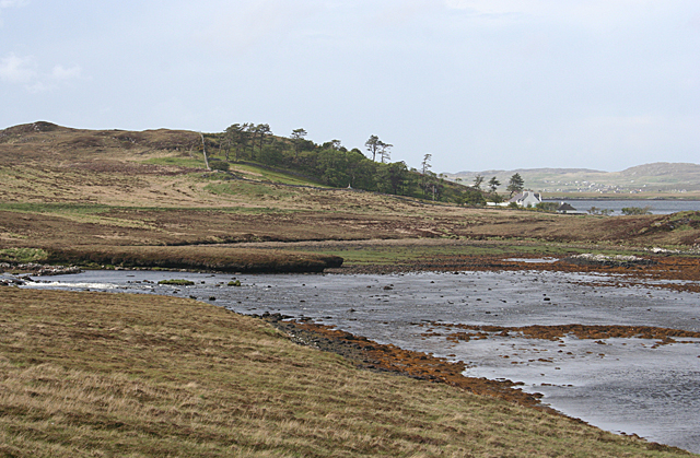
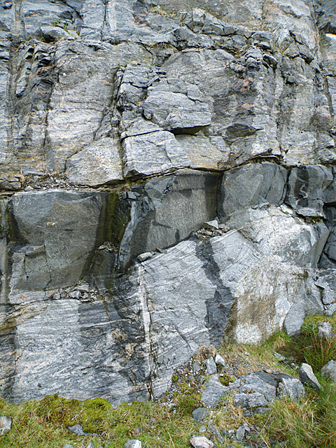
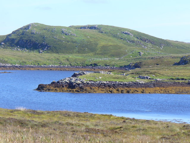
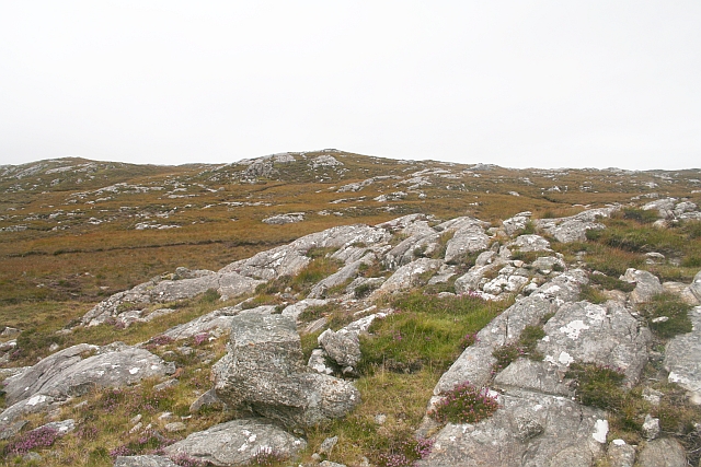
Àird Tharsuinnis is a prominent headland located in Ross-shire, Scotland. Situated on the northwest coast of the country, it juts out into the North Atlantic Ocean, offering breathtaking views of the surrounding landscape. The headland is known for its rugged cliffs, which reach impressive heights and are composed of ancient rock formations.

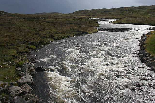
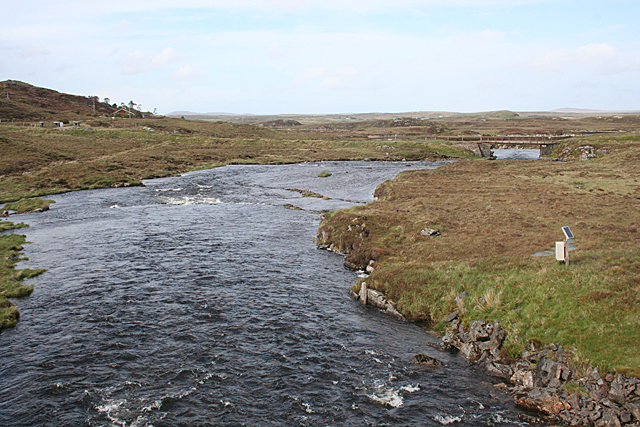
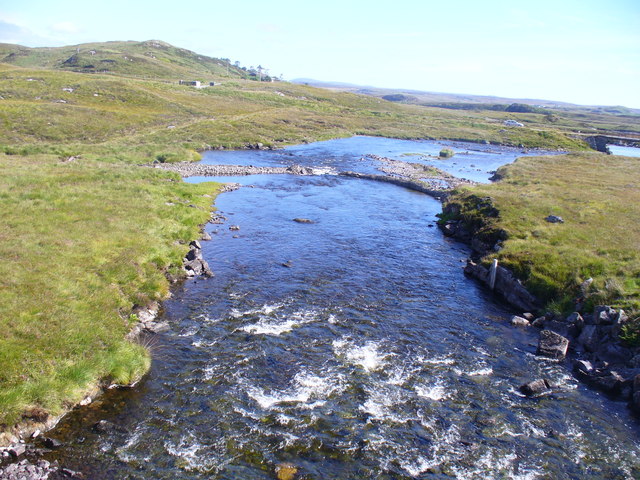
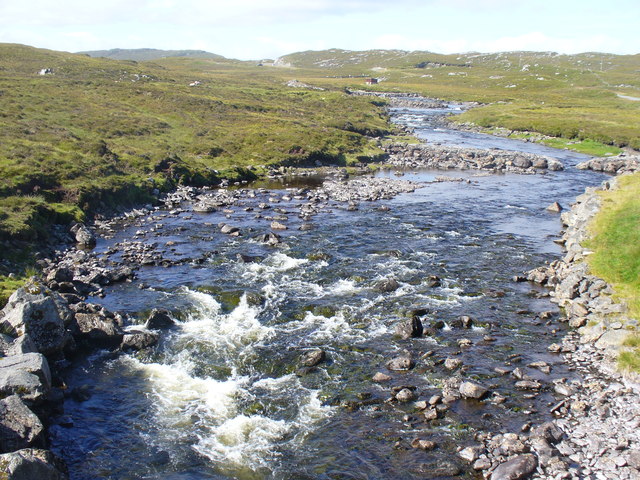
The coastal feature of Àird Tharsuinnis is characterized by its wild and untamed beauty. The area is sparsely populated and largely untouched by human development, making it a haven for nature enthusiasts and wildlife. The headland is home to a diverse range of flora and fauna, including various seabirds, marine mammals, and plant species that thrive in the coastal environment.

Visitors to Àird Tharsuinnis can enjoy scenic walks along the cliff tops, taking in the stunning panoramas of the North Atlantic Ocean and the surrounding coastal landscape. The headland also offers opportunities for birdwatching, with sightings of species such as puffins, guillemots, and gannets being common.

In addition to its natural beauty, Àird Tharsuinnis holds historical significance. The headland is believed to have been inhabited since ancient times, with archaeological remains suggesting human activity in the area dating back thousands of years. These remnants provide valuable insights into the lives and cultures of the people who once called this rugged coastline home.

Overall, Àird Tharsuinnis is a captivating coastal feature, offering a combination of stunning natural scenery, abundant wildlife, and a rich cultural heritage. It is a must-visit destination for those seeking a truly immersive and awe-inspiring experience of Scotland's coastal beauty.

If you have any feedback on the listing, please let us know in the comments section below.

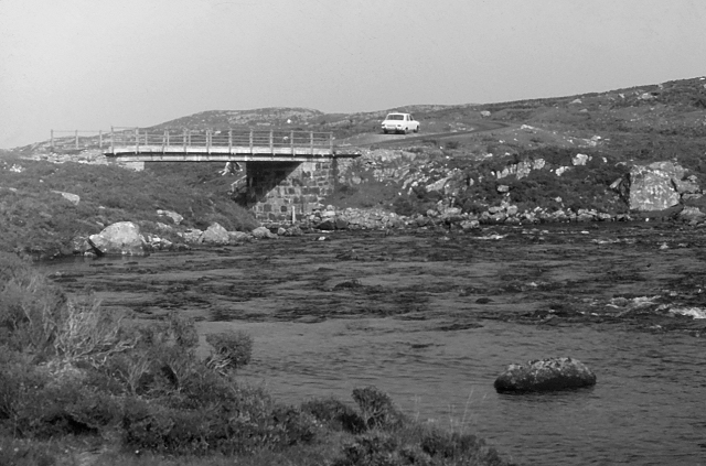
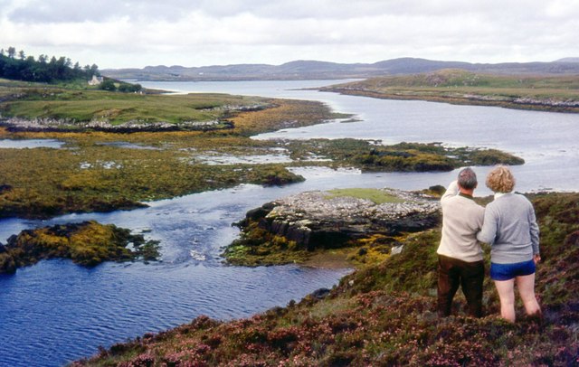
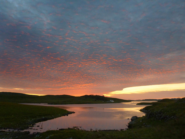
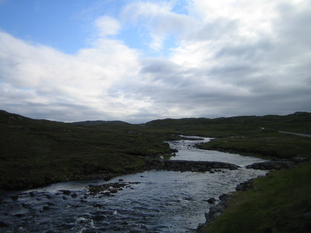
Àird Tharsuinnis Images

Images are sourced within 2km of 58.172032/-6.7285213 or Grid Reference NB2230. Thanks to Geograph Open Source API. All images are credited.

Loch Griomarstadh (Loch Grimersta) Loch Griomarstadh is a long narrow inlet of Loch Ceann Hulabhaig. It is tidal, and this view shows the sea a foot or so below high tide. In the distant, at left is Calanais (Callanish).
Loch Griomarstadh (Loch Grimersta)
Loch Griomarstadh is a long narrow inlet of Loch Ceann Hulabhaig. It is tidal, and this view shows the sea a foot or so below high tide. In the distant, at left is Calanais (Callanish).
Griomarstadh Abhainn Ghriomarstaidh (River Grimersta) enters the sea here from the left. The house at Griomarstadh is in the next square, and in the distance are the crofting communities of Calanais and Breascleit.
Griomarstadh
Abhainn Ghriomarstaidh (River Grimersta) enters the sea here from the left. The house at Griomarstadh is in the next square, and in the distance are the crofting communities of Calanais and Breascleit.
Abhainn Ghriomarstaidh (Grimersta River) Dramatic lighting as storm clouds gather to the south-west. This river is possibly the best salmon fishing river in the Western Isles, and drains a large tract of southern Lewis. There was a lot of water today following a week of unsettled weather with frequent rain showers.
Abhainn Ghriomarstaidh (Grimersta River)
Dramatic lighting as storm clouds gather to the south-west. This river is possibly the best salmon fishing river in the Western Isles, and drains a large tract of southern Lewis. There was a lot of water today following a week of unsettled weather with frequent rain showers.
Abhainn Ghriomarstaidh (Grimersta River) Looking downstream from the new bridge which carries the B8011 over the river. The next bridge is the private access to Griomarstadh House and jetty.
Abhainn Ghriomarstaidh (Grimersta River)
Looking downstream from the new bridge which carries the B8011 over the river. The next bridge is the private access to Griomarstadh House and jetty.
Roadside Cutting This cutting was made to accommodate the new B8011 south of Gearraidh na h-Aibhne (Garynahine). It reveals a sheet of dark rock intruded into grey gneiss. The gneiss is about 3000 million years old, and the dark rock is 'Younger Basic' mafic material intruded about 2400 million years ago. These events took place deep in the crust of the Earth as a result of tectonic movements associated with the break-up on an ancient continent.
Roadside Cutting
This cutting was made to accommodate the new B8011 south of Gearraidh na h-Aibhne (Garynahine). It reveals a sheet of dark rock intruded into grey gneiss. The gneiss is about 3000 million years old, and the dark rock is 'Younger Basic' mafic material intruded about 2400 million years ago. These events took place deep in the crust of the Earth as a result of tectonic movements associated with the break-up on an ancient continent.
Loch Ceann Hulabhig The tidal head, the southern end, of the sea loch close to Calanais / Callanish.
Loch Ceann Hulabhig
The tidal head, the southern end, of the sea loch close to Calanais / Callanish.
Grimersta River Abhainn Ghriomarstaidh tumbling down to the sea at Loch Ceann Hulabhig. The old road and bridge are visible in mid distance.
Grimersta River
Abhainn Ghriomarstaidh tumbling down to the sea at Loch Ceann Hulabhig. The old road and bridge are visible in mid distance.
Grimersta River from the Bridge View upstream of a tumbling, Highland river (Abhainn Ghriomarstaidh) from the new B8011 road bridge.
Grimersta River from the Bridge
View upstream of a tumbling, Highland river (Abhainn Ghriomarstaidh) from the new B8011 road bridge.
Old road bridge over the Abhainn Ghriomarstaidh/Grimersta River When this photo was taken in 1975, the bridge seen carried the B road to west Lewis over the river. Since then, a replacement has been constructed a short distance downstream. Fairly recent imagery seen online suggests that the bridge is still standing, although it no longer lies on a public road.
Old road bridge over the Abhainn Ghriomarstaidh/Grimersta River
When this photo was taken in 1975, the bridge seen carried the B road to west Lewis over the river. Since then, a replacement has been constructed a short distance downstream. Fairly recent imagery seen online suggests that the bridge is still standing, although it no longer lies on a public road.
Looking south east from the old Ardroil road A short spur which has been bypassed by new road construction forms a convenient parking place to admire the view.
Looking south east from the old Ardroil road
A short spur which has been bypassed by new road construction forms a convenient parking place to admire the view.
Loch Griomarstadh (Loch Grimersta) Part of the intricate coastline of west Lewis.
Loch Griomarstadh (Loch Grimersta)
Part of the intricate coastline of west Lewis.
Callanish 5 stone row A line of five stones, two of which have fallen.
<span class="nowrap"><a title="https://stonerows.wordpress.com/gazetteer/region/western-isles/callanish-5/" rel="nofollow ugc noopener" href="https://stonerows.wordpress.com/gazetteer/region/western-isles/callanish-5/">Link</a><img style="margin-left:2px;" alt="External link" title="External link - shift click to open in new window" src="https://s1.geograph.org.uk/img/external.png" width="10" height="10"/></span>
Callanish 5 stone row
A line of five stones, two of which have fallen. LinkExternal link
Allt na Muilne drains into Loch Griomarstadh Underlit clouds illuminate the southern tip of Loch Griomarstadh during a summer sunset. The view is barely west of due north, but this far north, the sun stays above the horizon late - it is almost half past ten - and the earth has time to rotate much further before the light finally fades.
Allt na Muilne drains into Loch Griomarstadh
Underlit clouds illuminate the southern tip of Loch Griomarstadh during a summer sunset. The view is barely west of due north, but this far north, the sun stays above the horizon late - it is almost half past ten - and the earth has time to rotate much further before the light finally fades.
Grimersta River The most famous and productive salmon river in the Scottish islands. Also the most expensive! and booked up years in advance anyway.
Grimersta River
The most famous and productive salmon river in the Scottish islands. Also the most expensive! and booked up years in advance anyway.
Southerly Bay of Loch Ceann Hulabhig This is the most southerly point of the sea loch.
Southerly Bay of Loch Ceann Hulabhig
This is the most southerly point of the sea loch.
Beinn Hulavig Overlooking Loch Ceann Hulabhig.
Beinn Hulavig
Overlooking Loch Ceann Hulabhig.
Aird na Faoghalach Rocky landscape interspersed with peat bog.
Aird na Faoghalach
Rocky landscape interspersed with peat bog.
Abhainn Ghriomarstaidh
Show me another place!

Àird Tharsuinnis is located at Grid Ref: NB2230 (Lat: 58.172032, Lng: -6.7285213)

Unitary Authority: Na h-Eileanan an Iar

Police Authority: Highlands and Islands

What 3 Words

///jousting.appear.newspaper. Near Carloway, Na h-Eileanan Siar

Related Wikis

Callanish IV

The Callanish IV stone circle (Scottish Gaelic: Ceann Hulavig) is one of many megalithic structures around the better-known (and larger) Calanais I on...

Garynahine

Garynahine (Scottish Gaelic: Gearraidh na h-aibhne) is a settlement on Lewis, in the Outer Hebrides, Scotland. Garynahine is situated at a T-junction where...

Garynahine Estate

Garynahine Estate (Scottish Gaelic: Gearraidh na h-aibhne) in Garynahine, a village on the Isle of Lewis, Outer Hebrides was owned by Sir James Matheson...
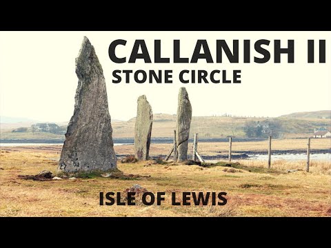
Callanish II

The Callanish II stone circle (Scottish Gaelic: Cnoc Ceann a' Gharaidh) is one of many megalithic structures around the better-known (and larger) Calanais...

Related Videos

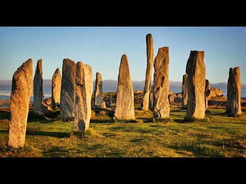
Callanish Standing Stones With Music On History Visit To Isle Of Lewis Outer Hebrides Scotland

Tour Scotland short 4K travel video clip, with Scottish music, of Callanish Standing Stones circle on ancestry visit to Isle Of Lewis ...

Callanish Standing Stones Circle On History Visit To Isle Of Lewis Outer Hebrides Scotland

Tour Scotland 4K travel video, with Scottish music, of Callanish Standing Stones Circle on ancestry, history visit to Isle Of Lewis in ...

Callanish II Stone Circle | Isle of Lewis | Neolithic Age | History of Scotland | Before Caledonia

'Before Caledonia' - A journey through Scotland's Ancient Sites. ---------- FACEBOOK share photos, articles, review books and ...

Nearby Amenities

Located within 500m of 58.172032,-6.7285213
Power: pole
Lat/Long: 58.1726666/-6.7356941
Power: pole
Lat/Long: 58.1728021/-6.7363731
The data included in this document is from www.openstreetmap.org. The data is made available under ODbL.

Have you been to Àird Tharsuinnis?

Leave your review of Àird Tharsuinnis below (or comments, questions and feedback).