Rubha nan Sgarbh

Coastal Feature, Headland, Point in Inverness-shire

Scotland

Rubha nan Sgarbh

North Harris Roads Geocaching is a type of global treasure hunt of people looking for caches, or hidden stashes of objects. Geocaching may also be described as a series of hide-and-seek games, where hiders provide online clues for seekers. Seekers use global positioning system (GPS) devices to find hidden caches
North Harris Roads Credit: Ralph Greig

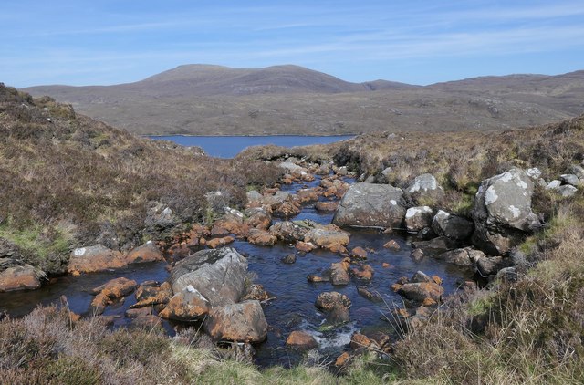
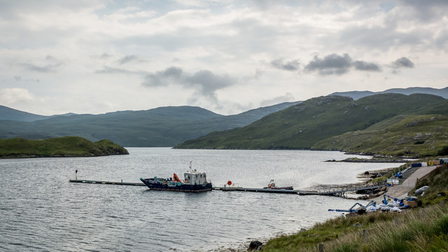
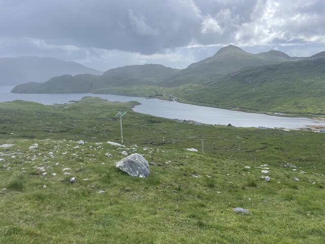
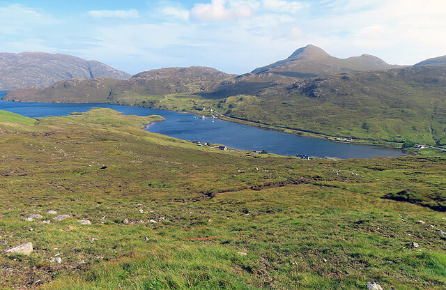
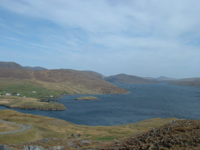
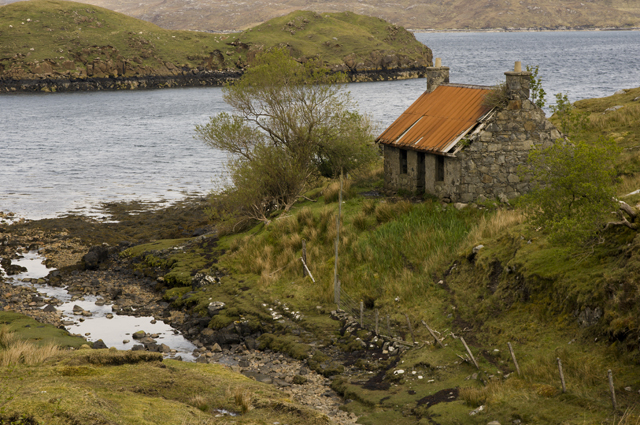
Rubha nan Sgarbh is a prominent coastal feature located in the Inverness-shire region of Scotland. Known for its stunning natural beauty and rugged landscape, it is a headland or point that juts out into the North Atlantic Ocean. The name "Rubha nan Sgarbh" translates to "Point of the Cormorants" in Scottish Gaelic, highlighting the abundant birdlife found in the area.

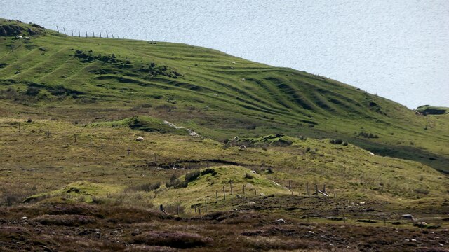
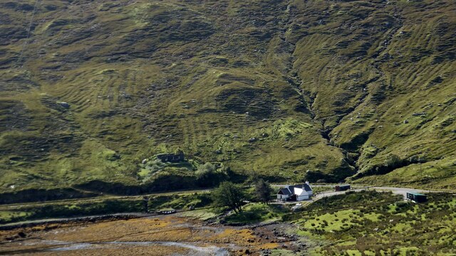
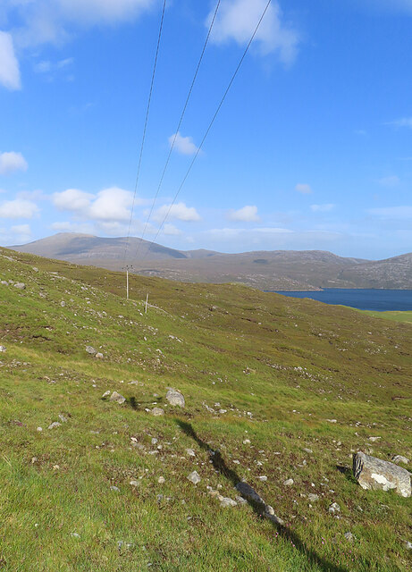
The headland is characterized by steep cliffs that rise dramatically from the sea, offering breathtaking panoramic views of the surrounding coastline. The cliffs are composed of ancient rocks, displaying layers of sedimentary and igneous formations, providing valuable insights into the geological history of the area.

The rugged terrain of Rubha nan Sgarbh is adorned with a variety of vegetation, including heather, grasses, and wildflowers, adding vibrant colors to the landscape. The headland is also home to a diverse range of wildlife, such as seals, dolphins, and various seabird species, including the aforementioned cormorants.

In addition to its natural beauty, Rubha nan Sgarbh offers recreational opportunities for nature enthusiasts and hikers. There are several walking trails that traverse the headland, allowing visitors to explore the rugged coastline and appreciate the stunning views. The area is also popular for birdwatching, with numerous vantage points offering excellent opportunities to observe the various avian species that inhabit the region.

Overall, Rubha nan Sgarbh is a captivating coastal feature that showcases the raw beauty of the Inverness-shire region. Its dramatic cliffs, diverse wildlife, and picturesque views make it a must-visit destination for nature lovers and outdoor enthusiasts.

If you have any feedback on the listing, please let us know in the comments section below.

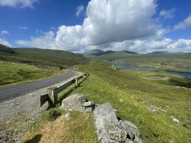
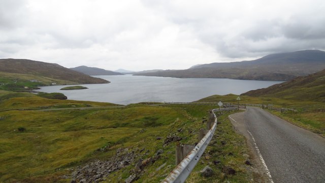
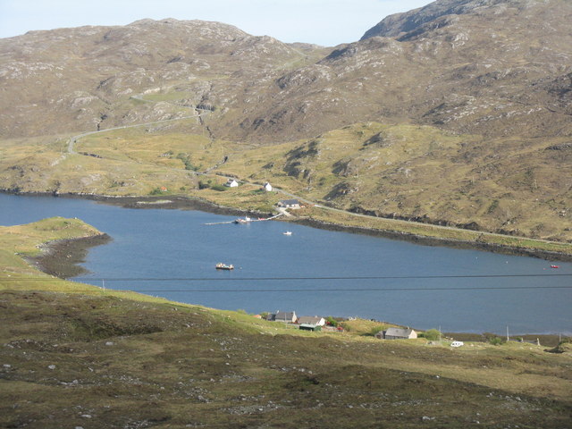
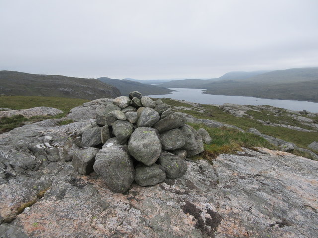
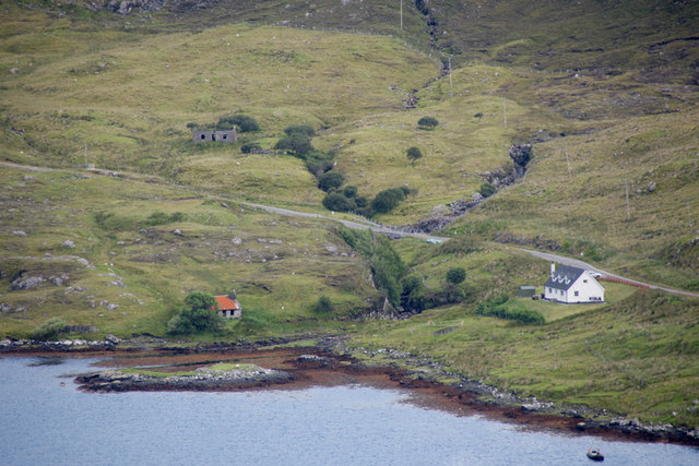
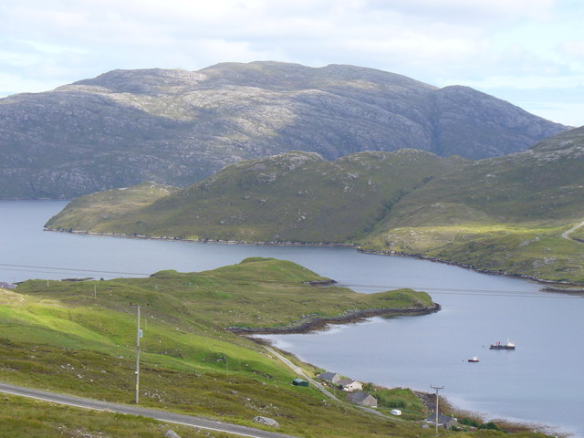
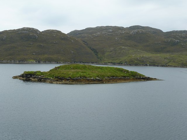
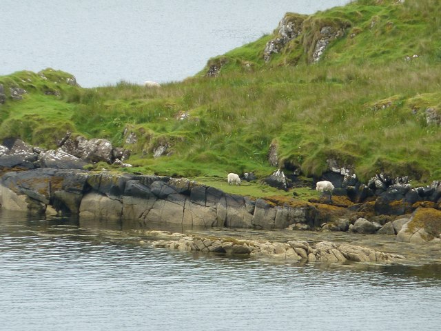
Rubha nan Sgarbh Images

Images are sourced within 2km of 57.960876/-6.7232588 or Grid Reference NB2006. Thanks to Geograph Open Source API. All images are credited.

North Harris Roads Geocaching is a type of global treasure hunt of people looking for caches, or hidden stashes of objects. Geocaching may also be described as a series of hide-and-seek games, where hiders provide online clues for seekers. Seekers use global positioning system (GPS) devices to find hidden caches
North Harris Roads
Geocaching is a type of global treasure hunt of people looking for caches, or hidden stashes of objects. Geocaching may also be described as a series of hide-and-seek games, where hiders provide online clues for seekers. Seekers use global positioning system (GPS) devices to find hidden caches
Loch Seaforth from the road to Rhenigidale
Jetty at Loch Màraig Presumably associated with fish farming. The road to Rhenigidale can be seen snaking along the lochside and over the hill at the left.
Jetty at Loch Màraig
Presumably associated with fish farming. The road to Rhenigidale can be seen snaking along the lochside and over the hill at the left.
Above Loch Seaforth Looking north along Loch Seaforth.
Above Loch Seaforth
Looking north along Loch Seaforth.
The Allt Loch nan Eang, Isle of Lewis Looking towards Loch Seaforth/Loch Shìophoirt, the sea loch into which the burn flows.
The Allt Loch nan Eang, Isle of Lewis
Looking towards Loch Seaforth/Loch Shìophoirt, the sea loch into which the burn flows.
Support craft on Loch Maraig
Lazy beds at Maraig Ridges formed by hand cultivation. <span class="nowrap"><a title="https://en.wikipedia.org/wiki/Lazy_bed" rel="nofollow ugc noopener" href="https://en.wikipedia.org/wiki/Lazy_bed">Link</a><img style="margin-left:2px;" alt="External link" title="External link - shift click to open in new window" src="https://s1.geograph.org.uk/img/external.png" width="10" height="10"/></span>
Lazy beds at Maraig
Ridges formed by hand cultivation. LinkExternal link
Lazy beds and croft ruin at Ailean Anabaich It is hard to appreciate how difficult it would have been to carry out arable farming on the side of a mountain. <span class="nowrap"><a title="https://en.wikipedia.org/wiki/Lazy_bed" rel="nofollow ugc noopener" href="https://en.wikipedia.org/wiki/Lazy_bed">Link</a><img style="margin-left:2px;" alt="External link" title="External link - shift click to open in new window" src="https://s1.geograph.org.uk/img/external.png" width="10" height="10"/></span>
Lazy beds and croft ruin at Ailean Anabaich
It is hard to appreciate how difficult it would have been to carry out arable farming on the side of a mountain. LinkExternal link
Lewis and Harris Landscape Geocaching is a type of global treasure hunt of people looking for caches, or hidden stashes of objects. Geocaching may also be described as a series of hide-and-seek games, where hiders provide online clues for seekers. Seekers use global positioning system (GPS) devices to find hidden caches
Lewis and Harris Landscape
Geocaching is a type of global treasure hunt of people looking for caches, or hidden stashes of objects. Geocaching may also be described as a series of hide-and-seek games, where hiders provide online clues for seekers. Seekers use global positioning system (GPS) devices to find hidden caches
Loch Màraig Loch Màraig is an arm of Loch Seaforth, a sea-loch that extends deep into the land between Lewis and Harris.
Loch Màraig
Loch Màraig is an arm of Loch Seaforth, a sea-loch that extends deep into the land between Lewis and Harris.
Power Line One of the most frequent and less picturesque features of the Hebridean scenery are the inevitable but necessary power lines that march across the landscape.
Power Line
One of the most frequent and less picturesque features of the Hebridean scenery are the inevitable but necessary power lines that march across the landscape.
No fish today <a href="https://www.geograph.org.uk/photo/574598">NB2005 : Loch Shiphoirt (Seaforth)</a>; 42 months on from Dave Fergusson's image and the fish farm has moved but everything else the same.
No fish today
NB2005 : Loch Shiphoirt (Seaforth); 42 months on from Dave Fergusson's image and the fish farm has moved but everything else the same.
Eilean Anabaich beside Loch Mharaig
Loch Maraig Side loch and village of the same name on the western shore of Loch Seaforth / Loch Shiphoirt. The mountain on the skyline is Caiteseal (449m), on the eastern shore of Loch Seaforth.
Loch Maraig
Side loch and village of the same name on the western shore of Loch Seaforth / Loch Shiphoirt. The mountain on the skyline is Caiteseal (449m), on the eastern shore of Loch Seaforth.
Eilean Mhàraig from Màraig This little island of about 2 acres (approx. 1 ha) in size lies in an inlet of Loch Sìophort (Seaforth) just to the north of the longer thinner inlet known as Loch Mhàraig. There were several sheep on this little island - see <a href="https://www.geograph.org.uk/photo/2621576">NB2006 : Sheep graze on Eilean Mhàraig</a>
The alternative name for Eilean Mhàraig is Maaruig Island.
Eilean Mhàraig from Màraig
This little island of about 2 acres (approx. 1 ha) in size lies in an inlet of Loch Sìophort (Seaforth) just to the north of the longer thinner inlet known as Loch Mhàraig. There were several sheep on this little island - see NB2006 : Sheep graze on Eilean Mhàraig The alternative name for Eilean Mhàraig is Maaruig Island.
Sheep graze on Eilean Mhàraig Despite being a definite island, unconnected by any causeway, there were several sheep roaming about on Eilean Mhàraig, so presumably they had been taken there by a farmer - unless they're better swimmers than I'd thought.
Sheep graze on Eilean Mhàraig
Despite being a definite island, unconnected by any causeway, there were several sheep roaming about on Eilean Mhàraig, so presumably they had been taken there by a farmer - unless they're better swimmers than I'd thought.
Ruined cottage beside Loch Maraig
Looking over Mhàraig In the distance is Ceann Mòr jutting into Loch Seaforth.
Looking over Mhàraig
In the distance is Ceann Mòr jutting into Loch Seaforth.
Show me another place!

Rubha nan Sgarbh is located at Grid Ref: NB2006 (Lat: 57.960876, Lng: -6.7232588)

Unitary Authority: Na h-Eileanan an Iar

Police Authority: Highlands and Islands

What 3 Words

///demoted.tripped.boards. Near Tarbert, Na h-Eileanan Siar

Related Wikis

Loch Seaforth

Loch Seaforth (Scottish Gaelic: Loch Shiphoirt or Shìophoirt) is a sea loch in the Outer Hebrides of Scotland. It consists of three distinct sections;...

Ardvourlie Castle

Ardvourlie Castle is a 19th-century country house on Harris, one of the Western Isles off the north-west coast of Scotland. The house was built beside...

Seaforth Island

Seaforth Island (Scottish Gaelic: Eilean Shìphoirt/Shìophoirt or Mulag) is an uninhabited island in the Outer Hebrides of Scotland. Unlike many other...

Rèinigeadal

Rèinigeadal (or Rhenigidale) is a small settlement in Harris, in the Western Isles in Scotland. It is situated on the east coast of Harris 8 kilometres...

Nearby Amenities

Located within 500m of 57.960876,-6.7232588
Turning Circle
Lat/Long: 57.9586617/-6.7271604
Material: wood
Power: pole
Lat/Long: 57.958347/-6.7275309
Material: wood
Power: pole
Lat/Long: 57.9579586/-6.7275966
Material: wood
Power: pole
Lat/Long: 57.9575502/-6.7276758
Material: wood
Power: pole
Lat/Long: 57.9572179/-6.7277428
Material: wood
Power: pole
Lat/Long: 57.9587866/-6.7269986
Rubha nan Sgarbh
Natural: cape
Lat/Long: 57.9604901/-6.7223689
Barrier: cattle_grid
Lat/Long: 57.9587593/-6.7269083
The data included in this document is from www.openstreetmap.org. The data is made available under ODbL.

Have you been to Rubha nan Sgarbh?

Leave your review of Rubha nan Sgarbh below (or comments, questions and feedback).