Àird Mhàraig

Coastal Feature, Headland, Point in Inverness-shire

Scotland

Àird Mhàraig

North Harris Roads
North Harris Roads Credit: Ralph Greig

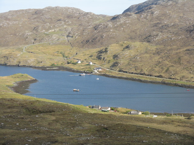
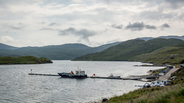
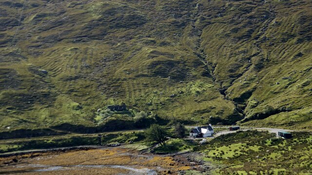
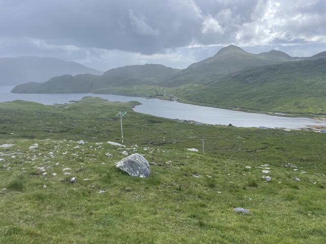
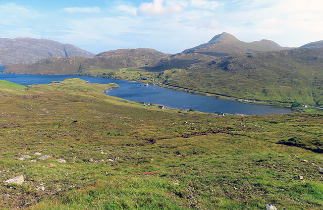
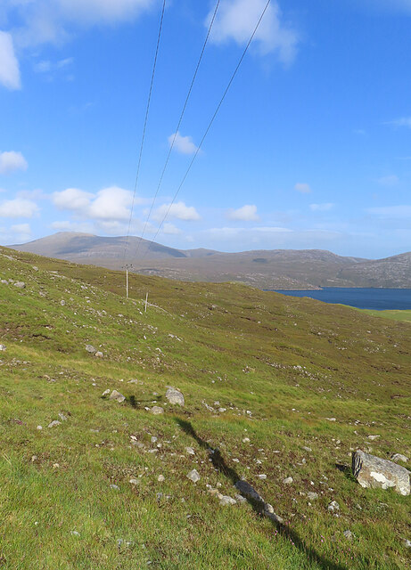
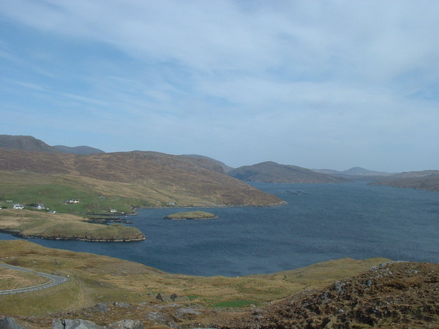
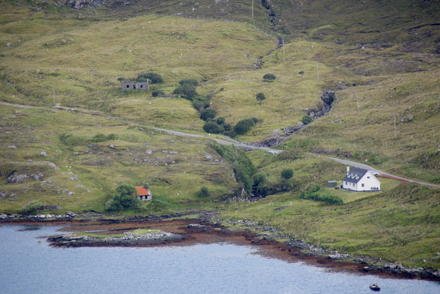
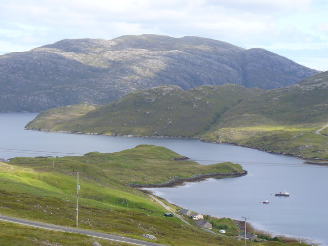
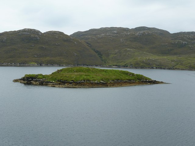
Àird Mhàraig, located in Inverness-shire, Scotland, is a captivating coastal feature that encompasses a headland and a point. Situated on the western coast of the Scottish Highlands, it offers breathtaking views of the North Atlantic Ocean. The name Àird Mhàraig translates to "St. Maelrubha's Point" in English, paying homage to the saint who is said to have founded a monastery in the area during the 7th century.

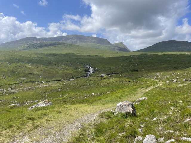
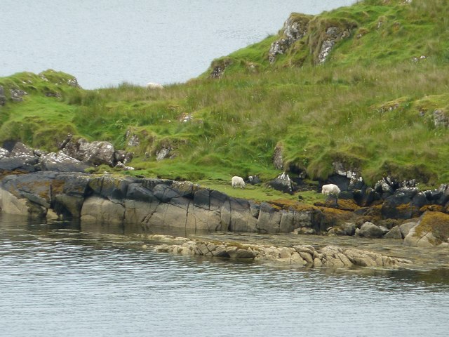
This headland and point are characterized by rugged cliffs that rise majestically from the sea, with their imposing presence attracting both locals and tourists alike. The cliffs offer a nesting site for various seabird species, including guillemots, fulmars, and kittiwakes, making Àird Mhàraig a haven for bird enthusiasts and nature lovers.

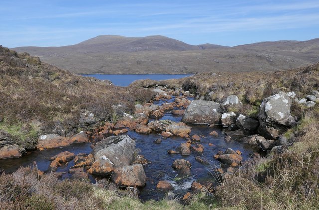
The area surrounding Àird Mhàraig is renowned for its rich marine life. The crystal-clear waters are home to a diverse range of fish species, including cod, haddock, and mackerel, attracting fishermen from far and wide. The headland also provides an excellent vantage point for observing seals, dolphins, and even the occasional whale.

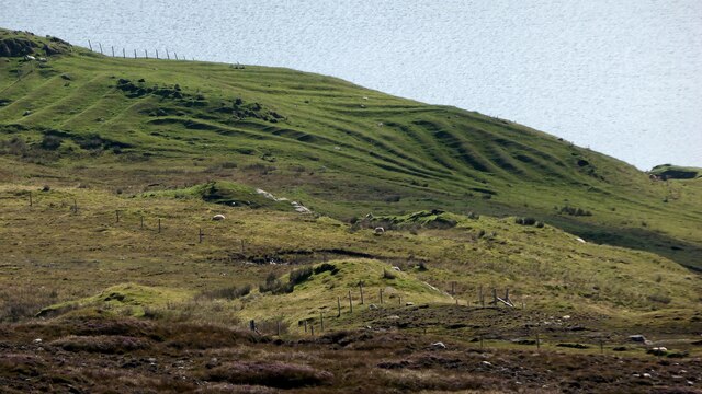
Visitors to Àird Mhàraig can enjoy leisurely walks along the coastal paths, immersing themselves in the picturesque scenery and experiencing the invigorating sea breeze. The headland offers various viewpoints that afford panoramic vistas of the surrounding landscape, with distant mountains creating a dramatic backdrop.

Àird Mhàraig is not only a place of natural beauty but also holds historical significance. The ruins of St. Maelrubha's monastery can still be seen, serving as a reminder of the area's ancient past. Exploring these archaeological remnants provides a glimpse into the lives of the early Christian settlers who once inhabited this remote corner of Scotland.

Overall, Àird Mhàraig is a captivating coastal feature that seamlessly combines natural beauty, abundant wildlife, and a rich historical heritage,

If you have any feedback on the listing, please let us know in the comments section below.

Àird Mhàraig Images

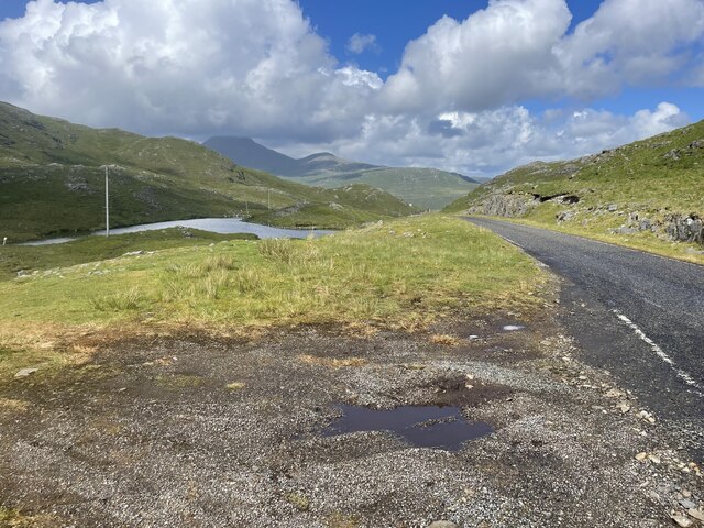
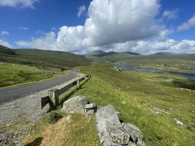
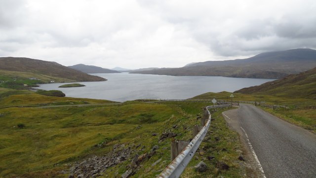
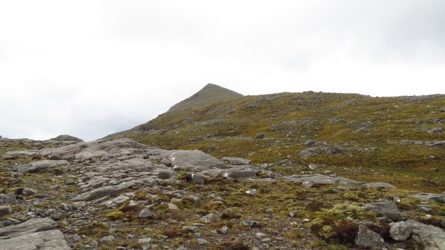
Images are sourced within 2km of 57.953546/-6.7256434 or Grid Reference NB2005. Thanks to Geograph Open Source API. All images are credited.

North Harris Roads
North Harris Roads
North Harris Roads Geocaching is a type of global treasure hunt of people looking for caches, or hidden stashes of objects. Geocaching may also be described as a series of hide-and-seek games, where hiders provide online clues for seekers. Seekers use global positioning system (GPS) devices to find hidden caches
North Harris Roads
Geocaching is a type of global treasure hunt of people looking for caches, or hidden stashes of objects. Geocaching may also be described as a series of hide-and-seek games, where hiders provide online clues for seekers. Seekers use global positioning system (GPS) devices to find hidden caches
Loch Seaforth from the road to Rhenigidale
Ascending across Cadhan Dubha towards Todun
Jetty at Loch Màraig Presumably associated with fish farming. The road to Rhenigidale can be seen snaking along the lochside and over the hill at the left.
Jetty at Loch Màraig
Presumably associated with fish farming. The road to Rhenigidale can be seen snaking along the lochside and over the hill at the left.
The Allt Loch nan Eang, Isle of Lewis Looking towards Loch Seaforth/Loch Shìophoirt, the sea loch into which the burn flows.
The Allt Loch nan Eang, Isle of Lewis
Looking towards Loch Seaforth/Loch Shìophoirt, the sea loch into which the burn flows.
Support craft on Loch Maraig
Lazy beds at Maraig Ridges formed by hand cultivation. <span class="nowrap"><a title="https://en.wikipedia.org/wiki/Lazy_bed" rel="nofollow ugc noopener" href="https://en.wikipedia.org/wiki/Lazy_bed">Link</a><img style="margin-left:2px;" alt="External link" title="External link - shift click to open in new window" src="https://s1.geograph.org.uk/img/external.png" width="10" height="10"/></span>
Lazy beds at Maraig
Ridges formed by hand cultivation. LinkExternal link
Lazy beds and croft ruin at Ailean Anabaich It is hard to appreciate how difficult it would have been to carry out arable farming on the side of a mountain. <span class="nowrap"><a title="https://en.wikipedia.org/wiki/Lazy_bed" rel="nofollow ugc noopener" href="https://en.wikipedia.org/wiki/Lazy_bed">Link</a><img style="margin-left:2px;" alt="External link" title="External link - shift click to open in new window" src="https://s1.geograph.org.uk/img/external.png" width="10" height="10"/></span>
Lazy beds and croft ruin at Ailean Anabaich
It is hard to appreciate how difficult it would have been to carry out arable farming on the side of a mountain. LinkExternal link
Lewis and Harris Landscape Geocaching is a type of global treasure hunt of people looking for caches, or hidden stashes of objects. Geocaching may also be described as a series of hide-and-seek games, where hiders provide online clues for seekers. Seekers use global positioning system (GPS) devices to find hidden caches
Lewis and Harris Landscape
Geocaching is a type of global treasure hunt of people looking for caches, or hidden stashes of objects. Geocaching may also be described as a series of hide-and-seek games, where hiders provide online clues for seekers. Seekers use global positioning system (GPS) devices to find hidden caches
North Harris trail Geocaching is a type of global treasure hunt of people looking for caches, or hidden stashes of objects. Geocaching may also be described as a series of hide-and-seek games, where hiders provide online clues for seekers. Seekers use global positioning system (GPS) devices to find hidden caches
North Harris trail
Geocaching is a type of global treasure hunt of people looking for caches, or hidden stashes of objects. Geocaching may also be described as a series of hide-and-seek games, where hiders provide online clues for seekers. Seekers use global positioning system (GPS) devices to find hidden caches
Loch Màraig Loch Màraig is an arm of Loch Seaforth, a sea-loch that extends deep into the land between Lewis and Harris.
Loch Màraig
Loch Màraig is an arm of Loch Seaforth, a sea-loch that extends deep into the land between Lewis and Harris.
Power Line One of the most frequent and less picturesque features of the Hebridean scenery are the inevitable but necessary power lines that march across the landscape.
Power Line
One of the most frequent and less picturesque features of the Hebridean scenery are the inevitable but necessary power lines that march across the landscape.
No fish today <a href="https://www.geograph.org.uk/photo/574598">NB2005 : Loch Shiphoirt (Seaforth)</a>; 42 months on from Dave Fergusson's image and the fish farm has moved but everything else the same.
No fish today
NB2005 : Loch Shiphoirt (Seaforth); 42 months on from Dave Fergusson's image and the fish farm has moved but everything else the same.
Eilean Anabaich beside Loch Mharaig
Loch Maraig Side loch and village of the same name on the western shore of Loch Seaforth / Loch Shiphoirt. The mountain on the skyline is Caiteseal (449m), on the eastern shore of Loch Seaforth.
Loch Maraig
Side loch and village of the same name on the western shore of Loch Seaforth / Loch Shiphoirt. The mountain on the skyline is Caiteseal (449m), on the eastern shore of Loch Seaforth.
Eilean Mhàraig from Màraig This little island of about 2 acres (approx. 1 ha) in size lies in an inlet of Loch Sìophort (Seaforth) just to the north of the longer thinner inlet known as Loch Mhàraig. There were several sheep on this little island - see <a href="https://www.geograph.org.uk/photo/2621576">NB2006 : Sheep graze on Eilean Mhàraig</a>
The alternative name for Eilean Mhàraig is Maaruig Island.
Eilean Mhàraig from Màraig
This little island of about 2 acres (approx. 1 ha) in size lies in an inlet of Loch Sìophort (Seaforth) just to the north of the longer thinner inlet known as Loch Mhàraig. There were several sheep on this little island - see NB2006 : Sheep graze on Eilean Mhàraig The alternative name for Eilean Mhàraig is Maaruig Island.
Sheep graze on Eilean Mhàraig Despite being a definite island, unconnected by any causeway, there were several sheep roaming about on Eilean Mhàraig, so presumably they had been taken there by a farmer - unless they're better swimmers than I'd thought.
Sheep graze on Eilean Mhàraig
Despite being a definite island, unconnected by any causeway, there were several sheep roaming about on Eilean Mhàraig, so presumably they had been taken there by a farmer - unless they're better swimmers than I'd thought.
Show me another place!

Àird Mhàraig is located at Grid Ref: NB2005 (Lat: 57.953546, Lng: -6.7256434)

Unitary Authority: Na h-Eileanan an Iar

Police Authority: Highlands and Islands

What 3 Words

///bonus.obliging.stove. Near Tarbert, Na h-Eileanan Siar

Related Wikis

Loch Seaforth

Loch Seaforth (Scottish Gaelic: Loch Shiphoirt or Shìophoirt) is a sea loch in the Outer Hebrides of Scotland. It consists of three distinct sections;...

Rèinigeadal

Rèinigeadal (or Rhenigidale) is a small settlement in Harris, in the Western Isles in Scotland. It is situated on the east coast of Harris 8 kilometres...

Ardvourlie Castle

Ardvourlie Castle is a 19th-century country house on Harris, one of the Western Isles off the north-west coast of Scotland. The house was built beside...

Seaforth Island

Seaforth Island (Scottish Gaelic: Eilean Shìphoirt/Shìophoirt or Mulag) is an uninhabited island in the Outer Hebrides of Scotland. Unlike many other...

Nearby Amenities

Located within 500m of 57.953546,-6.7256434
Bus Stop
Maaruig Harris
Naptan AtcoCode: 6010731743
Naptan Bearing: W
Naptan CommonName: Maaruig Harris
Naptan Indicator: Village
Naptan Landmark: Village
Naptan NaptanCode: 94723692
Naptan Street: Village
Naptan Verified: no
Source: naptan_import
Lat/Long: 57.9560499/-6.7305732
Màraig
Alt Name En: Marig
Name En: Maaruig
Name Gd: Màraig
Place: village
Lat/Long: 57.9571906/-6.7304872
Passing Place
Lat/Long: 57.949528/-6.7278518
Passing Place
Lat/Long: 57.950257/-6.7301763
Passing Place
Lat/Long: 57.949359/-6.726288
An t-Eilean Anabaich
Alt Name: Eilean Anabuich
Place: isolated_dwelling
Lat/Long: 57.949732/-6.7280535
Passing Place
Lat/Long: 57.9553379/-6.7332977
Barrier: cattle_grid
Lat/Long: 57.9560842/-6.7301407
Material: wood
Power: pole
Lat/Long: 57.9492235/-6.7277132
Material: wood
Power: pole
Lat/Long: 57.9495541/-6.7285566
Material: wood
Power: pole
Lat/Long: 57.9498364/-6.7293167
Material: wood
Power: pole
Lat/Long: 57.950167/-6.7301171
Material: wood
Power: pole
Lat/Long: 57.9502483/-6.7310384
Material: wood
Power: pole
Lat/Long: 57.9575502/-6.7276758
Material: wood
Power: pole
Lat/Long: 57.9572179/-6.7277428
Material: wood
Power: pole
Lat/Long: 57.9569347/-6.7279895
Material: wood
Power: pole
Lat/Long: 57.9566701/-6.7282833
Material: wood
Power: pole
Lat/Long: 57.9563077/-6.7294662
Material: wood
Power: pole
Lat/Long: 57.9561282/-6.7301776
Material: wood
Power: pole
Lat/Long: 57.9559437/-6.7309154
Material: wood
Power: pole
Lat/Long: 57.9562276/-6.7316267
Aird Mharaig
Natural: cape
Lat/Long: 57.9541946/-6.7250941
Loch Mharaig
Natural: bay
Lat/Long: 57.9519516/-6.7301581
Leisure: slipway
Lat/Long: 57.9512026/-6.7319424
Height: 4
Man Made: mast
Tower Construction: mast
Tower Type: communication
Lat/Long: 57.9493623/-6.724921
Material: wood
Power: pole
Lat/Long: 57.9503017/-6.730008
Power: pole
Lat/Long: 57.9562038/-6.7284146
Power: pole
Lat/Long: 57.9564817/-6.7288981
The data included in this document is from www.openstreetmap.org. The data is made available under ODbL.

Have you been to Àird Mhàraig?

Leave your review of Àird Mhàraig below (or comments, questions and feedback).