Rubha na h-Airde Mòire

Coastal Feature, Headland, Point in Argyllshire

Scotland

Rubha na h-Airde Mòire

Disused quarry at Rubha na h-Airde Mòire
Disused quarry at Rubha na h-Airde Mòire Credit: Mick Garratt

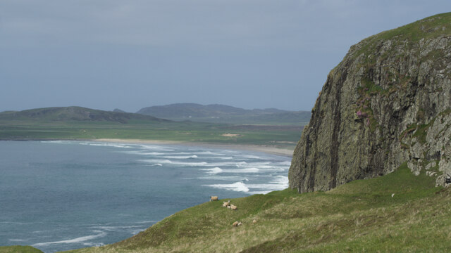
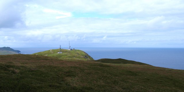
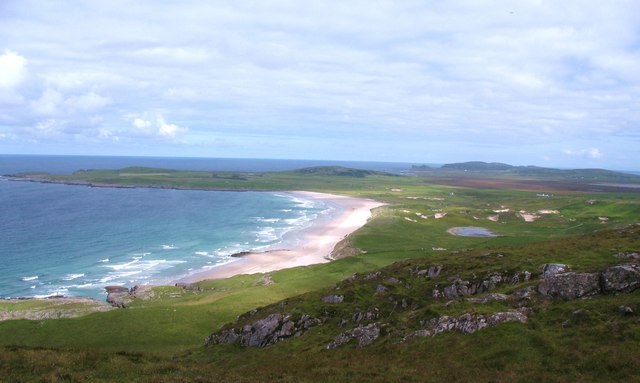
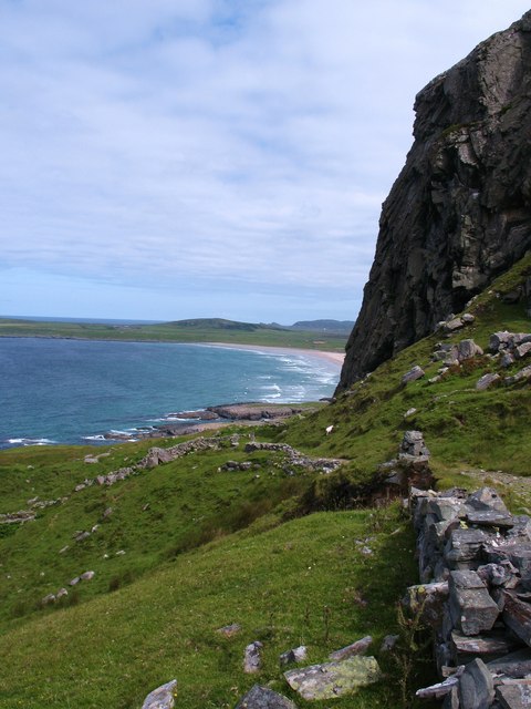
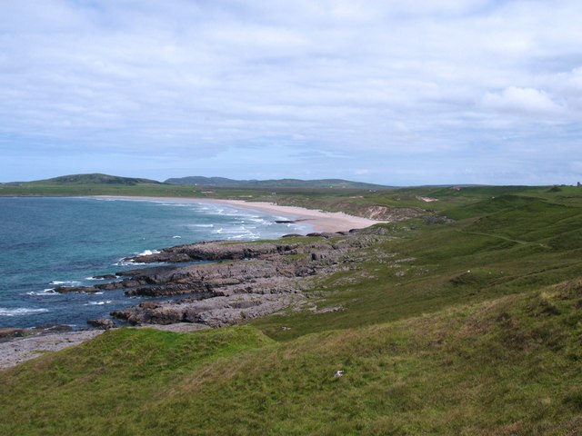
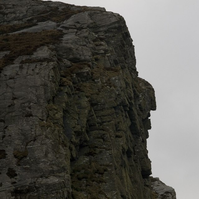
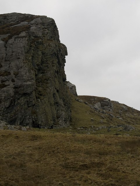
Rubha na h-Airde Mòire is a prominent headland located in Argyllshire, Scotland. Situated on the west coast of the Scottish mainland, it juts out into the Atlantic Ocean, offering stunning views of the surrounding landscape. The headland is known for its rugged cliffs, which reach heights of up to 100 meters, creating a dramatic and imposing sight.

The area surrounding Rubha na h-Airde Mòire is abundant in natural beauty. The headland is surrounded by pristine sandy beaches and crystal-clear waters, making it a popular destination for beachgoers and water sports enthusiasts. The coastal waters are home to a diverse range of marine life, making it an ideal spot for snorkeling and diving.

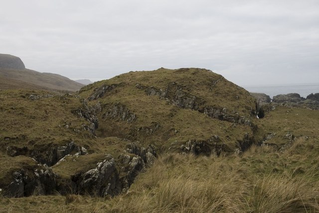
The headland itself is characterized by its rocky terrain, adorned with heather and grasses. It offers an excellent vantage point to observe the local wildlife, including seabirds such as gannets, puffins, and razorbills that nest on the cliffs. The area is also frequented by seals and occasionally dolphins and whales, providing a unique opportunity for wildlife enthusiasts.

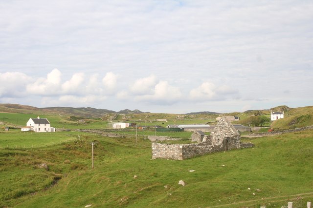
Rubha na h-Airde Mòire is a site of historical importance as well. It is home to the ruins of an ancient fort, which dates back to the Iron Age. The fort provides insights into the region's rich history and offers visitors a chance to step back in time.

Overall, Rubha na h-Airde Mòire is a captivating coastal feature, offering a perfect blend of natural beauty, wildlife, and historical significance. It is a must-visit destination for those seeking to explore the rugged beauty of Argyllshire's coastline.

If you have any feedback on the listing, please let us know in the comments section below.

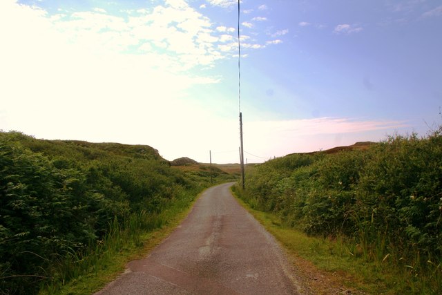
Rubha na h-Airde Mòire Images

Images are sourced within 2km of 55.755272/-6.4697644 or Grid Reference NR1960. Thanks to Geograph Open Source API. All images are credited.

Disused quarry at Rubha na h-Airde Mòire
Kilchiaran Bay
Kilchiaran Bay
Creag Bealach na Caillich — Granny's Crag
Disused military buildings
Winter view south-east from Cnoc nam Muc-chlach, Islay
Kilchiaran Bay, Islay With ruined chapel in distance.
Kilchiaran Bay, Islay
With ruined chapel in distance.
Meall Riabhach Looking south west from near point 149 on the heathery ridge to the south of Kilchoman.
Meall Riabhach
Looking south west from near point 149 on the heathery ridge to the south of Kilchoman.
View north from Cnoc nam Muc-chlach The view north from near the hilltop transmitters above Machir Bay.
View north from Cnoc nam Muc-chlach
The view north from near the hilltop transmitters above Machir Bay.
Old Woman's Pass Old Woman's Pass is the name given to this old track which crosses the headland between Kilchoman and Kilchiaran. The splendid view northwards is along the beach at Machir Bay.
Old Woman's Pass
Old Woman's Pass is the name given to this old track which crosses the headland between Kilchoman and Kilchiaran. The splendid view northwards is along the beach at Machir Bay.
Machir Bay To the right is the path leading down to the beach from Old Woman's Pass. A fine stretch of sand backed by dunes and machair where the corncrake can often be heard, but rarely seen.
Machir Bay
To the right is the path leading down to the beach from Old Woman's Pass. A fine stretch of sand backed by dunes and machair where the corncrake can often be heard, but rarely seen.
Cill Chiarain The church of Saint Ciaron, this church originates from around 1200.
Cill Chiarain
The church of Saint Ciaron, this church originates from around 1200.
Kilchiaran Farm The farmstead of Kilchiaran on the Rinns of Islay.
Kilchiaran Farm
The farmstead of Kilchiaran on the Rinns of Islay.
Road to Kilchiaran The road passing through high banks close to Kilchiaran.
Road to Kilchiaran
The road passing through high banks close to Kilchiaran.
Granny Rock The profile of an old woman or 'Caillich' can be seen on this rock between Machir Bay and Kilchiaran. It is best viewed from the north. For a context photo, see <a href="https://www.geograph.org.uk/photo/2802956">NR2061 : Granny Rock, Islay</a>.
Granny Rock
The profile of an old woman or 'Caillich' can be seen on this rock between Machir Bay and Kilchiaran. It is best viewed from the north. For a context photo, see NR2061 : Granny Rock, Islay.
Granny Rock, Islay The profile of an old woman or 'Caillich' can be seen in this rock face between Machir Bay to the north and Kilchiaran to the south. It is best viewed from the north. For a closer picture, see <a href="https://www.geograph.org.uk/photo/2802952">NR2061 : Granny Rock</a>.
Granny Rock, Islay
The profile of an old woman or 'Caillich' can be seen in this rock face between Machir Bay to the north and Kilchiaran to the south. It is best viewed from the north. For a closer picture, see NR2061 : Granny Rock.
Dun south of Machir Bay, Islay
Footbridge across the Abhainn na Braid, Islay This footbridge is marked on my older version of the 1:25 000 Explorer map of Islay north, but not on the newer version that Geograph uses - the opposite way round of the water butt photo - see <a href="https://www.geograph.org.uk/photo/2802972">NR2162 : Farm Track near Machir Bay, Islay</a>
Footbridge across the Abhainn na Braid, Islay
This footbridge is marked on my older version of the 1:25 000 Explorer map of Islay north, but not on the newer version that Geograph uses - the opposite way round of the water butt photo - see NR2162 : Farm Track near Machir Bay, Islay
Ruin near Kilchiaran, Islay Marked as simply two rectangles on the Explorer map, with no name, the inhabitants of this erstwhile dwelling house surely enjoyed true tranquility. What stories could this lonely dwelling share?
Ruin near Kilchiaran, Islay
Marked as simply two rectangles on the Explorer map, with no name, the inhabitants of this erstwhile dwelling house surely enjoyed true tranquility. What stories could this lonely dwelling share?
Show me another place!

Rubha na h-Airde Mòire is located at Grid Ref: NR1960 (Lat: 55.755272, Lng: -6.4697644)

Unitary Authority: Argyll and Bute

Police Authority: Argyll and West Dunbartonshire

What 3 Words

///deals.supposing.cages. Near Port Charlotte, Argyll & Bute

Related Wikis

RAF Kilchiaran

RAF Kilchiaran was a Royal Air Force radar station situated on the Isle of Islay in Scotland. It was originally active from 1940-1945. In 1954 the base...

Rinns of Islay

The Rinns of Islay (Scottish Gaelic: Na Roinn Ìleach; alternative English spelling Rhinns of Islay) is an area on the west of the island of Islay in the...

Kilchoman

Kilchoman ( kil-(K)HOM-ən; Scottish Gaelic: Cill Chomain [kʲʰiːʎ ˈxɔmɛɲ]) is a small settlement and large parish on the Scottish island of Islay, within...

Kilchoman distillery

Kilchoman distillery (pronounced Kil-ho-man) is a distillery that produces single malt Scotch whisky on Islay, an island of the Inner Hebrides. Kilchoman...

Nearby Amenities

Located within 500m of 55.755272,-6.4697644
Kilchiaran Bay
Natural: bay
Lat/Long: 55.7516749/-6.4671698
Port Meadhoin
Natural: bay
Lat/Long: 55.7527886/-6.464295
Port a' Bhata
Natural: bay
Lat/Long: 55.7532474/-6.4672776
The data included in this document is from www.openstreetmap.org. The data is made available under ODbL.

Have you been to Rubha na h-Airde Mòire?

Leave your review of Rubha na h-Airde Mòire below (or comments, questions and feedback).