Rubha na h-Athadh

Coastal Feature, Headland, Point in Ross-shire

Scotland

Rubha na h-Athadh

Sheepfold at Riof
Sheepfold at Riof Credit: Sandy Gerrard

Rubha na h-Athadh is a prominent coastal feature located in Ross-shire, Scotland. Situated on the western coast of the Highlands, it is a headland that extends into the North Atlantic Ocean. The name "Rubha na h-Athadh" is derived from Scottish Gaelic, meaning "point of the ford." This name is a reflection of the historical significance of the area as a crossing point for people and livestock.

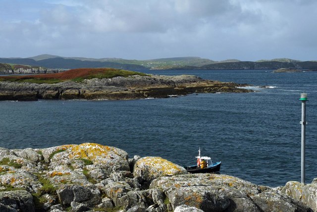
The headland of Rubha na h-Athadh is characterized by rugged cliffs that rise steeply from the sea to a height of about 100 meters. These cliffs offer breathtaking panoramic views of the surrounding ocean and the picturesque Scottish landscape. The headland is composed of rocky outcrops, with some areas covered in grass and heather.

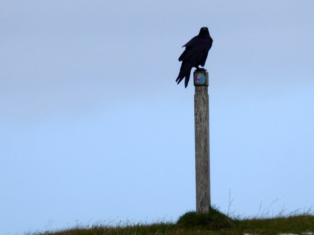
The coastal area around Rubha na h-Athadh is rich in biodiversity, with a diverse range of flora and fauna. The waters around the headland are known for their abundant marine life, including seals, dolphins, and various species of fish. The headland itself is home to a variety of bird species, making it a popular spot for birdwatching.

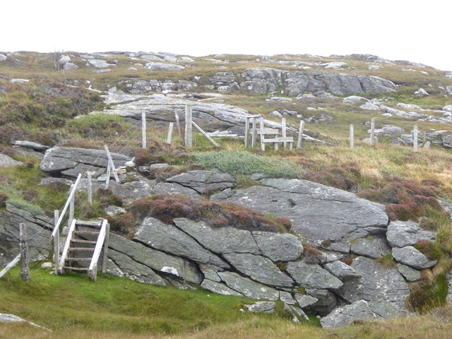
Access to Rubha na h-Athadh is facilitated by a network of walking trails that wind through the surrounding countryside. These trails provide visitors with an opportunity to explore the headland and experience its natural beauty up close. Additionally, there are several viewpoints along the trails that offer stunning vistas of the coastline and the open sea.

Overall, Rubha na h-Athadh is a captivating coastal feature that showcases the rugged beauty of the Scottish Highlands. Its dramatic cliffs, diverse wildlife, and scenic trails make it an ideal destination for nature enthusiasts and those seeking an escape into the untamed wilderness of Scotland's coast.

If you have any feedback on the listing, please let us know in the comments section below.

Rubha na h-Athadh Images

Images are sourced within 2km of 58.212128/-6.8843683 or Grid Reference NB1335. Thanks to Geograph Open Source API. All images are credited.

Sheepfold at Riof
Sheepfold at Riof
Norse Mill on burn leading from Loch Lionais The mill is very ruinous and survives as a spread of rubble overlying the lower courses of the building.  The leat serving the mill is represented by the bright green stripe.
Norse Mill on burn leading from Loch Lionais
The mill is very ruinous and survives as a spread of rubble overlying the lower courses of the building. The leat serving the mill is represented by the bright green stripe.
Norse Mill on burn leading from Loch Lionais The lower mill is rather better preserved with the tail race opening still intact.
Norse Mill on burn leading from Loch Lionais
The lower mill is rather better preserved with the tail race opening still intact.
Beach north of Bhalasaigh
Bridge at Bhalasaigh Looking back to the road end on the main island of Great Bernera.
Bridge at Bhalasaigh
Looking back to the road end on the main island of Great Bernera.
Valasay Bridge Carrying the single track road across an outlet of the tidal lagoon, Tob Bhalasaigh on Great Bernera / Bearnaraigh.
<span class="nowrap"><a title="http://www.uigandbernera.com/" rel="nofollow ugc noopener" href="http://www.uigandbernera.com/">Link</a><img style="margin-left:2px;" alt="External link" title="External link - shift click to open in new window" src="https://s1.geograph.org.uk/img/external.png" width="10" height="10"/></span>
Valasay Bridge
Carrying the single track road across an outlet of the tidal lagoon, Tob Bhalasaigh on Great Bernera / Bearnaraigh. LinkExternal link
A rocky buttress contains Tràigh na Beirigh
Morning RIB Commute Seatrek worker on morning commute to work at Miabhaig on a RIB. Photo taken from the MV Lochlann.
Morning RIB Commute
Seatrek worker on morning commute to work at Miabhaig on a RIB. Photo taken from the MV Lochlann.
Coastline, Rubha Domhain, Great Bernera Looking towards the island of Eunaigh Mòr.  The part of the island shown in the photo also lies within the grid square.
Coastline, Rubha Domhain, Great Bernera
Looking towards the island of Eunaigh Mòr. The part of the island shown in the photo also lies within the grid square.
Tràigh Teinish
Tràigh Teinish
A tricky spot on the Great Bernera Coastal Path On the way from Tobson to Valasay.
A tricky spot on the Great Bernera Coastal Path
On the way from Tobson to Valasay.
Raven by the path A raven atop one of the waymarks on the Great Bernera Coastal Path from Valasay to Tobson.
Raven by the path
A raven atop one of the waymarks on the Great Bernera Coastal Path from Valasay to Tobson.
Flotsam on the shore A bay on the west coast of Great Bernera.
Flotsam on the shore
A bay on the west coast of Great Bernera.
Derelict cottage at Valasay Obviously only recently demolished.
Derelict cottage at Valasay
Obviously only recently demolished.
Rocky shore near Valasay On the west coast of Great Bernera.
Rocky shore near Valasay
On the west coast of Great Bernera.
Cove by Rubha Sheotharaid It is a surprise that this feature is unnamed on the 1:25,000 map.
Cove by Rubha Sheotharaid
It is a surprise that this feature is unnamed on the 1:25,000 map.
Tacleit Road Looking north to Balasaigh.
Tacleit Road
Looking north to Balasaigh.
Lochan Sgeirean North of Tacleit.
Lochan Sgeirean
North of Tacleit.
Show me another place!

Rubha na h-Athadh is located at Grid Ref: NB1335 (Lat: 58.212128, Lng: -6.8843683)

Unitary Authority: Na h-Eileanan an Iar

Police Authority: Highlands and Islands

What 3 Words

///community.cross.shackles. Near Carloway, Na h-Eileanan Siar

Related Wikis

Fuaigh Mòr

Fuaigh Mòr (sometimes anglicised as Vuia Mor) is an island in the Outer Hebrides of Scotland. It is off the west coast of Lewis near Great Bernera in...

Loch Ròg

Loch Ròg or Loch Roag is a large sea loch on the west coast of Lewis, Outer Hebrides. It is broadly divided into East Loch Roag and West Loch Roag with...

Fuaigh Beag

Fuaigh Beag or Vuia Be(a)g is an island in the Outer Hebrides. It is off the west coast of Lewis near Great Bernera in Loch Roag. Its name means "little...

Dun Bharabhat, Great Bernera

Dun Bharabhat (or Dun Baravat) is an Iron Age galleried dun or "semi-broch" situated on the island of Great Bernera near Lewis in Scotland (grid reference...

Have you been to Rubha na h-Athadh?

Leave your review of Rubha na h-Athadh below (or comments, questions and feedback).