Rubha Carnach
Coastal Feature, Headland, Point in Ross-shire
Scotland
Rubha Carnach

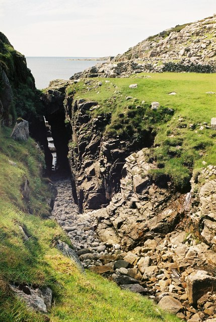
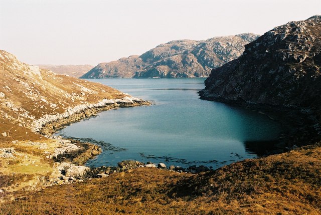
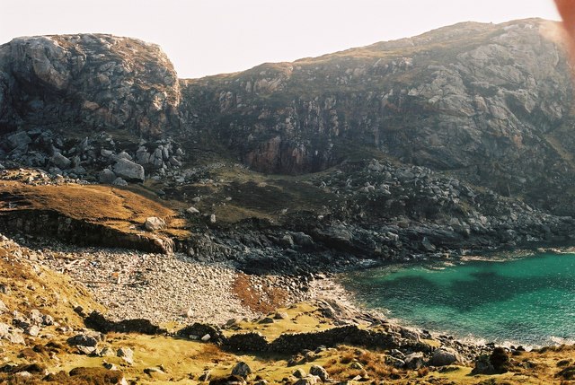
Rubha Carnach is a prominent coastal feature located in Ross-shire, Scotland. It is a headland that juts out into the North Atlantic Ocean, forming a distinct point on the coastline. This stunning natural formation is known for its rugged beauty and dramatic cliffs, making it a popular destination for both locals and tourists.
The headland is characterized by its steep and rocky cliffs, which rise up to impressive heights, offering breathtaking views of the surrounding area. The cliffs are adorned with lush vegetation, including hardy grasses and wildflowers, adding to the visual appeal of the landscape.
At the tip of Rubha Carnach, there is a lighthouse that serves as a navigational aid for ships entering the nearby Cromarty Firth. This lighthouse has been in operation since the 19th century and is an iconic landmark of the area. It stands tall against the backdrop of the open sea, its bright light guiding ships safely through the treacherous waters.
The headland is also home to a diverse range of wildlife, including seabirds such as puffins, gannets, and kittiwakes, which can be spotted nesting on the cliffs. The surrounding waters are teeming with marine life, making it a popular spot for fishing and birdwatching enthusiasts.
Visitors to Rubha Carnach can enjoy a variety of outdoor activities, including hiking along the coastal trails, exploring the rocky shoreline, or simply taking in the awe-inspiring views. The headland offers a peaceful and serene atmosphere, making it an ideal destination for nature lovers and those seeking a tranquil escape from the bustling city life.
If you have any feedback on the listing, please let us know in the comments section below.
Rubha Carnach Images
Images are sourced within 2km of 58.06376/-7.0759049 or Grid Reference NB0019. Thanks to Geograph Open Source API. All images are credited.


Rubha Carnach is located at Grid Ref: NB0019 (Lat: 58.06376, Lng: -7.0759049)
Unitary Authority: Na h-Eileanan an Iar
Police Authority: Highlands and Islands
What 3 Words
///puppy.tweed.stocked. Near Tarbert, Na h-Eileanan Siar
Related Wikis

Eilean Mhealasta
Eilean Mhealasta (Mealista Island) is an uninhabited island off the west coast of Lewis in the Outer Hebrides of Scotland. It takes its name from Mealista...

Game pieces of the Lewis chessmen hoard
Game pieces of the Lewis chessmen hoard include the ninety-three game pieces of the Lewis chessmen hoard found on the Isle of Lewis in the Outer Hebrides...

Mealista
Mealista (Scottish Gaelic: Mealasta) was a township in the west of the Isle of Lewis. It is currently largely uninhabited due to the Highland Clearances...

Scarp, Scotland
Scarp (Scottish Gaelic: An Sgarp) is an uninhabited island in the Outer Hebrides of Scotland, west of Hushinish on Harris. Once inhabited, the island was...

Brenish
Brenish (Scottish Gaelic: Brèinis) is a small village situated on the west coast of the Isle of Lewis, which is part of the Outer Hebrides of Scotland...

Hushinish
Huisinish or Hushinish (Scottish Gaelic Hùisinis) is a remote place on the west coast of Harris in the Outer Hebrides of Scotland. It lies at the end of...

Tiorga Mor
Tiorga Mor (679 m) is a mountain in Harris, in the Outer Hebrides of Scotland. The most westerly peak of the high mountains of Harris, it is a very rugged...

Uladail
Uladail is a location near Amhuinnsuidhe, on Harris in the Outer Hebrides, Scotland. Sron Ulladail is a sheer cliff which at 370 metres (1,210 ft) is one...
Nearby Amenities
Located within 500m of 58.06376,-7.0759049Have you been to Rubha Carnach?
Leave your review of Rubha Carnach below (or comments, questions and feedback).