Sròn na Faing

Coastal Feature, Headland, Point in Ross-shire

Scotland

Sròn na Faing

Mangurstadh Coastline Looking South The cliffs here are spectacular and the Lewisian Gneiss makes for some great climbing.
Mangurstadh Coastline Looking South Credit: RIJones

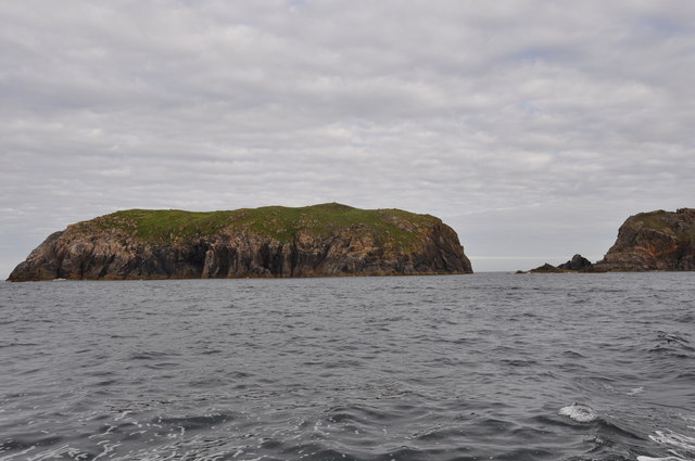
Sròn na Faing is a prominent coastal feature located in Ross-shire, Scotland. It is a headland that juts out into the sea, forming a distinctive point along the coastline. The name "Sròn na Faing" translates to "Nose of the Slope" in English, which aptly describes its physical characteristics.

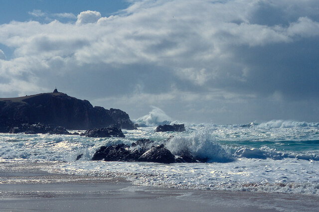
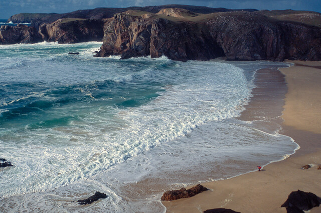
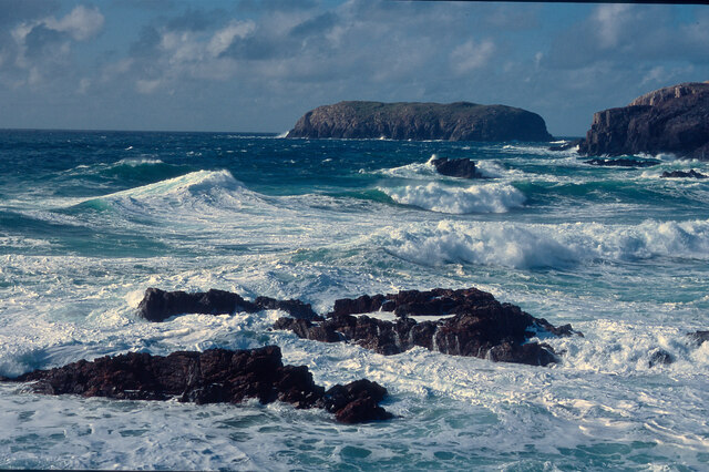
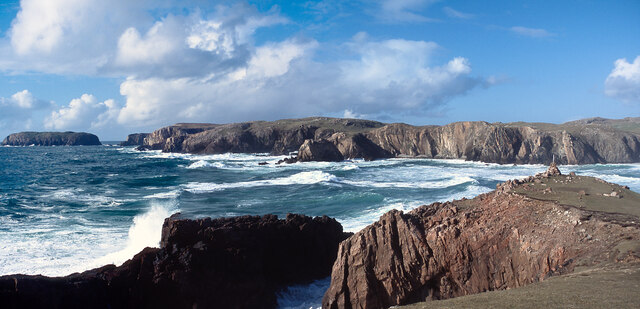
This headland is situated on the western coast of Ross-shire, overlooking the North Atlantic Ocean. It is known for its rugged and dramatic landscape, characterized by steep cliffs and rocky outcrops. The headland is composed of several layers of sedimentary rocks, including sandstone and shale, which have been shaped over millions of years by the erosive forces of the sea.

Sròn na Faing offers breathtaking views of the surrounding coastal scenery, with panoramic vistas of the ocean and nearby islands. It is a popular destination for nature enthusiasts and hikers, who can explore the headland's diverse flora and fauna. The area is home to various seabird species, such as gulls and puffins, which nest along the cliffs.

In addition to its natural beauty, Sròn na Faing also holds historical significance. It is believed to have been a strategic vantage point during ancient times, offering a commanding view of the sea and potential invaders. Today, remnants of ancient fortifications can still be seen on the headland, adding to its allure and cultural value.

Overall, Sròn na Faing is a captivating coastal feature in Ross-shire, offering a combination of stunning natural scenery, wildlife, and historical interest.

If you have any feedback on the listing, please let us know in the comments section below.

Sròn na Faing Images

Images are sourced within 2km of 58.165569/-7.0920192 or Grid Reference NB0030. Thanks to Geograph Open Source API. All images are credited.

Mangurstadh Coastline Looking South The cliffs here are spectacular and the Lewisian Gneiss makes for some great climbing.
Mangurstadh Coastline Looking South
The cliffs here are spectacular and the Lewisian Gneiss makes for some great climbing.
Eilean Molach Showing the narrow gap between it and mainland Lewis.
Eilean Molach
Showing the narrow gap between it and mainland Lewis.
Road, Peat Cuttings and Moorland
Geodh' an Fhithich Sea Stacks
A pretty lochan This is Lochan Mealabhat, two thirds of which is in this square. It is a pleasing geograph photo, because it clearly shows what you can see on the map: I'm standing on a little tongue of land that sticks out into the lochan, the tongue is in the square, and I'm looking across to a similar tongue.
A pretty lochan
This is Lochan Mealabhat, two thirds of which is in this square. It is a pleasing geograph photo, because it clearly shows what you can see on the map: I'm standing on a little tongue of land that sticks out into the lochan, the tongue is in the square, and I'm looking across to a similar tongue.
Rubh' an Taroin headland
Rubh' an Taroin
Rubh' an Taroin
Coastal moor at Mullach an Tàroin
North end of Traigh Mhangarstaidh A beautiful beach with a fine Atlantic swell pounding in.
North end of Traigh Mhangarstaidh
A beautiful beach with a fine Atlantic swell pounding in.
Atlantic swell, Traigh Mhangarstaidh An exciting time being beside to a tumultuous sea - and at close range.
Atlantic swell, Traigh Mhangarstaidh
An exciting time being beside to a tumultuous sea - and at close range.
Looking down on Traigh Mhangarstaidh A walk for the view with my son on the beach.
Looking down on Traigh Mhangarstaidh
A walk for the view with my son on the beach.
Sea off Traigh Mhangarstaidh Exhilarating!
Sea off Traigh Mhangarstaidh
Exhilarating!
Coast line near Traigh Mhangarstaidh A wide view from stitching images.  An amazing experience.
Coast line near Traigh Mhangarstaidh
A wide view from stitching images. An amazing experience.
Geodha an Fhithich Several ridges of rock have been eroded to form a series of jagged rock stacks north of Aird Feinis.
Geodha an Fhithich
Several ridges of rock have been eroded to form a series of jagged rock stacks north of Aird Feinis.
Geodha an Fhithich Several ridges of rock have been eroded to form a series of jagged rock stacks north of Aird Feinis.
Geodha an Fhithich
Several ridges of rock have been eroded to form a series of jagged rock stacks north of Aird Feinis.
Geodha an Fhithich The sea north of Aird Feinis is studded with jagged sea stacks formed from granite intruded into the local Lewisian gneiss.
Geodha an Fhithich
The sea north of Aird Feinis is studded with jagged sea stacks formed from granite intruded into the local Lewisian gneiss.
Aird Feinis
Aird Feinis
Geodha Sgoilte 12 Apostles on the Great Ocean Road eat your heart out.  This is the dramatic site of the proposed St Kilda Centre near Mangersta.
Geodha Sgoilte
12 Apostles on the Great Ocean Road eat your heart out. This is the dramatic site of the proposed St Kilda Centre near Mangersta.
Show me another place!

Sròn na Faing is located at Grid Ref: NB0030 (Lat: 58.165569, Lng: -7.0920192)

Unitary Authority: Na h-Eileanan an Iar

Police Authority: Highlands and Islands

What 3 Words

///former.subplot.pedicure. Near Carloway, Na h-Eileanan Siar

Related Wikis

Stac Dhòmhnaill Chaim

Stac Dhòmnuill Chaim, or Stac Dhòmhnaill Chaim, or Stac Domhnuill Chaim, is a fortified promontory located near Mangursta (or Mangersta, Scottish Gaelic...

Abhainn Dearg distillery

Abhainn Dearg distillery ( AV-in JAIRG) or Red River distillery is a Scotch whisky distillery in Uig, on the west coast of the Isle of Lewis in the Outer...

Gasker

Gasker is a small uninhabited islet in the Outer Hebrides of Scotland, 8 kilometres (4+1⁄2 nautical miles) southwest of Scarp, off the west coast of Harris...

Ardroil

Ardroil (Scottish Gaelic: Eadar Dhà Fhadhail) is a village on the Isle of Lewis in the Outer Hebrides, Scotland. Ardroil is within the parish of Uig....

Uig, Lewis

Uig (Scottish Gaelic: Ùig [uːkʲ]), also known as Sgìr' Ùig, is a civil parish and community in the west of the Isle of Lewis in the Outer Hebrides, Scotland...

Brenish

Brenish (Scottish Gaelic: Brèinis) is a small village situated on the west coast of the Isle of Lewis, which is part of the Outer Hebrides of Scotland...

Timsgarry

Timsgarry (Scottish Gaelic: Tuimisgearraidh) is a village on the Isle of Lewis, in the Outer Hebrides, Scotland. Timsgarry is home to the Baile na Cille...

Camas Uig

Camas Uig (Uig Bay) is a bay on the west coast of the Isle of Lewis, in the Outer Hebrides of Scotland. The Lewis Chessmen were discovered in the dunes...

Nearby Amenities

Located within 500m of 58.165569,-7.0920192
Bus Stop
Mangersta Village
Bus: yes
Naptan AtcoCode: 6010731745
Naptan Bearing: E
Naptan CommonName: Mangersta Village
Naptan Indicator: Mangersta Village
Naptan Landmark: Mangersta Village
Naptan NaptanCode: 94723789
Naptan Street: Mangersta Village
Naptan Verified: no
Shelter: no
Source: naptan_import
Lat/Long: 58.1697704/-7.0918812
Turning Circle
Lat/Long: 58.1697077/-7.0918304
Barrier: cattle_grid
Lat/Long: 58.1698227/-7.0917505
Mangersta Stack
Tourism: viewpoint
Lat/Long: 58.1685717/-7.0952906
Power: pole
Lat/Long: 58.1696804/-7.0908782
Power: pole
Lat/Long: 58.1696556/-7.0897536
Power: pole
Lat/Long: 58.1695841/-7.088589
Power: pole
Lat/Long: 58.1690313/-7.0878131
The data included in this document is from www.openstreetmap.org. The data is made available under ODbL.

Have you been to Sròn na Faing?

Leave your review of Sròn na Faing below (or comments, questions and feedback).