Rubha Loisgte
Coastal Feature, Headland, Point in Ross-shire
Scotland
Rubha Loisgte

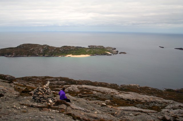
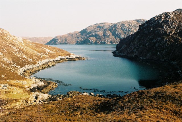
Rubha Loisgte, located in Ross-shire, Scotland, is a prominent headland that juts out into the North Atlantic Ocean. This coastal feature is known for its stunning natural beauty and its rugged cliffs, offering breathtaking views of the surrounding landscape.
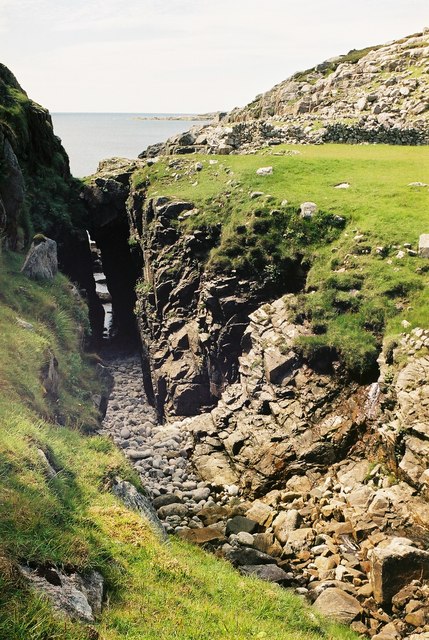
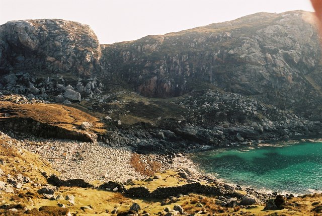
The headland is characterized by its rocky terrain, with steep cliffs that rise dramatically from the water's edge. These cliffs, which reach heights of up to 100 meters, are composed of ancient rock formations, giving the area a unique geological significance.
The headland is home to a diverse range of flora and fauna, with various species of seabirds nesting in the cliffs. Visitors to Rubha Loisgte may be lucky enough to spot seabirds such as puffins, guillemots, and razorbills, as well as the occasional seal or dolphin swimming in the waters below.
The area surrounding Rubha Loisgte is rich in history, with evidence of human occupation dating back thousands of years. The headland itself is believed to have been a significant landmark for ancient seafarers, providing a navigational point along the rugged Scottish coastline.
Today, Rubha Loisgte is a popular destination for nature enthusiasts, hikers, and photographers. The headland offers several walking trails that allow visitors to explore its stunning vistas, offering panoramic views of the ocean and the surrounding landscape.
In conclusion, Rubha Loisgte is a captivating headland located in Ross-shire, Scotland. Its rugged cliffs, diverse wildlife, and rich history make it a must-visit destination for those seeking to experience the natural beauty of the Scottish coast.
If you have any feedback on the listing, please let us know in the comments section below.
Rubha Loisgte Images
Images are sourced within 2km of 58.063899/-7.0812214 or Grid Reference NB0019. Thanks to Geograph Open Source API. All images are credited.


Rubha Loisgte is located at Grid Ref: NB0019 (Lat: 58.063899, Lng: -7.0812214)
Unitary Authority: Na h-Eileanan an Iar
Police Authority: Highlands and Islands
What 3 Words
///routine.hologram.amaze. Near Tarbert, Na h-Eileanan Siar
Related Wikis

Eilean Mhealasta
Eilean Mhealasta (Mealista Island) is an uninhabited island off the west coast of Lewis in the Outer Hebrides of Scotland. It takes its name from Mealista...

Game pieces of the Lewis chessmen hoard
Game pieces of the Lewis chessmen hoard include the ninety-three game pieces of the Lewis chessmen hoard found on the Isle of Lewis in the Outer Hebrides...

Mealista
Mealista (Scottish Gaelic: Mealasta) was a township in the west of the Isle of Lewis. It is currently largely uninhabited due to the Highland Clearances...

Scarp, Scotland
Scarp (Scottish Gaelic: An Sgarp) is an uninhabited island in the Outer Hebrides of Scotland, west of Hushinish on Harris. Once inhabited, the island was...
Nearby Amenities
Located within 500m of 58.063899,-7.0812214Have you been to Rubha Loisgte?
Leave your review of Rubha Loisgte below (or comments, questions and feedback).