Rubha Mhic-ille-mhalaidh

Coastal Feature, Headland, Point in Inverness-shire

Scotland

Rubha Mhic-ille-mhalaidh

Hamarsaigh From the ferry into Lochmaddy.
Hamarsaigh Credit: Hugh Venables

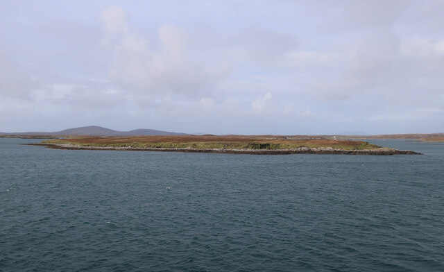
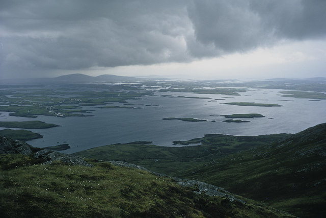
Rubha Mhic-ille-mhalaidh, located in Inverness-shire, Scotland, is a prominent coastal feature known for its remarkable headland and picturesque point. This stunning geographical formation is situated on the western coast of Scotland, near the village of Gairloch.

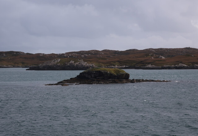
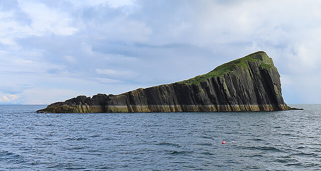
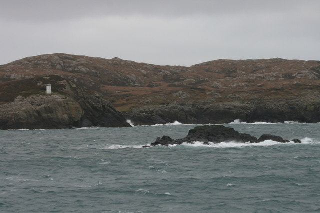
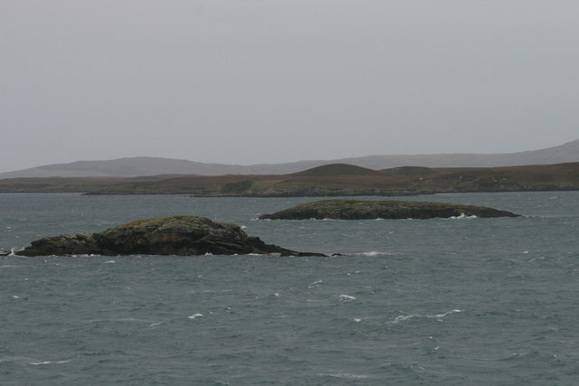
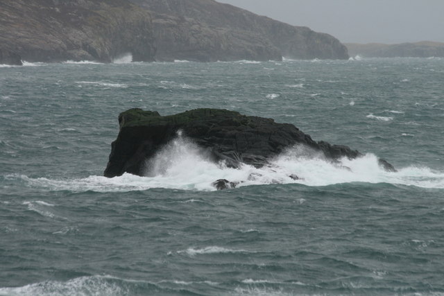
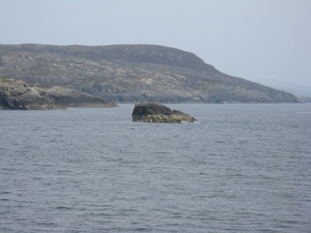
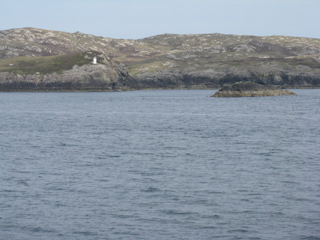
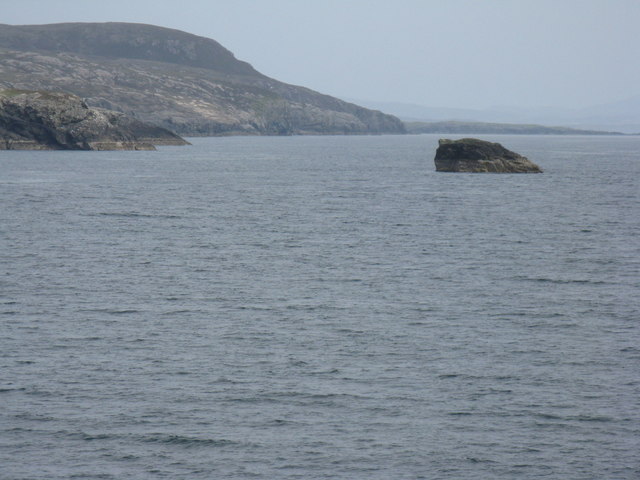
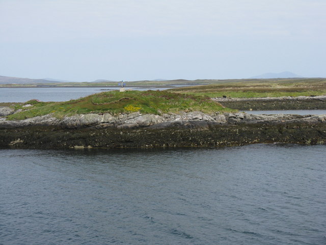
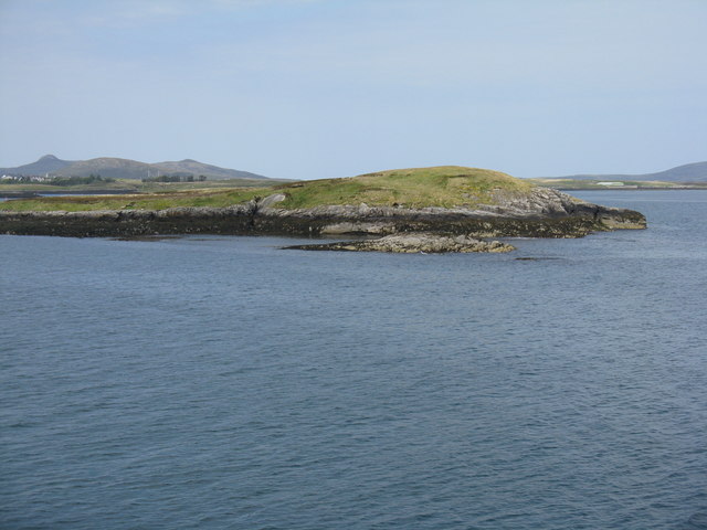
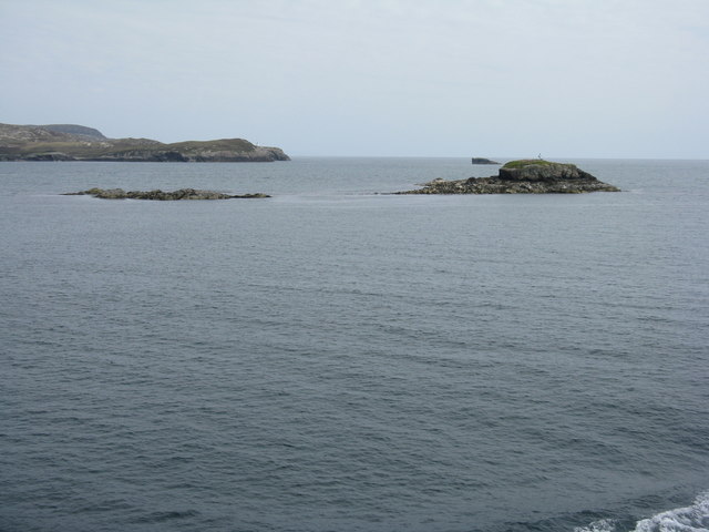
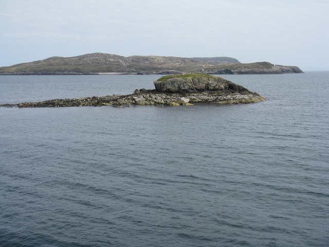
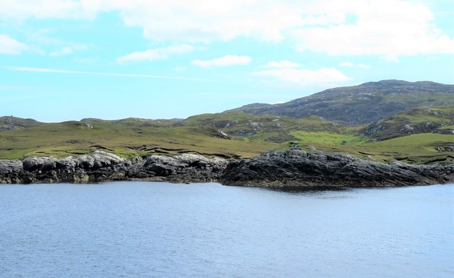
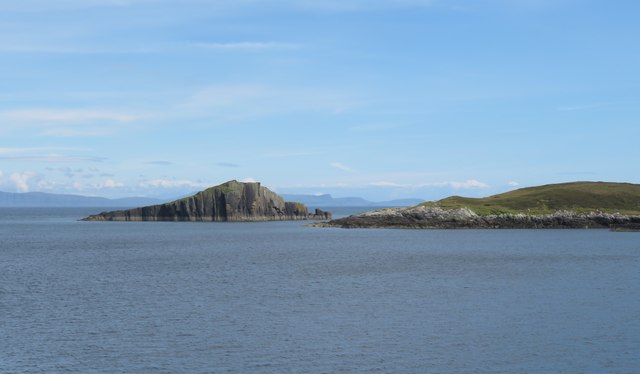
Rubha Mhic-ille-mhalaidh is characterized by its rugged cliffs, which rise majestically from the surrounding sea. These cliffs offer breathtaking panoramic views of the North Atlantic Ocean and the nearby islands. The headland itself juts out into the water, creating a prominent and eye-catching feature along the coast.

The point of Rubha Mhic-ille-mhalaidh is a popular destination for nature enthusiasts and hikers, as it offers excellent opportunities for exploration and outdoor activities. Visitors can enjoy scenic walks along the coastal paths, taking in the dramatic views and observing the diverse wildlife that inhabits the area. Seabird colonies, including puffins and guillemots, can often be spotted nesting on the cliffs, while seals and dolphins can occasionally be seen swimming in the waters below.

In addition to its natural beauty, Rubha Mhic-ille-mhalaidh also holds historical significance. The remains of an ancient broch, a type of Iron Age fortification, can be found on the headland. These ruins provide a glimpse into the area's rich past and offer archaeologists and history enthusiasts a fascinating insight into the lives of the people who once inhabited this rugged coastal region.

Overall, Rubha Mhic-ille-mhalaidh is a captivating coastal feature that combines stunning natural beauty, abundant wildlife, and a touch of history. Its picturesque headland and point make it a must-visit destination for those seeking an immersive and awe-inspiring experience in the heart of Inverness-shire.

If you have any feedback on the listing, please let us know in the comments section below.

Rubha Mhic-ille-mhalaidh Images

Images are sourced within 2km of 57.594141/-7.1128945 or Grid Reference NF9467. Thanks to Geograph Open Source API. All images are credited.

Hamarsaigh From the ferry into Lochmaddy.
Hamarsaigh
From the ferry into Lochmaddy.
Glas Eilean Mòr From the ferry into Lochmaddy.
Glas Eilean Mòr
From the ferry into Lochmaddy.
MV 'Hebrides' Leaving Lochmaddy The ferry is setting off for Uig in the Isle of Skye.
MV 'Hebrides' Leaving Lochmaddy
The ferry is setting off for Uig in the Isle of Skye.
Madadh Mòr Madadh Mòr means 'big dog (or wolf)' and the name is applied to this rock just outside Loch nam Madadh (Loch Maddy), whose name means 'loch of the dogs'. Its counterpart Madadh Beag, the 'small dog', is on the north of the loch. Clearly different from the prevailing Lewisian gneiss, it is in fact part of the Little Minch Sill complex. It is igneous in origin, formed between 23 and 66 million years ago and quite young by comparison with the 3000-million-year-old gneiss!
Madadh Mòr
Madadh Mòr means 'big dog (or wolf)' and the name is applied to this rock just outside Loch nam Madadh (Loch Maddy), whose name means 'loch of the dogs'. Its counterpart Madadh Beag, the 'small dog', is on the north of the loch. Clearly different from the prevailing Lewisian gneiss, it is in fact part of the Little Minch Sill complex. It is igneous in origin, formed between 23 and 66 million years ago and quite young by comparison with the 3000-million-year-old gneiss!
Madadh Beag to the Sou'east of Rubha an Fhigheadair The ferry out of Loch Maddy seems further north from the planned track than normal. There's a strong southerly wind blowing and the Minch looks so exciting.
Madadh Beag to the Sou'east of Rubha an Fhigheadair
The ferry out of Loch Maddy seems further north from the planned track than normal. There's a strong southerly wind blowing and the Minch looks so exciting.
An Glais-eilean Meadhonach Mind your navigation in these waters! Can you imagine sailing into Loch Maddy on foggy days prior to the advent of radar, radio beacons, and sonar?
An Glais-eilean Meadhonach
Mind your navigation in these waters! Can you imagine sailing into Loch Maddy on foggy days prior to the advent of radar, radio beacons, and sonar?
Hunched against a strong southerly - that's Madadh Beag What a sanctuary for fishes these rocks provide! Cast a line near here for the coalfish (Saith or coley) the Pollack (Lythe) and the Wrasse.
Hunched against a strong southerly - that's Madadh Beag
What a sanctuary for fishes these rocks provide! Cast a line near here for the coalfish (Saith or coley) the Pollack (Lythe) and the Wrasse.
Madadh Beag With the rocky slopes of Rubha na h-Aoir beyond. Seen from the ferry for Uig.
Madadh Beag
With the rocky slopes of Rubha na h-Aoir beyond. Seen from the ferry for Uig.
Lighthouse on Rubha an Fhigheadair With Madadh Beag in the near distance.
Lighthouse on Rubha an Fhigheadair
With Madadh Beag in the near distance.
Madadh Beag and Rubha na h-Aoir Looking from the Lochmaddy-Uig ferry.
Madadh Beag and Rubha na h-Aoir
Looking from the Lochmaddy-Uig ferry.
Ruigh Liath Part of a small, low island near the entrance to Lochmaddy harbour.
Ruigh Liath
Part of a small, low island near the entrance to Lochmaddy harbour.
Beacon on Ruigh Liath With Fathoire behind, to the right.
Beacon on Ruigh Liath
With Fathoire behind, to the right.
Fathoire - the eastern end A small island in Loch nam Madadh.
Fathoire - the eastern end
A small island in Loch nam Madadh.
Glas Eilean Mòr Looking northeast from the Lochmaddy-Uig ferry. The lighthouse on Rubha an Fhigheadair is just visible on the headland beyond.
Glas Eilean Mòr
Looking northeast from the Lochmaddy-Uig ferry. The lighthouse on Rubha an Fhigheadair is just visible on the headland beyond.
Glas Eilean Mòr Looking northeast from the Lochmaddy-Uig ferry. Beyond is the headland of Rubha an Fhigheadair
Glas Eilean Mòr
Looking northeast from the Lochmaddy-Uig ferry. Beyond is the headland of Rubha an Fhigheadair
Rubha Mhic ille-mhalaidh Headland seen off the port side of the MV Hebrides as she slows on the approach to Lochmaddy. If a certain on line translation service is correct, this is 'Son in-law's headland'. There's a navigation light on the rocks to the right of centre with solar panels visible.
Rubha Mhic ille-mhalaidh
Headland seen off the port side of the MV Hebrides as she slows on the approach to Lochmaddy. If a certain on line translation service is correct, this is 'Son in-law's headland'. There's a navigation light on the rocks to the right of centre with solar panels visible.
Madadh Mor from the ferry The sea stack of Madadh Mor from the MV Hebrides as she steams towards Lochmaddy. I'm sure the captain was kind enough to edge into this square to enable a 'geograph' to be taken.
Madadh Mor from the ferry
The sea stack of Madadh Mor from the MV Hebrides as she steams towards Lochmaddy. I'm sure the captain was kind enough to edge into this square to enable a 'geograph' to be taken.
Hebridean line squall, North Lee, Lochmaddy The hill was being climbed instead of sailing the coast of North Uist in a full westerly gale.
Hebridean line squall, North Lee, Lochmaddy
The hill was being climbed instead of sailing the coast of North Uist in a full westerly gale.
Show me another place!

Rubha Mhic-ille-mhalaidh is located at Grid Ref: NF9467 (Lat: 57.594141, Lng: -7.1128945)

Unitary Authority: Na h-Eileanan an Iar

Police Authority: Highlands and Islands

What 3 Words

///hiding.revamping.decades. Near Lochmaddy, Na h-Eileanan Siar

Related Wikis

Weavers Point

Weavers Point (Scottish Gaelic: Rubha an Fhigheadair) is a headland to the north of the entrance to Loch Maddy, on the north eastern coastline of North...

Taigh Chearsabhagh

Taigh Chearsabhagh is an arts centre and museum in Lochmaddy on the island of North Uist, Scotland.Taigh Chearsabhagh was built in 1741 and originally...

Lochmaddy

Lochmaddy (Scottish Gaelic: Loch nam Madadh [l̪ˠɔx nə ˈmat̪əɣ], "Loch of the Hounds") is the administrative centre of North Uist in the Outer Hebrides...

Ceallasaigh Beag

Ceallasaigh Beag (or Keallasay Beg) is a low-lying island in Loch Maddy off North Uist in the Outer Hebrides of Scotland. This an area of shallow lagoons...

Nearby Amenities

Located within 500m of 57.594141,-7.1128945
Seamark Light Character: Fl
Seamark Light Colour: red
Seamark Light Height: 7
Seamark Light Period: 4
Seamark Light Range: 5
Seamark Light Reference: A 3996.6
Seamark Light Sequence: 0.3+(3.7)
Seamark Type: light_minor
Source: US NGA Pub. 114. 2011-05-26.
Lat/Long: 57.59605/-7.1126
The data included in this document is from www.openstreetmap.org. The data is made available under ODbL.

Have you been to Rubha Mhic-ille-mhalaidh?

Leave your review of Rubha Mhic-ille-mhalaidh below (or comments, questions and feedback).