Rubha Dubh

Coastal Feature, Headland, Point in Inverness-shire

Scotland

Rubha Dubh

Flodda causeway
Flodda causeway Credit: Catherine Morgan

Rubha Dubh is a prominent coastal feature located in Inverness-shire, Scotland. It is a headland that extends out into the North Atlantic Ocean, forming a distinct point along the rugged coastline. The name "Rubha Dubh" translates to "black point" in Gaelic, which is fitting considering the dark, rocky cliffs that characterize the area.

Situated approximately 10 miles northwest of the town of Ullapool, Rubha Dubh offers breathtaking views of the surrounding landscape. The headland is known for its dramatic cliffs, which rise steeply from the sea, creating a striking contrast against the azure waters. These cliffs provide a nesting site for a variety of seabirds, including puffins, guillemots, and razorbills, making the area a haven for birdwatchers.

The rugged coastline of Rubha Dubh is also home to several caves and sea stacks, which add to its natural beauty and allure. These geological formations have been shaped by years of erosion from the powerful waves, creating unique and awe-inspiring structures that attract photographers and nature enthusiasts alike.

Access to Rubha Dubh is relatively straightforward, with a well-maintained footpath leading visitors to the headland. The path offers stunning views along the way, allowing visitors to appreciate the surrounding flora and fauna. Additionally, the headland can be reached by boat, providing an alternative perspective from the sea.

Overall, Rubha Dubh is a must-visit destination for those seeking to experience the raw beauty of the Scottish coastline. Its towering cliffs, diverse wildlife, and captivating geological formations make it a remarkable coastal feature that leaves a lasting impression on all who visit.

If you have any feedback on the listing, please let us know in the comments section below.

Rubha Dubh Images

Images are sourced within 2km of 57.489231/-7.2580276 or Grid Reference NF8556. Thanks to Geograph Open Source API. All images are credited.
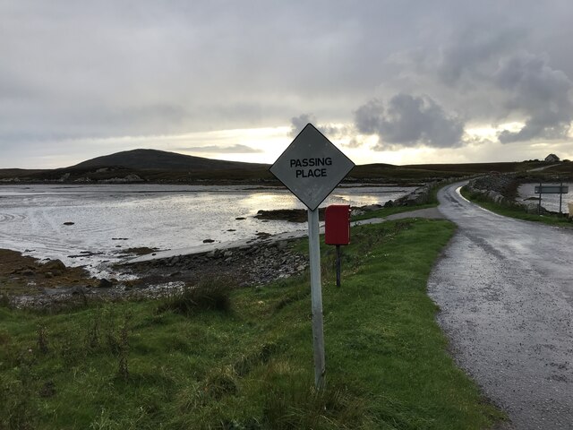
Flodda causeway
Flodda causeway
NCN780 on Grimsay Looking east, Loch an Fhaing on the left and Eaval, North Uist, in the distance.
NCN780 on Grimsay
Looking east, Loch an Fhaing on the left and Eaval, North Uist, in the distance.
Signpost on Grimsay The house beyond the end of Loch an Fhaing is marked as a Post Office on the map, but the may not be up to date information.
Signpost on Grimsay
The house beyond the end of Loch an Fhaing is marked as a Post Office on the map, but the may not be up to date information.
Bus stop and post box on Grimsay At the road-end of a loop that leaves the main road [A865].
Bus stop and post box on Grimsay
At the road-end of a loop that leaves the main road [A865].
House on Grimsay Looking across Bog Cotton from the A865.
House on Grimsay
Looking across Bog Cotton from the A865.
Gearraidh Dubh Looking over the shore near Gearraidh Dubh towards Eabhal.
Gearraidh Dubh
Looking over the shore near Gearraidh Dubh towards Eabhal.
Loch na Faoileag on Grimsay One of many small islets on Loch na Faoileag on the Isle of Grimsay
Loch na Faoileag on Grimsay
One of many small islets on Loch na Faoileag on the Isle of Grimsay
Loch na Faoileag Shoreline A view along the shoreline to north west finger on Loch na Faoileag (Isle of Grimsay) .Taken on the opposite bank from the roadside.
Loch na Faoileag Shoreline
A view along the shoreline to north west finger on Loch na Faoileag (Isle of Grimsay) .Taken on the opposite bank from the roadside.
Loch na Faoileag Cairn A small cairn situated at the south-eastern end of Loch na Faoileag.
Loch na Faoileag Cairn
A small cairn situated at the south-eastern end of Loch na Faoileag.
Near Gearraidh Dubh
Near Gearraidh Dubh
Oitir Mhòr
Oitir Mhòr
Bagh Sgotbheinn Not all Hebridean buildings fall into disrepair. I note that Dave Fergusson's 2007 photograph includes this small building, but now, twelve years later it has a new roof and is looking well cared for.
Bagh Sgotbheinn
Not all Hebridean buildings fall into disrepair. I note that Dave Fergusson's 2007 photograph includes this small building, but now, twelve years later it has a new roof and is looking well cared for.
Eilean an t-Seagail Seating located at a parking spot just off the A865 near Baile Glas on Benbecula.
Eilean an t-Seagail
Seating located at a parking spot just off the A865 near Baile Glas on Benbecula.
The summit region of Grimsay Grimsay is a low island between North Uist and Benbecula. It is difficult to be certain of its highest point, but this eminence, 25m or so above Mean Sea Level, is a good contender.
The summit region of Grimsay
Grimsay is a low island between North Uist and Benbecula. It is difficult to be certain of its highest point, but this eminence, 25m or so above Mean Sea Level, is a good contender.
Road on Eilean na h-Airigh Leaving the causeway from Benbecula and heading for Grimsay and North Uist. Eaval / Eabhal is the North Uist mountain in the distance.
<span class="nowrap"><a title="http://www.isle-of-benbecula.co.uk/" rel="nofollow ugc noopener" href="http://www.isle-of-benbecula.co.uk/">Link</a><img style="margin-left:2px;" alt="External link" title="External link - shift click to open in new window" src="https://s1.geograph.org.uk/img/external.png" width="10" height="10"/></span>
Road on Eilean na h-Airigh
Leaving the causeway from Benbecula and heading for Grimsay and North Uist. Eaval / Eabhal is the North Uist mountain in the distance. LinkExternal link
Baile Glas, Grimsay Hamlet on the causewayed road between Benbecula and North Uist.
<span class="nowrap"><a title="http://www.isle-of-benbecula.co.uk/" rel="nofollow ugc noopener" href="http://www.isle-of-benbecula.co.uk/">Link</a><img style="margin-left:2px;" alt="External link" title="External link - shift click to open in new window" src="https://s1.geograph.org.uk/img/external.png" width="10" height="10"/></span>
Baile Glas, Grimsay
Hamlet on the causewayed road between Benbecula and North Uist. LinkExternal link
Sand Flats at Grimsay Tidal flats between Grimsay (foreground) and North Uist (background). Eaval / Eabhal is the distinctive mountain.
Sand Flats at Grimsay
Tidal flats between Grimsay (foreground) and North Uist (background). Eaval / Eabhal is the distinctive mountain.
Sandy inlet on the coast of Grimsay One of a maze of inlets and channels around Grimsay. This view is interesting as there are remains of old field walls [possibly iron age/centre picture] visible in the sand, indicating a lower sea level at some time. Cloud capped Eabhal rises in the distance.
Sandy inlet on the coast of Grimsay
One of a maze of inlets and channels around Grimsay. This view is interesting as there are remains of old field walls [possibly iron age/centre picture] visible in the sand, indicating a lower sea level at some time. Cloud capped Eabhal rises in the distance.
Show me another place!

Rubha Dubh is located at Grid Ref: NF8556 (Lat: 57.489231, Lng: -7.2580276)

Unitary Authority: Na h-Eileanan an Iar

Police Authority: Highlands and Islands

What 3 Words

///universally.positions.stepping. Near Balivanich, Na h-Eileanan Siar

Related Wikis

Grimsay

Grimsay (Scottish Gaelic: Griomasaigh) is a tidal island in the Outer Hebrides of Scotland. == Geography == Grimsay is the largest of the low-lying stepping...

Baile Glas

Baile Glas or Ballaglasa (Scottish Gaelic: Am Baile Glas) is a settlement on Grimsay in the Outer Hebrides, Scotland. Ballaglasa is within the parish of...

Flodaigh

Flodaigh is a tidal island lying to the north of Benbecula and south of Grimsay in the Outer Hebrides, Scotland. It is connected to Benbecula by a causeway...

Fraoch-Eilean

Fraoch-eilean is a small island with an uncertain population north of Benbecula in the Outer Hebrides of Scotland. It is about 55 hectares (140 acres...

Nearby Amenities

Located within 500m of 57.489231,-7.2580276
Created By: dmgroom_coastlines
Lat/Long: 57.48586/-7.25619
Created By: dmgroom_coastlines
Lat/Long: 57.48925/-7.26125
Passing Place
Lat/Long: 57.4906237/-7.2557351
Passing Place
Lat/Long: 57.486237/-7.252485
Barrier: cattle_grid
Lat/Long: 57.4868405/-7.2557534
Passing Place
Lat/Long: 57.4868391/-7.2546683
Passing Place
Lat/Long: 57.4915276/-7.2580672
Turning Circle
Turning Circle: knuckle
Lat/Long: 57.4917795/-7.2555342
Barrier: cattle_grid
Lat/Long: 57.4926086/-7.2620139
Turning Circle
Lat/Long: 57.4908414/-7.2543656
Bàgh Dubh
Natural: bay
Lat/Long: 57.4910836/-7.2626281
Power: pole
Lat/Long: 57.4931363/-7.2618476
Power: pole
Lat/Long: 57.4928581/-7.2615365
Power: pole
Lat/Long: 57.4922671/-7.260764
Power: pole
Lat/Long: 57.4919586/-7.2604019
Power: pole
Lat/Long: 57.4916314/-7.2600103
Power: pole
Lat/Long: 57.4913647/-7.2596724
Power: pole
Lat/Long: 57.4924502/-7.2623304
Power: pole
Lat/Long: 57.4909809/-7.2547011
Power: pole
Lat/Long: 57.4914328/-7.254959
Power: pole
Lat/Long: 57.4903689/-7.2549617
Power: pole
Lat/Long: 57.4904873/-7.254454
Power: pole
Lat/Long: 57.4890495/-7.2567612
Power: pole
Lat/Long: 57.489624/-7.2556116
Power: pole
Lat/Long: 57.4877964/-7.255805
Power: pole
Lat/Long: 57.4878325/-7.2552275
Power: pole
Lat/Long: 57.4875698/-7.2548945
Power: pole
Lat/Long: 57.4873128/-7.2552705
Power: pole
Lat/Long: 57.4884677/-7.2560306
Power: pole
Lat/Long: 57.4869808/-7.2541585
Power: pole
Lat/Long: 57.4865794/-7.2536321
Power: pole
Lat/Long: 57.4860077/-7.252931
Power: pole
Lat/Long: 57.489746/-7.2576287
Power: pole
Lat/Long: 57.4900235/-7.2564123
Power: pole
Lat/Long: 57.4902722/-7.2582912
Power: pole
Lat/Long: 57.4907537/-7.258884
Power: pole
Lat/Long: 57.4868729/-7.2559362
Passing Place
Lat/Long: 57.4896019/-7.2557256
Power: pole
Lat/Long: 57.4901604/-7.2558734
Barrier: cattle_grid
Lat/Long: 57.4912789/-7.256088
Passing Place
Lat/Long: 57.4911806/-7.2561564
The data included in this document is from www.openstreetmap.org. The data is made available under ODbL.

Have you been to Rubha Dubh?

Leave your review of Rubha Dubh below (or comments, questions and feedback).