Creag an Eilein

Coastal Feature, Headland, Point in Inverness-shire

Scotland

Creag an Eilein

Old peat cuttings near Camas an Lochain South Uist Old peat cutting showing historical settlement near the SE tip of South Uist
Old peat cuttings near Camas an Lochain South Uist Credit: Pete Lynn

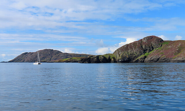
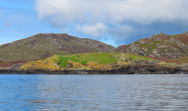
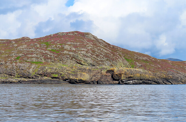
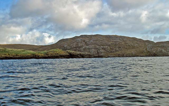
Creag an Eilein is a stunning coastal headland located in Inverness-shire, Scotland. The name Creag an Eilein translates to "rock of the island" in Gaelic, referencing the rocky terrain and surrounding islands visible from the headland.

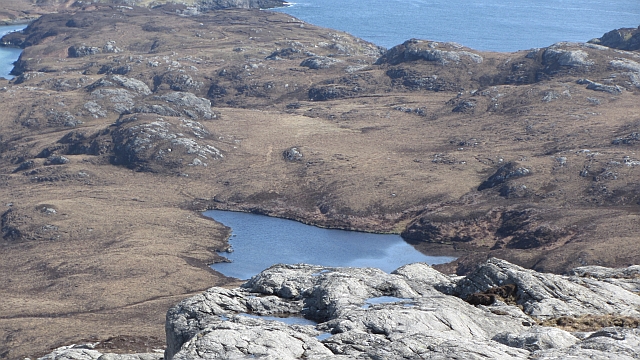
The headland is known for its dramatic cliffs and rugged coastline, offering breathtaking views of the surrounding sea and nearby islands. The area is popular among hikers and nature enthusiasts, who come to explore the diverse flora and fauna that call Creag an Eilein home.

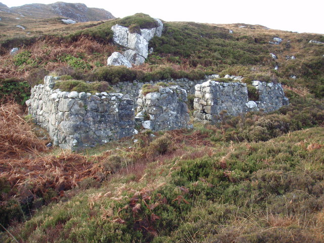
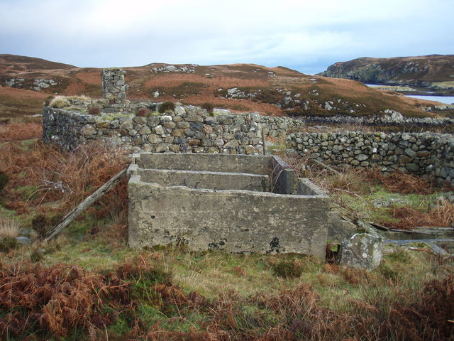
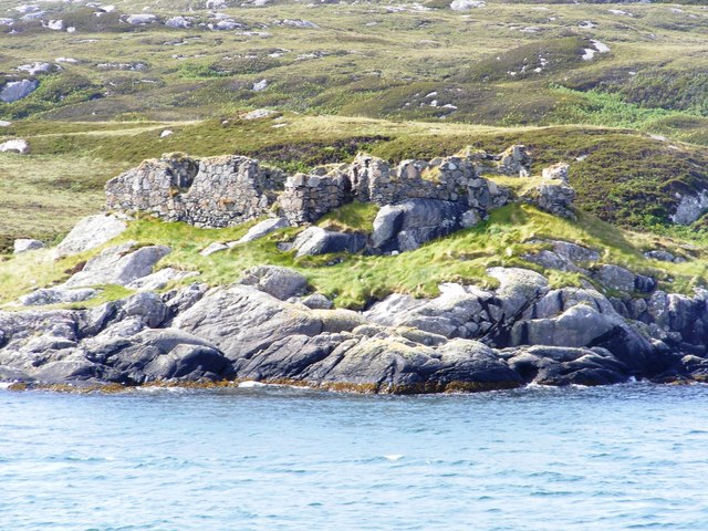
The headland is also steeped in history, with ancient ruins and archaeological sites scattered throughout the area. Visitors can explore the remains of old settlements and fortifications, providing a glimpse into the past of this historic location.

Creag an Eilein is a peaceful and picturesque spot, perfect for those looking to escape the hustle and bustle of everyday life and immerse themselves in the natural beauty of the Scottish Highlands. Whether you're a history buff, nature lover, or simply looking for a scenic spot to relax and unwind, Creag an Eilein has something to offer everyone.

If you have any feedback on the listing, please let us know in the comments section below.

Creag an Eilein Images

Images are sourced within 2km of 57.11015/-7.2233705 or Grid Reference NF8314. Thanks to Geograph Open Source API. All images are credited.

Old peat cuttings near Camas an Lochain South Uist Old peat cutting showing historical settlement near the SE tip of South Uist
Old peat cuttings near Camas an Lochain South Uist
Old peat cutting showing historical settlement near the SE tip of South Uist
Rubha Mealabhaig South Uist Ridge falling to Rubha Mealabhaig at SE tip of South Uist
Rubha Mealabhaig South Uist
Ridge falling to Rubha Mealabhaig at SE tip of South Uist
The summit of Maol na h-Ordaig This modest (106m) hill is near the extreme south-east corner of the Uists. We are looking almost due north to the hills on the east coast of South Uist.

It feels like some sort of achievement to get three of the four cardinal directions into the same sentence!
The summit of Maol na h-Ordaig
This modest (106m) hill is near the extreme south-east corner of the Uists. We are looking almost due north to the hills on the east coast of South Uist. It feels like some sort of achievement to get three of the four cardinal directions into the same sentence!
Rubha na h-Ordaig One of many peninsulas on the east coast of South Uist.
Rubha na h-Ordaig
One of many peninsulas on the east coast of South Uist.
Coast south of Rubha na h-Ordaig A catamaran hugs the coast one her way north past South Uist.
Coast south of Rubha na h-Ordaig
A catamaran hugs the coast one her way north past South Uist.
Nameless Headland There's an obvious directional fabric in these rock layers, but closer investigation would be required to find out whether it is the remnants of original bedding, or a set of imbricated thrust sheets.
Nameless Headland
There's an obvious directional fabric in these rock layers, but closer investigation would be required to find out whether it is the remnants of original bedding, or a set of imbricated thrust sheets.
A Green Hill We noticed that several of the rocks closest to the sea were covered with exceptionally bright green vegetation, and wondered if they had benefited from the guano left by many generations of seabirds.
A Green Hill
We noticed that several of the rocks closest to the sea were covered with exceptionally bright green vegetation, and wondered if they had benefited from the guano left by many generations of seabirds.
A Monocline A monocline is a fold with only one limb, and this looks like a good example, with just the right-hand end dipping from the horizontal. It looks, on cursory inspection, as if it is a set of thrust sheets, but it would need closer examination to be sure.
A Monocline
A monocline is a fold with only one limb, and this looks like a good example, with just the right-hand end dipping from the horizontal. It looks, on cursory inspection, as if it is a set of thrust sheets, but it would need closer examination to be sure.
Rubha Mealabhaig The most southerly headland on the east coast of South Uist.
Rubha Mealabhaig
The most southerly headland on the east coast of South Uist.
East side of   Ròineabhal Steepish ground with a series of parallel gneiss ribs falling to the east coast.
East side of Ròineabhal
Steepish ground with a series of parallel gneiss ribs falling to the east coast.
East side of   Ròineabhal Bogs at the southeast corner of South Uist.
East side of Ròineabhal
Bogs at the southeast corner of South Uist.
East of Ròineabhal Bogs and gneiss on the east side of South Uist.
East of Ròineabhal
Bogs and gneiss on the east side of South Uist.
Loch Mòraibh Loch Mòraibh on the southeast corner of South Uist.
Loch Mòraibh
Loch Mòraibh on the southeast corner of South Uist.
Sea inlet, Bun Sruth A small sea loch on the southeast corner of South Uist.
Sea inlet, Bun Sruth
A small sea loch on the southeast corner of South Uist.
Loch Ropàch A moorland lochan beneath Roineabhal.
Loch Ropàch
A moorland lochan beneath Roineabhal.
A small hill, Rubha Mealabhaig A small peak on the southeast corner of South Uist.
A small hill, Rubha Mealabhaig
A small peak on the southeast corner of South Uist.
Ruin by the path Looks like the ruin of a black house having low thick walls.  Nicely situated by a small burn with a lochan out front.  There always seems to be bracken near to old habitations.
Ruin by the path
Looks like the ruin of a black house having low thick walls. Nicely situated by a small burn with a lochan out front. There always seems to be bracken near to old habitations.
Ruin by the sheepwash The sheepwash is marked on the 1:25000 OS map.  This ruin has a chimney and walled enclosure so is more sophisticated than the first one along the path.  The sheepwash being a concrete construction would be much more recent.
Ruin by the sheepwash
The sheepwash is marked on the 1:25000 OS map. This ruin has a chimney and walled enclosure so is more sophisticated than the first one along the path. The sheepwash being a concrete construction would be much more recent.
Show me another place!

Creag an Eilein is located at Grid Ref: NF8314 (Lat: 57.11015, Lng: -7.2233705)

Unitary Authority: Na h-Eileanan an Iar

Police Authority: Highlands and Islands

What 3 Words

///booklets.doctors.spun. Near Lochboisdale, Na h-Eileanan Siar

Related Wikis

Bun Sruth

Bun Sruth is a small loch about 70 yards (64 m) in length at the southeast extremity of the island of South Uist in the Outer Hebrides of Scotland. It...

SS Politician

SS Politician was a cargo ship that ran aground off the coast of the Hebridean island of Eriskay in 1941. Her cargo included 22,000 cases of scotch whisky...

Calvay

Calvay (Scottish Gaelic: Calbhaigh) is a currently uninhabited island situated in the Sound of Eriskay in the Outer Hebrides, at grid reference NF810126...

Calvay Castle

Calvay Castle (Scottish Gaelic: Caisteal Calbhaigh) is a ruined castle on an islet close to the island of Calbhaigh, at the eastern approaches to Loch...

Nearby Amenities

Located within 500m of 57.11015,-7.2233705
Bun Sruth
Natural: bay
Lat/Long: 57.1106702/-7.2177906
The data included in this document is from www.openstreetmap.org. The data is made available under ODbL.

Have you been to Creag an Eilein?

Leave your review of Creag an Eilein below (or comments, questions and feedback).