Rubha na Creige Mòire
Coastal Feature, Headland, Point in Inverness-shire
Scotland
Rubha na Creige Mòire
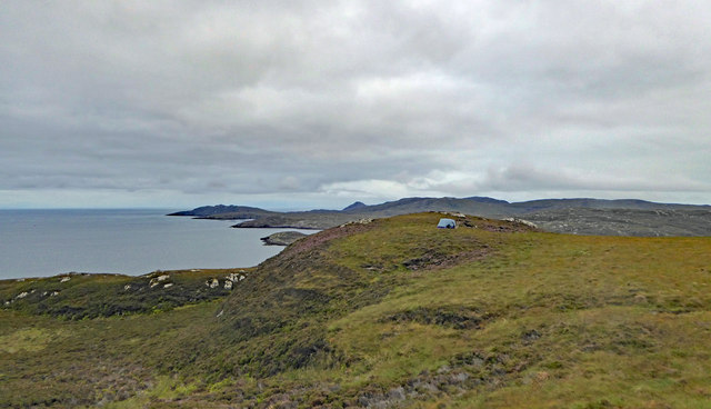
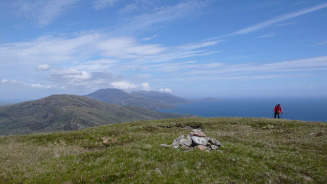
Rubha na Creige Mòire is a prominent headland located in Inverness-shire, Scotland. Situated along the coastal area, this awe-inspiring point stretches out into the North Atlantic Ocean. With its breathtaking views and rugged beauty, it has become a popular destination for tourists and nature enthusiasts.
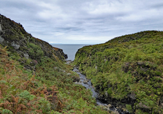
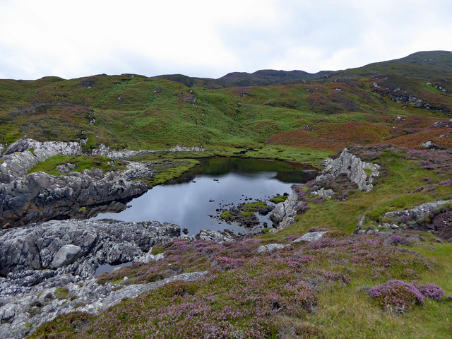
The headland is characterized by its towering cliffs, which rise dramatically from the sea. These cliffs are composed of sedimentary rocks that showcase a variety of colors, ranging from deep reds to vibrant oranges. The constant erosion from the crashing waves has sculpted the cliffs into unique formations, adding to the charm of the area.
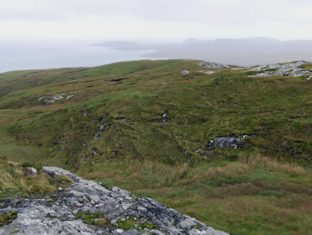
At the peak of Rubha na Creige Mòire, visitors are treated to panoramic vistas of the surrounding landscape. On clear days, one can see the distant mountains of the Scottish Highlands, creating a truly picturesque scene. The headland also offers a perfect vantage point for observing marine wildlife, including dolphins, seals, and various seabirds.
The coastal path that winds around the headland provides an opportunity for hikers to explore the area further. The path takes visitors along the edge of the cliffs, offering stunning views at every turn. It is important to note, however, that caution must be exercised while walking along the path due to the steep drops and unpredictable weather conditions.
Rubha na Creige Mòire is a place of natural beauty, offering a glimpse into the untamed wilderness of Scotland's coastline. Whether it's admiring the geological wonders, observing wildlife, or simply enjoying the serenity of the surroundings, a visit to this headland is an unforgettable experience for anyone seeking to connect with nature.
If you have any feedback on the listing, please let us know in the comments section below.
Rubha na Creige Mòire Images
Images are sourced within 2km of 57.164385/-7.2474168 or Grid Reference NF8220. Thanks to Geograph Open Source API. All images are credited.


Rubha na Creige Mòire is located at Grid Ref: NF8220 (Lat: 57.164385, Lng: -7.2474168)
Unitary Authority: Na h-Eileanan an Iar
Police Authority: Highlands and Islands
What 3 Words
///drags.arrow.grounded. Near Lochboisdale, Na h-Eileanan Siar
Nearby Locations
Related Wikis

Beinn Ruigh Choinnich
Beinn Ruigh Choinnich is a hill which overlooks the port of Lochboisdale on the east coast of the island of South Uist in the Outer Hebrides Scotland....
Calvay Castle
Calvay Castle (Scottish Gaelic: Caisteal Calbhaigh) is a ruined castle on an islet close to the island of Calbhaigh, at the eastern approaches to Loch...

Stuley
Stuley is an island lying to the east of South Uist in the Outer Hebrides, Scotland. It lies off the section of coastline between Loch Eynort and Loch...

Lochboisdale
Lochboisdale (Scottish Gaelic: Loch Baghasdail [ɫ̪ɔx ˈbɤːs̪t̪ɪl]) is the main village and port on the island of South Uist, Outer Hebrides, Scotland. Lochboisdale...

Auratote
Auratote (Scottish Gaelic: Oratobht) is a location on South Uist in the Outer Hebrides, Scotland. Auratote is within the parish of South Uist. == References... ==
Eileanan Iasgaich
Na h-Eileanan Iasgaich comprise a small uninhabited archipelago in Loch Boisdale, in the south east of the island of South Uist, in the Outer Hebrides...
Papar
The Papar (Icelandic pronunciation: [ˈpʰaːpar̥]; from Latin papa, via Old Irish, meaning "father" or "pope") were, according to early Icelandic sagas,...

Bun Sruth
Bun Sruth is a small loch about 70 yards (64 m) in length at the southeast extremity of the island of South Uist in the Outer Hebrides of Scotland. It...
Have you been to Rubha na Creige Mòire?
Leave your review of Rubha na Creige Mòire below (or comments, questions and feedback).