Rubha na h-Uamh

Coastal Feature, Headland, Point in Inverness-shire

Scotland

Rubha na h-Uamh

Setting up camp near Gighay Very remote, between Gighay and Hellisay.  Manx Shearwaters came home to roost in the night.  Very spooky sound!
Setting up camp near Gighay Credit: Phil Berry

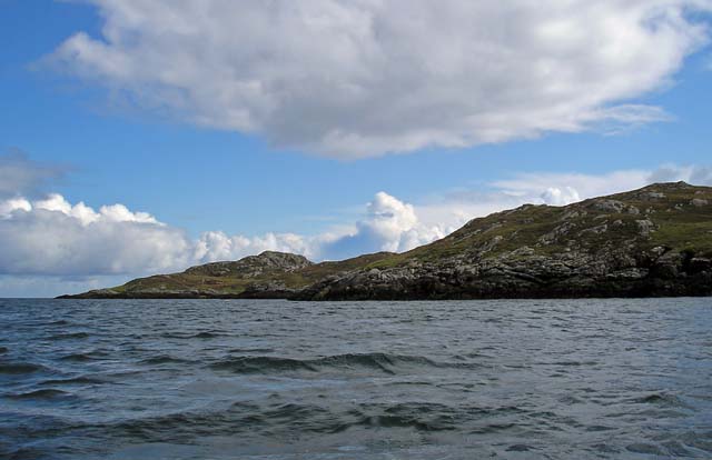
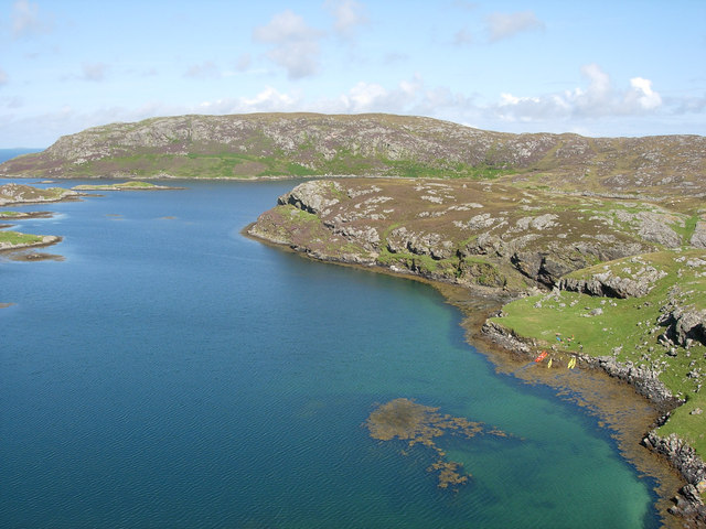
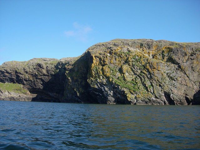
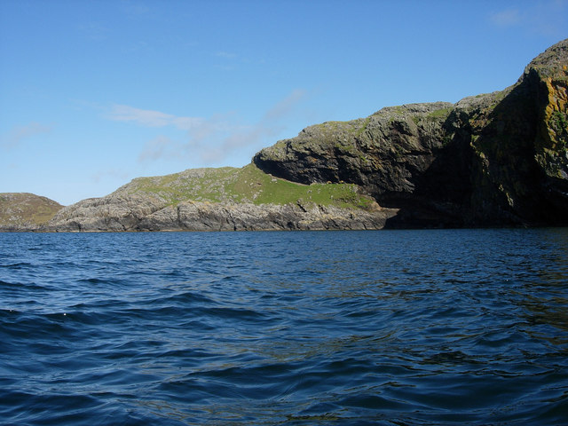
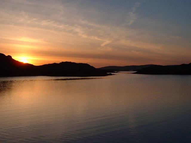
Rubha na h-Uamh is a picturesque headland located in Inverness-shire, Scotland. The name translates to "Cave Point" in Gaelic, which is fitting as the headland is known for its stunning sea caves and rock formations.

The headland is situated on the coastline, offering sweeping views of the surrounding waters and rugged cliffs. It is a popular destination for hikers and nature enthusiasts, who come to explore the coastal trails and take in the breathtaking scenery.

Rubha na h-Uamh is home to a diverse array of wildlife, including seabirds, seals, and occasionally dolphins and whales. The headland's rocky shores provide a habitat for marine life, making it a prime spot for birdwatching and wildlife photography.

Visitors to Rubha na h-Uamh can also discover the ruins of an ancient fort, adding a historical element to the natural beauty of the area. The headland is a tranquil and remote location, perfect for those looking to escape the hustle and bustle of city life and immerse themselves in the peacefulness of nature.

If you have any feedback on the listing, please let us know in the comments section below.

Rubha na h-Uamh Images

Images are sourced within 2km of 57.00807/-7.3330269 or Grid Reference NF7603. Thanks to Geograph Open Source API. All images are credited.

Setting up camp near Gighay Very remote, between Gighay and Hellisay.  Manx Shearwaters came home to roost in the night.  Very spooky sound!
Setting up camp near Gighay
Very remote, between Gighay and Hellisay. Manx Shearwaters came home to roost in the night. Very spooky sound!
Hintinish Bay, Hellisay The clear waters of Hintinish Bay, enclosed within the narrow sound between Hellisay and Gighay, provide perfect shelter for a small boat.
Hintinish Bay, Hellisay
The clear waters of Hintinish Bay, enclosed within the narrow sound between Hellisay and Gighay, provide perfect shelter for a small boat.
Sound of Gighay A secluded sound between the remote Hebridean islands of Hellisay and Gighay. Narrow, rock-bound entrances at both ends open into a sheltered lagoon. Martin Lawrence (in The Yachtsman's Pilot to the Western Isles) says that the flood tide either enters the sound from both ends, or it runs right through from SE to NW, or it does both, the former at springs and the latter at neaps. He also says that both entrances are choked with rocks, and, "Each visiting yacht seems to find more rocks, or perhaps the same rocks in different positions." The view is of the NW entrance, from Hellisay.
Sound of Gighay
A secluded sound between the remote Hebridean islands of Hellisay and Gighay. Narrow, rock-bound entrances at both ends open into a sheltered lagoon. Martin Lawrence (in The Yachtsman's Pilot to the Western Isles) says that the flood tide either enters the sound from both ends, or it runs right through from SE to NW, or it does both, the former at springs and the latter at neaps. He also says that both entrances are choked with rocks, and, "Each visiting yacht seems to find more rocks, or perhaps the same rocks in different positions." The view is of the NW entrance, from Hellisay.
Natural sheltered harbour This perfectly sheltered anchorage provided a perfect situation with no light pollution to observe the long-awaited gathering of the five naked-eye planets on the nights of May 4-5-6 in the western evening sky. In a single glance you could see all five planets, a feat not possible again for decades.
Natural sheltered harbour
This perfectly sheltered anchorage provided a perfect situation with no light pollution to observe the long-awaited gathering of the five naked-eye planets on the nights of May 4-5-6 in the western evening sky. In a single glance you could see all five planets, a feat not possible again for decades.
Mary Doune enters anchorage Not much room for manoeuvre here.
Mary Doune enters anchorage
Not much room for manoeuvre here.
A view into the natural harbour from Gighay/Gioghaigh
Kayaking along the coast of Hellisay/Theiliseigh Taken during a kayak journey from Barra to Eriskay and back.
Kayaking along the coast of Hellisay/Theiliseigh
Taken during a kayak journey from Barra to Eriskay and back.
Beinn a' Chàrnain on Hellisay/Theiliseigh
Looking up at Mullach a' Chàrnain on Hellisay/Theiliseigh
Along the coast of Gighay/Gioghaigh
Càrais, Hellisay Looking down from Meall Meadhonach.
Càrais, Hellisay
Looking down from Meall Meadhonach.
Blue Lagoon, Hellisay Looking from Meall Meadhonach towards Gighay.
Blue Lagoon, Hellisay
Looking from Meall Meadhonach towards Gighay.
Blue Lagoon, Hellisay Looking from Meall Meadhonach towards Gighay.
Blue Lagoon, Hellisay
Looking from Meall Meadhonach towards Gighay.
South coast of Hellisay Looking down from Meall Meadhonach.
South coast of Hellisay
Looking down from Meall Meadhonach.
Bò Bheanachan North-east side of Flodaigh. The island is uninhabited but grazed by sheep.
Bò Bheanachan
North-east side of Flodaigh. The island is uninhabited but grazed by sheep.
Coast of Flodaigh Taken on a Clearwater Paddling sea kayaking trip <span class="nowrap"><a title="http://www.clearwaterpaddling.com/index.asp" rel="nofollow ugc noopener" href="http://www.clearwaterpaddling.com/index.asp">Link</a><img style="margin-left:2px;" alt="External link" title="External link - shift click to open in new window" src="https://s1.geograph.org.uk/img/external.png" width="10" height="10"/></span>
Coast of Flodaigh
Taken on a Clearwater Paddling sea kayaking trip LinkExternal link
Meall Mòr The cliffs at the southern end of Hellisay.
Meall Mòr
The cliffs at the southern end of Hellisay.
Meall Mòr The southern end of Hellisay.
Meall Mòr
The southern end of Hellisay.
Show me another place!

Rubha na h-Uamh is located at Grid Ref: NF7603 (Lat: 57.00807, Lng: -7.3330269)

Unitary Authority: Na h-Eileanan an Iar

Police Authority: Highlands and Islands

What 3 Words

///trading.copes.steam. Near CastleBay, Na h-Eileanan Siar

Related Wikis

Hellisay

Hellisay (Scottish Gaelic: Theiliseigh) is a currently uninhabited island and is one of ten islands in the Sound of Barra, a Site of Community Importance...

Gighay

Gighay (Scottish Gaelic Gioghaigh) an uninhabited island off the northeast coast of Barra. It is one of ten islands in the Sound of Barra, a Site of Community...

Flodday (Sound of Barra)

Flodday or Flodaigh (Scottish Gaelic), is a currently uninhabited island that lies to the north east of Barra and is one of ten islands in the Sound of...

Fuiay

Fuiay (Scottish Gaelic: Fùidheigh) is an island in Scotland. It is one of ten islands in the Sound of Barra, a Site of Community Importance for conservation...

Nearby Amenities

Located within 500m of 57.00807,-7.3330269
Càrais
Place: locality
Lat/Long: 57.0123453/-7.3316946
Bàgh Hintis
Natural: bay
Lat/Long: 57.0111957/-7.3355741
Meall Mòr
Ele: 70
Natural: peak
Lat/Long: 57.0080084/-7.334527
Rubha na h-Uamh
Natural: cape
Lat/Long: 57.006237/-7.3302483
The data included in this document is from www.openstreetmap.org. The data is made available under ODbL.

Have you been to Rubha na h-Uamh?

Leave your review of Rubha na h-Uamh below (or comments, questions and feedback).