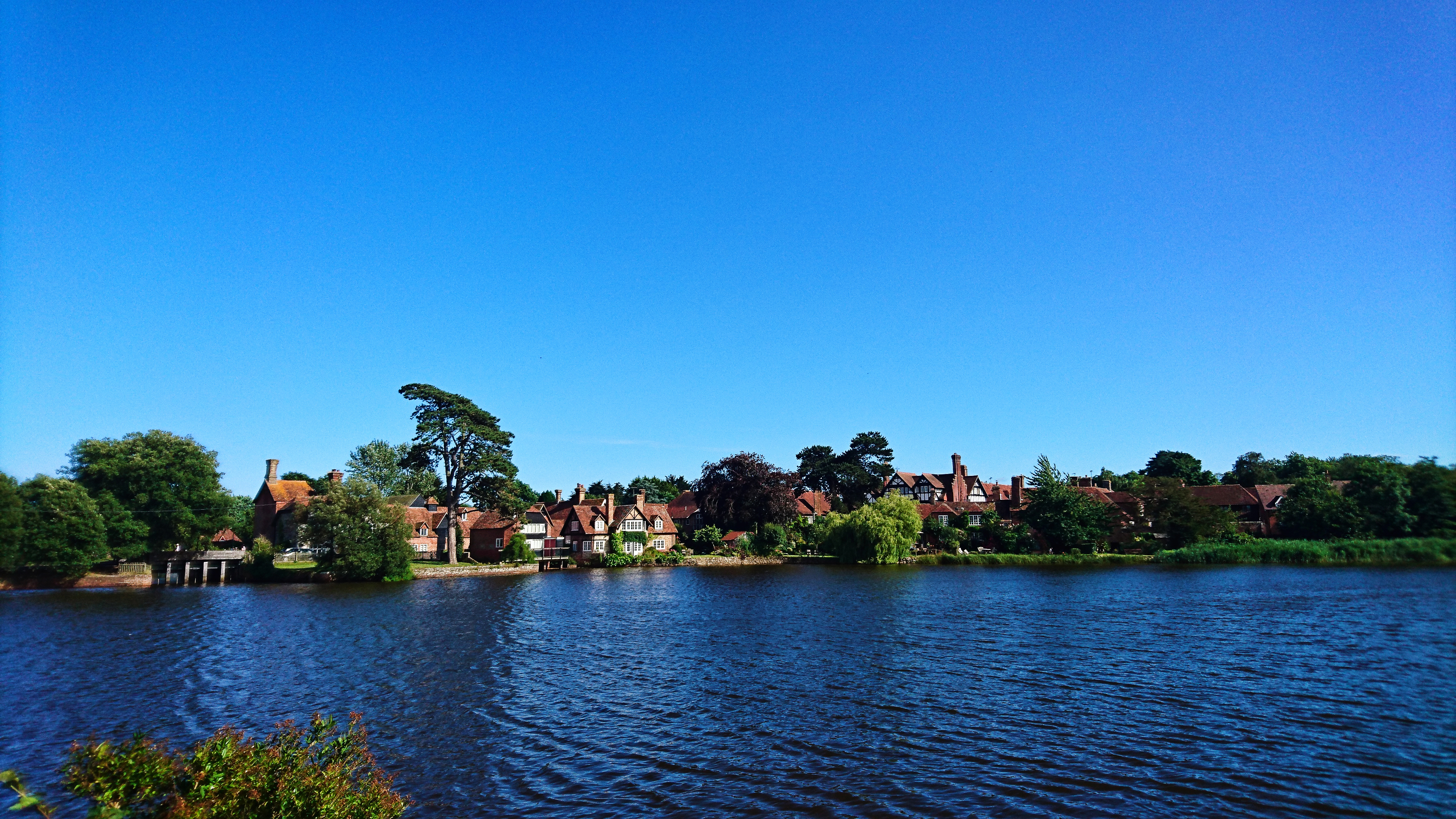
Furzey Lodge

Settlement in Hampshire New Forest

England

Furzey Lodge
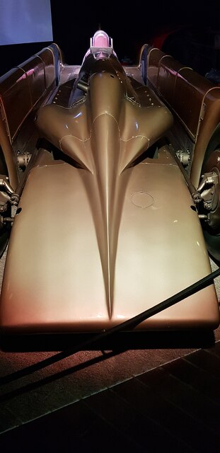
Golden Arrow at the National Motor Museum, Beaulieu There are of course dozens of remarkable vehicles on show at the National Motor Museum, Beaulieu - but this is still one of the sleekest - at nearly 100 years old. 
Golden Arrow, driven by Henry Segrave on the 11th March 1929 at Daytona Beach broke the land speed record clocking 231.446mph (372.459 km/h) on the 'flying mile'; Segrave was knighted for this achievement. The record held for nearly two years up to February 5, 1931.
Golden Arrow has a 23.9 Litre (1,460 in³) W12 Napier Lion aero engine (used in Supermarine aeroplanes).
Wikipedia article: <span class="nowrap"><a title="https://en.wikipedia.org/wiki/Golden_Arrow_(car)" rel="nofollow ugc noopener" href="https://en.wikipedia.org/wiki/Golden_Arrow_(car)">Link</a><img style="margin-left:2px;" alt="External link" title="External link - shift click to open in new window" src="https://s1.geograph.org.uk/img/external.png" width="10" height="10"/></span>
Cf. Basher's side view from 10 years ago <a href="https://www.geograph.org.uk/photo/2669999">SU3802 : Lord Montagu's Wonderful Collection (166)</a>
Golden Arrow at the National Motor Museum, Beaulieu Credit: Rob Farrow

Furzey Lodge is a charming country house located in Hampshire, England. Situated amidst picturesque surroundings, this elegant lodge offers a peaceful retreat for visitors seeking tranquility and natural beauty. The lodge is nestled within the heart of the New Forest National Park, a renowned area of outstanding natural beauty.

The lodge itself is a stunning example of Victorian architecture, with its distinctive red-brick façade and intricate detailing. It boasts a rich history, dating back to the late 19th century when it was built as a hunting lodge for a local aristocratic family. Today, it has been lovingly restored and converted into a luxurious guesthouse.

Furzey Lodge offers a range of comfortable and tastefully decorated rooms, each providing a serene and welcoming atmosphere. The lodge prides itself on its warm hospitality, ensuring that guests feel pampered and well taken care of throughout their stay.

Surrounded by lush gardens and ancient woodlands, Furzey Lodge provides ample opportunities for outdoor activities and exploration. Guests can enjoy leisurely walks, cycling or horse riding in the nearby forest trails, or simply relax in the peaceful garden and soak in the serene atmosphere.

The lodge is also conveniently located in close proximity to several popular attractions, including the charming village of Lyndhurst, the Beaulieu National Motor Museum, and the historic city of Winchester. With its idyllic location, comfortable accommodations, and a touch of history, Furzey Lodge offers a truly unforgettable experience for those seeking a tranquil escape in the heart of Hampshire.

If you have any feedback on the listing, please let us know in the comments section below.

Furzey Lodge Images

Images are sourced within 2km of 50.817495/-1.480556 or Grid Reference SU3602. Thanks to Geograph Open Source API. All images are credited.

Golden Arrow at the National Motor Museum, Beaulieu There are of course dozens of remarkable vehicles on show at the National Motor Museum, Beaulieu - but this is still one of the sleekest - at nearly 100 years old. 
Golden Arrow, driven by Henry Segrave on the 11th March 1929 at Daytona Beach broke the land speed record clocking 231.446mph (372.459 km/h) on the 'flying mile'; Segrave was knighted for this achievement. The record held for nearly two years up to February 5, 1931.
Golden Arrow has a 23.9 Litre (1,460 in³) W12 Napier Lion aero engine (used in Supermarine aeroplanes).
Wikipedia article: <span class="nowrap"><a title="https://en.wikipedia.org/wiki/Golden_Arrow_(car)" rel="nofollow ugc noopener" href="https://en.wikipedia.org/wiki/Golden_Arrow_(car)">Link</a><img style="margin-left:2px;" alt="External link" title="External link - shift click to open in new window" src="https://s1.geograph.org.uk/img/external.png" width="10" height="10"/></span>
Cf. Basher's side view from 10 years ago <a href="https://www.geograph.org.uk/photo/2669999">SU3802 : Lord Montagu's Wonderful Collection (166)</a>
Golden Arrow at the National Motor Museum, Beaulieu
There are of course dozens of remarkable vehicles on show at the National Motor Museum, Beaulieu - but this is still one of the sleekest - at nearly 100 years old. Golden Arrow, driven by Henry Segrave on the 11th March 1929 at Daytona Beach broke the land speed record clocking 231.446mph (372.459 km/h) on the 'flying mile'; Segrave was knighted for this achievement. The record held for nearly two years up to February 5, 1931. Golden Arrow has a 23.9 Litre (1,460 in³) W12 Napier Lion aero engine (used in Supermarine aeroplanes). Wikipedia article: LinkExternal link Cf. Basher's side view from 10 years ago SU3802 : Lord Montagu's Wonderful Collection (166)
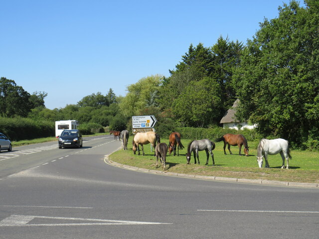
Horses grazing, Beaulieu Horses grazing by the roadside in Beaulieu, in The New Forest.  The road junction in the foreground forms the junction of the B3056, which starts/ends here, and the B3054.
Horses grazing, Beaulieu
Horses grazing by the roadside in Beaulieu, in The New Forest. The road junction in the foreground forms the junction of the B3056, which starts/ends here, and the B3054.
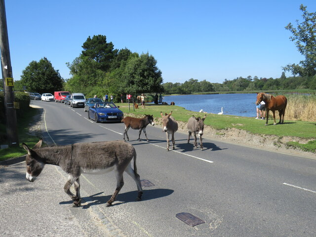
Ponies in the road, Beaulieu New Forest ponies wandering in the road in the village of Beaulieu.  The road forms part of the route of the B3054 which links the towns of Lymington and Hythe.
Ponies in the road, Beaulieu
New Forest ponies wandering in the road in the village of Beaulieu. The road forms part of the route of the B3054 which links the towns of Lymington and Hythe.
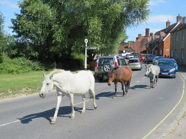
Horses in the road, Beaulieu Horses wandering along Palace Lane, in the village of Beaulieu.  A queue of cars has formed behind the animals.

Palace Lane forms part of the route of the B3054 road which links the towns of Lymington and Hythe.
Horses in the road, Beaulieu
Horses wandering along Palace Lane, in the village of Beaulieu. A queue of cars has formed behind the animals. Palace Lane forms part of the route of the B3054 road which links the towns of Lymington and Hythe.
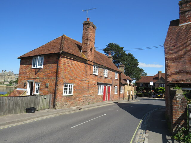
Palace Lane, Beaulieu Palace Lane in the village of Beaulieu, in The New Forest.  This road forms part of the route of the B3054 which links the towns of Lymington and Hythe.
Palace Lane, Beaulieu
Palace Lane in the village of Beaulieu, in The New Forest. This road forms part of the route of the B3054 which links the towns of Lymington and Hythe.
Model Flying Club Area Model Flying Club area only on part of the former hardstanding of RAF Beaulieu
Model Flying Club Area
Model Flying Club area only on part of the former hardstanding of RAF Beaulieu
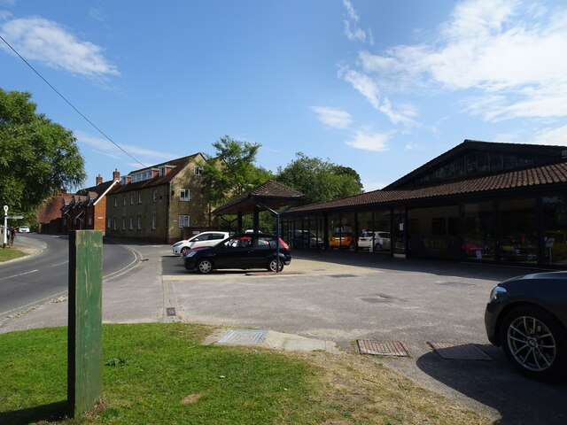
 Beaulieu Garage View The in Beaulieu village.
Beaulieu Garage View
The in Beaulieu village.
Hawkhill Gate The view in Hawkhill Car Park off the B3055, on the southern edge of Hawkhill Inclosure in the New Forest.
Hawkhill Gate
The view in Hawkhill Car Park off the B3055, on the southern edge of Hawkhill Inclosure in the New Forest.
Hawkhill Car Park The view in Hawkhill Car Park off the B3055, on the southern edge of Hawkhill Inclosure in the New Forest.
Hawkhill Car Park
The view in Hawkhill Car Park off the B3055, on the southern edge of Hawkhill Inclosure in the New Forest.
Hawkhill View The view in Hawkhill Car Park off the B3055, on the southern edge of Hawkhill Inclosure in the New Forest.
Hawkhill View
The view in Hawkhill Car Park off the B3055, on the southern edge of Hawkhill Inclosure in the New Forest.
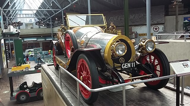
Beaulieu Motor Museum Beaulieu Motor Museum, car on display, on the upper level, is as we know it, Chitty Chitty Bang Bang, it's actually Chitty Bang Bang, which won several races early 1920's
Beaulieu Motor Museum
Beaulieu Motor Museum, car on display, on the upper level, is as we know it, Chitty Chitty Bang Bang, it's actually Chitty Bang Bang, which won several races early 1920's
Pool on an Old Airfield A rainwater pool beside one of the old roads across Beaulieu Heath which are still here from RAF Beaulieu, a WW2 airfield which closed in 1959.
I quite like this scene, and it marks 20,000 pictures from me on Geograph.
Pool on an Old Airfield
A rainwater pool beside one of the old roads across Beaulieu Heath which are still here from RAF Beaulieu, a WW2 airfield which closed in 1959. I quite like this scene, and it marks 20,000 pictures from me on Geograph.
Horses on an old airfield The road is a remnant from RAF Beaulieu, a WW2 airfield which closed in 1959. Still in reasonable condition it's now part of the extensive network of cycle routes in the New Forest.
Horses on an old airfield
The road is a remnant from RAF Beaulieu, a WW2 airfield which closed in 1959. Still in reasonable condition it's now part of the extensive network of cycle routes in the New Forest.
Enjoying the Sunshine Another pony picture, standard fare for the New Forest, but this horse definitely seemed to be basking.
It was a very sunny day for mid January and a lot of the ponies looked to be just standing around soaking up the rays.
Enjoying the Sunshine
Another pony picture, standard fare for the New Forest, but this horse definitely seemed to be basking. It was a very sunny day for mid January and a lot of the ponies looked to be just standing around soaking up the rays.
Tracks at Hawkhill Two tracks into Hawkhill Inclosure. The right hand one goes to a parking area, the left hand one is a cycleway into the heart of the forest.
Tracks at Hawkhill
Two tracks into Hawkhill Inclosure. The right hand one goes to a parking area, the left hand one is a cycleway into the heart of the forest.
Still Flying at Beaulieu Airfield Closed in 1959, a former WW2 airfield is still used by model aircraft enthusiats.
Still Flying at Beaulieu Airfield
Closed in 1959, a former WW2 airfield is still used by model aircraft enthusiats.
Barrier on an Old Road Still in a fairly reasonable condition beyond here, a road built as part of RAF Beaulieu, an old WW2 airfield, is still open as a cycleway beyond the gate.
Barrier on an Old Road
Still in a fairly reasonable condition beyond here, a road built as part of RAF Beaulieu, an old WW2 airfield, is still open as a cycleway beyond the gate.
Ponies on Beaulieu Heath
Show me another place!

Furzey Lodge is located at Grid Ref: SU3602 (Lat: 50.817495, Lng: -1.480556)

Administrative County: Hampshire

District: New Forest

Police Authority: Hampshire

What 3 Words

///quieter.bandwagon.rumbles. Near Brockenhurst, Hampshire

Related Wikis

New Forest East (UK Parliament constituency)

New Forest East is a constituency in Hampshire represented in the House of Commons of the UK Parliament since its creation in 1997 by Julian Lewis of the...

East Boldre

East Boldre is a linear village and civil parish situated near Lymington, Hampshire, England. East Boldre is surrounded by the New Forest and forms part...

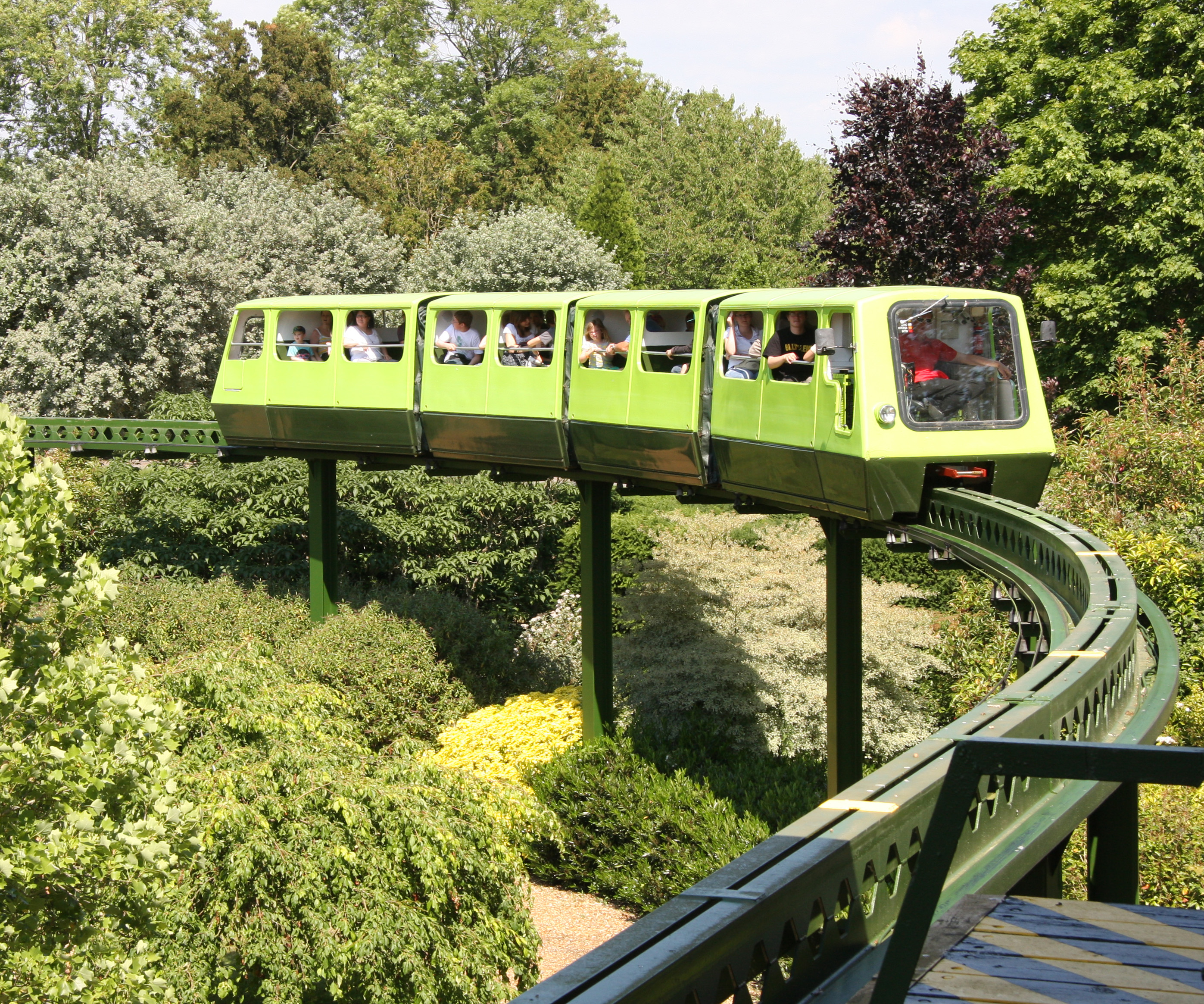
National Motor Museum Monorail

The Beaulieu Monorail is England's first monorail, linking the National Motor Museum to the Beaulieu Palace House. the monorail line passes through the...

National Motor Museum, Beaulieu

The National Motor Museum (originally the Montagu Motor Museum) is a museum in the village of Beaulieu, set in the heart of the New Forest, in the English...

RAF Beaulieu

Royal Air Force Beaulieu or more simply RAF Beaulieu is a former Royal Air Force station in the New Forest, Hampshire, England. It was also known as Beaulieu...

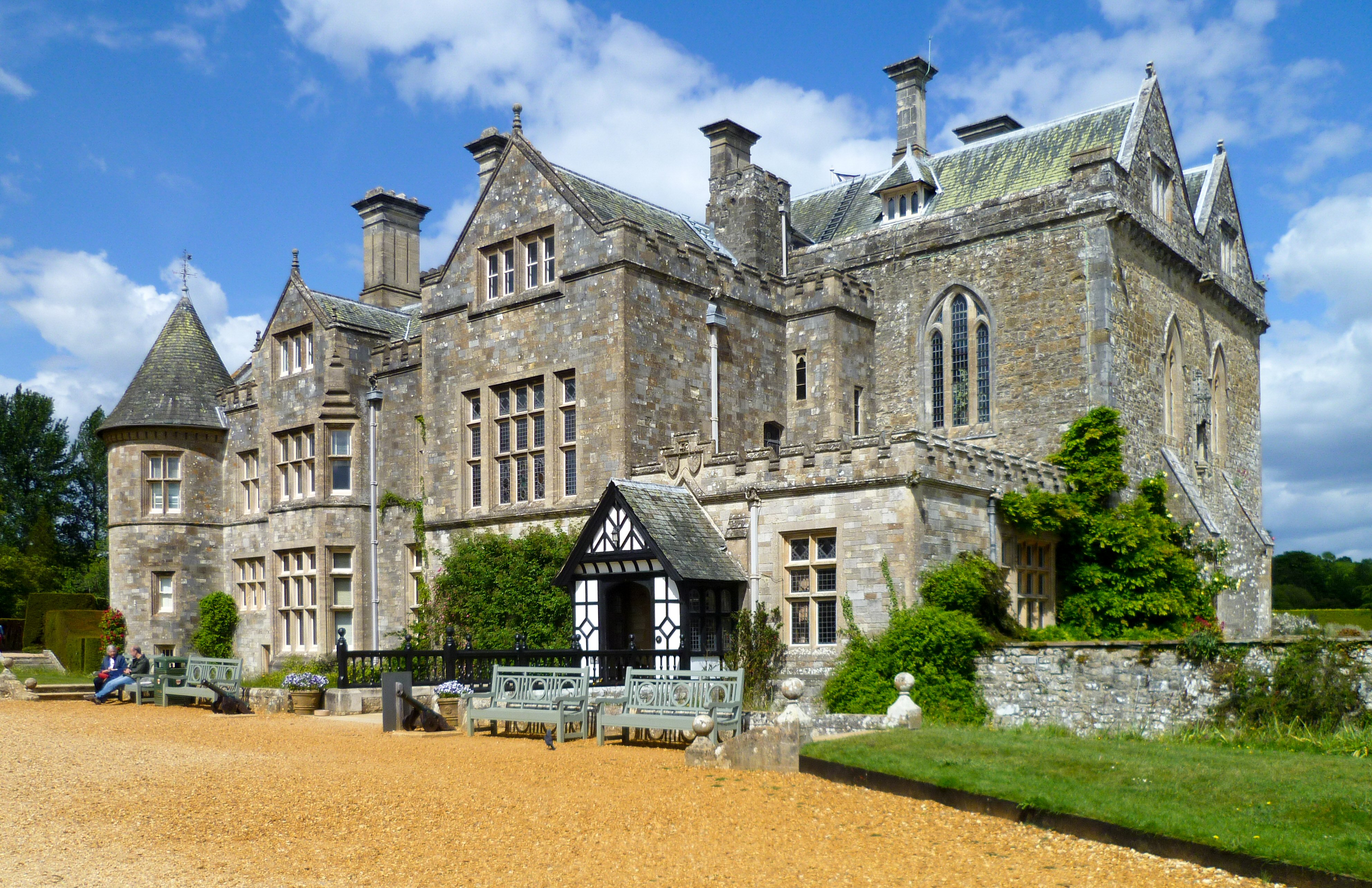
Beaulieu Palace House

Beaulieu Palace House ( BEW-lee) is a 13th-century house in Beaulieu, Hampshire, United Kingdom. Originally part of Beaulieu Abbey, the estate was bought...

Beaulieu, Hampshire

Beaulieu ( BEW-lee) is a small village located on the southeastern edge of the New Forest national park in Hampshire, England, and home to both Palace...

Beaulieu Abbey

Beaulieu Abbey was a Cistercian abbey in Hampshire, England. It was founded in 1203–1204 by King John and (uniquely in Britain) populated by 30 monks sent...

Nearby Amenities

Located within 500m of 50.817495,-1.480556
Lcn Ref: 342
Lat/Long: 50.8200736/-1.4790743
Parking
Rans Wood
Lat/Long: 50.8206722/-1.4808098
Post Box
Operator: Royal Mail
Operator Wikidata: Q638098
Ref: SO42 198D
Source: survey
Lat/Long: 50.8186417/-1.4782901
Bench
Lat/Long: 50.8137742/-1.4792164
Furzey Lodge
Place: hamlet
Lat/Long: 50.8177701/-1.4777908
The data included in this document is from www.openstreetmap.org. The data is made available under ODbL.

Have you been to Furzey Lodge?

Leave your review of Furzey Lodge below (or comments, questions and feedback).