Àird an Rùnair

Coastal Feature, Headland, Point in Inverness-shire

Scotland

Àird an Rùnair

Potatoes growing on the Machair Crop affected by dry weather.
Potatoes growing on the Machair Credit: Alan Pickup

Àird an Rùnair is a prominent headland located in Inverness-shire, Scotland. Situated along the coast, this rugged and picturesque point offers stunning views of the surrounding coastline and the nearby waters of the Moray Firth. The headland is characterized by its steep cliffs, which rise dramatically from the sea, providing a dramatic backdrop for visitors to admire.

The area surrounding Àird an Rùnair is rich in wildlife, with seabirds such as puffins, guillemots, and razorbills often seen nesting on the cliffs. The waters below the headland are also home to a variety of marine life, including seals and dolphins, making it a popular spot for wildlife enthusiasts and photographers.

Visitors to Àird an Rùnair can enjoy scenic walks along the coastal paths, taking in the stunning views and exploring the rugged landscape. The headland is also a popular spot for fishing and birdwatching, with many visitors coming to the area to enjoy the tranquility and natural beauty of this remote coastal location. Overall, Àird an Rùnair is a must-visit destination for anyone looking to experience the beauty of Scotland's rugged coastline.

If you have any feedback on the listing, please let us know in the comments section below.

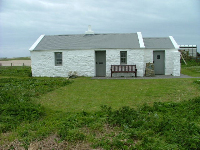
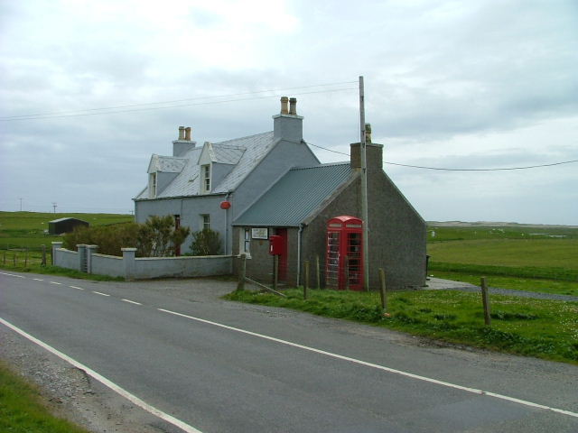
Àird an Rùnair Images

Images are sourced within 2km of 57.60511/-7.5398543 or Grid Reference NF6970. Thanks to Geograph Open Source API. All images are credited.

Potatoes growing on the Machair Crop affected by dry weather.
Potatoes growing on the Machair
Crop affected by dry weather.
Approaching Traigh Iar Traigh Iar - west coast or beach.  There are quite a few Traigh Iar's dotted around the Hebrides!
Approaching Traigh Iar
Traigh Iar - west coast or beach. There are quite a few Traigh Iar's dotted around the Hebrides!
Traigh Iar Traigh Iar - west coast or beach.  There are quite a few Traigh Iar's dotted around the Hebrides!
Traigh Iar
Traigh Iar - west coast or beach. There are quite a few Traigh Iar's dotted around the Hebrides!
Traigh Iar, Balranald reserve The huge beaches and skies of the Uists
Traigh Iar, Balranald reserve
The huge beaches and skies of the Uists
Beach and waves on Tràigh Iar
Turnstones at Balranald bird reserve Not that rare around here, this is a small flock of Turnstones (Arenaria interpres) on a rock at the end of Tràigh Iar. The bird earns its name from its habit of flipping stones, searching for small insects, crustaceans and shellfish.
Turnstones at Balranald bird reserve
Not that rare around here, this is a small flock of Turnstones (Arenaria interpres) on a rock at the end of Tràigh Iar. The bird earns its name from its habit of flipping stones, searching for small insects, crustaceans and shellfish.
Tràigh Iar - the beach to the west of Balranald reserve
Tràigh Iar from the dunes Another sweep of Hebridean sand. I personally think they're the finest in the world, but will admit that good weather helps a lot.
Tràigh Iar from the dunes
Another sweep of Hebridean sand. I personally think they're the finest in the world, but will admit that good weather helps a lot.
Traigh Iar
Traigh Iar
Eilean na Rubha, North Uist A stony, rocky headland overlooking the Sound of Monach/Caolas Mhonach.
Eilean na Rubha, North Uist
A stony, rocky headland overlooking the Sound of Monach/Caolas Mhonach.
The Sound of Monach from Eilan an Rubha With Heisker/Theisgeir or the Monach Islands/Na h-Eileanan Monach about 10km southwest.
The Sound of Monach from Eilan an Rubha
With Heisker/Theisgeir or the Monach Islands/Na h-Eileanan Monach about 10km southwest.
Sea Campion in North Uist Silene uniflora on stony ground at Eilean an Rubha.
Sea Campion in North Uist
Silene uniflora on stony ground at Eilean an Rubha.
Tràigh Iar at Balranald Part of the RSPB Reserve on North Uist - beach and sand dunes, with machair behind.
Tràigh Iar at Balranald
Part of the RSPB Reserve on North Uist - beach and sand dunes, with machair behind.
Path to the headland On a trail on the RSPB reserve at Balranald.
Path to the headland
On a trail on the RSPB reserve at Balranald.
Newly reseeded machair Behind the dunes. The machair is cultivated on a rotation; I suspect the wide drill spacing allows the seed bank of machair plants to establish without competition from the grass.
Newly reseeded machair
Behind the dunes. The machair is cultivated on a rotation; I suspect the wide drill spacing allows the seed bank of machair plants to establish without competition from the grass.
Machair grassland at Balranald Looking west towards the dunes.
Machair grassland at Balranald
Looking west towards the dunes.
Machair flowers Seaside Pansy [Viola tricolor ssp. curtisii] and Dune Storksbill [Erodium cicutarium ssp. dunense], growing on almost bare sand at Balranald.
Machair flowers
Seaside Pansy [Viola tricolor ssp. curtisii] and Dune Storksbill [Erodium cicutarium ssp. dunense], growing on almost bare sand at Balranald.
The Machair in flower Early in a late season, so not yet in full bloom, but with Pansies and Storksbill among the thin grass growing on the sand.
The Machair in flower
Early in a late season, so not yet in full bloom, but with Pansies and Storksbill among the thin grass growing on the sand.
Show me another place!

Àird an Rùnair is located at Grid Ref: NF6970 (Lat: 57.60511, Lng: -7.5398543)

Unitary Authority: Na h-Eileanan an Iar

Police Authority: Highlands and Islands

What 3 Words

///replayed.skims.coast. Near Balivanich, Na h-Eileanan Siar

Related Wikis

Aird an Rùnair

Aird an Rùnair is the most westerly point of the island of North Uist in the Western Isles of Scotland. The headland is approximately 4 kilometres (2.5...

Balranald Nature Reserve

The Balranald Nature Reserve is an RSPB reserve on the north west coast of North Uist, Outer Hebrides, Scotland. The reserve is open all year round and...

Tigharry

Tigharry (Scottish Gaelic: Taigh a' Ghearraidh) is a small village on the west of North Uist. It is mostly a farming community. There are a few rocky beaches...

Scolpaig Tower

Scolpaig Tower (also known as Dùn Scolpaig or MacLeod’s Folly) is a Georgian folly located near the village of Scolpaig on the island of North Uist in...

Nearby Amenities

Located within 500m of 57.60511,-7.5398543
Source: PGS
Lat/Long: 57.6008709/-7.5376285
Source: PGS
Lat/Long: 57.6008966/-7.5395446
Source: PGS
Lat/Long: 57.6009101/-7.5399074
Source: PGS
Lat/Long: 57.6009203/-7.540217
Source: PGS
Lat/Long: 57.6039124/-7.5477201
Source: PGS
Lat/Long: 57.604266/-7.5475672
Source: PGS
Lat/Long: 57.605129/-7.5479413
Source: PGS
Lat/Long: 57.6052642/-7.5470049
Source: PGS
Lat/Long: 57.6056893/-7.546604
Source: PGS
Lat/Long: 57.6059559/-7.5458665
Source: PGS
Lat/Long: 57.6059818/-7.5448073
Source: PGS
Lat/Long: 57.6058496/-7.5444131
Source: PGS
Lat/Long: 57.6058634/-7.5435142
Source: PGS
Lat/Long: 57.6064237/-7.5427706
Source: PGS
Lat/Long: 57.6068396/-7.542243
Source: PGS
Lat/Long: 57.6078575/-7.542822
Source: PGS
Lat/Long: 57.6087582/-7.5416709
Source: PGS
Lat/Long: 57.6083438/-7.5396187
Source: PGS
Lat/Long: 57.6086722/-7.5399963
Source: PGS
Lat/Long: 57.6088402/-7.5397041
Source: PGS
Lat/Long: 57.6091779/-7.5394682
Source: PGS
Lat/Long: 57.6094188/-7.5391156
Source: PGS
Lat/Long: 57.6072606/-7.5325817
Source: PGS
Lat/Long: 57.6066097/-7.5327534
Source: PGS
Lat/Long: 57.6062131/-7.5327399
Source: PGS
Lat/Long: 57.6058613/-7.5326119
Source: PGS
Lat/Long: 57.6056268/-7.5323725
Source: PGS
Lat/Long: 57.6054572/-7.5327319
Source: PGS
Lat/Long: 57.6049859/-7.5323296
Source: PGS
Lat/Long: 57.6046913/-7.5321499
Source: PGS
Lat/Long: 57.6044341/-7.5320613
Aird an Rùnair
Natural: cape
Wikidata: Q4698591
Wikipedia: en:Aird an Rùnair
Lat/Long: 57.6043594/-7.5375867
Machair Life+
Board Type: nature
Information: board
Tourism: information
Website: http://www.machairlife.org.uk
Lat/Long: 57.6013027/-7.5378267
Barrier: kissing_gate
Lat/Long: 57.6011891/-7.5410417
Bench
Backrest: yes
Material: wood
Seats: 2
Lat/Long: 57.6012301/-7.5379129
Information: guidepost
Osmc Symbol: red_bar
Symbol: Red bar
Tourism: information
Lat/Long: 57.6013659/-7.5375377
Information: guidepost
Man Made: cairn
Osmc Symbol: red_bar
Symbol: Red bar
Tourism: information
Lat/Long: 57.6049963/-7.5327225
Information: guidepost
Osmc Symbol: red_bar
Symbol: Red bar
Tourism: information
Lat/Long: 57.6066478/-7.533442
RSPB Balranald
Description: OS Map of RSPB site including Visitor Train
Hiking: yes
Information: map
Map Size: site
Map Type: street
Tourism: information
Lat/Long: 57.6069973/-7.5336385
Information: guidepost
Man Made: cairn
Osmc Symbol: red_bar
Symbol: Red bar
Tourism: information
Lat/Long: 57.608413/-7.5344532
Man Made: cairn
Lat/Long: 57.6085448/-7.5390458
Information: guidepost
Osmc Symbol: red_bar
Symbol: Red bar
Tourism: information
Lat/Long: 57.6082661/-7.5390223
Information: guidepost
Man Made: cairn
Osmc Symbol: red_bar
Symbol: Red bar
Tourism: information
Lat/Long: 57.6081123/-7.5403051
Information: guidepost
Osmc Symbol: red_bar
Symbol: Red bar
Tourism: information
Lat/Long: 57.6077732/-7.5413881
Information: guidepost
Man Made: cairn
Osmc Symbol: red_bar
Symbol: Red bar
Tourism: information
Lat/Long: 57.6067545/-7.5417729
Information: guidepost
Man Made: cairn
Osmc Symbol: red_bar
Symbol: Red bar
Tourism: information
Lat/Long: 57.6055805/-7.5436988
Information: guidepost
Man Made: cairn
Osmc Symbol: red_bar
Symbol: Red bar
Tourism: information
Lat/Long: 57.6050635/-7.5459398
Information: guidepost
Osmc Symbol: red_bar
Symbol: Red bar
Tourism: information
Lat/Long: 57.6044585/-7.5465976
Man Made: cairn
Lat/Long: 57.6041593/-7.5466438
Information: guidepost
Man Made: cairn
Osmc Symbol: red_bar
Symbol: Red bar
Tourism: information
Lat/Long: 57.6032744/-7.5469449
Information: guidepost
Osmc Symbol: red_bar
Symbol: Red bar
Tourism: information
Lat/Long: 57.6010573/-7.5422403
Ford: stepping_stones
Lat/Long: 57.6038004/-7.5467987
Ford: yes
Lat/Long: 57.6011874/-7.5409614
The data included in this document is from www.openstreetmap.org. The data is made available under ODbL.

Have you been to Àird an Rùnair?

Leave your review of Àird an Rùnair below (or comments, questions and feedback).