Àird a' Chaolais

Coastal Feature, Headland, Point in Inverness-shire

Scotland

Àird a' Chaolais

Coming home, Caolas, Bhatarsaigh Atlantic swells crash outside the bay.
Coming home, Caolas, Bhatarsaigh Credit: Alan Reid

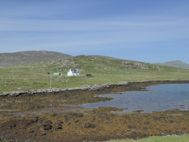
Àird a' Chaolais is a prominent coastal feature located in Inverness-shire, Scotland. It is characterized by its stunning headland and point, which offer magnificent views of the surrounding landscape and sea. The name Àird a' Chaolais translates to "Point of the Narrow Sound" in English, referencing its position at the entrance of a narrow body of water.

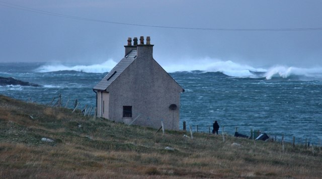
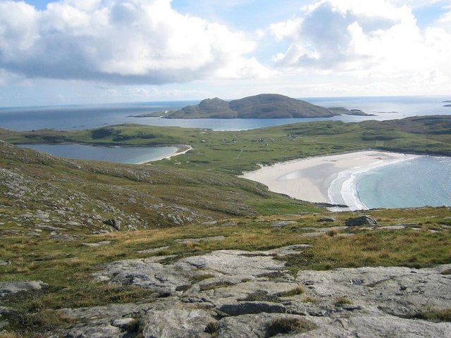
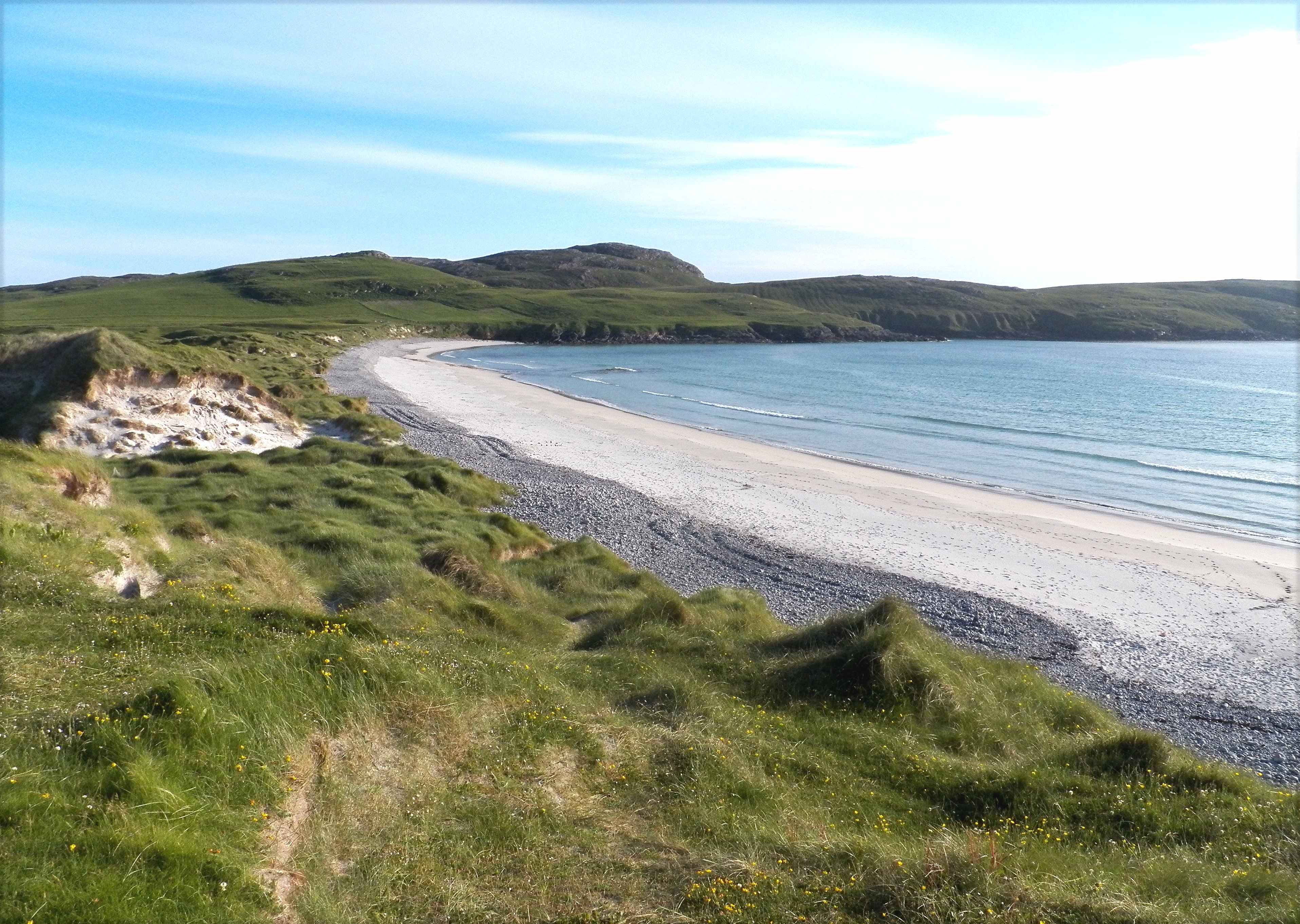
Situated on the western coast of Scotland, Àird a' Chaolais is known for its rugged and dramatic beauty. The headland juts out into the sea, forming a natural barrier against the crashing waves and creating a sense of awe-inspiring grandeur. Visitors to the area can enjoy breathtaking vistas of the open ocean, as well as the nearby islands that dot the horizon.

The point at Àird a' Chaolais provides a unique perspective of the surrounding landscape. From here, one can witness the powerful forces of nature as the waves crash against the rocks and cliffs, creating a mesmerizing display of natural beauty. The area is also home to a diverse range of wildlife, including seabirds, seals, and occasionally, dolphins.

In addition to its natural splendor, Àird a' Chaolais holds historical significance. The headland is believed to have been a strategic location during ancient times, serving as a lookout point and a defensive position. Today, remnants of ancient settlements can still be found in the vicinity, adding an extra layer of intrigue to the area.

Overall, Àird a' Chaolais stands as a testament to the raw beauty and power of Scotland's coastal landscape. Its headland and point offer a captivating experience for nature enthusiasts, history buffs, and anyone seeking a moment of tranquility amidst nature's grandeur.

If you have any feedback on the listing, please let us know in the comments section below.

Àird a' Chaolais Images

Images are sourced within 2km of 56.947529/-7.5706534 or Grid Reference NL6197. Thanks to Geograph Open Source API. All images are credited.

Coming home, Caolas, Bhatarsaigh Atlantic swells crash outside the bay.
Coming home, Caolas, Bhatarsaigh
Atlantic swells crash outside the bay.
House above Bàgh Chornaig
Western slopes of Heiseabhal Mòr
Rock-strewn moorland on Bhatarsaigh
Raised beach at Caolas Bhatarsaigh
Rocky foreshore at Caolas Bhatarsaigh
Rock pools at Caolas Bhatarsaigh
Àird a' Chaolais and the Atlantic
A bay on the west coast of Vatersay Mingulay through the gap.
A bay on the west coast of Vatersay
Mingulay through the gap.
Looking towards Bioruaslum, Vatersay
The summit of Heiseabhal Mor in deteriorating weather
Sea Stacks south of Rubha na Doirlinn These sea stacks are just south of the natural arch marked on the OS map.
Sea Stacks south of Rubha na Doirlinn
These sea stacks are just south of the natural arch marked on the OS map.
Vatersay (Bhatarsaigh) Causeway from near the summit of Beinne an Scuite
Traigh Bharlais, Vatersay I had to get quite close before I realised the black dots on the beach were cows!
Traigh Bharlais, Vatersay
I had to get quite close before I realised the black dots on the beach were cows!
Vatersay The view from Theiseabhal Mor, the highest point of Vatersay (624 feet) south to Vatersay village and the island of Sandray beyond.
Vatersay
The view from Theiseabhal Mor, the highest point of Vatersay (624 feet) south to Vatersay village and the island of Sandray beyond.
Cairn on Theiseabhal Mor The highest point on the Isle of Vatersay (190m) is the triangulation pillar behind the photographer, but the cairn is the more visible from the Isle of Barra. The causeway connecting the two islands is shown in the middle distance.
Cairn on Theiseabhal Mor
The highest point on the Isle of Vatersay (190m) is the triangulation pillar behind the photographer, but the cairn is the more visible from the Isle of Barra. The causeway connecting the two islands is shown in the middle distance.
Rocky North shore of Caolas Bhatarsaigh View looking North West of the North shore of Caolas Bhatarsaigh, the stretch of water between Vatersay and Barra.
Rocky North shore of Caolas Bhatarsaigh
View looking North West of the North shore of Caolas Bhatarsaigh, the stretch of water between Vatersay and Barra.
Across Caolas Bhatarsaigh, Vatersay To the north of this channel is Barra. The causeway between Barra and Vatersay is east of this bay.
Across Caolas Bhatarsaigh, Vatersay
To the north of this channel is Barra. The causeway between Barra and Vatersay is east of this bay.
Show me another place!

Àird a' Chaolais is located at Grid Ref: NL6197 (Lat: 56.947529, Lng: -7.5706534)

Unitary Authority: Na h-Eileanan an Iar

Police Authority: Highlands and Islands

What 3 Words

///learns.reversed.warms. Near CastleBay, Na h-Eileanan Siar

Related Wikis

Biruaslum

Biruaslum or Bioruaslam is a stack in the Barra Isles of Scotland, to the west of Vatersay. Approximately 2.5 kilometres (1+1⁄2 miles) from the nearest...

Caolas

Caolas (Scottish Gaelic: An Caolas [ən̪ˠ ˈkʰɯːl̪ˠəs̪]), is a small settlement on the island of Vatersay, in the Outer Hebrides, Scotland. Caolas is within...

Vatersay Causeway

The Vatersay Causeway (Scottish Gaelic: Rathad Bhàgh Bhatarsaigh) is a 250-metre-long causeway that links the Scottish Hebridean Islands of Vatersay and...

Vatersay

The island of Vatersay (; Scottish Gaelic: Bhatarsaigh) is the southernmost and westernmost inhabited island in the Outer Hebrides of Scotland, and the...

Nearby Amenities

Located within 500m of 56.947529,-7.5706534
Aird a'Chaolais
Note: Geodetic reference point for UK baseline
Ref: 17
Source: The Territorial Sea (Amendment) Order 1998 (No. 2564)
Lat/Long: 56.9489519/-7.5722634
The data included in this document is from www.openstreetmap.org. The data is made available under ODbL.

Have you been to Àird a' Chaolais?

Leave your review of Àird a' Chaolais below (or comments, questions and feedback).