Tilburstowhill Plantation

Wood, Forest in Surrey Tandridge

England

Tilburstowhill Plantation

Posterngate Farm, South Godstone, Surrey Part of the extensive grounds of Posterngate Farm, where the many activities include the maintenance of a herd of pedigree Charollais, and a lake for trout fishing.  There is even a small business park.  
And this photograph 'wraps up' the TQ34 hectad, of which I have claimed 48 first geographs.
Posterngate Farm, South Godstone, Surrey Credit: Dr Neil Clifton

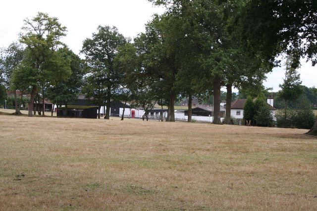
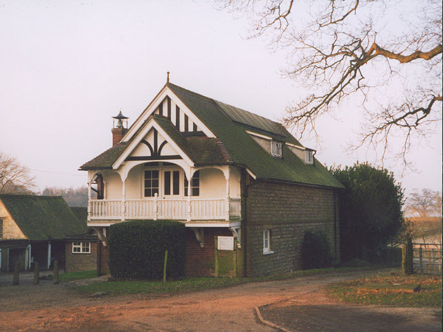
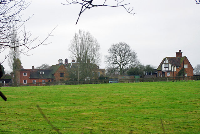
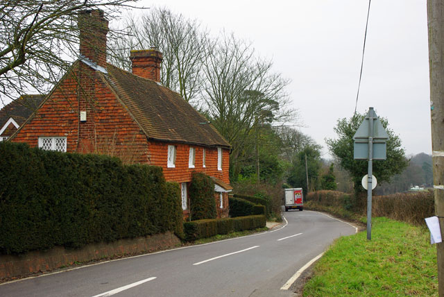
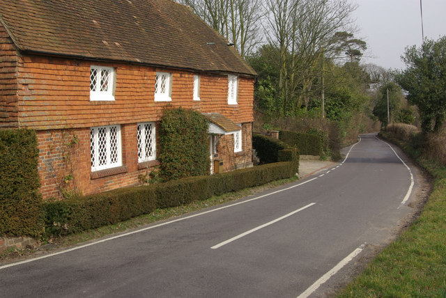
Tilburstowhill Plantation, located in Surrey, England, is a picturesque woodland area nestled in the heart of the county. Spanning across an impressive area, this plantation is well-known for its dense forest cover, diverse wildlife, and captivating natural beauty.

The plantation boasts a rich history, dating back several centuries. Originally designated as a hunting ground for local nobility, Tilburstowhill Plantation has since evolved into a beloved recreational space for both locals and visitors. The woodland is now managed by the Forestry Commission, ensuring the preservation of its unique ecosystem.

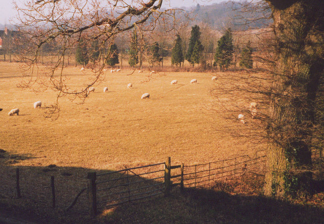
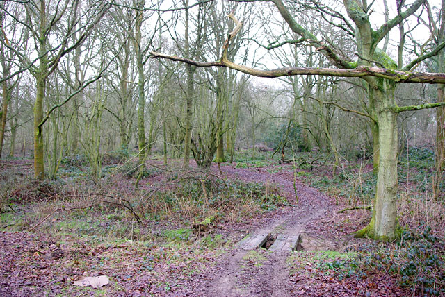
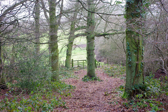
The plantation's forest is predominantly composed of deciduous trees, including oak, beech, and birch, creating a stunning display of autumnal colors during the fall season. These trees provide ample shade during the summer months, making it an ideal spot for picnics and leisurely walks.

Wildlife enthusiasts will find themselves captivated by the diverse range of fauna that call Tilburstowhill Plantation their home. The woodland is known to harbor an array of bird species, including woodpeckers, owls, and various songbirds. It is also common to spot squirrels, foxes, and deer roaming freely in the plantation.

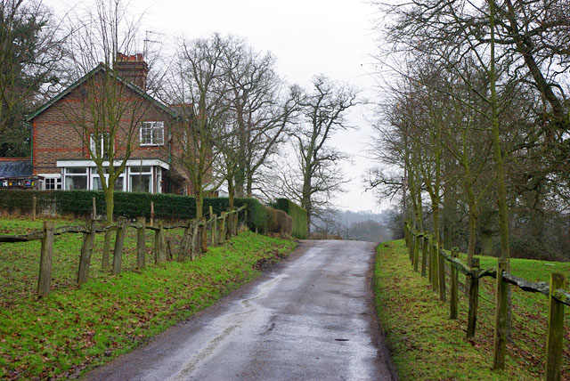
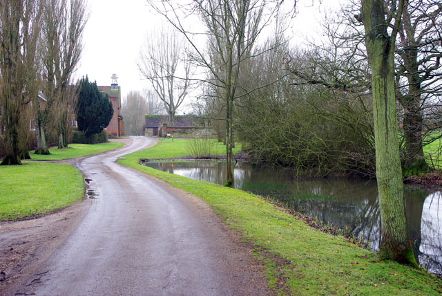
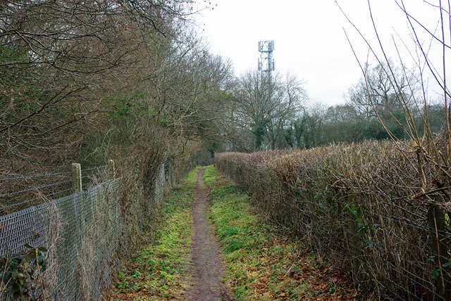
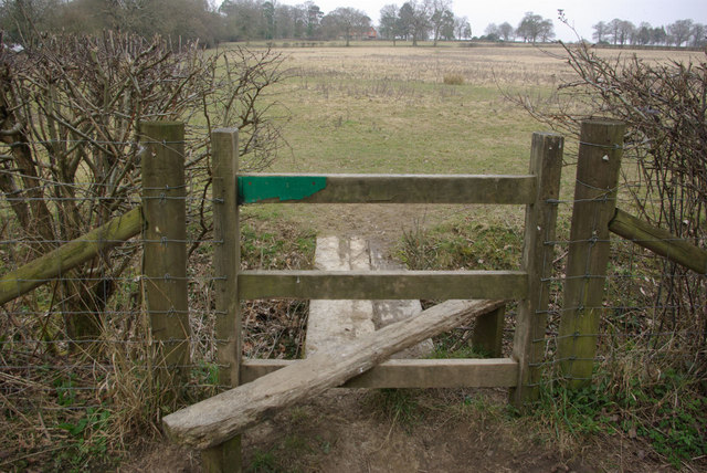
For those seeking outdoor activities, Tilburstowhill Plantation offers several well-maintained trails and paths that meander through the woodland. These paths cater to both walkers and cyclists, providing an opportunity to explore the plantation's natural wonders at one's own pace.

Overall, Tilburstowhill Plantation in Surrey is a haven for nature lovers, offering a tranquil escape from the hustle and bustle of everyday life. Its enchanting forest, diverse wildlife, and recreational facilities make it a must-visit destination for anyone seeking a serene and idyllic outdoor experience.

If you have any feedback on the listing, please let us know in the comments section below.

Tilburstowhill Plantation Images

Images are sourced within 2km of 51.235476/-0.069035564 or Grid Reference TQ3450. Thanks to Geograph Open Source API. All images are credited.

Posterngate Farm, South Godstone, Surrey Part of the extensive grounds of Posterngate Farm, where the many activities include the maintenance of a herd of pedigree Charollais, and a lake for trout fishing.  There is even a small business park.  
And this photograph 'wraps up' the TQ34 hectad, of which I have claimed 48 first geographs.
Posterngate Farm, South Godstone, Surrey
Part of the extensive grounds of Posterngate Farm, where the many activities include the maintenance of a herd of pedigree Charollais, and a lake for trout fishing. There is even a small business park. And this photograph 'wraps up' the TQ34 hectad, of which I have claimed 48 first geographs.
Fox and Hounds at South Godstone This building has served ale since the 17th century. On the Tilburstow Hill Road and well worth the diversion !
Fox and Hounds at South Godstone
This building has served ale since the 17th century. On the Tilburstow Hill Road and well worth the diversion !
Coldharbour Farm now a private house
Coldharbour Farm
now a private house
St Mark's Foundation A private chapel at South Park Farm, listed grade II and occasionally used for public services.
St Mark's Foundation
A private chapel at South Park Farm, listed grade II and occasionally used for public services.
Wychcroft Retreat House Anglican Diocese of Southwark Retreat House used for residential training and quiet days
Wychcroft Retreat House
Anglican Diocese of Southwark Retreat House used for residential training and quiet days
The chapel at Wychcroft An unusual private chapel, dedicated to the People of God, part of the Southwark diocesan retreat house and training centre.
The chapel at Wychcroft
An unusual private chapel, dedicated to the People of God, part of the Southwark diocesan retreat house and training centre.
Sheep grazing at Wychcroft A pastoral scene near Bletchingley.
Sheep grazing at Wychcroft
A pastoral scene near Bletchingley.
Track into woods Branching north from the public bridleway into Crookedfield Shaw is a track used by a quad bike or similar - probably a gamekeeper's route.
Track into woods
Branching north from the public bridleway into Crookedfield Shaw is a track used by a quad bike or similar - probably a gamekeeper's route.
Path out of the wood Branching south from the track used as a public bridleway, this private path into the field has not merited such a big gate for a long time.
Path out of the wood
Branching south from the track used as a public bridleway, this private path into the field has not merited such a big gate for a long time.
South Park Farm Something more than a farm, there is a chapel in the complex.
South Park Farm
Something more than a farm, there is a chapel in the complex.
Cottages on drive to South Park Farm Just over the crest is the drive entrance where the public bridleway along the drive finishes and the public road, South Park Lane, starts.
Cottages on drive to South Park Farm
Just over the crest is the drive entrance where the public bridleway along the drive finishes and the public road, South Park Lane, starts.
Approach to South Park The chapel is prominent ahead.
Approach to South Park
The chapel is prominent ahead.
Railway Bridge over Roman road The Redhill - Tonbridge line crosses Tilburstow Hill Road, mapped as a Roman road, and certainly an older southern approach to Godstone than the course used by the A22.
Railway Bridge over Roman road
The Redhill - Tonbridge line crosses Tilburstow Hill Road, mapped as a Roman road, and certainly an older southern approach to Godstone than the course used by the A22.
Cottages on Hart's Lane Handily placed for the pub - just round the corner to the Fox and Hounds on Tilburstow Hill Road.
Cottages on Hart's Lane
Handily placed for the pub - just round the corner to the Fox and Hounds on Tilburstow Hill Road.
Footpath beside railway This footpath parallels the railway, through the fence on the left, nearly all the way from South Godstone to Tilburstow Hill Road. It is tarmac all the way, although grassed over in more open spots.
Footpath beside railway
This footpath parallels the railway, through the fence on the left, nearly all the way from South Godstone to Tilburstow Hill Road. It is tarmac all the way, although grassed over in more open spots.
The Fox and Hounds, South Godstone Although somewhat remote from South Godstone village, this attractive pub seemed to be doing a thriving trade on a weekday lunchtime. Daffodils have appeared along the fence - some of the first to be seen in this unusually late spring.
The Fox and Hounds, South Godstone
Although somewhat remote from South Godstone village, this attractive pub seemed to be doing a thriving trade on a weekday lunchtime. Daffodils have appeared along the fence - some of the first to be seen in this unusually late spring.
Stile near South Godstone This stile leads off the footpath between South Godstone and Tilburstow Hill Road, giving access to the field although there is no right of way.
Stile near South Godstone
This stile leads off the footpath between South Godstone and Tilburstow Hill Road, giving access to the field although there is no right of way.
Harts Lane, South Godstone Looking along Harts Lane, towards the A22 and South Godstone village, from its junction with Tilburstow Hill Road.
Harts Lane, South Godstone
Looking along Harts Lane, towards the A22 and South Godstone village, from its junction with Tilburstow Hill Road.
Show me another place!

Tilburstowhill Plantation is located at Grid Ref: TQ3450 (Lat: 51.235476, Lng: -0.069035564)

Administrative County: Surrey

District: Tandridge

Police Authority: Surrey

Also known as: Tilbusterhill Plantation

What 3 Words

///relax.nature.roses. Near Godstone, Surrey

Related Wikis

Tilburstow Hill

Tilburstow Hill is a 9-hectare (22-acre) nature reserve south-east of Godstone in Surrey. It is managed by the Surrey Wildlife Trust.This is a semi-natural...

Graeme Hendrey Wood

Graeme Hendrey Wood is a 10-hectare (25-acre) nature reserve east of Bletchingley in Surrey. It is managed by the Surrey Wildlife Trust.This former sand...

Godstone Ponds

Godstone Ponds is a 13.6-hectare (34-acre) biological Site of Special Scientific Interest in Godstone in Surrey. Bay Pond is an educational nature reserve...

1929 Luft Hansa Junkers G 24 crash

The 1929 Luft Hansa Junkers G.24 crash occurred on 6 November 1929 when a Junkers G 24 of Luft Hansa crashed at Godstone, Surrey, United Kingdom while...

Bay Pond

Bay Pond is a 7-hectare (17-acre) nature reserve in Godstone in Surrey. It is managed by the Surrey Wildlife Trust. It is part of Godstone Ponds Site...

Godstone

Godstone is a village and civil parish in the Tandridge District of Surrey, England. It is 6 miles (9.7 km) east of Reigate, 3 miles (4.8 km) west of Oxted...

A25 road

The A25 road is an east–west main road in the South-East of England. Its carries traffic east from Guildford, Surrey, eastward through Surrey and into...

Tandridge Hundred

Tandridge Hundred was a hundred in Surrey, England. It comprised areas in the Tandridge District, the easternmost part of the county, bordering Kent, West...

Nearby Amenities

Located within 500m of 51.235476,-0.069035564
Tilburstow Hill
Natural: peak
Source: npe
Wikidata: Q60255354
Wikipedia: en:Tilburstow Hill
Lat/Long: 51.2352411/-0.0715754
Barrier: stile
Lat/Long: 51.2383811/-0.0741553
Barrier: stile
Lat/Long: 51.2326088/-0.0727314
Cherishland Farm
Place: farm
Lat/Long: 51.2328944/-0.0631578
Tourism: viewpoint
Wheelchair: yes
Lat/Long: 51.2337627/-0.0690122
Bench
Lat/Long: 51.2337642/-0.0690609
Barrier: stile
Lat/Long: 51.236591/-0.0757359
Bench
Lat/Long: 51.2325717/-0.071875
Leisure: picnic_table
Lat/Long: 51.2338015/-0.0685418
Leisure: picnic_table
Lat/Long: 51.2338275/-0.0686471
The data included in this document is from www.openstreetmap.org. The data is made available under ODbL.

Have you been to Tilburstowhill Plantation?

Leave your review of Tilburstowhill Plantation below (or comments, questions and feedback).