Brimstone Covert

Wood, Forest in Suffolk East Suffolk

England

Brimstone Covert

Field south-east of Wrentham
Field south-east of Wrentham Credit: Christopher Hilton

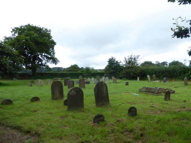
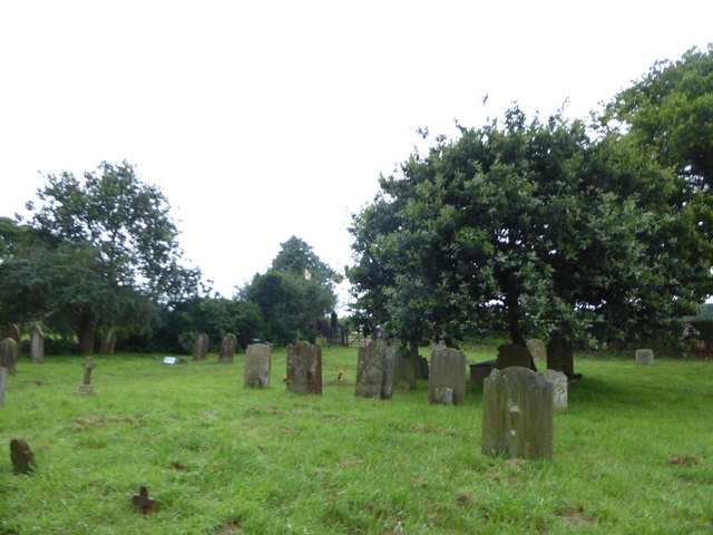
Brimstone Covert, located in Suffolk, England, is a picturesque wood and forest area that covers approximately 200 acres. This enchanting woodland is renowned for its natural beauty and diverse ecosystem, attracting visitors and nature enthusiasts from near and far.

The woodland of Brimstone Covert boasts a mix of deciduous and coniferous trees, creating a rich tapestry of colors throughout the changing seasons. Ancient oak, beech, and birch trees dominate the landscape, providing a haven for a wide array of flora and fauna. The forest floor is carpeted with a variety of wildflowers, including bluebells, primroses, and wood anemones during the springtime.

Home to a thriving population of wildlife, Brimstone Covert is a sanctuary for numerous species. Birdwatchers can spot an array of feathered friends, such as woodpeckers, nuthatches, and tawny owls, while other visitors may have the chance to observe timid deer, foxes, and badgers silently going about their daily routines.

The woodland also offers several well-maintained trails and footpaths, allowing visitors to explore the area at their own pace. Whether hiking, biking, or simply enjoying a leisurely stroll, the diverse paths meander through the woods, offering breathtaking views and opportunities to immerse oneself in nature.

Managed by the Suffolk Wildlife Trust, Brimstone Covert is not only an idyllic location for recreational activities but also a place of conservation and education. The trust organizes various educational programs and events throughout the year, aiming to raise awareness about the importance of preserving this valuable natural habitat.

In conclusion, Brimstone Covert in Suffolk is a captivating wood and forest area that offers a tranquil escape into nature. With its stunning scenery, abundant wildlife, and commitment to conservation, it is a destination that delights and educates visitors of all ages.

If you have any feedback on the listing, please let us know in the comments section below.

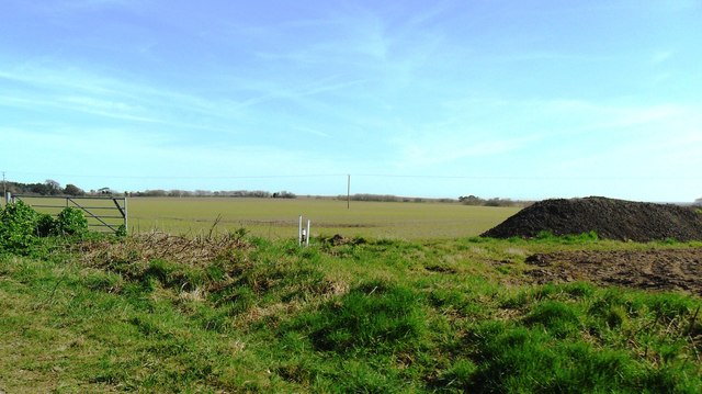
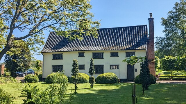
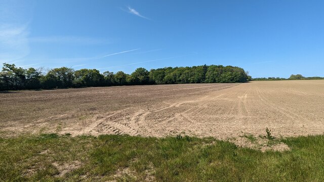
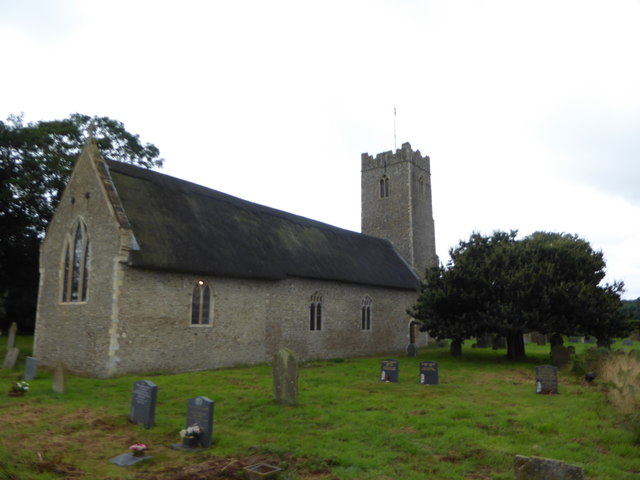
Brimstone Covert Images

Images are sourced within 2km of 52.375056/1.6508289 or Grid Reference TM4881. Thanks to Geograph Open Source API. All images are credited.

Field south-east of Wrentham
Fields and fertiliser near Covehithe, Suffolk
Church of All Saints, Frostenden <span class="nowrap"><a title="https://historicengland.org.uk/listing/the-list/list-entry/1032170?section=official-list-entry" rel="nofollow ugc noopener" href="https://historicengland.org.uk/listing/the-list/list-entry/1032170?section=official-list-entry">Link</a><img style="margin-left:2px;" alt="External link" title="External link - shift click to open in new window" src="https://s1.geograph.org.uk/img/external.png" width="10" height="10"/></span>
Church of All Saints, Frostenden
Goughs, Frostenden <span class="nowrap"><a title="https://historicengland.org.uk/listing/the-list/list-entry/1352547?section=official-list-entry" rel="nofollow ugc noopener" href="https://historicengland.org.uk/listing/the-list/list-entry/1352547?section=official-list-entry">Link</a><img style="margin-left:2px;" alt="External link" title="External link - shift click to open in new window" src="https://s1.geograph.org.uk/img/external.png" width="10" height="10"/></span>
Goughs, Frostenden
Waiting for Life to Emerge Large field near Frostenden Hall.
Waiting for Life to Emerge
Large field near Frostenden Hall.
Blomfield Wood
Blomfield Wood
Church of St. Nicholas, Wrentham <span class="nowrap"><a title="https://historicengland.org.uk/listing/the-list/list-entry/1284532?section=official-list-entry" rel="nofollow ugc noopener" href="https://historicengland.org.uk/listing/the-list/list-entry/1284532?section=official-list-entry">Link</a><img style="margin-left:2px;" alt="External link" title="External link - shift click to open in new window" src="https://s1.geograph.org.uk/img/external.png" width="10" height="10"/></span>
Church of St. Nicholas, Wrentham
Wrentham War Memorial <span class="nowrap"><a title="https://historicengland.org.uk/listing/the-list/list-entry/1458655?section=official-list-entry" rel="nofollow ugc noopener" href="https://historicengland.org.uk/listing/the-list/list-entry/1458655?section=official-list-entry">Link</a><img style="margin-left:2px;" alt="External link" title="External link - shift click to open in new window" src="https://s1.geograph.org.uk/img/external.png" width="10" height="10"/></span>
Wrentham War Memorial
Gate And Field Metal gate and field near to South Cove, Suffolk.
Gate And Field
Metal gate and field near to South Cove, Suffolk.
Minor Road Minor road looking west near to South Cove, Suffolk.
Minor Road
Minor road looking west near to South Cove, Suffolk.
St Lawrence, South Cove: churchyard
St Lawrence, South Cove: porch
St Lawrence, South Cove: churchyard (iv)
St Lawrence, South Cove: churchyard (v)
St Lawrence, South Cove: churchyard (vi)
St Lawrence, South Cove: flower festival exhibits (i)
St Lawrence, South Cove: flower festival exhibits (ii)
St Lawrence, South Cove: flower festival exhibits (iii)
Show me another place!

Brimstone Covert is located at Grid Ref: TM4881 (Lat: 52.375056, Lng: 1.6508289)

Administrative County: Suffolk

District: East Suffolk

Police Authority: Suffolk

What 3 Words

///chemistry.flexibly.merit. Near Southwold, Suffolk

Related Wikis

Frostenden

Frostenden is a village and civil parish in the East Suffolk district of the English county of Suffolk. It is around 8 miles (13 km) south-west of Lowestoft...

South Cove, Suffolk

South Cove is a civil parish in the east of the English county of Suffolk. It is 3 miles (4.8 km) north of the coastal town of Southwold and 1 mile (1...

Wrentham, Suffolk

Wrentham is a village and civil parish in the East Suffolk district, in the north-east of the English county of Suffolk. It is located about 2 miles (3...

Old Town Hall, Wrentham

The Old Town Hall is a former municipal building in the High Street in Wrentham, Suffolk, England. The building, which was the meeting place of Wrentham...

Nearby Amenities

Located within 500m of 52.375056,1.6508289
Frostenden
Place: village
Wikidata: Q2412024
Wikipedia: en:Frostenden
Lat/Long: 52.3732685/1.645158
Parking
Fee: no
Parking: surface
Lat/Long: 52.3781486/1.6484937
Parking
Fee: no
Parking: surface
Lat/Long: 52.3782538/1.6543268
Power: pole
Lat/Long: 52.3782149/1.6556592
Power: pole
Lat/Long: 52.3769779/1.6554098
Power: pole
Lat/Long: 52.3759758/1.6551845
Power: pole
Lat/Long: 52.3746552/1.655674
Power: pole
Lat/Long: 52.3736285/1.6560455
Power: pole
Lat/Long: 52.3737718/1.6548143
Power: pole
Lat/Long: 52.3730406/1.6532922
Power: pole
Lat/Long: 52.3723111/1.651766
Power: pole
Lat/Long: 52.3715692/1.6502197
Power: pole
Lat/Long: 52.3724183/1.6540298
Power: pole
Lat/Long: 52.3718116/1.6547526
Power: pole
Lat/Long: 52.372483/1.6564465
Power: pole
Lat/Long: 52.3718575/1.6553186
Power: pole
Lat/Long: 52.3712385/1.6541317
The data included in this document is from www.openstreetmap.org. The data is made available under ODbL.

Have you been to Brimstone Covert?

Leave your review of Brimstone Covert below (or comments, questions and feedback).