Cliff Belt

Wood, Forest in Suffolk East Suffolk

England

Cliff Belt

The ruins of Greyfriars through an ancient archway
The ruins of Greyfriars through an ancient archway Credit: Chris Holifield

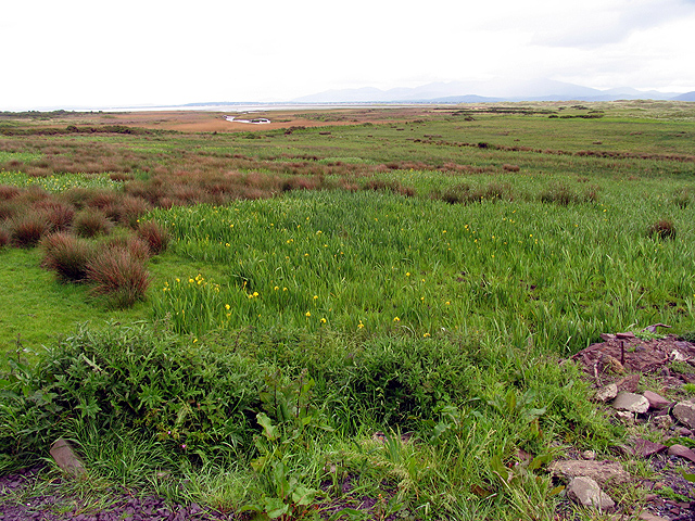
Cliff Belt, Suffolk (Wood, Forest) is a picturesque and tranquil area located in the county of Suffolk, England. Nestled amidst rolling hills and lush green landscapes, this idyllic woodland is a haven for nature enthusiasts and outdoor lovers.

Covering an expansive area of approximately 500 acres, Cliff Belt boasts an impressive variety of flora and fauna. The forest is primarily composed of oak, birch, and beech trees, creating a dense canopy that provides shade and shelter for a wide range of wildlife. Visitors to this enchanting woodland can spot an array of bird species, including woodpeckers, owls, and various songbirds.

The forest is crisscrossed by a network of well-maintained trails, making it an ideal destination for hiking, biking, and horseback riding. These paths lead visitors through ancient woodlands, across babbling brooks, and up to breathtaking viewpoints, offering stunning vistas of the surrounding countryside.

In addition to its natural beauty, Cliff Belt also holds historical significance. The forest is home to several archaeological sites, including ancient burial mounds and remnants of Iron Age settlements. These sites provide a fascinating glimpse into the area's rich and diverse past.

To ensure the preservation of this precious ecosystem, Cliff Belt is managed by a team of dedicated conservationists. They work tirelessly to maintain the balance between human activity and the protection of the forest's delicate ecosystem.

Overall, Cliff Belt, Suffolk (Wood, Forest) is a captivating destination that offers a serene escape from the hustle and bustle of everyday life. Whether you are seeking a peaceful walk in nature, a glimpse into history, or simply a moment of tranquility, this enchanting woodland has something for everyone.

If you have any feedback on the listing, please let us know in the comments section below.

Cliff Belt Images

Images are sourced within 2km of 52.262064/1.6277804 or Grid Reference TM4768. Thanks to Geograph Open Source API. All images are credited.

The ruins of Greyfriars through an ancient archway
Daffodils in Greyfriars Wood The wood is noted for its spring flowers. The snowdrops have just finished and now the daffs are out.
Daffodils in Greyfriars Wood
The wood is noted for its spring flowers. The snowdrops have just finished and now the daffs are out.
Dunwich, The Ferns According to the OS benchmark database there is a benchmark cut into a post amongst this roadside hedge. The vegetation was too thick to find anything.
Dunwich, The Ferns
According to the OS benchmark database there is a benchmark cut into a post amongst this roadside hedge. The vegetation was too thick to find anything.
Dunwich, Sea View The benchmark is cut into the right of the front fascia of the property. It is on the south side of the road.
Dunwich, Sea View
The benchmark is cut into the right of the front fascia of the property. It is on the south side of the road.
Dunwich, Sea View There is a benchmark cut into the right brickwork of the front facia of the property. It is on the south side of the road.
Dunwich, Sea View
There is a benchmark cut into the right brickwork of the front facia of the property. It is on the south side of the road.
Dunwich, St James' church The benchmark is cut into the north-east facing buttress of the church tower.
Dunwich, St James' church
The benchmark is cut into the north-east facing buttress of the church tower.
Dunwich, St James' church There is a benchmark cut into the north-east facing buttress of the church tower.
Dunwich, St James' church
There is a benchmark cut into the north-east facing buttress of the church tower.
Dunwich, Bridge Cottage The benchmark is cut into the right side of the gable end of the cottage, which faces onto the road.
Dunwich, Bridge Cottage
The benchmark is cut into the right side of the gable end of the cottage, which faces onto the road.
Dunwich, Bridge Cottage There is a benchmark cut into the right side of the gable end of the cottage, which faces onto the road.
Dunwich, Bridge Cottage
There is a benchmark cut into the right side of the gable end of the cottage, which faces onto the road.
Dunwich, High Street The OS Flush Bracket 016S is embedded into a brick wall which divides the Old Stables from No 6 High Street. This is on the south side of the road.
Dunwich, High Street
The OS Flush Bracket 016S is embedded into a brick wall which divides the Old Stables from No 6 High Street. This is on the south side of the road.
Dunwich, Beehive Cottage The benchmark is cut into the east facing wall of the cottage. It is partially obscured from sight after a new brick gatepost has been erected adjoining the cottage.
Dunwich, Beehive Cottage
The benchmark is cut into the east facing wall of the cottage. It is partially obscured from sight after a new brick gatepost has been erected adjoining the cottage.
Dunwich, Beehive Cottage There is a benchmark cut into the east facing wall of the cottage. It is partially obscured from sight after a new brick gatepost supporting a high wooden gate has been erected adjoining the cottage.
Dunwich, Beehive Cottage
There is a benchmark cut into the east facing wall of the cottage. It is partially obscured from sight after a new brick gatepost supporting a high wooden gate has been erected adjoining the cottage.
Dunwich, Greyfriars Archway The benchmark is cut into the right support of the archway. This was part of the Greyfriars friary on the edge of Dunwich.
Dunwich, Greyfriars Archway
The benchmark is cut into the right support of the archway. This was part of the Greyfriars friary on the edge of Dunwich.
Dunwich, archway to Greyfriars There is a benchmark cut into the right support of the archway. This was part of the Greyfriars friary on the edge of Dunwich.
Dunwich, archway to Greyfriars
There is a benchmark cut into the right support of the archway. This was part of the Greyfriars friary on the edge of Dunwich.
Path across the Dunwich River valley
Wetland in the floor of the Dunwich River valley
Path across the Dunwich River valley
Show me another place!

Cliff Belt is located at Grid Ref: TM4768 (Lat: 52.262064, Lng: 1.6277804)

Administrative County: Suffolk

District: East Suffolk

Police Authority: Suffolk

What 3 Words

///vase.booklets.clear. Near Leiston, Suffolk

Related Wikis

Dunwich Heath

Dunwich Heath is an area of coastal lowland heath just south of the village of Dunwich, in the Suffolk Coast and Heaths AONB, England. It is adjacent to...

Minsmere–Walberswick Heaths and Marshes

Minsmere–Walberswick Heaths and Marshes are a Special Area of Conservation and Site of Special Scientific Interest in the English county of Suffolk. The...

Dunwich Bank Wreck

The remains of an unknown armed cargo vessel dating to the sixteenth to seventeenth century were identified off Dunwich, Suffolk, England in 1993. The...
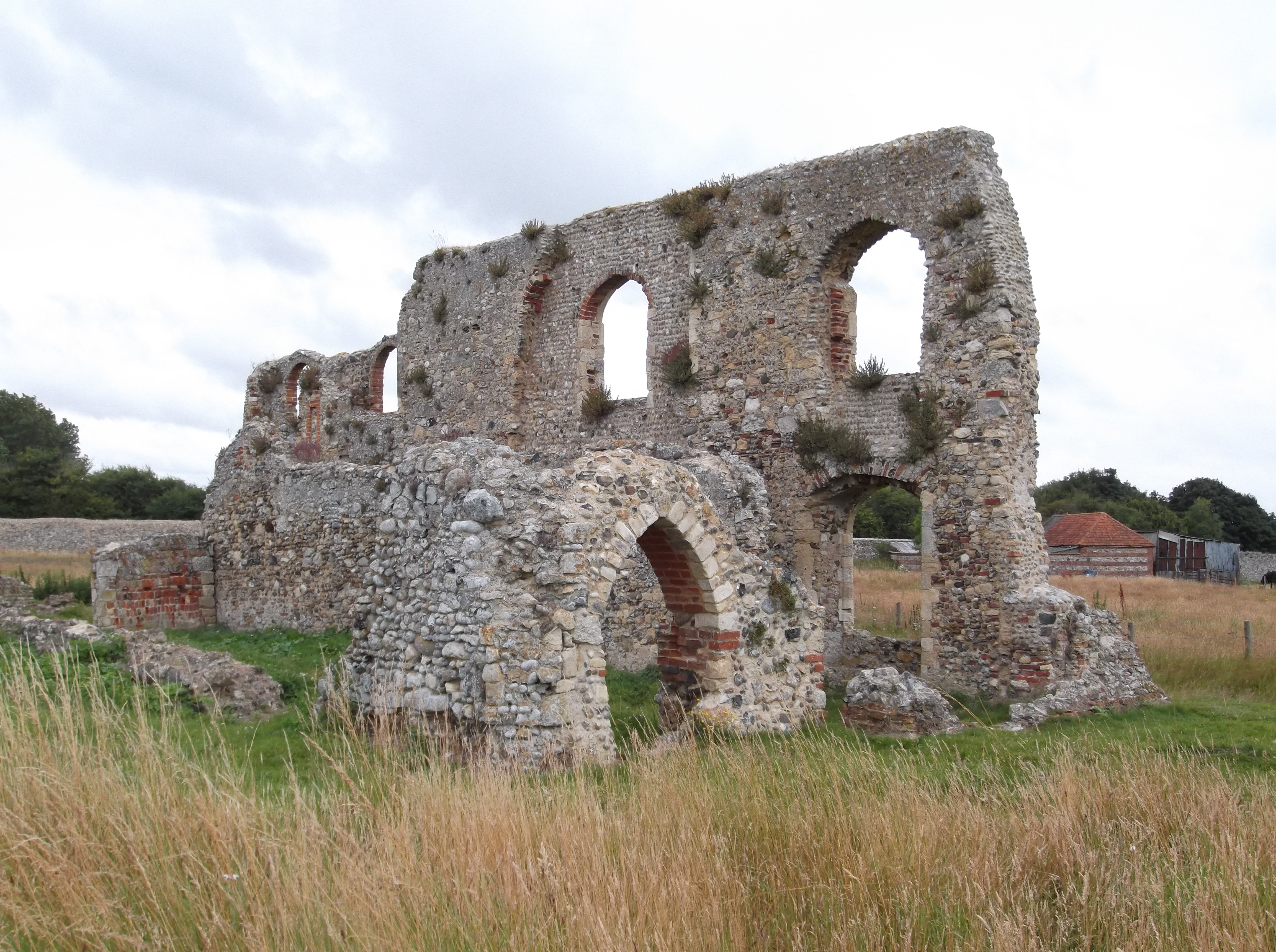
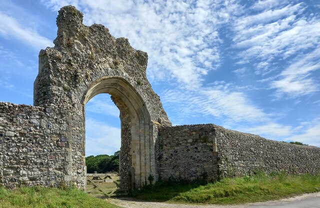
Greyfriars, Dunwich

Greyfriars, Dunwich was a Franciscan friary in Dunwich in the English county of Suffolk. The friary was founded before 1277 by Richard FitzJohn and his...
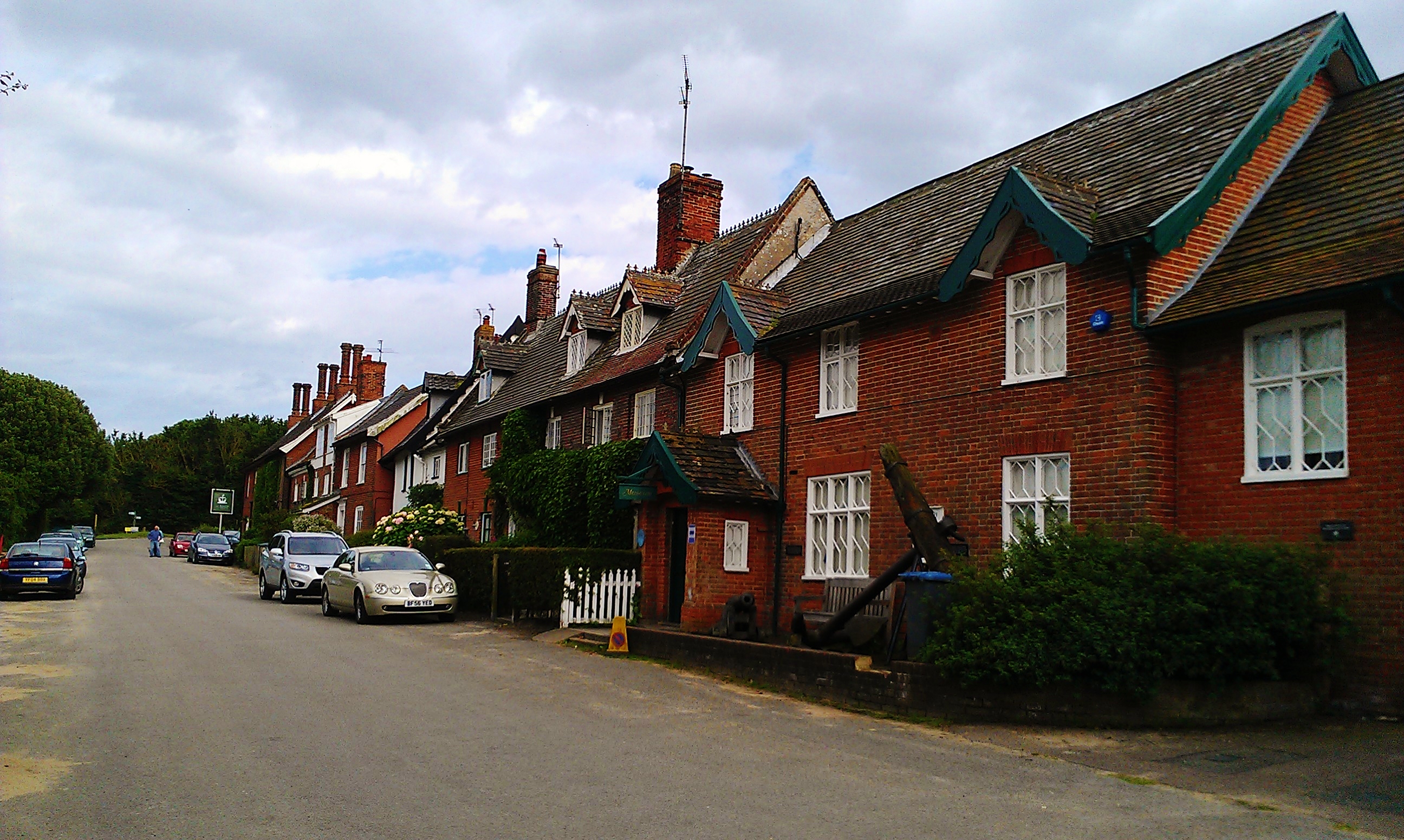
Dunwich

Dunwich () is a village and civil parish in Suffolk, England. It is in the Suffolk Coast and Heaths AONB around 92 miles (148 km) north-east of London...

Minsmere

Minsmere is a place in the English county of Suffolk. It is located on the North Sea coast around 3.5 miles (5.6 km) north of Leiston and 1.5 miles (2...

RSPB Minsmere

RSPB Minsmere is a nature reserve owned and managed by the Royal Society for the Protection of Birds (RSPB) at Minsmere, Suffolk. The 1,000-hectare (2...
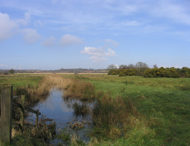
Dingle Marshes

Dingle Marshes is a 93-hectare (230-acre) wildlife reserve on the North Sea coast of the English county of Suffolk. The reserve is located between Dunwich...

Nearby Amenities

Located within 500m of 52.262064,1.6277804
Created By: almien_coastlines
Source: PGS
Lat/Long: 52.25977/1.629988
Created By: almien_coastlines
Source: PGS
Lat/Long: 52.260794/1.629956
Created By: almien_coastlines
Source: PGS
Lat/Long: 52.263617/1.630287
Traffic Calming: bump
Lat/Long: 52.2591227/1.6267656
Traffic Calming: bump
Lat/Long: 52.257726/1.6272232
Fixme: continue
Lat/Long: 52.2590738/1.625693
The data included in this document is from www.openstreetmap.org. The data is made available under ODbL.

Have you been to Cliff Belt?

Leave your review of Cliff Belt below (or comments, questions and feedback).