Blomfield Wood

Wood, Forest in Suffolk East Suffolk

England

Blomfield Wood

Church of All Saints, Frostenden <span class="nowrap"><a title="https://historicengland.org.uk/listing/the-list/list-entry/1032170?section=official-list-entry" rel="nofollow ugc noopener" href="https://historicengland.org.uk/listing/the-list/list-entry/1032170?section=official-list-entry">Link</a><img style="margin-left:2px;" alt="External link" title="External link - shift click to open in new window" src="https://s1.geograph.org.uk/img/external.png" width="10" height="10"/></span>
Church of All Saints, Frostenden Credit: Sandy Gerrard

Blomfield Wood is a picturesque forest located in Suffolk, England. Covering an area of approximately 200 acres, it is known for its diverse flora and fauna, making it a popular destination for nature enthusiasts and hikers.

The woodland is primarily composed of deciduous trees, including oak, beech, and ash. These towering trees provide a dense canopy, allowing only dappled sunlight to penetrate the forest floor. As a result, the undergrowth is rich with ferns, mosses, and wildflowers, creating a vibrant and colorful environment.

Blomfield Wood is home to a wide range of wildlife. Birdwatchers can spot various species, such as woodpeckers, owls, and jays, while small mammals like foxes, badgers, and squirrels can be observed scurrying through the underbrush. Additionally, the forest is inhabited by numerous insects, including butterflies and beetles, further adding to its ecological diversity.

The forest offers several well-marked trails, allowing visitors to explore its natural beauty. These paths wind through the woodlands, providing stunning views of the surrounding countryside. Along the way, there are designated picnic areas and benches, perfect for a tranquil break amidst nature.

Blomfield Wood is managed by a local conservation organization, which ensures the preservation of its natural environment. They organize educational programs and guided tours, aiming to raise awareness about the importance of protecting this unique ecosystem.

Overall, Blomfield Wood is a captivating forest in Suffolk, offering a serene escape into nature. Its diverse flora and fauna, coupled with well-maintained trails, make it an ideal destination for outdoor enthusiasts and nature lovers alike.

If you have any feedback on the listing, please let us know in the comments section below.

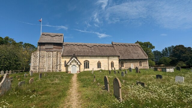
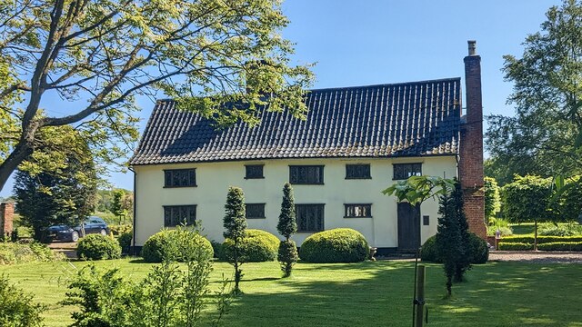
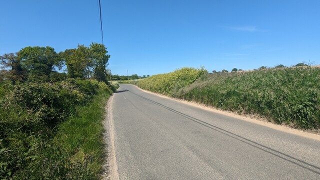
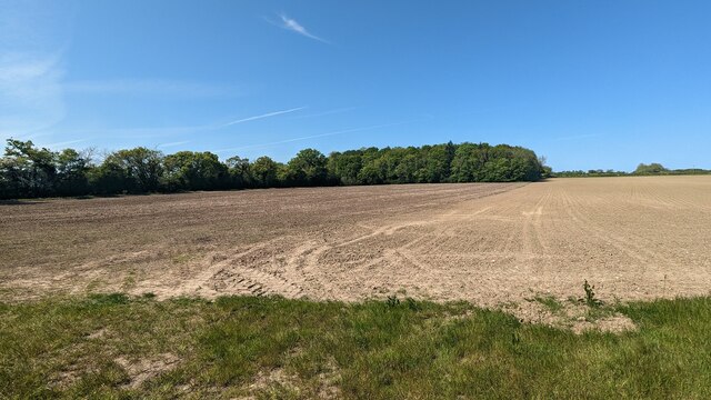
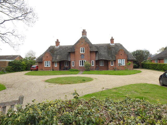
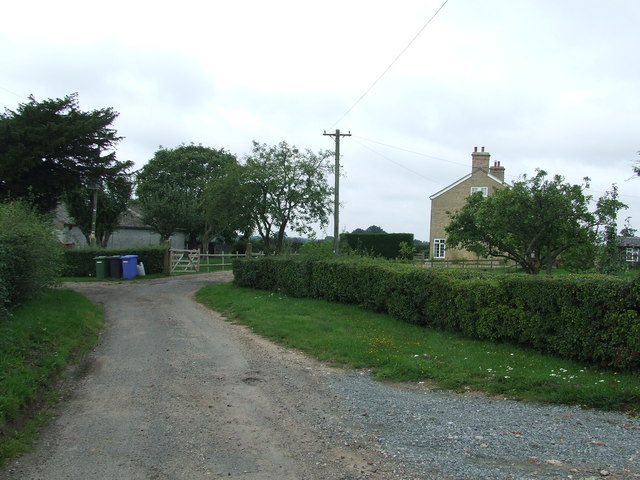
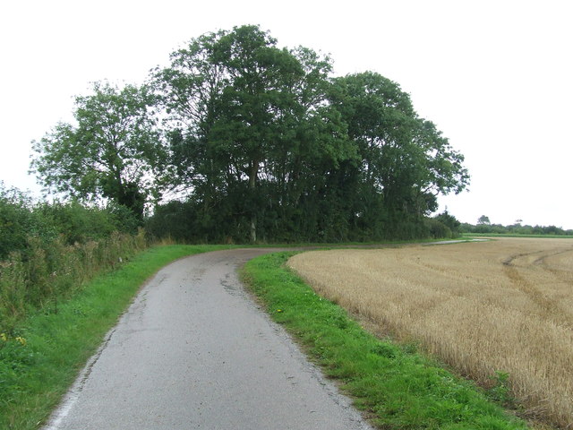
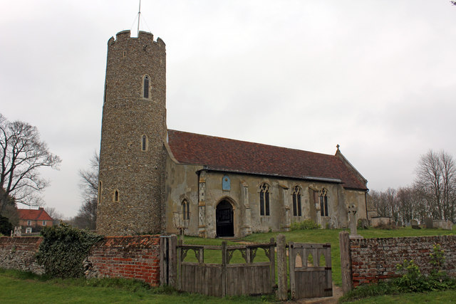
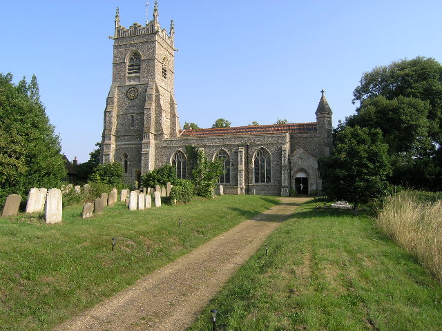
Blomfield Wood Images

Images are sourced within 2km of 52.366292/1.6296224 or Grid Reference TM4780. Thanks to Geograph Open Source API. All images are credited.

Church of All Saints, Frostenden <span class="nowrap"><a title="https://historicengland.org.uk/listing/the-list/list-entry/1032170?section=official-list-entry" rel="nofollow ugc noopener" href="https://historicengland.org.uk/listing/the-list/list-entry/1032170?section=official-list-entry">Link</a><img style="margin-left:2px;" alt="External link" title="External link - shift click to open in new window" src="https://s1.geograph.org.uk/img/external.png" width="10" height="10"/></span>
Church of All Saints, Frostenden
Church of St. Mary, Uggeshall <span class="nowrap"><a title="https://historicengland.org.uk/listing/the-list/list-entry/1284129?section=official-list-entry" rel="nofollow ugc noopener" href="https://historicengland.org.uk/listing/the-list/list-entry/1284129?section=official-list-entry">Link</a><img style="margin-left:2px;" alt="External link" title="External link - shift click to open in new window" src="https://s1.geograph.org.uk/img/external.png" width="10" height="10"/></span>
Church of St. Mary, Uggeshall
Goughs, Frostenden <span class="nowrap"><a title="https://historicengland.org.uk/listing/the-list/list-entry/1352547?section=official-list-entry" rel="nofollow ugc noopener" href="https://historicengland.org.uk/listing/the-list/list-entry/1352547?section=official-list-entry">Link</a><img style="margin-left:2px;" alt="External link" title="External link - shift click to open in new window" src="https://s1.geograph.org.uk/img/external.png" width="10" height="10"/></span>
Goughs, Frostenden
Waiting for Life to Emerge Large field near Frostenden Hall.
Waiting for Life to Emerge
Large field near Frostenden Hall.
Road from Wangford to Uggeshall
Blomfield Wood
Blomfield Wood
Alms houses at Wangford A plaque between the central windows reads thus: "These almshouses were built by George, 3rd Earl of Stradbroke and Helena his wife in memory of their son Christopher Simon Rous who died in Melbourne, Australia after long suffering bourne with heroic patience and cheerfulness."
The plaque can be seen here  <a href="https://www.geograph.org.uk/photo/7473017">TM4679 : Plaque on the almshouses at Wangford</a>
Alms houses at Wangford
A plaque between the central windows reads thus: "These almshouses were built by George, 3rd Earl of Stradbroke and Helena his wife in memory of their son Christopher Simon Rous who died in Melbourne, Australia after long suffering bourne with heroic patience and cheerfulness." The plaque can be seen here TM4679 : Plaque on the almshouses at Wangford
Plaque on the almshouses at Wangford The plaque between the central windows reads thus: "These almshouses were built by George, 3rd Earl of Stradbroke and Helena his wife in memory of their son Christopher Simon Rous who died in Melbourne, Australia after long suffering bourne with heroic patience and cheerfulness."  <a href="https://www.geograph.org.uk/photo/7473012">TM4679 : Alms houses at Wangford</a>
Plaque on the almshouses at Wangford
The plaque between the central windows reads thus: "These almshouses were built by George, 3rd Earl of Stradbroke and Helena his wife in memory of their son Christopher Simon Rous who died in Melbourne, Australia after long suffering bourne with heroic patience and cheerfulness." TM4679 : Alms houses at Wangford
Serpentine wall at Parson's Meadow, Wangford A serpentine or crinkle-crankle wall was initially designed to save bricks and reduce to cost of building walls. Suffolk seems to be the historical birthplace of the metamorphic remodelling of the straightforward into the curiously peculiar.
A wavy wall can be built with the thickness of a single brick and is self supporting even in very strong winds whereas a straight wall requires a thickness of at least two bricks (9 inches) and even buttresses if raised over about three feet.

Wikipedia has a few words to add: A crinkle crankle wall, also known as a crinkum crankum, slangenmuur  (snake-wall) sinusoidal, serpentine, ribbon or wavy wall, is an unusual type of structural or garden wall built in a serpentine shape with alternating curves, originally used in Ancient Egypt, but also typically found in Suffolk in England.
The alternate convex and concave curves in the wall provide stability and help it to resist lateral forces,  leading to greater strength than a straight wall of the same thickness of bricks without the need for buttresses.
The phrase "crinkle crankle" is an ablaut reduplication, defined as something with bends and turns, first attested in 1598 (though "crinkle" and "crankle" have somewhat longer histories).
Serpentine wall at Parson's Meadow, Wangford
A serpentine or crinkle-crankle wall was initially designed to save bricks and reduce to cost of building walls. Suffolk seems to be the historical birthplace of the metamorphic remodelling of the straightforward into the curiously peculiar. A wavy wall can be built with the thickness of a single brick and is self supporting even in very strong winds whereas a straight wall requires a thickness of at least two bricks (9 inches) and even buttresses if raised over about three feet. Wikipedia has a few words to add: A crinkle crankle wall, also known as a crinkum crankum, slangenmuur (snake-wall) sinusoidal, serpentine, ribbon or wavy wall, is an unusual type of structural or garden wall built in a serpentine shape with alternating curves, originally used in Ancient Egypt, but also typically found in Suffolk in England. The alternate convex and concave curves in the wall provide stability and help it to resist lateral forces, leading to greater strength than a straight wall of the same thickness of bricks without the need for buttresses. The phrase "crinkle crankle" is an ablaut reduplication, defined as something with bends and turns, first attested in 1598 (though "crinkle" and "crankle" have somewhat longer histories).
Old Post Office at Wangford <span class="nowrap"><a title="https://historicengland.org.uk/listing/the-list/list-entry/1182410?section=official-list-entry" rel="nofollow ugc noopener" href="https://historicengland.org.uk/listing/the-list/list-entry/1182410?section=official-list-entry">Link</a><img style="margin-left:2px;" alt="External link" title="External link - shift click to open in new window" src="https://s1.geograph.org.uk/img/external.png" width="10" height="10"/></span>
Old Post Office at Wangford
Maltings at Elms Farm <span class="nowrap"><a title="https://historicengland.org.uk/listing/the-list/list-entry/1352534?section=official-list-entry" rel="nofollow ugc noopener" href="https://historicengland.org.uk/listing/the-list/list-entry/1352534?section=official-list-entry">Link</a><img style="margin-left:2px;" alt="External link" title="External link - shift click to open in new window" src="https://s1.geograph.org.uk/img/external.png" width="10" height="10"/></span>
Maltings at Elms Farm
Brick Kiln Farm Brick Kiln Farm near to Clay Common, Suffolk.
Brick Kiln Farm
Brick Kiln Farm near to Clay Common, Suffolk.
Track Footpath and farm track near to Clay Common, Suffolk.
Track
Footpath and farm track near to Clay Common, Suffolk.
Open Gate Open gate near to Stoven, Suffolk.
Open Gate
Open gate near to Stoven, Suffolk.
St Mary Uggeshall The church of St Mary Uggeshall, Suffolk for more info see <span class="nowrap"><a title="http://www.suffolkchurches.co.uk/uggeshall.htm" rel="nofollow ugc noopener" href="http://www.suffolkchurches.co.uk/uggeshall.htm">Link</a><img style="margin-left:2px;" alt="External link" title="External link - shift click to open in new window" src="https://s1.geograph.org.uk/img/external.png" width="10" height="10"/></span>
St Mary Uggeshall
The church of St Mary Uggeshall, Suffolk for more info see LinkExternal link
Primrose Lane Junction off Primrose Lane near to Clay Common, Suffolk.
Primrose Lane
Junction off Primrose Lane near to Clay Common, Suffolk.
Footpath Footpath near to Frostenden, Suffolk.
Footpath
Footpath near to Frostenden, Suffolk.
All Saints Church, Church Lane, Frostenden Grade I Listed medieval church restored about 1890 according to the listing. A photograph by Henry Munro Cautley FSA ARIBA labelled 'Restored and re-opened 9th April 1936' shows the church with no roof and roof trusses partially replaced. The tower is either Norman or even Saxon and one of Suffolk's oldest round towers. All Saints was built in the 13th century and the main body of the church consists of  nave, chancel, and 15th century south aisle. The nave door and lean-to aisle roof are largely original. The parish registers date from 1538. The Domesday Book of 1086 shows that sea-going ships tied up here, indicating that the now dried-up river bed behind the church was once navigable. There were also two churches here.
All Saints Church, Church Lane, Frostenden
Grade I Listed medieval church restored about 1890 according to the listing. A photograph by Henry Munro Cautley FSA ARIBA labelled 'Restored and re-opened 9th April 1936' shows the church with no roof and roof trusses partially replaced. The tower is either Norman or even Saxon and one of Suffolk's oldest round towers. All Saints was built in the 13th century and the main body of the church consists of nave, chancel, and 15th century south aisle. The nave door and lean-to aisle roof are largely original. The parish registers date from 1538. The Domesday Book of 1086 shows that sea-going ships tied up here, indicating that the now dried-up river bed behind the church was once navigable. There were also two churches here.
Show me another place!

Blomfield Wood is located at Grid Ref: TM4780 (Lat: 52.366292, Lng: 1.6296224)

Administrative County: Suffolk

District: East Suffolk

Police Authority: Suffolk

What 3 Words

///runner.arranger.homework. Near Southwold, Suffolk

Related Wikis

Frostenden

Frostenden is a village and civil parish in the East Suffolk district of the English county of Suffolk. It is around 8 miles (13 km) south-west of Lowestoft...

Wangford

Wangford is a village and former civil parish, now in the parish of Wangford with Henham, in the East Suffolk district, in the county of Suffolk, England...

Wangford Priory

The Cluniac Priory of Wangford was a small religious house in Wangford in the English county of Suffolk. It was founded before 1159 as a dependency of...

Reydon Wood

Reydon Wood is a 16 hectare nature reserve west of Wangford in Suffolk, England. It is managed by the Suffolk Wildlife Trust.This conifer wood has many...

Wangford with Henham

Wangford with Henham is a civil parish in the East Suffolk district of the English county of Suffolk. It is around 5.5 miles (8.9 km) east of Halesworth...

Uggeshall

Uggeshall is a village and civil parish in the East Suffolk district, in the county of Suffolk, England, located approximately 6 miles (10 km) south of...

Stoven

Stoven is a village and former civil parish now in the parish of Brampton with Stoven, in the East Suffolk district of the English county of Suffolk. It...

South Cove, Suffolk

South Cove is a civil parish in the east of the English county of Suffolk. It is 3 miles (4.8 km) north of the coastal town of Southwold and 1 mile (1...

Related Videos

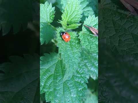
A superb Slender Groundhopper on Nettle with a cheeky Ladybird getting in on the action

This is a Slender Groundhopper (Tetrix subulata). They are like small Grasshoppers, but do not make any noise (and have no ...

Suffolk Drone Southwold Maize Maze

MAIZE MAZES, GO KARTS & PLAY PARK OPEN OCTOBER HALF TERM FOR HALLOWEEN SCARETACULAR EVENT 21 - 29 ...

The St Elizabeth Hospice Firewalk Southwold 3rd Sept 2021

Held at Old Hall Cafe in Reydon, Southwold, Suffolk on Friday 3rd September at around 7.30pm, with the River Blyth estuary in ...

whimbrel at hen reedbeds reydon 27 april 2022 [a rare visitor ]

a rare glimpse of a whimbrel walking around hen reedbeds reydon.

Nearby Amenities

Located within 500m of 52.366292,1.6296224
The data included in this document is from www.openstreetmap.org. The data is made available under ODbL.

Have you been to Blomfield Wood?

Leave your review of Blomfield Wood below (or comments, questions and feedback).