Boon's Heath

Wood, Forest in Norfolk South Norfolk

England

Boon's Heath

River Waveney
River Waveney Credit: Matthew Chadwick

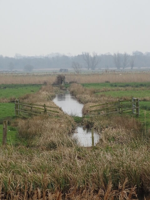
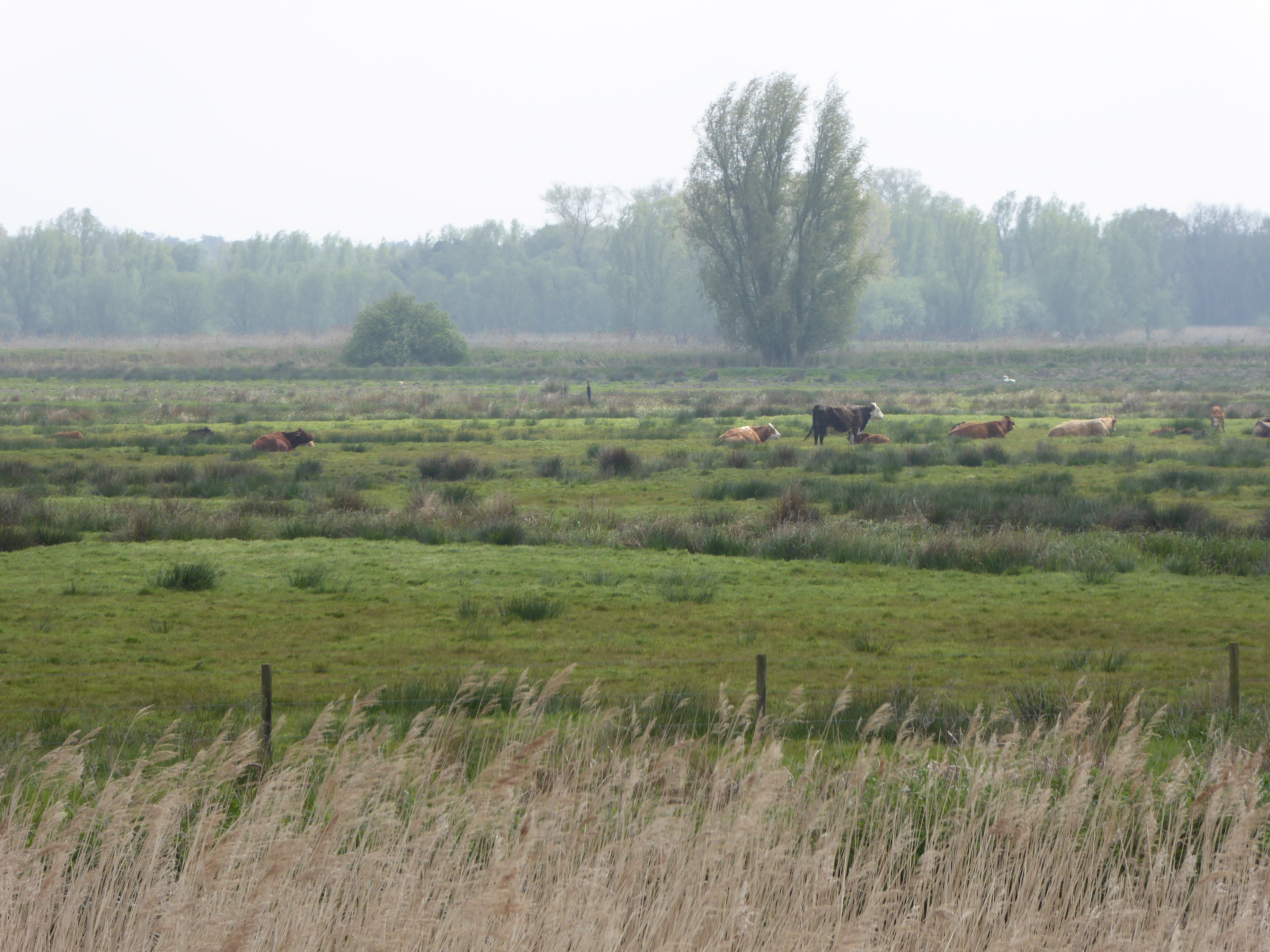
Boon's Heath is a picturesque woodland located in Norfolk, England. Nestled within the county's beautiful countryside, it covers an area of approximately 400 acres. Boon's Heath is renowned for its dense and diverse forest, making it a haven for nature enthusiasts and wildlife alike.

The woodland is predominantly composed of mixed broadleaf trees, including oak, beech, and birch, creating a stunning tapestry of vibrant colors throughout the seasons. The forest floor is carpeted with a rich variety of flora, such as bluebells, ferns, and mosses, adding to the enchanting atmosphere of the area.

Boon's Heath boasts an extensive network of well-maintained footpaths and trails, allowing visitors to explore the woodland at their leisure. These paths wind through the forest, offering breathtaking views of the surrounding landscape and providing opportunities for peaceful walks or invigorating hikes.

The woodland is home to a diverse range of wildlife, including deer, badgers, foxes, and a plethora of bird species. Birdwatchers can spot a variety of feathered inhabitants, such as woodpeckers, owls, and warblers.

Boon's Heath is a popular destination for outdoor activities, attracting both locals and tourists. It offers opportunities for picnicking, camping, and nature photography. The tranquil ambiance and unspoiled natural beauty make it an ideal location for those seeking solace in nature.

Overall, Boon's Heath in Norfolk is a captivating woodland retreat, with its ancient trees, abundant wildlife, and peaceful surroundings, making it a must-visit destination for nature lovers and outdoor enthusiasts alike.

If you have any feedback on the listing, please let us know in the comments section below.

Boon's Heath Images

Images are sourced within 2km of 52.475424/1.6352184 or Grid Reference TM4692. Thanks to Geograph Open Source API. All images are credited.

River Waveney
River Waveney
Castle Marsh drainage channel
Castle Drainage Mill
Reeds along the River Waveney
The Angles Way More detail on the Angles Way can be found at: <span class="nowrap"><a title="https://en.wikipedia.org/wiki/Angles_Way" rel="nofollow ugc noopener" href="https://en.wikipedia.org/wiki/Angles_Way">Link</a><img style="margin-left:2px;" alt="External link" title="External link - shift click to open in new window" src="https://s1.geograph.org.uk/img/external.png" width="10" height="10"/></span>
The Angles Way
More detail on the Angles Way can be found at: LinkExternal link
Whiteways, Wheatacre One of several distinctive and thoughtful council housing projects by Herbert Tayler & David Green for Loddon District Council. Built in two phases, 1948 and 1957. Mostly two-storey houses.
Whiteways, Wheatacre
One of several distinctive and thoughtful council housing projects by Herbert Tayler & David Green for Loddon District Council. Built in two phases, 1948 and 1957. Mostly two-storey houses.
River Waveney The River Waveney forms the boundary between Suffolk and Norfolk. It rises at Redgrave Fen and flows in an easterly direction though the towns of Diss, Bungay (the head of navigation) and Beccles. There is a weir at Billingford, shortly after the River Dove, flowing northwards from Eye, joins the Waveney on the southern bank. The Waveney passes round Bungay and on to Beccles. Having skirted past Oulton Broad it passes through Somerleyton and Hadiscoe before merging with the Yare in Breydon Water.
River Waveney
The River Waveney forms the boundary between Suffolk and Norfolk. It rises at Redgrave Fen and flows in an easterly direction though the towns of Diss, Bungay (the head of navigation) and Beccles. There is a weir at Billingford, shortly after the River Dove, flowing northwards from Eye, joins the Waveney on the southern bank. The Waveney passes round Bungay and on to Beccles. Having skirted past Oulton Broad it passes through Somerleyton and Hadiscoe before merging with the Yare in Breydon Water.
Drainage ditch
Drainage ditch
Angles Way A 77 mile long path. From Great Yarmouth the route goes by Breydon Water, along and near the River Waveney, passing around Oulton Broad, Beccles and Bungay, and Harleston and Diss, to its source, and then by the Little Ouse from its source very close by through heathland and marsh to Knettishall Heath in the Suffolk Brecks. Less than a mile onwards west across the heath the coincident start of the Peddars Way and finish of the Icknield Way Path are reached.
Logo <a href="https://www.geograph.org.uk/photo/7632664">TM3890 : Angles Way Logo</a>
Angles Way
A 77 mile long path. From Great Yarmouth the route goes by Breydon Water, along and near the River Waveney, passing around Oulton Broad, Beccles and Bungay, and Harleston and Diss, to its source, and then by the Little Ouse from its source very close by through heathland and marsh to Knettishall Heath in the Suffolk Brecks. Less than a mile onwards west across the heath the coincident start of the Peddars Way and finish of the Icknield Way Path are reached. Logo TM3890 : Angles Way Logo
River Waveney The River Waveney forms the boundary between Suffolk and Norfolk. It rises at Redgrave Fen and flows in an easterly direction though the towns of Diss, Bungay (the head of navigation) and Beccles. There is a weir at Billingford, shortly after the River Dove, flowing northwards from Eye, joins the Waveney on the southern bank. The Waveney passes round Bungay and on to Beccles. Having skirted past Oulton Broad it passes through Somerleyton and Hadiscoe before merging with the Yare in Breydon Water.
River Waveney
The River Waveney forms the boundary between Suffolk and Norfolk. It rises at Redgrave Fen and flows in an easterly direction though the towns of Diss, Bungay (the head of navigation) and Beccles. There is a weir at Billingford, shortly after the River Dove, flowing northwards from Eye, joins the Waveney on the southern bank. The Waveney passes round Bungay and on to Beccles. Having skirted past Oulton Broad it passes through Somerleyton and Hadiscoe before merging with the Yare in Breydon Water.
Drainage ditch
Drainage ditch
Pumping Station
Pumping Station
Pumping station by River Waveney
Drainage ditch
Drainage ditch
River Waveney The River Waveney forms the boundary between Suffolk and Norfolk. It rises at Redgrave Fen and flows in an easterly direction though the towns of Diss, Bungay (the head of navigation) and Beccles. There is a weir at Billingford, shortly after the River Dove, flowing northwards from Eye, joins the Waveney on the southern bank. The Waveney passes round Bungay and on to Beccles. Having skirted past Oulton Broad it passes through Somerleyton and Hadiscoe before merging with the Yare in Breydon Water.
River Waveney
The River Waveney forms the boundary between Suffolk and Norfolk. It rises at Redgrave Fen and flows in an easterly direction though the towns of Diss, Bungay (the head of navigation) and Beccles. There is a weir at Billingford, shortly after the River Dove, flowing northwards from Eye, joins the Waveney on the southern bank. The Waveney passes round Bungay and on to Beccles. Having skirted past Oulton Broad it passes through Somerleyton and Hadiscoe before merging with the Yare in Breydon Water.
Pumping Station
Pumping Station
Pumping station by River Waveney The River Waveney forms the boundary between Suffolk and Norfolk. It rises at Redgrave Fen and flows in an easterly direction though the towns of Diss, Bungay (the head of navigation) and Beccles. There is a weir at Billingford, shortly after the River Dove, flowing northwards from Eye, joins the Waveney on the southern bank. The Waveney passes round Bungay and on to Beccles. Having skirted past Oulton Broad it passes through Somerleyton and Hadiscoe before merging with the Yare in Breydon Water.
Pumping station by River Waveney
The River Waveney forms the boundary between Suffolk and Norfolk. It rises at Redgrave Fen and flows in an easterly direction though the towns of Diss, Bungay (the head of navigation) and Beccles. There is a weir at Billingford, shortly after the River Dove, flowing northwards from Eye, joins the Waveney on the southern bank. The Waveney passes round Bungay and on to Beccles. Having skirted past Oulton Broad it passes through Somerleyton and Hadiscoe before merging with the Yare in Breydon Water.
Show me another place!

Boon's Heath is located at Grid Ref: TM4692 (Lat: 52.475424, Lng: 1.6352184)

Administrative County: Norfolk

District: South Norfolk

Police Authority: Norfolk

What 3 Words

///swoop.lamppost.stars. Near Beccles, Suffolk

Nearby Locations

Boon's Heath

Related Wikis

Burgh St Peter

Burgh St Peter is a village and civil parish in the South Norfolk district of Norfolk, England. The village is about 3+1⁄2 miles (6 km) northeast of Beccles...

Barnby Broad and Marshes

Barnby Broad and Marshes is a Site of Special Scientific Interest (SSSI) in the Waveney district of the English county of Suffolk. The site is 189.6 hectares...

Wheatacre

Wheatacre is a civil parish in the English county of Norfolk. It covers an area of 4.38 km2 (1.69 sq mi) and had a population of 112 in 43 households at...

Castle Marshes

Castle Marshes is a 71 hectare nature reserve west of Lowestoft in Suffolk. It is managed by the Suffolk Wildlife Trust. It is part of the Barnby Broad...

Nearby Amenities

Located within 500m of 52.475424,1.6352184
Give Way
Lat/Long: 52.4770507/1.6349571
Power: pole
Lat/Long: 52.4793433/1.6352329
Power: pole
Lat/Long: 52.4791097/1.6366035
Power: pole
Lat/Long: 52.4788908/1.6377166
Power: pole
Lat/Long: 52.4786441/1.6390067
Power: pole
Lat/Long: 52.4784938/1.6397846
Power: pole
Lat/Long: 52.4766559/1.637215
Power: pole
Lat/Long: 52.4777554/1.6374913
Barrier: bollard
Bollard: fixed
Material: wood
Lat/Long: 52.4743998/1.634274
The data included in this document is from www.openstreetmap.org. The data is made available under ODbL.

Have you been to Boon's Heath?

Leave your review of Boon's Heath below (or comments, questions and feedback).