Fulwood

Settlement in Lancashire Preston

England

Fulwood

A6 Garstang Road northbound in Fulwood
A6 Garstang Road northbound in Fulwood Credit: Colin Pyle

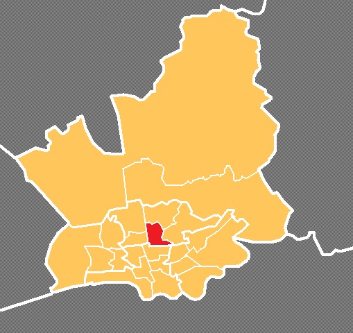
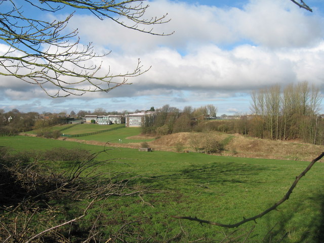
Fulwood is a suburban area located in the county of Lancashire, in the northwest of England. Situated approximately 3 miles north of the city center of Preston, it is part of the larger administrative area known as the City of Preston. Fulwood is situated on higher ground, providing picturesque views of the surrounding countryside.

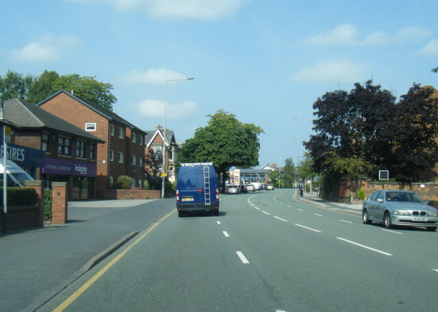
The area is primarily residential, featuring a mix of housing types including detached houses, semi-detached houses, and some apartment complexes. The architecture in Fulwood ranges from Victorian and Edwardian buildings to more modern developments, reflecting the area's diverse history.

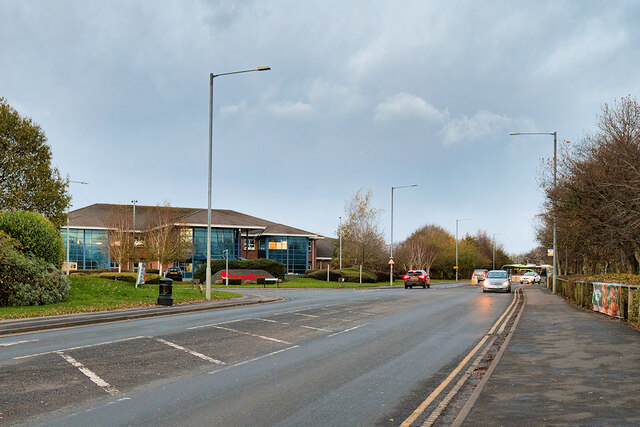
Fulwood offers a range of amenities and facilities to its residents. There are several primary and secondary schools in the area, providing educational opportunities for local families. The area is also well-served by public transportation, with regular bus services connecting Fulwood to nearby towns and cities.

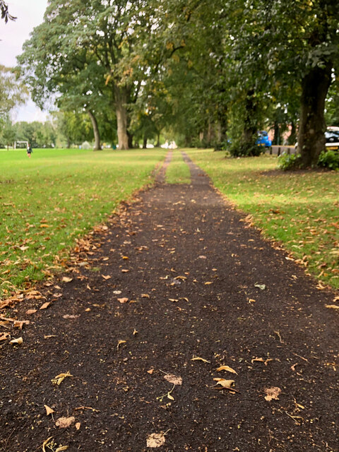
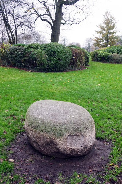
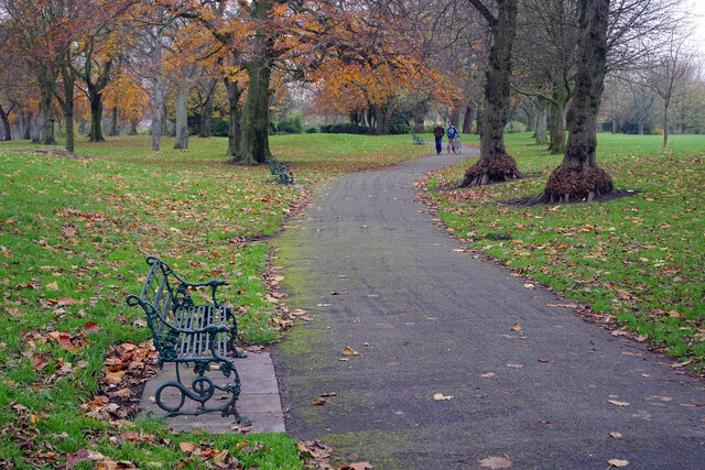
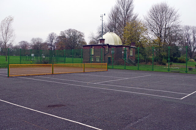
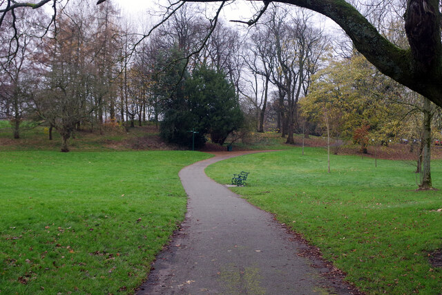
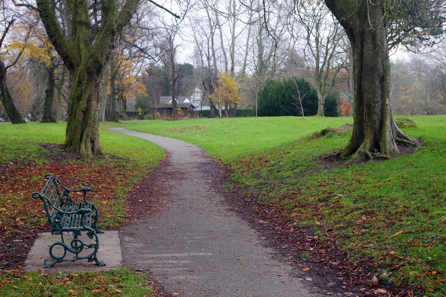
In terms of leisure and recreation, Fulwood boasts several parks and green spaces, offering opportunities for outdoor activities and relaxation. Notably, the stunning landscapes of the nearby Forest of Bowland and the Ribble Valley are within easy reach, providing further options for outdoor enthusiasts.

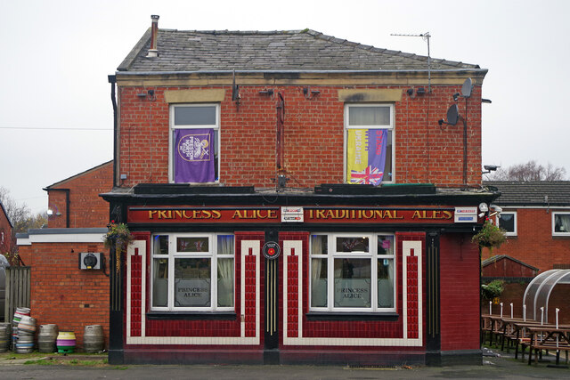
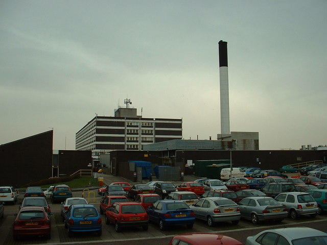
Fulwood is home to several local shops, supermarkets, and restaurants, catering to the needs of its residents. Additionally, the area has a range of healthcare facilities, including a hospital and medical centers, ensuring that healthcare services are easily accessible.

Overall, Fulwood is a desirable residential area, offering a peaceful and picturesque environment while still providing easy access to the amenities and services of nearby Preston.

If you have any feedback on the listing, please let us know in the comments section below.

Fulwood Images

Images are sourced within 2km of 53.78465/-2.709358 or Grid Reference SD5332. Thanks to Geograph Open Source API. All images are credited.

A6 Garstang Road northbound in Fulwood
Asda Fulwood Superstore
Fulwood Park, Pittman Way
Fulwood Asda
Fulwood Asda
Moor Park
Moor Park
Bonnets and boots
Bonnets and boots
Midgery Lane Heading northwest from an industrial estate to D'Urton Lane
Midgery Lane
Heading northwest from an industrial estate to D'Urton Lane
Redwing Estate, Preston Looking across a pond from Eastway to the recently erected Redwing Estate
Redwing Estate, Preston
Looking across a pond from Eastway to the recently erected Redwing Estate
Bridleway heading towards the Redwing Estate
D'Urton Lane Now a quiet backwater and part of the Preston Guild Wheel cycle route.
D'Urton Lane
Now a quiet backwater and part of the Preston Guild Wheel cycle route.
The Princess Alice, Preston The Princess Alice on Cambridge Walk is a traditional Victorian back-street pub that has survived despite all the redevelopment around it.
The Princess Alice, Preston
The Princess Alice on Cambridge Walk is a traditional Victorian back-street pub that has survived despite all the redevelopment around it.
Tom Benson Stone, Moor Park Unfortunately the stone seems to have lost its plaque but it is here to commemorate the achievements of Tom Benson, a long-distance walker. Benson was a local man who set a world record in 1986 by walking 415 miles non-stop around Moor Park. He did this when he was in his fifties.
Tom Benson Stone, Moor Park
Unfortunately the stone seems to have lost its plaque but it is here to commemorate the achievements of Tom Benson, a long-distance walker. Benson was a local man who set a world record in 1986 by walking 415 miles non-stop around Moor Park. He did this when he was in his fifties.
Moor Park High pressure conditions have created a bleak grey day in Preston, with no sign of the sun at all, but there is still some autumn colour in Moor Park at the end of November.
Moor Park
High pressure conditions have created a bleak grey day in Preston, with no sign of the sun at all, but there is still some autumn colour in Moor Park at the end of November.
Jeremiah Horrocks Observatory, Moor Park This observatory in the north-west part of Moor Park was designed by George James Gibbs, at the time the honorary curator of Preston Municipal Observatory, and officially opened in 1927 to coincide with a total eclipse of the sun. It was named after Jeremiah Horrocks, a 17th century English astronomer who was the first person to show that the Moon orbited around the Earth in an elliptical pattern. Today the building belongs to the University of Central Lancashire although light pollution prevents it from being used for serious astronomy.
Jeremiah Horrocks Observatory, Moor Park
This observatory in the north-west part of Moor Park was designed by George James Gibbs, at the time the honorary curator of Preston Municipal Observatory, and officially opened in 1927 to coincide with a total eclipse of the sun. It was named after Jeremiah Horrocks, a 17th century English astronomer who was the first person to show that the Moon orbited around the Earth in an elliptical pattern. Today the building belongs to the University of Central Lancashire although light pollution prevents it from being used for serious astronomy.
Moor Park Weather Station The weather station, in the north-west corner of Moor Park, is adjacent to the Jeremiah Horrocks Observatory.
Moor Park Weather Station
The weather station, in the north-west corner of Moor Park, is adjacent to the Jeremiah Horrocks Observatory.
Tennis court in Moor Park This public tennis court has been fitted with a vandal-proof and weather-resistant steel net. We are unlikely to see these at Wimbledon anytime soon, but in a location like this it makes a great deal of sense. Beyond the court is the Jeremiah Horrocks Observatory.
Tennis court in Moor Park
This public tennis court has been fitted with a vandal-proof and weather-resistant steel net. We are unlikely to see these at Wimbledon anytime soon, but in a location like this it makes a great deal of sense. Beyond the court is the Jeremiah Horrocks Observatory.
Moor Park This view shows the path round the northern side of the park. Moor Park was created when Preston Council enclosed 100 acres of Preston Moor making it the first municipal park in the new industrial towns of north-west England. Improvements were carried out between 1862 and 1865 by garden designer Edward Milner using the labour of unemployed cotton workers.
Moor Park
This view shows the path round the northern side of the park. Moor Park was created when Preston Council enclosed 100 acres of Preston Moor making it the first municipal park in the new industrial towns of north-west England. Improvements were carried out between 1862 and 1865 by garden designer Edward Milner using the labour of unemployed cotton workers.
Moor Park This path winds round the northern side of the park with North Lodge in the background. Moor Park was created when Preston Council enclosed 100 acres of Preston Moor making it the first municipal park in the new industrial towns of north-west England. Improvements were carried out between 1862 and 1865 by garden designer Edward Milner using the labour of unemployed cotton workers.
Moor Park
This path winds round the northern side of the park with North Lodge in the background. Moor Park was created when Preston Council enclosed 100 acres of Preston Moor making it the first municipal park in the new industrial towns of north-west England. Improvements were carried out between 1862 and 1865 by garden designer Edward Milner using the labour of unemployed cotton workers.
Show me another place!

Fulwood is located at Grid Ref: SD5332 (Lat: 53.78465, Lng: -2.709358)

Administrative County: Lancashire

District: Preston

Police Authority: Lancashire

What 3 Words

///limes.rope.happen. Near Preston, Lancashire

Nearby Locations

Fulwood

Related Wikis

Corpus Christi Catholic High School, Fulwood

Corpus Christi Catholic High School is a coeducational secondary school located in Fulwood (near Preston) in the English county of Lancashire.It is a voluntary...

Archbishop Temple School

Archbishop Temple Church of England High School is a voluntary aided Church of England secondary school, situated in the city of Preston in Lancashire...

College (Preston ward)

College is an electoral ward and one of the districts of Preston. The population of the Ward as taken at the 2011 census was 3,578. College is in the Fulwood...

Preston College

Preston College is a further education college in the city of Preston, Lancashire, England. The college originally opened as W. R. Tuson College in September...
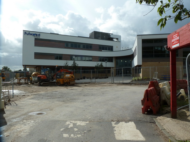
Fulwood Academy

Fulwood Academy (formerly Fulwood High School) is a coeducational secondary school located in Fulwood, Preston) in the English county of Lancashire.Previously...

The Street That Cut Everything

The Street That Cut Everything is a British television documentary presented by BBC political editor Nick Robinson. Billed as a social experiment, 50 residents...

Cadley, Lancashire

Cadley is a largely residential suburban area of Preston, Lancashire, England, and an electoral ward. The population of the ward taken at the 2011 census...

Royal Preston Hospital

The Royal Preston Hospital or RPH, is an acute general hospital in Preston, Lancashire, England. It is managed by the Lancashire Teaching Hospitals NHS...

Nearby Amenities

Located within 500m of 53.78465,-2.709358
Nooklands
Place: neighbourhood
Source: OS_OpenData_StreetView
Lat/Long: 53.7813301/-2.7125873
Speed Camera
Lat/Long: 53.7828135/-2.7111694
Crossing
Crossing: uncontrolled
Crossing Ref: zebra
Lat/Long: 53.7844322/-2.7059396
Crossing
Lat/Long: 53.7835983/-2.7046288
St Pius X Prep School
Bus: yes
Naptan AtcoCode: 250020122
Naptan Bearing: S
Naptan BusStopType: MKD
Naptan CommonName: St Pius X Prep School
Naptan Indicator: o/s
Naptan Landmark: St Pius X Prep School
Naptan LocalityCode: E0016132
Naptan NaptanCode: lanatpmw
Naptan Street: Garstang Road
Naptan Verified: no
Public Transport: stop_position
Ref: lanatpmw
Lat/Long: 53.7817856/-2.7109586
Kings Drive
Bus: yes
Naptan AtcoCode: 250011672
Naptan Bearing: S
Naptan BusStopType: MKD
Naptan CommonName: Kings Drive
Naptan Indicator: opp
Naptan Landmark: Kings Drive
Naptan LocalityCode: E0016132
Naptan NaptanCode: lanagmaj
Naptan Street: Garstang Road
Naptan Verified: no
Public Transport: stop_position
Ref: lanagmaj
Lat/Long: 53.7842458/-2.7116144
Harrison Road
Bus: yes
Naptan AtcoCode: 2500DCL3118
Naptan Bearing: S
Naptan BusStopType: MKD
Naptan CommonName: Harrison Road
Naptan Indicator: by
Naptan Landmark: Harrison Road
Naptan LocalityCode: E0016132
Naptan NaptanCode: landgpgj
Naptan Street: Garstang Road
Naptan Verified: no
Public Transport: stop_position
Ref: landgpgj
Lat/Long: 53.7865699/-2.7122288
Queens Drive
Bus: yes
Naptan AtcoCode: 250014397
Naptan Bearing: N
Naptan BusStopType: MKD
Naptan CommonName: Queens Drive
Naptan Indicator: by
Naptan Landmark: Queens Drive/Garstang Rd (North)
Naptan LocalityCode: E0016132
Naptan NaptanCode: lanamtam
Naptan Street: Garstang Road
Naptan Verified: no
Public Transport: stop_position
Public Transport Version: 2
Ref: lanamtam
Lat/Long: 53.7881773/-2.7126563
Harris Centre
Bus: yes
Naptan AtcoCode: 2500IMG1307
Naptan Bearing: N
Naptan BusStopType: MKD
Naptan CommonName: Harris Centre
Naptan Indicator: by
Naptan Landmark: Harris Centre
Naptan LocalityCode: E0016132
Naptan NaptanCode: landptwt
Naptan Street: Garstang Road
Naptan Verified: no
Public Transport: stop_position
Public Transport Version: 2
Ref: landptwt
Lat/Long: 53.7851311/-2.7118475
St Pius X Prep School
Bus: yes
Naptan AtcoCode: 250020065
Naptan Bearing: N
Naptan BusStopType: MKD
Naptan CommonName: St Pius X Prep School
Naptan Indicator: opp
Naptan Landmark: St Pius X Prep School
Naptan LocalityCode: E0016132
Naptan NaptanCode: lanatmtw
Naptan Street: Garstang Road
Naptan Verified: no
Public Transport: stop_position
Public Transport Version: 2
Ref: lanatmtw
Lat/Long: 53.7818806/-2.710984
Generator Method: photovoltaic
Generator Output Electricity: yes
Generator Source: solar
Generator Type: solar_photovoltaic_panel
Location: roof
Power: generator
Lat/Long: 53.7817276/-2.7079904
Bus Stop
Harrison Road
Bench: yes
Bin: yes
Bus: yes
Lit: yes
Public Transport: platform
Shelter: yes
Tactile Paving: no
Lat/Long: 53.7865745/-2.7121203
Generator Method: photovoltaic
Generator Output Electricity: yes
Generator Place: roof
Generator Source: solar
Generator Type: solar_photovoltaic_panel
Orientation: SSE
Power: generator
Lat/Long: 53.7825147/-2.7144085
Bicycle Parking
Bicycle Parking: lockers
Covered: no
Lat/Long: 53.7883575/-2.7058671
Vacuum Cleaner
Lat/Long: 53.786864/-2.7127821
Compressed Air
Lat/Long: 53.7868513/-2.7127796
Waste Basket
Lat/Long: 53.7868259/-2.7127712
Man Made: water_tap
Lat/Long: 53.7868417/-2.7127765
Social Facility
Oxford House
Addr City: Preston
Addr Street: Garstang Road
Addr Suburb: Fulwood
Operator: J T Care Homes Group
Social Facility: nursing_home
Lat/Long: 53.7886495/-2.7124053
Doctors
Lytham Road Surgery
Addr City: Preston
Addr Housename: 1st Floor Fatima Health Centre
Addr Housenumber: 228
Addr Postcode: PR2 9QB
Addr Street: Garstang Road
Healthcare: doctor
Healthcare Speciality: general
Level: 1
Opening Hours: Mo-Fr 08:00-18:00
Lat/Long: 53.7854326/-2.7095774
Doctors
ISSA @ Fulwood
Addr City: Preston
Addr Housename: Fatima Health Centre
Addr Housenumber: 228
Addr Postcode: PR2 9QB
Addr Street: Garstang Road
Healthcare: doctor
Lat/Long: 53.7855055/-2.7096253
Clinic
Sexual Health Services
Addr City: Preston
Addr Housename: 1st Floor Fatima Health Centre
Addr Housenumber: 228
Addr Postcode: PR2 9QB
Addr Street: Garstang Road
Healthcare: clinic
Healthcare Speciality: sexual_health_advice;contraception;infectious_diseases;gynaecology
Level: 2
Operator: NHS
Operator Type: public
Operator Wikidata: Q918396
Lat/Long: 53.7853528/-2.7095337
The data included in this document is from www.openstreetmap.org. The data is made available under ODbL.

Have you been to Fulwood?

Leave your review of Fulwood below (or comments, questions and feedback).